National Weather Service United States Department of Commerce

Storm Impacting the Northwest U.S.; Fire Weather Conditions in Southern California; Severe Weather in the South

A Pacific storm is bringing areas of low elevation rain, moderate to heavy mountain snow, and high winds to the Northwest. Strong Santa Ana winds and very dry conditions are producing elevated to critical fire weather conditions in southern California. Isolated strong to severe thunderstorms are possible through early Wednesday morning across parts of northeast Texas into western Tennessee. Read More >

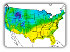
This graphic contains daily climate data (climate normals and records) for today for the sites listed. The legend is in the upper left portion of the image. The current "normals" period is 1991-2020. The date for each location represents the year in which the first observations began. For more information, please visit the National Centers for Environmental Information at http://www.ncdc.noaa.gov/
Click a location below for detailed forecast.

Last Map Update: Tue, Apr 8, 2025 at 8:44:19 pm EDT


Weather Hazards | Weather Forecasts | Past Weather | Power Page


 Current Weather Observations...
Location Time
(EDT)
Weather Vsby.
(SM)
Temp.
(ºF)
Dewpt.
(ºF)
Hum.
(%)
Wind
(mph)
Wind Chill / Heat Index
(ºF)
Pres.
(in)
Albany GA04:53Mostly Clear10504582NW 7-29.91
Athens GA04:51Clear10444085WNW 640 [WC]29.85
Atlanta GA04:52Clear10454082NW 1239 [WC]29.90
Augusta GA04:53Clear10514785NW 6-29.82
Blairsville GA05:35Clear10373592WSW 3-29.89
Cartersville GA05:35104141100CALM-29.94
Chamblee GA04:53Clear10434088W 738 [WC]29.90
Columbus GA04:51Clear10464388NNW 841 [WC]29.92
Dalton GA05:35Clear83939100CALM-29.91
Ellijay GA05:35Clear103737100NW 532 [WC]29.90
Gainesville GA04:53Clear10443776W 939 [WC]29.88
LaGrange GA05:35Clear10434296CALM-29.94
Lawrenceville GA04:56Clear104343100W 738 [WC]29.89
Macon GA04:53Clear10474489NW 644 [WC]29.88
Newnan GA05:35Clear10434191CALM-29.94
Peachtree City GA04:53Clear10434192NW 639 [WC]29.92
Rome GA04:53Clear10403789CALM-29.92
West Atlanta GA04:53Clear10444085WNW 541 [WC]29.91


Georgia Weather History for April 9th

In 1961, an EF-2 tornado struck Stewart County. It tracked across 4.9 miles of the eastern half of the county with a path width of 300 yards. Luckily no one was injured or killed as a result of the tornado.


Observations Discussion Satellite Climate Storm Reports
 
Hourly Forecasts Gridded Forecast Fire Weather Hydrology Aviation
 
Tropical Drought Information Wx Radio   SKYWARN Past Events