
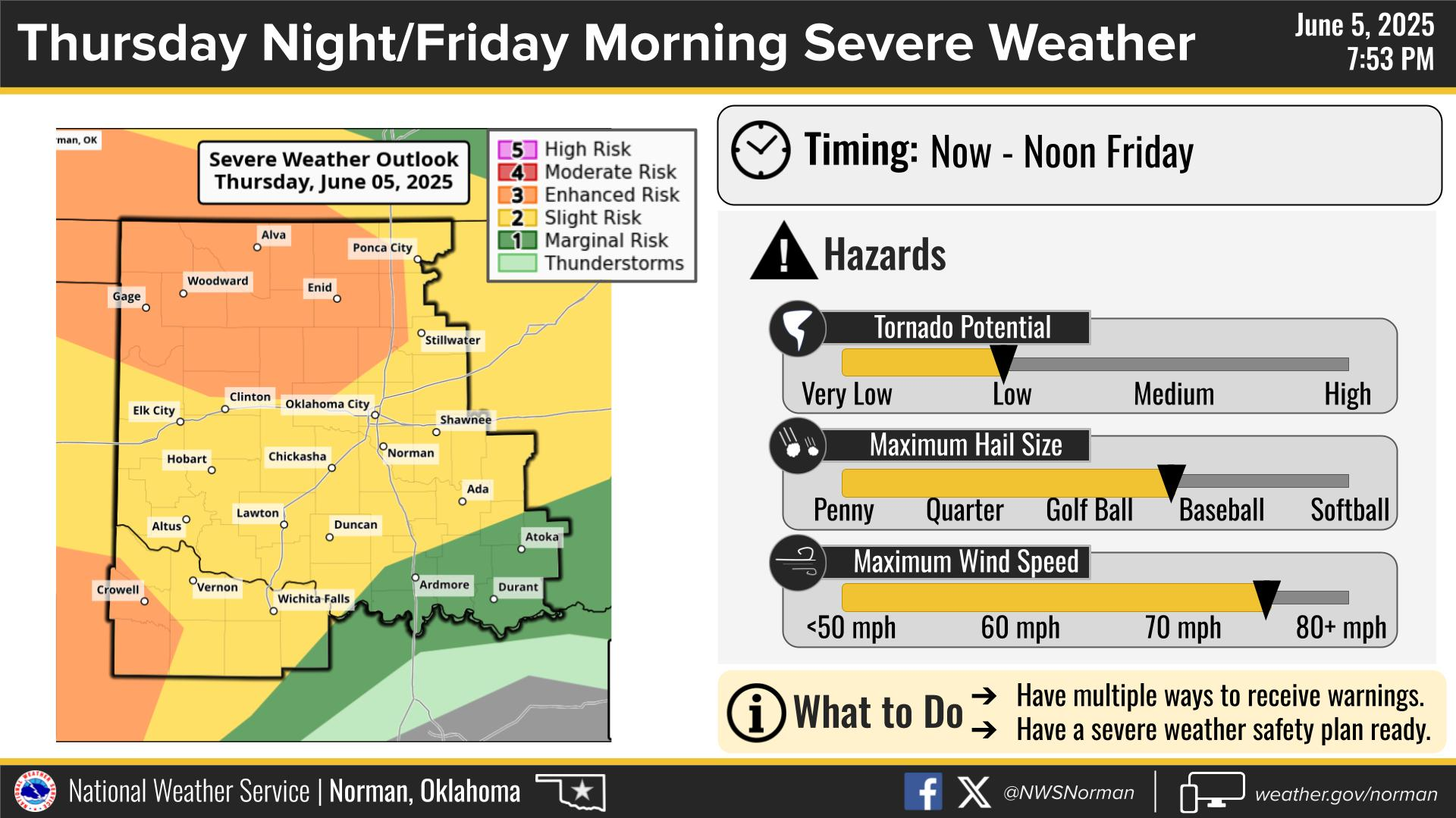
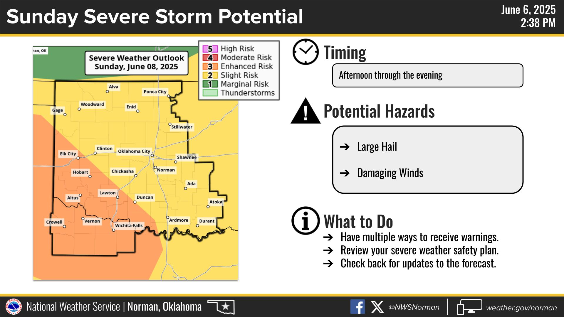
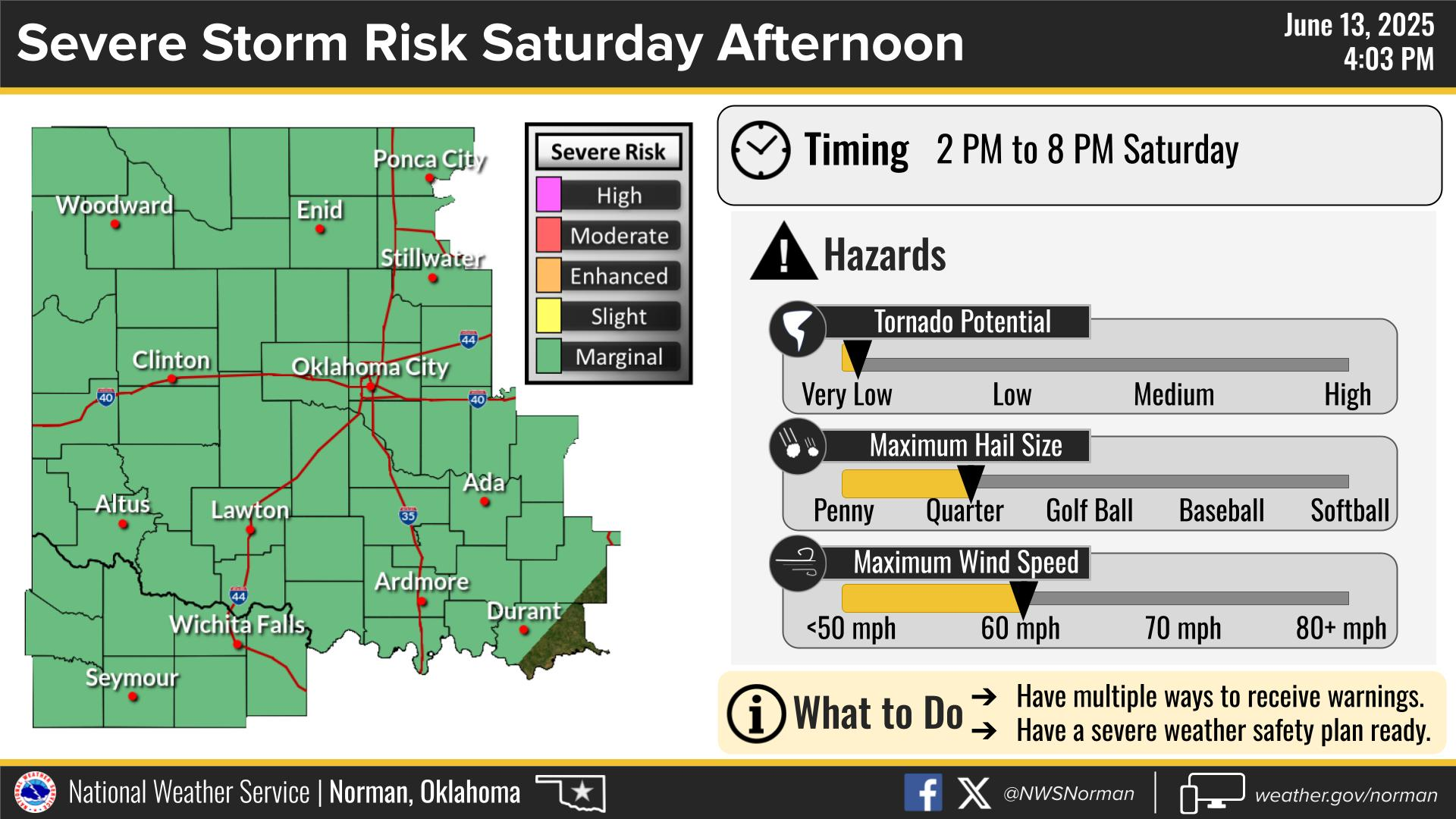
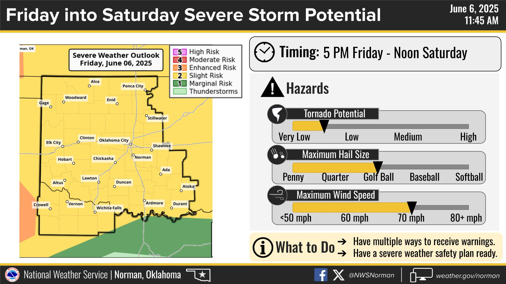
Active spring pattern across the center of our nation with several episodes of severe weather and heavy rainfall expected into next week. The potential for very large hail, long track tornadoes, severe wind gusts, frequent cloud to ground lightning strikes and flash flooding are in the outlook. Furthermore, dangerous early season heat wave continues for the Gulf Coast states into early next week. Read More >
Last Map Update: Wed, Jul 9, 2025 at 9:24:51 am CDT
|
Local Weather History For July 9th...
|
|
The hottest July temperature ever recorded in Oklahoma City is 110
degrees and has occurred twice. One of those instances was on this date in 2011. |
|
Text Product Selector (Selected product opens in current window)
|
|
 |
 |
 |
 |
 |
 |
| Observations | Discussion | Air Quality | Hydrology | FAQ | Social Media |
 |
 |
 |
 |
 |
 |
| Storm Reports | Gridded Forecast | Aviation | Climate | Storm Data | Weather Radio |
 |
 |
 |
 |
 |
 |
| Satellite | Hourly Forecast | Fire Weather | Past Events | StormReady | Storm Spotters |


 Local Radar
 Weather Map
 Drought Conditions