
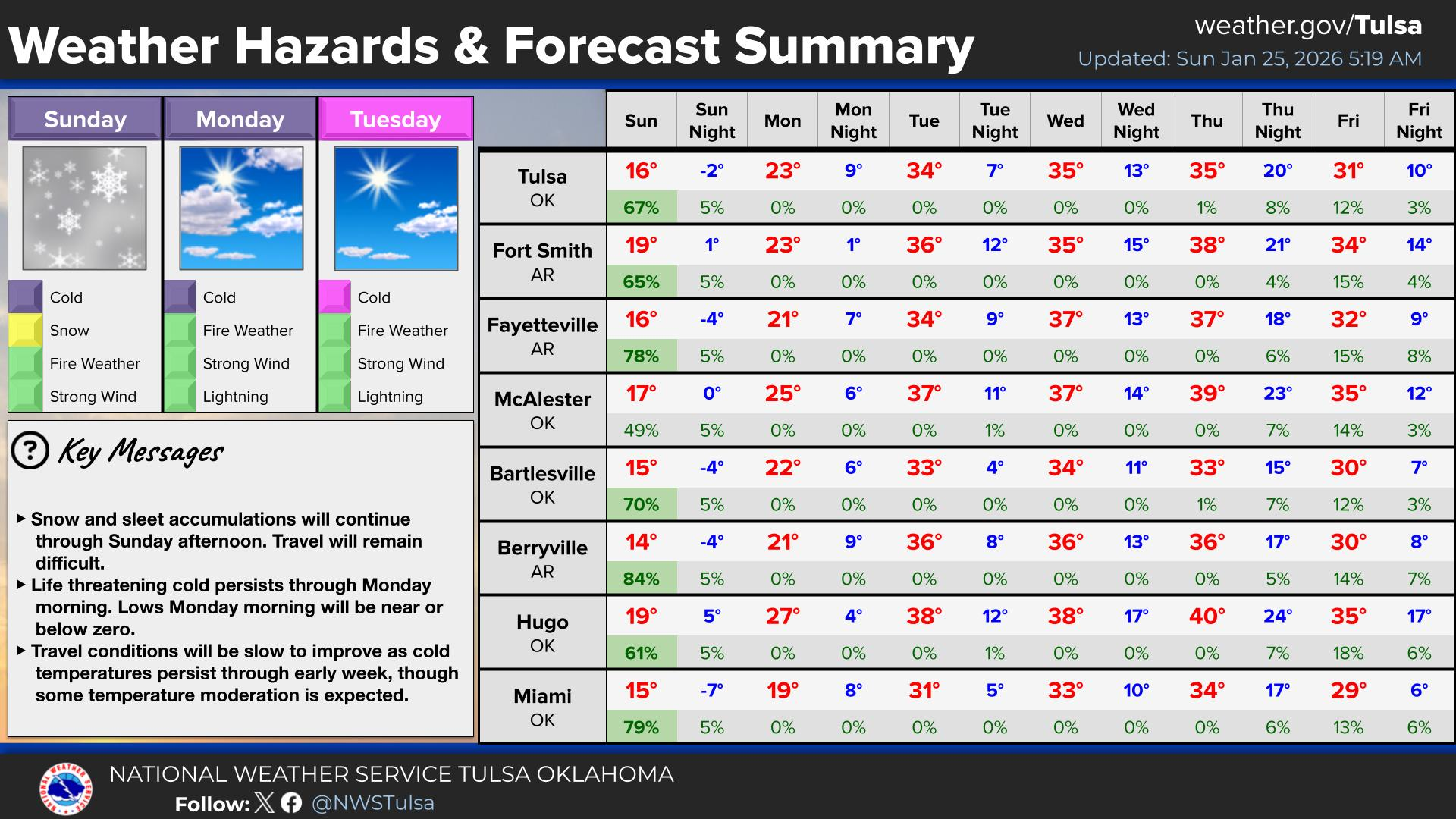
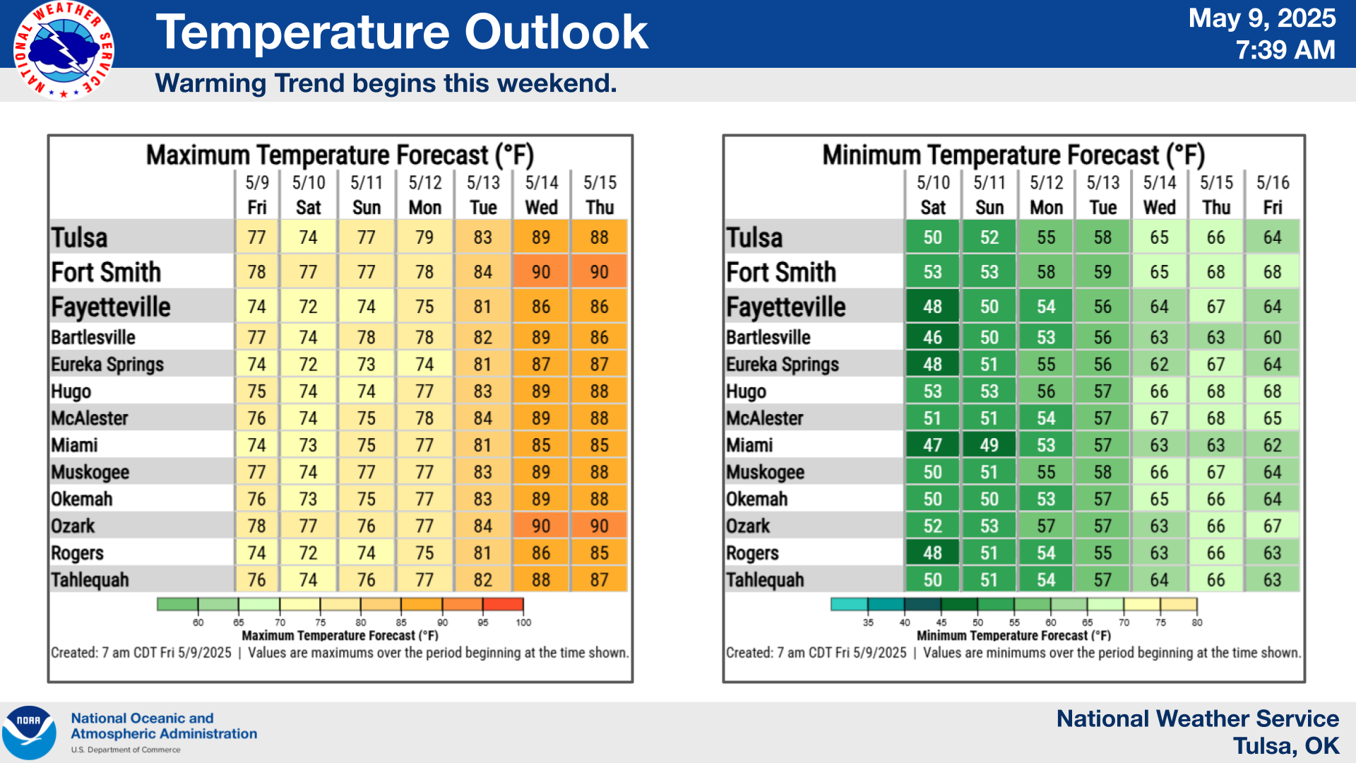
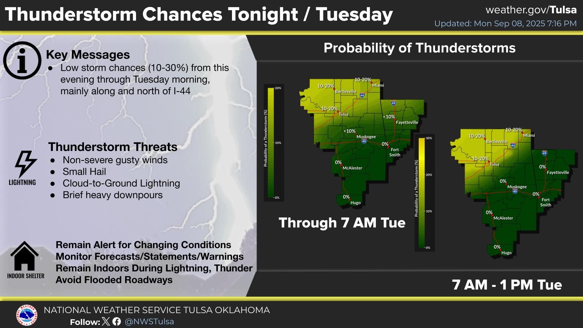
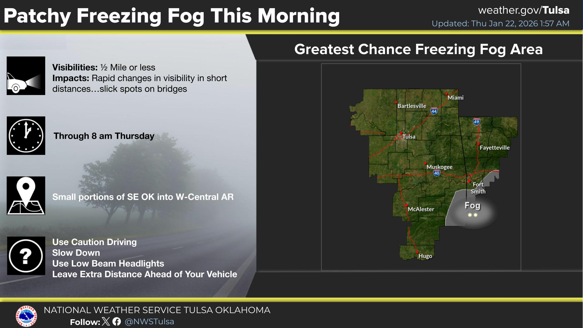
Tropical Depression Two is expected to gradually strengthen and could bring tropical storm conditions to the Florida Panhandle beginning late Monday. Areas of flash flooding will be possible through Thursday along the eastern and central Gulf Coast. Severe thunderstorms will develop and move along a cold front crossing the Upper Midwest Monday, and through the Ohio Valley/Mid-Atlantic on Tuesday. Read More >
Last Map Update: Mon, Jul 20, 2026 at 12:38:32 pm CDT


| Latest Text Product Selector (Selected product opens in a new window) | |
 |
 |
 |
 |
 |
 |
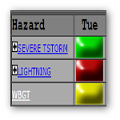
| Decision Support | Winter | Hazards | Observations | Climate | Hydrology |
 |
 |
 |
 |
 |
 |
| Social Media | Satellite | Fire Weather | Weather Radio | Spotter Training | Text Products |
 |
|||||
| Models | |||||


 Tulsa Radar
  Weather Map
 Fort Smith Radar