|
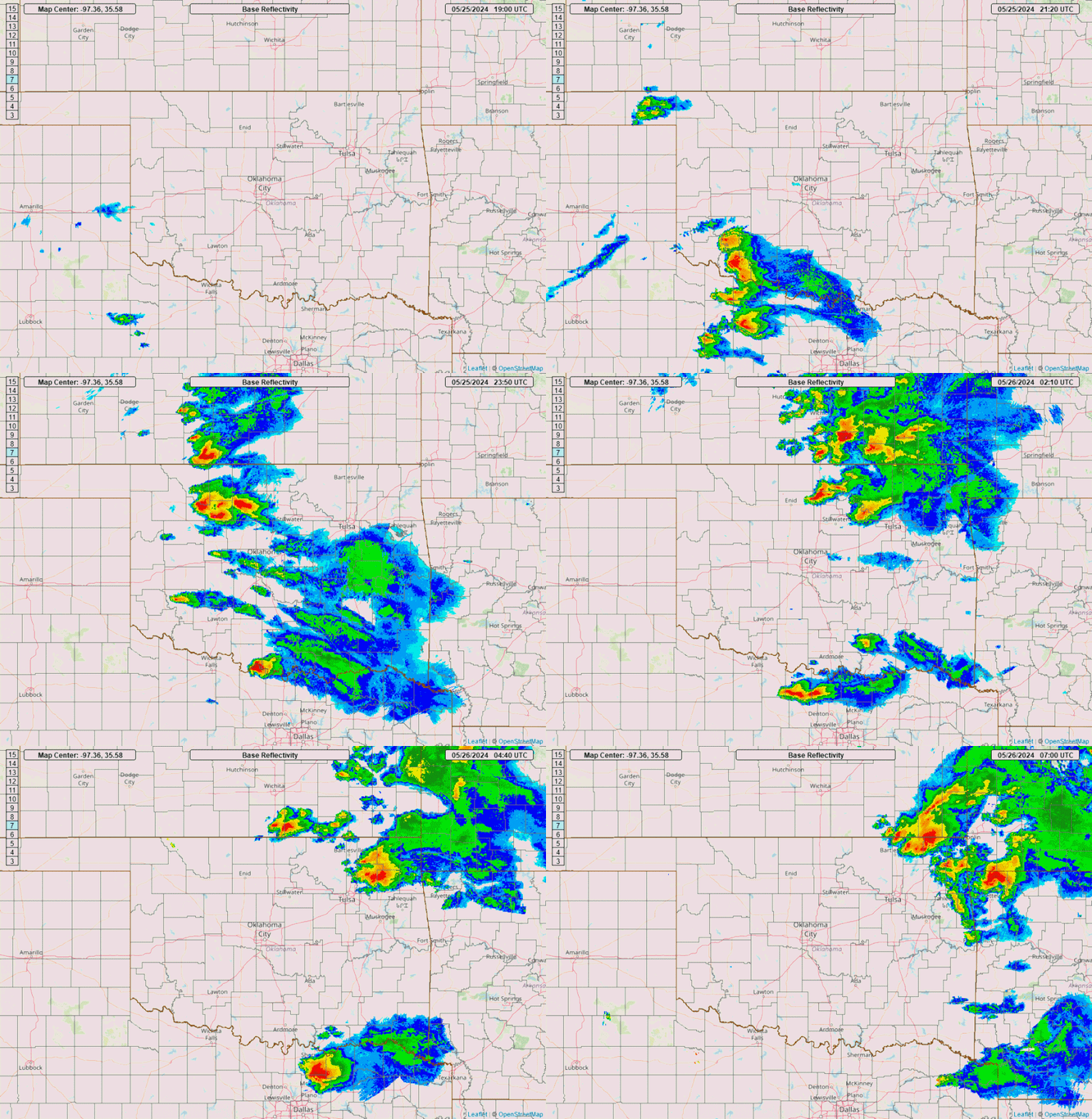
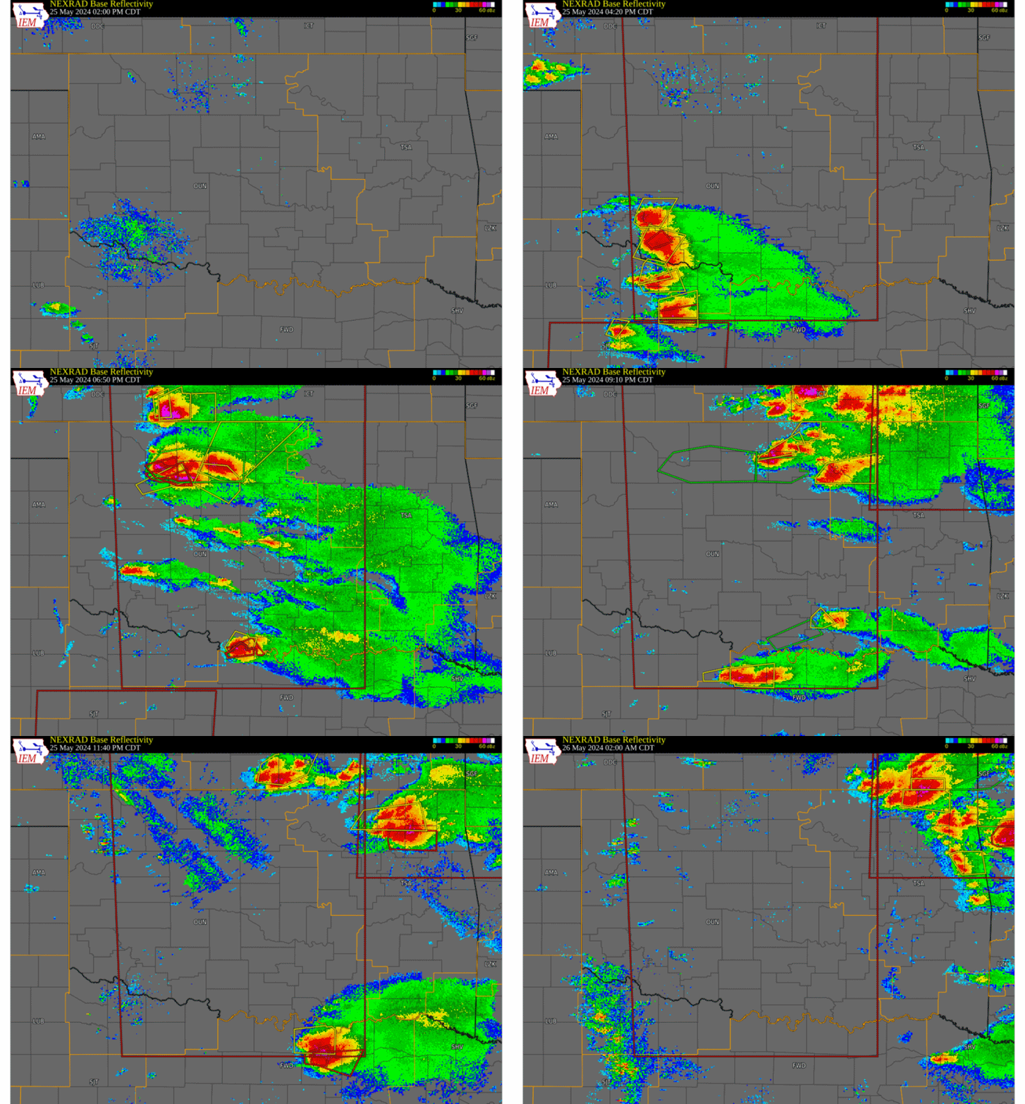
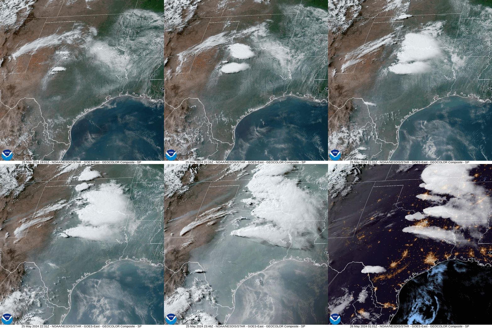
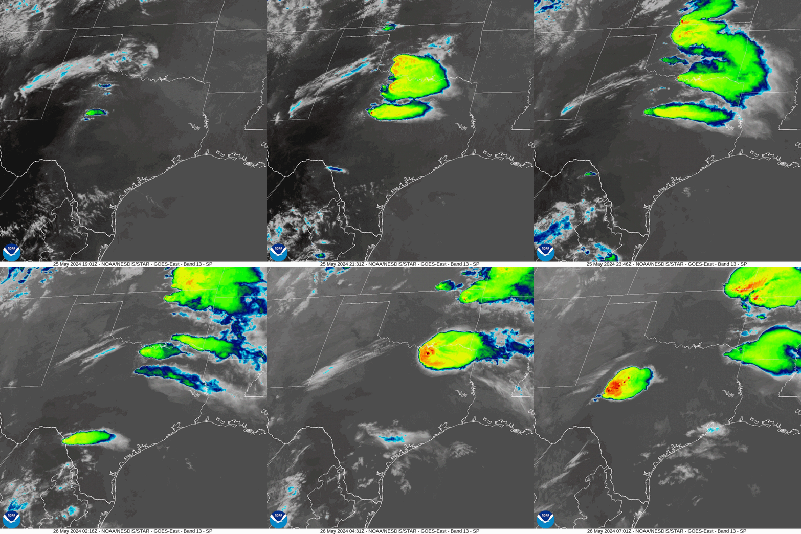
A severe weather outbreak impacted portions of western Oklahoma and western north Texas during the afternoon into evening of May 25th. At upper levels, a high-amplitude trough passed across the Great Plains during the day, with a focused jet ejection across portions of the Texas Panhandle/Oklahoma. The combination of strong dynamics/kinematics, locally extreme instability (objective analysis depiction >6000 J/kg CAPE) and unseasonably rich low-level moisture was sufficient for significant supercell thunderstorms. An initial round of supercells developed across portions of western-north Texas and eventually spread into portions of southwestern and southern Oklahoma through the evening. Additional supercells developed across northwestern Oklahoma, moving into northern Oklahoma by the late evening. All severe hazards, including multiple tornadoes, were observed with the most robust and longest-sustaining storms. A total of 6 tornadoes occurred during the May 25, 2024 severe weather event within the NWS Norman forecast area. Five more tornadoes occurred in the NWS Tulsa forecast are during the late evening hours of May 25th in northeastern Oklahoma.
|
|
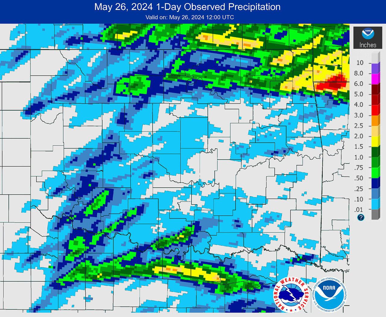
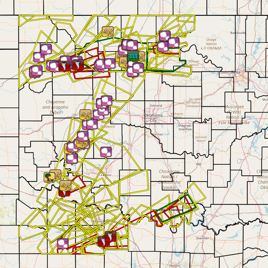
A total of 6 tornadoes occurred during the May 25, 2024 severe weather outbreak within the NWS Norman forecast area. Five more tornadoes occurred in the NWS Tulsa forecast are during the late evening hours of May 25th in northeastern Oklahoma.
Tornadoes by Intensity |
|||||||
|---|---|---|---|---|---|---|---|
| EF?/EFU | EF0 | EF1 | EF2 | EF3 | EF4 | EF5 | Total |
| 4 | 0 | 5 | 0 | 2 | 0 | 0 | 11 |
| Tornado Number |
Date | Time (CST) |
Length of Path (miles) |
Width of Path (yards) |
F-Scale | Killed | Injured | County | Location |
|---|---|---|---|---|---|---|---|---|---|
| 1 | 05/25/2024 | 1616-1624 | 3.4 | 200 | EF1 | 0 | 0 | Archer/ Clay | Windthorst (east portion) - 3 NE Windthorst |
| 2 | 05/25/2024 | 1633-1641 | 3.4 | 100 | EF? | 0 | 0 | Clay | 7 SSW - 4 SSW Bluegrove |
| 3 | 05/25/2024 | 1714-1720 | 2.6 | 50 | EF1 | 0 | 0 | Woodward | 1.5 SW - 1 E Mutual |
| 4 | 05/25/2024 | 1729-1740 | 3.4 | 200 | EF? | 0 | 0 | Major | 5 NNW - 7 N Chester |
| 5 | 05/25/2024 | 1854-1854 | 0.3 | 30 | EF? | 0 | 0 | Love | 5 NNE Burneyville |
| 6 | 05/25/2024 | 1906-1907 | 0.5 | 50 | EF? | 0 | 0 | Love | 4 WSW Overbrook |
| 7 | 05/25/2024 | 2219-2259 | 23.9 | 2000 | EF3 | 2 | 23 | Rogers/ Mayes | 5 ENE Owasso - 2 WNW Pryor |
| 8 | 05/25/2024 | 2307-2319 | 6.1 | 2000 | EF1 | 0 | 0 | Mayes | 2 NNW - 5 E Salina |
| 9 | 05/25/2024 | 2325-2330 | 2.4 | 300 | EF1 | 0 | 0 | Mayes | 1 NW - 2 SE Salina |
| 10 | 05/25/2024 | 2336-2339 | 1.8 | 650 | EF1 | 0 | 0 | Delaware | 6 N - 8 NNE Leach |
| 11 | 05/25/2024 | 2359-0021 | 7.9 | 3200 | EF3 | 0 | 2 | Delaware/ Benton AR | 2 W Cherokee City - 3 NW Decatur |
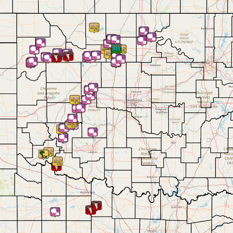
| Report Date |
Report Time (CST) |
Location | County | State | Event Type |
Mag. | Source | Lat. | Lon. | Remark |
|---|---|---|---|---|---|---|---|---|---|---|
| 05/25/2024 | 14:20 | 5 SE Seymour | Baylor | TX | Hail | 1.00 in. | Storm Chaser | 33.55 | -99.19 | |
| 05/25/2024 | 15:00 | 3 S Altus | Jackson | OK | Tstm Wind Gust | 59 mph | Mesonet | 34.60 | -99.33 | |
| 05/25/2024 | 15:05 | 1 WNW Olustee | Jackson | OK | Tstm Wind Damage | Public | 34.56 | -99.44 | Shingles blow off room. 1-inch tree limbs broken. | |
| 05/25/2024 | 15:07 | 9 NNW Davidson | Tillman | OK | Tornado | Emergency Mngr | 34.35 | -99.16 | Tornado from about 4:07 PM CDT to 4:10 PM CDT. The Tillman County Emergency Manager reports damage to a barn. | |
| 05/25/2024 | 15:20 | 4 S Tipton | Tillman | OK | Tstm Wind Gust | 58 mph | Mesonet | 34.44 | -99.14 | |
| 05/25/2024 | 15:25 | Roosevelt | Kiowa | OK | Hail | 2.75 in. | Trained Spotter | 34.85 | -99.02 | |
| 05/25/2024 | 15:25 | Roosevelt | Kiowa | OK | Hail | 1.75 in. | Public | 34.85 | -99.02 | Report from mPING. Time estimated based on radar. |
| 05/25/2024 | 15:28 | Roosevelt | Kiowa | OK | Hail | 2.50 in. | NWS Employee | 34.85 | -99.02 | |
| 05/25/2024 | 15:39 | 3 SE Hobart | Kiowa | OK | Tstm Wind Gust | 66 mph | ASOS | 35.00 | -99.06 | |
| 05/25/2024 | 15:42 | 4 E Hobart | Kiowa | OK | Hail | 1.75 in. | Storm Chaser | 35.02 | -99.01 | Time estimated based on radar. |
| 05/25/2024 | 15:47 | Gotebo | Kiowa | OK | Hail | 2.75 in. | Public | 35.07 | -98.88 | Report from mPING; Time estimated based on radar. |
| 05/25/2024 | 15:47 | 3 WSW Mountain View | Kiowa | OK | Hail | 2.50 in. | Broadcast Media | 35.07 | -98.80 | Time estimated based on radar. |
| 05/25/2024 | 15:50 | 2 NE Gotebo | Kiowa | OK | Tstm Wind Gust | 66 mph | Broadcast Media | 35.10 | -98.84 | Time estimated based on radar. |
| 05/25/2024 | 15:58 | 5 SSE Cloud Chief | Washita | OK | Hail | 1.00 in. | Trained Spotter | 35.19 | -98.82 | Spotter reported between Rocky and 152, north of Mountain View. Location estimated based on radar. |
| 05/25/2024 | 16:02 | Windthorst | Archer | TX | Hail | 1.75 in. | Public | 33.58 | -98.44 | Time estimated based on radar. |
| 05/25/2024 | 16:12 | 3 W Colony | Washita | OK | Hail | 2.50 in. | Emergency Mngr | 35.36 | -98.73 | Report on Hwy 54, 10 miles south of Weatherford; Time estimated based on radar. |
| 05/25/2024 | 16:15 | 1 NE Colony | Washita | OK | Hail | 1.75 in. | Public | 35.37 | -98.65 | Time estimated based on radar. |
| 05/25/2024 | 16:16 | 1 ENE Windthorst | Archer | TX | Tornado | Storm Chaser | 33.58 | -98.43 | Tornado observed near Windthorst, starting at 5:16 PM CDT and lasting until approximately 5:25 PM CDT. | |
| 05/25/2024 | 16:21 | 4 W Stecker | Caddo | OK | Hail | 1.00 in. | Public | 34.95 | -98.39 | Report from mPING; Time estimated based on radar. |
| 05/25/2024 | 16:25 | 4 E Arnett | Ellis | OK | Hail | 1.75 in. | Public | 36.14 | -99.71 | Report from mPING; Time estimated based on radar. |
| 05/25/2024 | 16:25 | 4 SE Hydro | Caddo | OK | Hail | 2.50 in. | Trained Spotter | 35.51 | -98.53 | |
| 05/25/2024 | 16:25 | 4 WSW Weatherford | Custer | OK | Tstm Wind Gust | 63 mph | Mesonet | 35.51 | -98.77 | |
| 05/25/2024 | 16:27 | 4 ENE Arnett | Ellis | OK | Hail | 2.75 in. | Emergency Mngr | 36.16 | -99.70 | Time estimated based on radar. |
| 05/25/2024 | 16:35 | 6 ENE Arnett | Ellis | OK | Hail | 3.50 in. | Broadcast Media | 36.17 | -99.67 | |
| 05/25/2024 | 16:35 | 4 WNW Bridgeport | Blaine | OK | Hail | 3.00 in. | Public | 35.58 | -98.44 | Via photo on Twitter; Location and time estimated based on radar. |
| 05/25/2024 | 16:35 | Fargo | Ellis | OK | Hail | 1.00 in. | Public | 36.37 | -99.63 | Report from mPING. |
| 05/25/2024 | 16:37 | 5 WSW Bluegrove | Clay | TX | Tornado | NWS Employee | 33.66 | -98.31 | ||
| 05/25/2024 | 16:40 | 5 NNE Tangier | Woodward | OK | Hail | 1.00 in. | Public | 36.49 | -99.50 | Time estimated based on radar. |
| 05/25/2024 | 16:42 | 6 SW Greenfield | Blaine | OK | Hail | 1.00 in. | Public | 35.68 | -98.47 | Report from mPING. |
| 05/25/2024 | 16:44 | 6 SW Greenfield | Blaine | OK | Hail | 1.25 in. | Public | 35.68 | -98.47 | Report from mPING. |
| 05/25/2024 | 16:49 | Greenfield | Blaine | OK | Hail | 1.75 in. | Public | 35.72 | -98.38 | Report from mPING; time estimated based on radar. |
| 05/25/2024 | 16:52 | 3 SW Sharon | Woodward | OK | Hail | 1.00 in. | Public | 36.25 | -99.39 | Report from mPING; time estimated based on radar. |
| 05/25/2024 | 16:55 | 3 S Sharon | Woodward | OK | Hail | 1.75 in. | Public | 36.23 | -99.34 | social media; time estimated based on radar. |
| 05/25/2024 | 17:13 | 2 NE Mutual | Woodward | OK | Hail | 2.50 in. | Emergency Mngr | 36.25 | -99.14 | |
| 05/25/2024 | 17:14 | 1 N Mutual | Woodward | OK | Tornado | Broadcast Media | 36.24 | -99.16 | Tornado observed approximately from 6:14 PM to 6:20 PM CDT. | |
| 05/25/2024 | 17:14 | 7 NNE Mutual | Woodward | OK | Hail | 3.00 in. | Emergency Mngr | 36.32 | -99.14 | Time estimated from radar. |
| 05/25/2024 | 17:19 | 3 N Chester | Major | OK | Hail | 1.00 in. | Public | 36.26 | -98.92 | |
| 05/25/2024 | 17:23 | 6 N Chester | Major | OK | Hail | 1.50 in. | Public | 36.31 | -98.93 | Report from mPING; time estimated based on radar. |
| 05/25/2024 | 17:29 | 3 NNE Chester | Major | OK | Tornado | Other Federal | 36.26 | -98.91 | Tornado observed beginning at 629 PM approximately 3 miles north of Chester. | |
| 05/25/2024 | 17:38 | 1 W Drummond | Garfield | OK | Hail | 1.75 in. | Emergency Mngr | 36.30 | -98.05 | Via NWSchat; Time estimated based on radar. |
| 05/25/2024 | 17:44 | Lahoma | Garfield | OK | Hail | 1.00 in. | Public | 36.39 | -98.09 | Report from mPING. |
| 05/25/2024 | 17:45 | 3 SW Fairview | Major | OK | Hail | 2.50 in. | Trained Spotter | 36.24 | -98.51 | Twitter photo; time and location estimated based on radar. |
| 05/25/2024 | 17:45 | 1 WSW Lahoma | Major | OK | Tstm Wind Gust | 61 mph | Mesonet | 36.38 | -98.11 | |
| 05/25/2024 | 17:48 | Enid | Garfield | OK | Hail | 1.00 in. | Other Federal | 36.40 | -97.88 | Via NWSchat. |
| 05/25/2024 | 17:50 | 3 SE Fairview | Major | OK | Hail | 2.50 in. | NWS Employee | 36.23 | -98.44 | Twitter photo; time estimated based on radar. |
| 05/25/2024 | 17:50 | 2 NNE Vance Air Force Base | Garfield | OK | Hail | 1.75 in. | Emergency Mngr | 36.37 | -97.89 | Via NWSchat; South end of Enid. |
| 05/25/2024 | 17:50 | Fairview | Major | OK | Hail | 2.50 in. | Trained Spotter | 36.27 | -98.48 | Twitter photo; time estimated based on radar. |
| 05/25/2024 | 17:51 | 2 W Carrier | Garfield | OK | Hail | 1.75 in. | Emergency Mngr | 36.48 | -98.06 | Via NWSchat. |
| 05/25/2024 | 17:56 | 1 SSW Hillsdale | Garfield | OK | Hail | 2.75 in. | Emergency Mngr | 36.55 | -98.00 | Delayed Report of baseball sized hail near the intersection of Boomer and Keowee Road. |
| 05/25/2024 | 17:57 | 3 NNE Isabella | Major | OK | Hail | 1.00 in. | Emergency Mngr | 36.28 | -98.32 | Photo via NWSchat; Time estimated based on radar. |
| 05/25/2024 | 17:57 | Hillsdale | Garfield | OK | Hail | 1.75 in. | Emergency Mngr | 36.56 | -97.99 | Via NWSchat. |
| 05/25/2024 | 17:59 | 4 W Kremlin | Garfield | OK | Hail | 1.75 in. | Emergency Mngr | 36.55 | -97.91 | Via NWSchat. |
| 05/25/2024 | 18:16 | Drummond | Garfield | OK | Tstm Wind Gust | 65 mph | Broadcast Media | 36.30 | -98.04 | |
| 05/25/2024 | 18:20 | 0.5 SSW Cherokee | Alfalfa | OK | Tstm Wind Gust | 58 mph | Mesonet | 36.75 | -98.36 | |
| 05/25/2024 | 18:23 | Vance Air Force Base | Garfield | OK | Hail | 1.00 in. | Other Federal | 36.34 | -97.90 | Via NWSchat. |
| 05/25/2024 | 18:27 | Waukomis | Garfield | OK | Hail | 0.50 in. | Public | 36.28 | -97.89 | Report from mPING. |
| 05/25/2024 | 18:28 | 1 SE Waukomis | Garfield | OK | Hail | 0.75 in. | Public | 36.26 | -97.89 | Report from mPING. |
| 05/25/2024 | 18:42 | 5 SW Breckenridge | Garfield | OK | Tstm Wind Gust | 74 mph | AWOS | 36.38 | -97.78 | |
| 05/25/2024 | 18:48 | 3 N Hennessey | Kingfisher | OK | Hail | 1.00 in. | Storm Chaser | 36.15 | -97.89 | Photo via Twitter. |
| 05/25/2024 | 18:48 | 4 N Hennessey | Kingfisher | OK | Hail | 2.00 in. | Public | 36.16 | -97.90 | Photo on Twitter; Time estimated based on radar. |
| 05/25/2024 | 18:53 | 5 E Bison | Garfield | OK | Hail | 1.25 in. | Public | 36.21 | -97.80 | Report from mPING. |
| 05/25/2024 | 18:57 | 1 SSW Enid | Garfield | OK | Flash Flood | Emergency Mngr | 36.39 | -97.89 | Intersection of 81 and 412 is underwater. | |
| 05/25/2024 | 19:37 | Tonkawa | Kay | OK | Hail | 1.00 in. | Emergency Mngr | 36.68 | -97.31 | Photo via NWSchat. |
| 05/25/2024 | 19:41 | 1 ENE Tonkawa | Kay | OK | Hail | 1.50 in. | NWS Employee | 36.69 | -97.30 | Hail a little smaller than golf balls. |
| 05/25/2024 | 20:27 | 5 NW Ceres | Noble | OK | Hail | 1.25 in. | NWS Employee | 36.53 | -97.34 | Hail dollar sized hail southeast of Billings. |
| 05/25/2024 | 20:44 | 2 NNE Marland | Kay | OK | Hail | 1.75 in. | Emergency Mngr | 36.59 | -97.14 | Golf ball sized hail along US177 on the Kay/Noble County line. |
