|
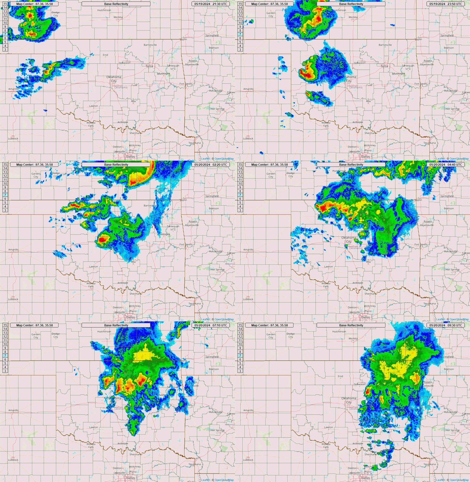
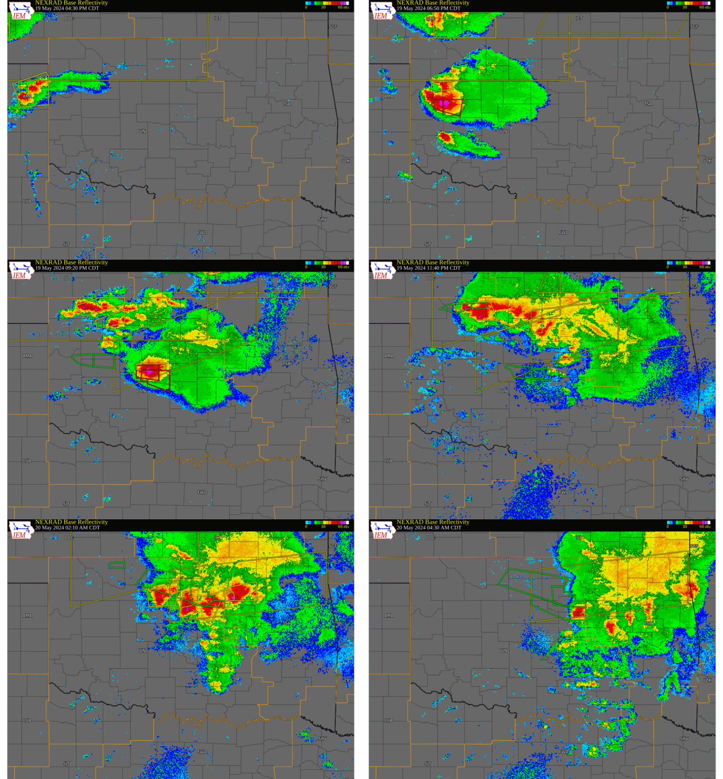
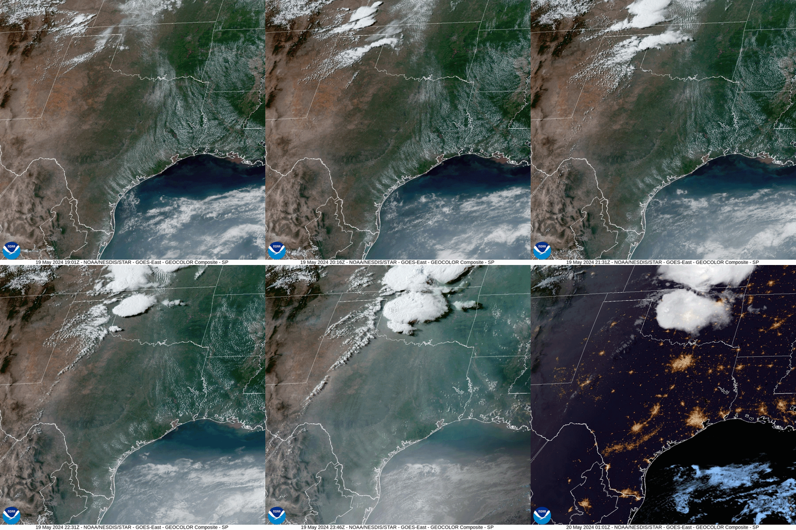
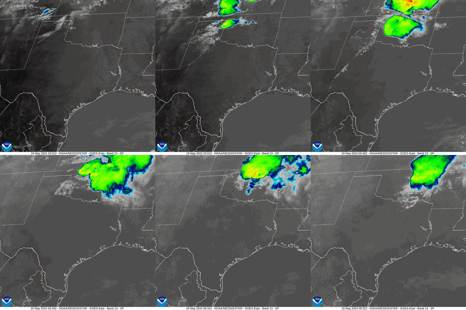
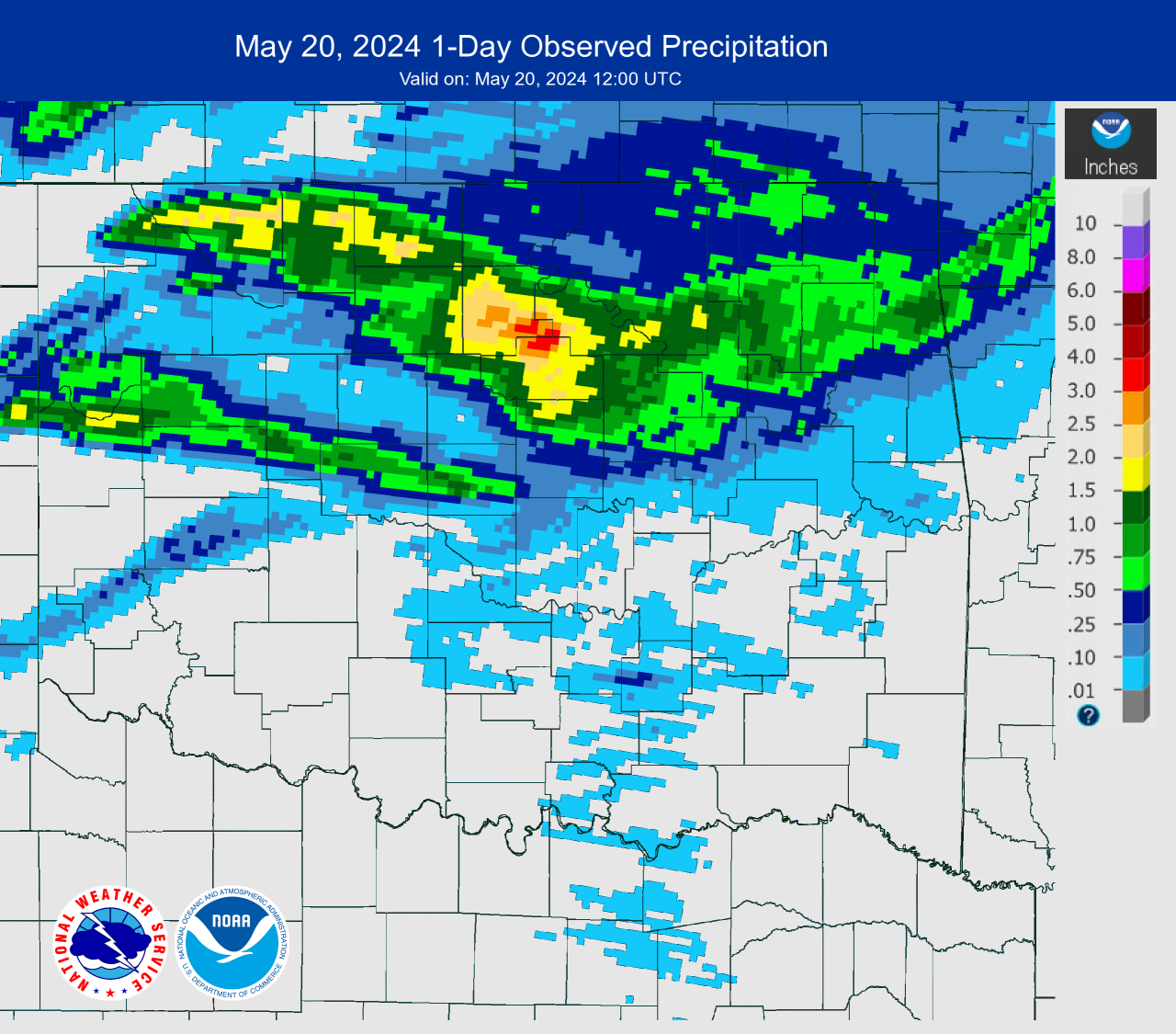
During the midafternoon (~2:00-2:30 pm CDT) of May 19, 2024, thunderstorms developed in the northwestern Texas panhandle in Lipscomb and Hemphill counties and moved eastward into western Oklahoma. One of the storms became a dominant supercell thunderstorm as it tracked east-southeastward through parts of Roger Mills County and produced hail to the size of golf balls and 75 mph wind gusts. As the supercell continued to the east-southeast into Custer County, it became tornadic, and dropped two tornadoes in the Butler-Custer City area and near Weatherford. Severe thunderstorm wind gusts and wind damage also occurred in Custer County. The storm moved through southern Blaine and northern Caddo counties, and produced a tornado near Hydro, before entering Canadian County around 8:30 pm CDT. In Canadian County, tornadoes were reported in the Union City-El Reno area and near Yukon, and hail from 1.00 to 2.25 inches in diameter also occurred. As the supercell moved east-southeastward into Oklahoma County (and just north of the Oklahoma/Cleveland county line), it produced severe hail (1.00-1.75 inches in diameter), severe wind gusts up to 75 mph, and one brief tornado in the southwestern part of Oklahoma City and north of OCCC. The supercell eventually weakened as it moved east of the OKC metro area. Meanwhile in northwestern Oklahoma, a severe thunderstorm had developed in Woodward County just before 8:00 pm CDT, and then more storms developed in eastern Harper, Woods, Major, and Alfalfa counties during the next couple of hours. Eventually, tornado warnings were issued for one supercell thunderstorm in Woods County around 11:00 pm CDT. The supercell generated two weak tornadoes in Woods County. These storms continued to the east into Grant, Garfield, Kay, Noble and Payne counties from just before midnight through the early morning hours of May 20, 2024. Some storms trained over Woods, Alfalfa, Grant, Garfield, and Payne counties during this period, and heavy rainfall totals of 1.5 to 4.0 inches were recorded, prompting the issuance of flash flood warnings for the affected area. NWS teams conducted damage surveys on May 20, 2024, and more research is ongoing to document the tornadoes and other severe weather that occurred on May 19, 2024. As of August 2024, 17 tornadoes had been documented for this severe weather event, and more information can be viewed through the "Tornado Table" tab. Additional information will be added as it becomes available. All data and information are preliminary. GIS Data |
|
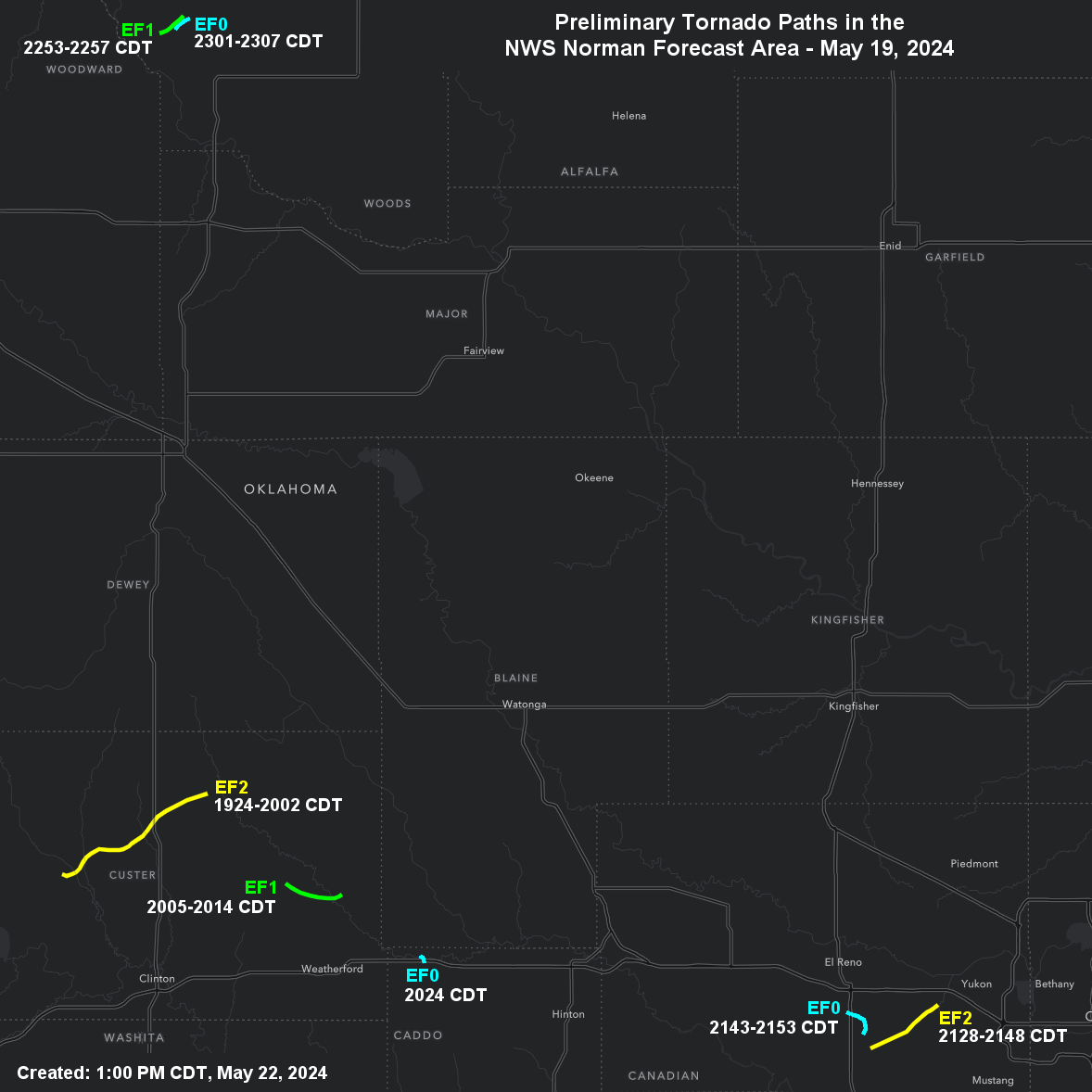
NOTE: This map does not include an unrated tornado that was reported in Oklahoma County on May 19, 2024.
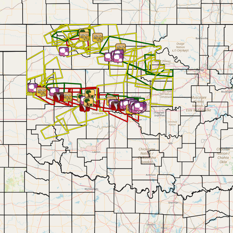
NOUS44 KOUN 220452 CCA
PNSOUN
OKZ004>048-050>052-TXZ083>090-220745-

Public Information Statement...CORRECTED
National Weather Service Norman OK
1152 PM CDT Tue May 21 2024

...NWS Damage Survey for 5/19/2024 Tornado Event...

.near Butler and Custer City...

Rating:                 EF2
Estimated Peak Wind:    120 to 125 mph
Path Length /statute/:  15 miles
Path Width /maximum/:   approximately 1500 yards
Fatalities:             0
Injuries:               To be determined

Start Date:             05/19/2024
Start Time:             07:24 PM CDT
Start Location:         4 E Butler / Custer County / OK
Start Lat/Lon:          35.64 / -99.11

End Date:               05/19/2024
End Time:               08:02 PM CDT
End Location:           5 N Custer City / Custer County / OK
End Lat/Lon:            35.74 / -98.89

Survey Summary:
A large multiple vortex tornado moved east and northeast from
east of Butler to north of Custer City. Besides the tornado,
widespread wind damage also occurred both south and north of the
tornado path. The total width of damage path was nearly three
miles, but the tornado itself was likely around one mile in
width. A few homes, and numerous trees and farm buildings were
damaged along the path.

.North of Weatherford...

Rating:                 EF1
Estimated Peak Wind:    105 to 110 mph
Path Length /statute/:  5 miles
Path Width /maximum/:   440 yards
Fatalities:             0
Injuries:               0

Start Date:             05/19/2024
Start Time:             08:05 PM CDT
Start Location:         6 ESE Custer City / Custer County / OK
Start Lat/Lon:          35.63 / -98.77

End Date:               05/19/2024
End Time:               08:14 PM CDT
End Location:           6 N Weatherford / Custer County / OK
End Lat/Lon:            35.62 / -98.69

Survey Summary:
A tornado moved east-southeast and then east crossing State
Highway 58 north of Weatherford. A few homes were damaged as well
as numerous trees and buildings.

.South of Hydro...

Rating:                 EF0
Estimated Peak Wind:    75 to 80 mph
Path Length /statute/:  0.8 miles
Path Width /maximum/:   40 yards
Fatalities:             0
Injuries:               0

Start Date:             05/19/2024
Start Time:             08:24 PM CDT
Start Location:         Hydro / Caddo County / OK
Start Lat/Lon:          35.54 / -98.58

End Date:               05/19/2024
End Time:               08:24 PM CDT
End Location:           1 SSE Hydro / Caddo County / OK
End Lat/Lon:            35.53 / -98.57

Survey Summary:
Multiple people witnessed a tornado cross Interstate 40 just to
the southeast of Hydro. One semi on the interstate was blown over
and a Department of Transportation facility was damaged.

.Southwest of Yukon...

Rating:                 EF2
Estimated Peak Wind:    125 to 130 mph
Path Length /statute/:  7 miles
Path Width /maximum/:   300 yards
Fatalities:             0
Injuries:               0

Start Date:             05/19/2024
Start Time:             09:34 PM CDT
Start Location:         3 NE Union City / Canadian County / OK
Start Lat/Lon:          35.43 / -97.91

End Date:               05/19/2024
End Time:               09:48 PM CDT
End Location:           4 WSW Yukon / Canadian County / OK
End Lat/Lon:            35.48 / -97.81

Survey Summary:
A tornado developed southwest of SW 29th Street and Radio Street
and moved northeast through southwest Oklahoma City to near NW
10th Street and Cimarron Road. Homes, trees and power poles were
damaged along the path.

.Southeast of El Reno...

Rating:                 EF0
Estimated Peak Wind:    75 to 80 mph
Path Length /statute/:  3 miles
Path Width /maximum/:   30 yards
Fatalities:             0
Injuries:               0

Start Date:             05/19/2024
Start Time:             09:43 PM CDT
Start Location:         4 NNE Union City / Canadian County / OK
Start Lat/Lon:          35.45 / -97.92

End Date:               05/19/2024
End Time:               09:53 PM CDT
End Location:           4 S El Reno / Canadian County / OK
End Lat/Lon:            35.47 / -97.94

Survey Summary:
A tornado was reported by storm spotters and chasers. A sign was
damaged along US-81 south of El Reno, otherwise the tornado moved
through rural areas. The tornado likely moved from near SW 15th
Street and Allendale Street north and then northwest crossing
US-81 south of 10th Street.

.Woods County #1...

Rating:                 EF1
Estimated Peak Wind:    100 to 105 mph
Path Length /statute/:  2.6 miles
Path Width /maximum/:   300 yards
Fatalities:             0
Injuries:               0

Start Date:             05/19/2024
Start Time:             10:53 PM CDT
Start Location:         6 NW Waynoka / Woods County / OK
Start Lat/Lon:          36.65 / -98.96

End Date:               05/19/2024
End Time:               10:56 PM CDT
End Location:           6 NNW Waynoka / Woods County / OK
End Lat/Lon:            36.67 / -98.93

Survey Summary:
A tornado developed in Woods County northwest of Waynoka. There
was damage to oil field equipment, outbuildings and trees.

.Woods County #2...

Rating:                 EF0
Estimated Peak Wind:    75 to 80 mph
Path Length /statute/:  1.5 miles
Path Width /maximum/:   30 yards
Fatalities:             0
Injuries:               0

Start Date:             05/19/2024
Start Time:             11:01 PM CDT
Start Location:         5 NNW Waynoka / Woods County / OK
Start Lat/Lon:          36.65 / -98.94

End Date:               05/19/2024
End Time:               11:07 PM CDT
End Location:           5 NNW Waynoka / Woods County / OK
End Lat/Lon:            36.66 / -98.92

Survey Summary:
A second tornado developed northwest of Waynoka in Woods County
and damaged a barn.

&&

EF Scale: The Enhanced Fujita Scale classifies tornadoes into the
following categories:

EF0.....65 to 85 mph
EF1.....86 to 110 mph
EF2.....111 to 135 mph
EF3.....136 to 165 mph
EF4.....166 to 200 mph
EF5.....>200 mph

NOTE:
The information in this statement is preliminary and subject to
change pending final review of the events and publication in
NWS Storm Data.


$$
|
NWS teams conducted damage surveys on May 20, 2024, and 16 tornadoes have been rated including 2 EF-2 tornadoes, 7 EF-1 tornadoes, and 7 EF-0 tornadoes. One tornado that occurred in Custer County was unrated.
Tornadoes by Intensity |
|||||||
|---|---|---|---|---|---|---|---|
| EFU | EF0 | EF1 | EF2 | EF3 | EF4 | EF5 | Total |
| 1 | 7 | 7 | 2 | 0 | 0 | 0 | 17 |
| Tornado Number |
Date | Time (CST) |
Length of Path (miles) |
Width of Path (yards) |
F-Scale | Killed | Injured | County | Location |
|---|---|---|---|---|---|---|---|---|---|
| 1 | 05/19/2024 | 1719-1719 | 0.2 | 30 | EF0 | 0 | 0 | Roger Mills | 5 E Roll |
| 2 | 05/19/2024 | 1727-1727 | 0.5 | 30 | EF0 | 0 | 0 | Roger Mills | 7 NNE Strong City |
| 3 | 05/19/2024 | 1743-1746 | 1.9 | 30 | EF0 | 0 | 0 | Roger Mills | 7 ENE Strong City - 5.5 NW Hammon |
| 4 | 05/19/2024 | 1758-1800 | 0.5 | 100 | EF? | 0 | 0 | Custer | 4 NE Hammon |
| 5 | 05/19/2024 | 1828-1844 | 7 | 1760 | EF2 | 0 | 0 | Custer | 7 ENE Butler - 5 WNW Custer City |
| 6 | 05/19/2024 | 1839-1902 | 7 | 400 | EF1 | 0 | 0 | Custer | 7 WNW - 5 N Custer City |
| 7 | 05/19/2024 | 1905-1914 | 5 | 440 | EF1 | 0 | 0 | Custer | 6 ESE Custer City - 6 N Weatherford |
| 8 | 05/19/2024 | 1913-1917 | 2.9 | 30 | EF1 | 0 | 0 | Custer | 3 NNE - 4 NE Weatherford |
| 9 | 05/19/2024 | 1924-1925 | 1 | 40 | EF0 | 0 | 0 | Caddo | Hydro - 1 SSE Hydro |
| 10 | 05/19/2024 | 1937-1938 | 0.5 | 50 | EF1 | 0 | 0 | Blaine | 9 WSW Geary |
| 11 | 05/19/2024 | 1937-1939 | 0.6 | 50 | EF1 | 0 | 0 | Blaine/ Caddo | 3 W Bridgeport |
| 12 | 05/19/2024 | 2032-2048 | 3.5 | 300 | EF2 | 0 | 0 | Canadian | SW OKC (near SW15th/Banner Road to NE of NW10th/Cimarron Road) |
| 13 | 05/19/2024 | 2041-2044 | 1.2 | 300 | EF0 | 0 | 0 | Canadian | SW OKC (NW of SE 15th/Manning - NW of Reno/Manning) |
| 14 | 05/19/2024 | 2041-2053 | 3 | 30 | EF0 | 0 | 0 | Canadian | 4 NNE Union City - 4 S El Reno |
| 15 | 05/19/2024 | 2110-2110 | 0.1 | 10 | EF0 | 0 | 0 | Oklahoma | SW OKC (near SW 59th and I-44) |
| 16 | 05/19/2024 | 2153-2157 | 2.7 | 300 | EF1 | 0 | 0 | Woods | 6 NW Waynoka |
| 17 | 05/19/2024 | 2201-2207 | 1.5 | 40 | EF1 | 0 | 0 | Woods | 5 NNW Waynoka |
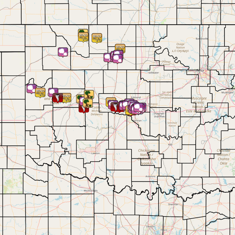
| Report Date |
Report Time (CST) |
Location | County | State | Event Type |
Mag. | Source | Lat. | Lon. | Remark |
|---|---|---|---|---|---|---|---|---|---|---|
| 05/19/2024 | 16:45 | 3 W Crawford | Roger Mills | OK | Hail | 1.50 in. | Public | 35.81 | -99.86 | Delayed report. Report from mPING: Ping Pong Ball (1.50 in.). |
| 05/19/2024 | 17:12 | 4 SE Roll | Roger Mills | OK | Tstm Wnd Gust | 75 mph | Broadcast Media | 35.74 | -99.66 | |
| 05/19/2024 | 17:57 | Moorewood | Custer | OK | Hail | 2.75 in. | Public | 35.74 | -99.36 | Report from mPING: Baseball (2.75 in.). |
| 05/19/2024 | 18:25 | 3 E Butler | Custer | OK | Tstm Wnd Gust | 78 mph | Other Federal | 35.64 | -99.13 | |
| 05/19/2024 | 18:28 | 6.5 E Butler | Custer | OK | Tstm Wnd Gust | 80 mph | Other Federal | 35.64 | -99.07 | |
| 05/19/2024 | 18:35 | 4 W Butler | Custer | OK | Tornado | Broadcast Media | 35.64 | -99.26 | ||
| 05/19/2024 | 19:10 | 6 SSE Weatherford | Washita | OK | Tornado | Trained Spotter | 35.45 | -98.66 | ||
| 05/19/2024 | 19:11 | 6 N Weatherford | Custer | OK | Tstm Wnd Dmg | Trained Spotter | 35.62 | -98.72 | Tree damage and power poles down. Possible tornado. | |
| 05/19/2024 | 19:14 | 4 NE Weatherford | Custer | OK | Hail | 1.25 in. | Public | 35.58 | -98.65 | Delayed report. Report from mPING: Half Dollar (1.25 in.). |
| 05/19/2024 | 19:20 | 10 WSW Greenfield | Blaine | OK | Tstm Wnd Dmg | Emergency Mngr | 35.70F | -98.54 | Delayed report. Damage to barns, 2 homes and granaries in the vicinity. Radar estimated time. | |
| 05/19/2024 | 19:40 | 1 SSE Hydro | Caddo | OK | Tstm Wnd Dmg | Public | 35.54 | -98.57 | Billboard blown down and semi-trailer turned over. | |
| 05/19/2024 | 19:40 | Kremlin | Garfield | OK | Non-Tstm Wnd Gust | 90 mph | Emergency Mngr | 36.55 | -97.83 | Possible heat burst, large area of damage from Kremlin to Hillsdale. |
| 05/19/2024 | 20:20 | 5 WNW El Reno | Canadian | OK | Tstm Wnd Gust | 58 mph | Mesonet | 35.56 | -98.04 | |
| 05/19/2024 | 20:21 | 5 NE Mooreland | Woodward | OK | Hail | 2.25 in. | Emergency Mngr | 36.49 | -99.14 | |
| 05/19/2024 | 20:33 | 2 SW El Reno | Canadian | OK | Hail | 1.25 in. | Public | 35.51 | -97.99 | Delayed report. Report from mPING: Half Dollar (1.25 in.). |
| 05/19/2024 | 20:37 | 6 WSW Yukon | Canadian | OK | Tornado | Mesonet | 35.46 | -97.84 | radar confirmed and media video. | |
| 05/19/2024 | 20:43 | Yukon | Canadian | OK | Hail | 1.25 in. | Public | 35.50 | -97.74 | |
| 05/19/2024 | 20:45 | Yukon | Canadian | OK | Hail | 2.25 in. | Broadcast Media | 35.50 | -97.74 | |
| 05/19/2024 | 20:51 | 4 SSE El Reno | Canadian | OK | Tornado | Broadcast Media | 35.47 | -97.93 | ||
| 05/19/2024 | 20:53 | 3 E Yukon | Canadian | OK | Hail | 1.00 in. | Public | 35.51 | -97.70 | Delayed report. Report from mPING: Quarter (1.00 in.). |
| 05/19/2024 | 21:00 | 1 N Warr Acres | Oklahoma | OK | Hail | 1.00 in. | Public | 35.54 | -97.62 | Delayed report. Report from mPING: Quarter (1.00 in.). |
| 05/19/2024 | 21:01 | 1 NE Yukon | Canadian | OK | Hail | 1.00 in. | Public | 35.50 | -97.73 | Delayed report. Report from mPING: Quarter (1.00 in.). |
| 05/19/2024 | 21:05 | 2 SW Bethany | Oklahoma | OK | Hail | 1.00 in. | Public | 35.49 | -97.66 | Delayed report. Report from mPING: Quarter (1.00 in.). |
| 05/19/2024 | 21:06 | 1 SE Yukon | Canadian | OK | Hail | 1.25 in. | Public | 35.49 | -97.74 | Delayed report. Report from mPING: Half Dollar (1.25 in.). |
| 05/19/2024 | 21:06 | 4 E Yukon | Canadian | OK | Hail | 1.50 in. | Trained Spotter | 35.50 | -97.67 | |
| 05/19/2024 | 21:09 | 5 W Valley Brook | Oklahoma | OK | Tornado | Broadcast Media | 35.40 | -97.57 | Brief tornado. | |
| 05/19/2024 | 21:10 | 6 SW Oklahoma City | Oklahoma | OK | Tstm Wnd Gust | 75 mph | ASOS | 35.41 | -97.59 | |
| 05/19/2024 | 21:18 | 3 S Nichols Hills | Oklahoma | OK | Hail | 1.00 in. | Public | 35.51 | -97.54 | Delayed report. Report from mPING: Quarter (1.00 in.). |
| 05/19/2024 | 21:20 | 2 SSW Nicoma Park | Oklahoma | OK | Hail | 1.19 in. | Emergency Mngr | 35.46 | -97.34 | Relayed images. Digital caliper measurement. |
| 05/19/2024 | 21:26 | 3 S Oklahoma City | Oklahoma | OK | Hail | 1.00 in. | Public | 35.43 | -97.52 | Delayed report. Report from mPING: Quarter (1.00 in.). |
| 05/19/2024 | 21:28 | Del City | Oklahoma | OK | Hail | 1.00 in. | Public | 35.45 | -97.44 | Report from mPING: Quarter (1.00 in.). |
| 05/19/2024 | 21:28 | 1 NE Oklahoma City | Oklahoma | OK | Hail | 1.00 in. | Public | 35.48 | -97.50 | Report from mPING: Quarter (1.00 in.). |
| 05/19/2024 | 21:29 | 1 W Tinker Air Force Base | Oklahoma | OK | Hail | 1.00 in. | Public | 35.42 | -97.41 | Report from mPING: Quarter (1.00 in.). |
| 05/19/2024 | 21:35 | 1 SW Del City | Oklahoma | OK | Hail | 1.75 in. | Law Enforcement | 35.43 | -97.46 | NWSChat report. |
| 05/19/2024 | 21:35 | Lahoma | Garfield | OK | Hail | 1.00 in. | Public | 36.39 | -98.09 | Report from mPING: Quarter (1.00 in.). Additional emergency management confirmation. |
| 05/19/2024 | 21:38 | 2 NE Tinker Air Force Base | Oklahoma | OK | Hail | 1.25 in. | Public | 35.44 | -97.37 | Report from mPING: Half Dollar (1.25 in.). |
| 05/19/2024 | 21:43 | Enid | Garfield | OK | Hail | 1.75 in. | Emergency Mngr | 36.41 | -97.88 | NWSChat report. |
| 05/19/2024 | 21:44 | 2 NE Valley Brook | Oklahoma | OK | Hail | 1.75 in. | Emergency Mngr | 35.42 | -97.46 | Relayed images. |
| 05/19/2024 | 21:45 | Enid | Garfield | OK | Hail | 2.00 in. | Emergency Mngr | 36.40 | -97.88 | Relayed images. Radar estimated time. |
| 05/19/2024 | 21:45 | 1 W Midwest City | Oklahoma | OK | Hail | 1.00 in. | Trained Spotter | 35.46 | -97.41 | Spotter Network report. |
| 05/19/2024 | 21:47 | 3 W Enid | Garfield | OK | Hail | 1.50 in. | Public | 36.39 | -97.94 | Report from mPING: Ping Pong Ball (1.50 in.). |
| 05/19/2024 | 21:47 | 3 NW Enid | Garfield | OK | Hail | 1.75 in. | Public | 36.42 | -97.93 | Report from mPING: Golf Ball (1.75 in.). |
| 05/19/2024 | 21:52 | 1 S Enid | Garfield | OK | Hail | 1.75 in. | Public | 36.39 | -97.89 | Report from mPING: Golf Ball (1.75 in.). |
| 05/19/2024 | 21:56 | North Enid | Garfield | OK | Hail | 1.00 in. | Public | 36.44 | -97.87 | Report from mPING: Quarter (1.00 in.). |
| 05/19/2024 | 21:56 | 2 N Vance Air Force Base | Garfield | OK | Hail | 1.75 in. | Public | 36.37 | -97.89 | Report from mPING: Golf Ball (1.75 in.). |
| 05/19/2024 | 22:40 | 2 NNW Alva | Woods | OK | Tstm Wnd Dmg | Emergency Mngr | 36.83 | -98.68 | Powerlines down along with damage to a barn in the vicinity. Radar estimated time. | |
| 05/19/2024 | 23:15 | 1 SW Cherokee | Alfalfa | OK | Tstm Wnd Gust | 60 mph | Mesonet | 36.75 | -98.36 | Cherokee (CHER) Mesonet. |
| 05/19/2024 | 23:15 | 2 S Alva | Woods | OK | Tstm Wnd Gust | 58 mph | AWOS | 36.77 | -98.67 | Alva Regional Airport (KAVK). |
