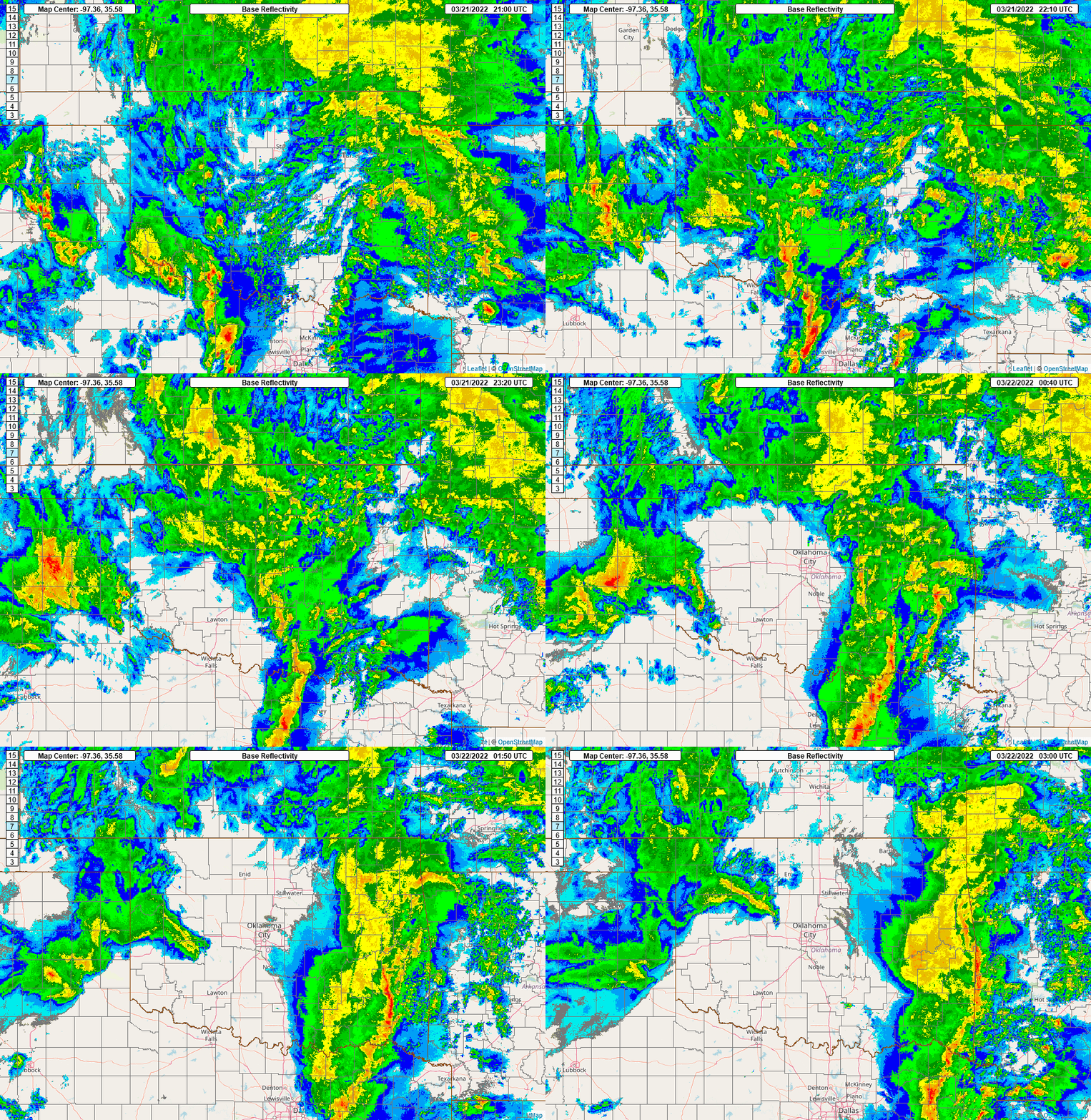
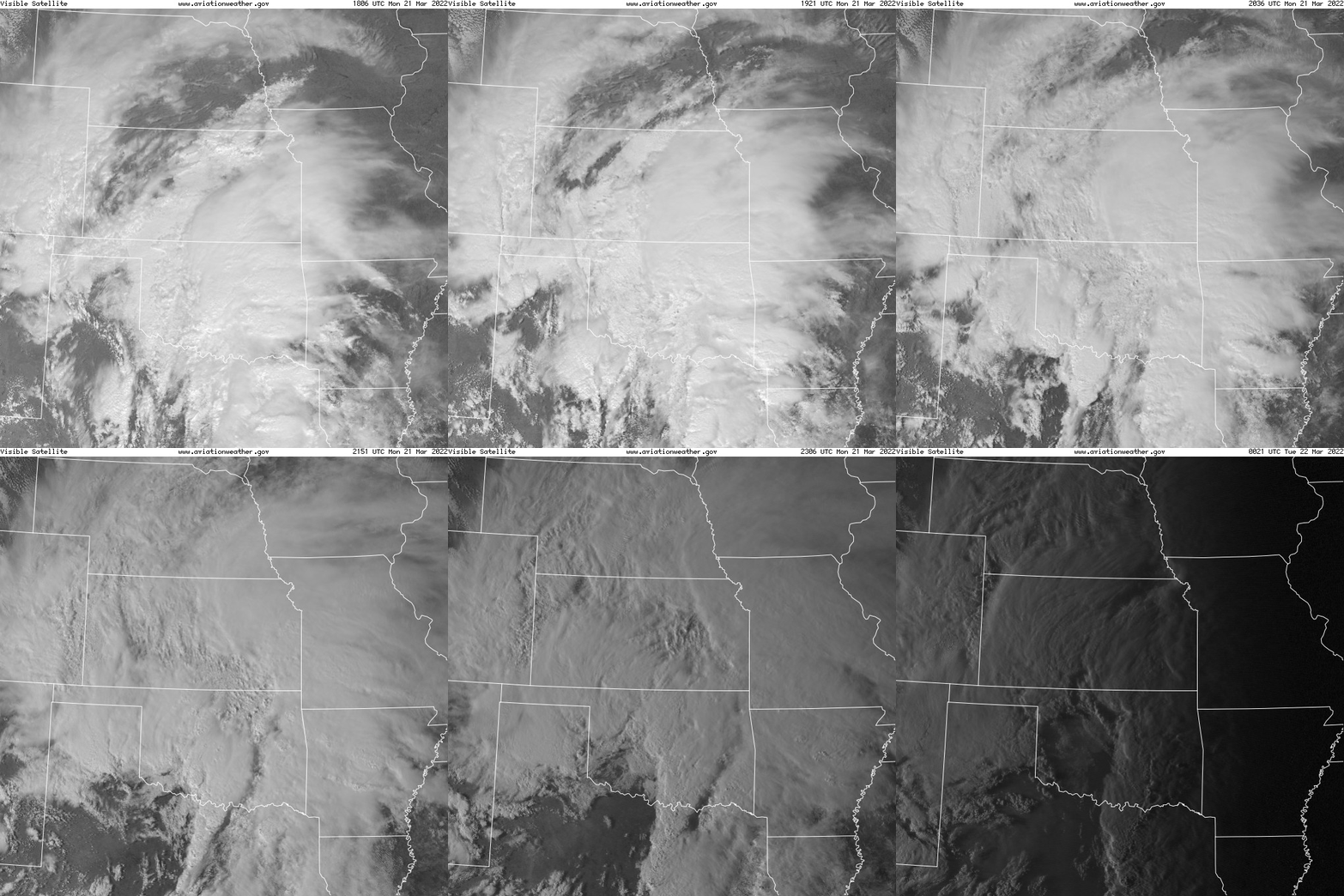
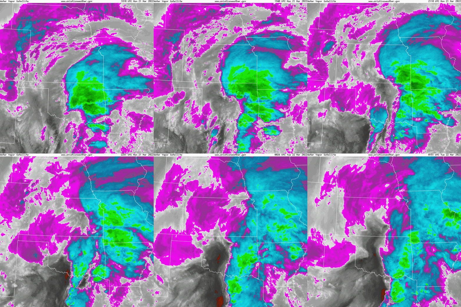
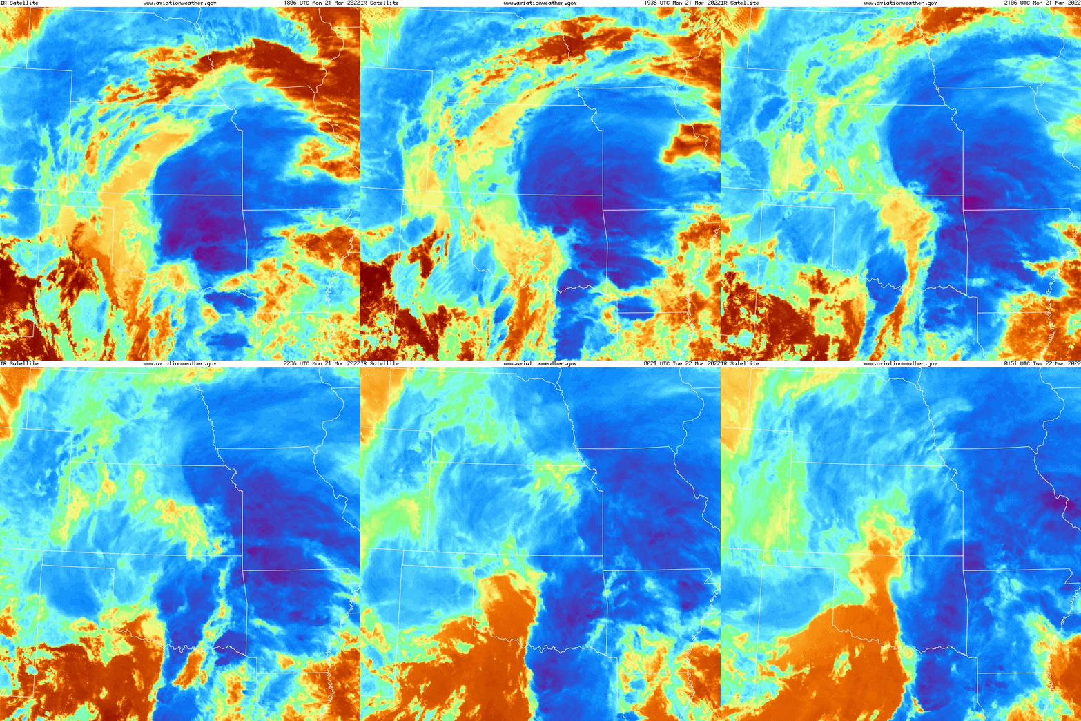
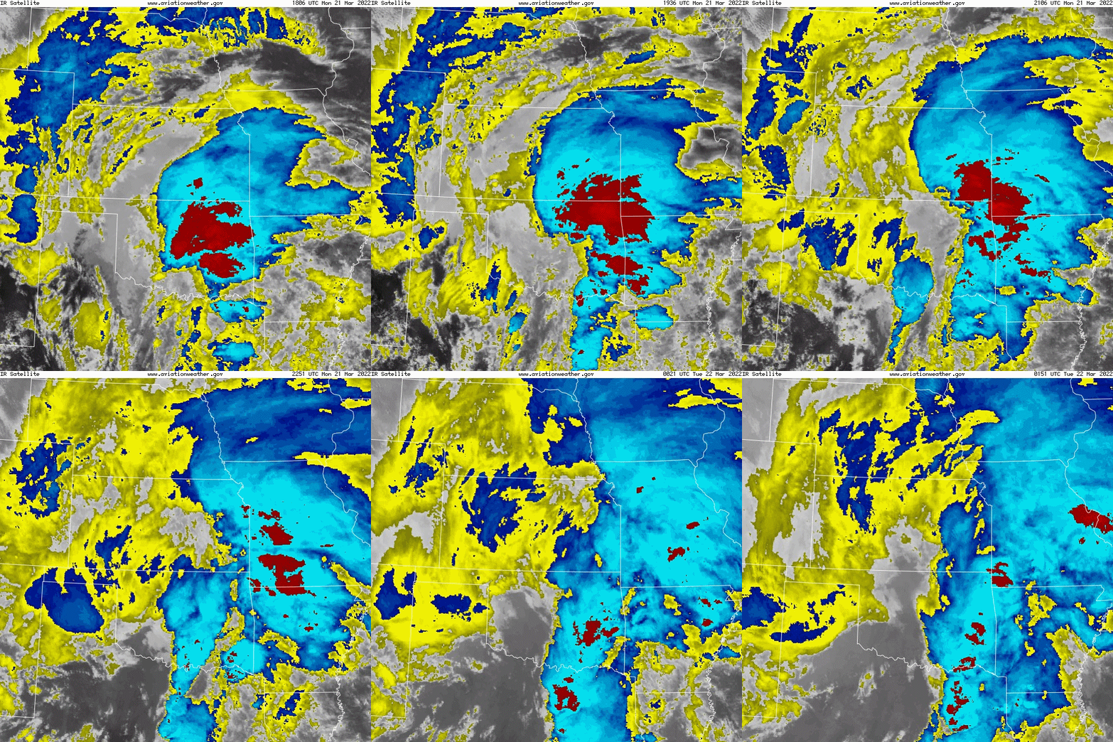
The Spring storm season started off with a bang as a powerful, upper-level storm system produced severe weather across the southern Great Plains in parts of southern Oklahoma and Texas during the afternoon and evening hours of March 21, 2022. Multiple tornadoes occurred in southern Oklahoma in the NWS Norman forecast area.
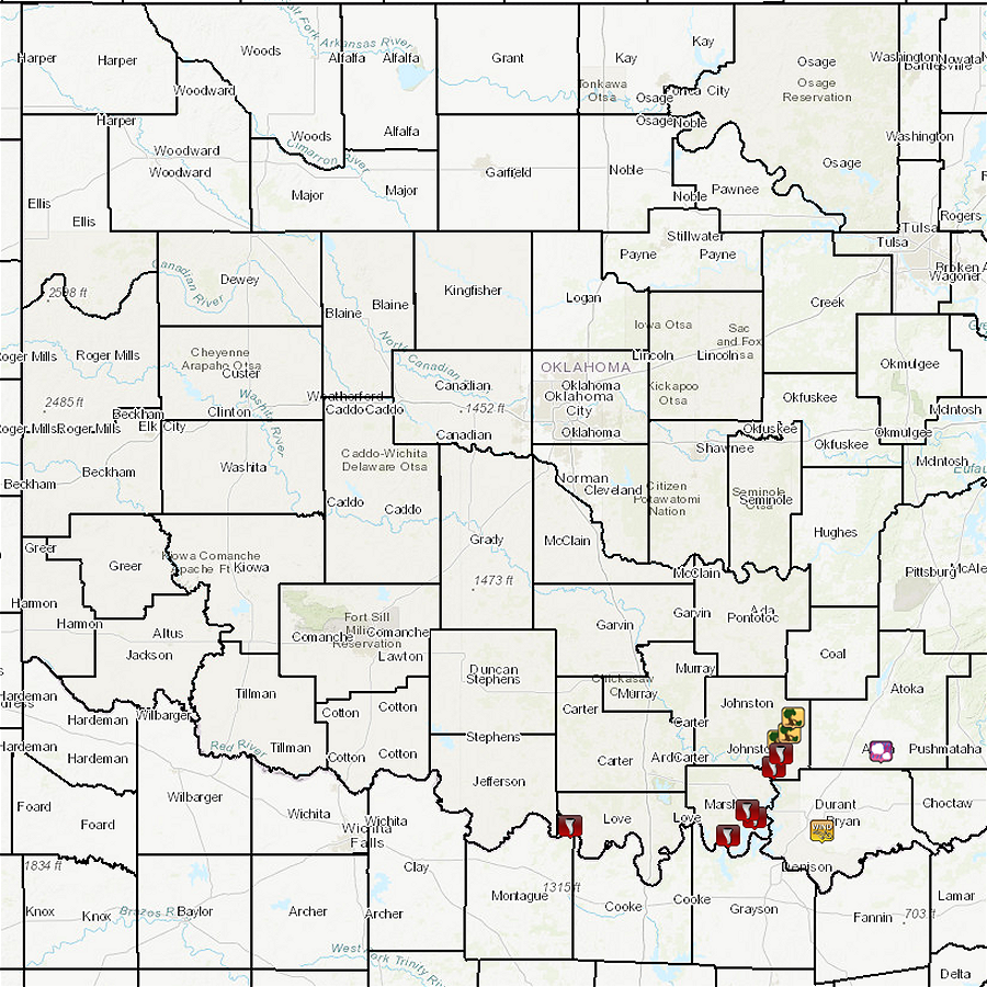
NWS Norman survey crews documented tornado damage paths in southern Oklahoma on Tuesday, March 22, 2022. Based on their findings, the "Buncombe" tornado in southern Marshall County was given a rating of EF-2. In addition, the "Kingston" tornado was rated EF-1, and the "Courtney" tornado in Love County was rated EF-0. More research is being conducted on other tornadoes that may have occurred on March 21, 2022 in the NWS Norman forecast area. Please check this page in the near future for updated information for this severe weather event.
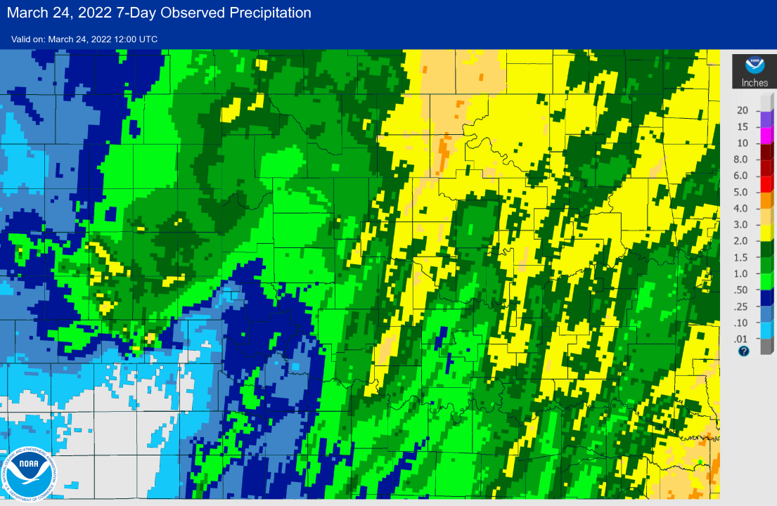
The powerful storm system also produced beneficial rainfall across the region as precipitation totals of 1 to 3 inches where recorded across most of central/western Oklahoma and western north Texas.
NOUS44 KOUN 222315
PNSOUN
OKZ004>048-050>052-TXZ083>090-231115-

Public Information Statement
National Weather Service Norman OK
615 PM CDT Tue Mar 22 2022

...NWS DAMAGE SURVEY FOR 03/21/2022 TORNADO EVENT...

.Overview...
Preliminary surveys can confirm 3 different tornadoes
spanning across Love, Marshall, and Johnston Counties.

.Buncombe Area...

Rating:                 EF-2
Estimated Peak Wind:    115 mph
Path Length /statute/:  2.6 miles
Path Width /maximum/:   200 yards
Fatalities:             NA
Injuries:               NA

Start Date:             03/21/2022
Start Time:             616 PM CDT
Start Location:         9 Miles SW Kingston
Start Lat/Lon:          33.87/-96.80

End Date:               03/21/2022
End Time:               621 PM CDT
End Location:           6 Miles SW Kingston
End Lat/Lon:            33.90/-96.77

Survey Summary: Tornado crossed over the Red River and into Marshall
County at approximately 616 PM. At this time, the tornado quickly
intensified up to an EF-2 rating as it moved toward the northeast.
Shortly after intensification, the tornado weakened and lifted
off the ground.

.Kingston...

Rating:                 EF-1
Estimated Peak Wind:    90 mph
Path Length /statute/:  20 miles
Path Width /maximum/:   200 yards
Fatalities:             NA
Injuries:               NA

Start Date:             03/21/2022
Start Time:             626 PM CDT
Start Location:         Kingston
Start Lat/Lon:          33.99/-96.70

End Date:               03/21/2022
End Time:               643 PM CDT
End Location:           1 NE Milburn
End Lat/Lon:            34.24/-96.53

Survey Summary: Tornado dropped just southeast of Highway 70 in
Kingston where EF-1 damage occurred. This tornado continued toward
the northeast over Lake Texoma where additional damage was found
in Little City. The path of this tornado continued northeast over
Lake Texoma once again where tree damage was found near Emet.
Ongoing assessment of this tornado will continue to determine if
more than one tornado was actually present, or if this was one
long-tracked tornado.

.Courtney...

Rating:                 EF-0
Estimated Peak Wind:    75 mph
Path Length /statute/:  5 miles
Path Width /maximum/:   50 yards
Fatalities:             NA
Injuries:               NA

Start Date:             03/21/2022
Start Time:             513 PM CDT
Start Location:         1 S Courtney
Start Lat/Lon:          33.92/-97.50

End Date:               03/21/2022
End Time:               520 PM CDT
End Location:           4 NE Courtney
End Lat/Lon:            33.99/-97.45

Survey Summary: A brief tornado occurred near Courtney beginning
on or just north of the Red River and moving northeast for about 5
miles. Damage to at least one home, and several power lines down
were noted.

EF Scale: The Enhanced Fujita Scale classifies tornadoes into the
following categories:

EF0...Weak......65 to 85 mph
EF1...Weak......86 to 110 mph
EF2...Strong....111 to 135 mph
EF3...Strong....136 to 165 mph
EF4...Violent...166 to 200 mph
EF5...Violent...>200 mph

NOTE:
The information in this statement is preliminary and subject to
change pending final review of the events and publication in NWS
Storm Data.

$$
|
| Tornadoes by Intensity | |||||||
|---|---|---|---|---|---|---|---|
| EFU | EF0 | EF1 | EF2 | EF3 | EF4 | EF5 | Total |
| 0 | 1 | 3 | 1 | 0 | 0 | 0 | 5 |
| Tornado Number |
Date | Time (CST) |
Length of Path (miles) |
Width of Path (yards) |
F-Scale | Killed | Injured | County | Location |
|---|---|---|---|---|---|---|---|---|---|
| 1 | 03/21/2022 | 1617-1632 | 7 | 50 | EF1 | 0 | 0 | Love | 1 E Courtney - 6 NNE Rubottom. |
| 2 | 03/21/2022 | 1711-1721 | 5 | 200 | EF2 | 1 | 10 | Grayson TX/ Marshall | 1 NE Cedar Mills TX - 4 E Willis OK |
| 3 | 03/21/2022 | 1726-1741 | 10 | 200 | EF1 | 0 | Marshall | 2 S Kingston - Little City | |
| 4 | 03/21/2022 | 1732-1735 | 2.6 | 20 | EF0 | 0 | 0 | Marshall | 0.5 SW - 2 NE Woodville |
| 5 | 03/21/2022 | 1743-1753 | 7 | 200 | EF1 | 0 | 0 | Johnston | 5 SW Emet - Emet - 1.5 ESE Milburn |
NWUS54 KOUN 222334
LSROUN

PRELIMINARY LOCAL STORM REPORT
NATIONAL WEATHER SERVICE NORMAN OK
634 PM CDT TUE MAR 22 2022

..TIME...   ...EVENT...      ...CITY LOCATION...     ...LAT.LON...
..DATE...   ....MAG....      ..COUNTY LOCATION..ST.. ...SOURCE....
            ..REMARKS..

0513 PM     TORNADO          1 E COURTNEY            33.94N 97.50W
03/21/2022                   LOVE               OK   EMERGENCY MNGR

            CORRECTS PREVIOUS TSTM WND DMG REPORT FROM 1
            E COURTNEY. DAMAGE TO THE ROOF OF A HOME AND
            POWERLINES. TIME FROM RADAR.

0616 PM     TORNADO          3 ENE WILLIS            33.90N 96.78W
03/21/2022                   MARSHALL           OK   EMERGENCY MNGR

            CORRECTS PREVIOUS TSTM WND DMG REPORT FROM 3
            ENE WILLIS. EXTENSIVE DAMAGE TO STRUCTURES
            AND TREES REPORTED IN BUNCOMBE CREEK AREA.
            TIME FROM RADAR.

0630 PM     TORNADO          2 E KINGSTON            34.00N 96.69W
03/21/2022                   MARSHALL           OK   BROADCAST MEDIA

            CORRECTS PREVIOUS TSTM WND DMG REPORT FROM 2
            E KINGSTON. DAMAGE REPORTED TO DOLLAR
            GENERAL AND OTHER STRUCTURES ALONG HIGHWAY
            70 EAST OF KINGSTON. TIME FROM RADAR.

0647 PM     TORNADO          4 WNW NIDA              34.16N 96.57W
03/21/2022                   JOHNSTON           OK   EMERGENCY MNGR

            CORRECTS PREVIOUS TSTM WND DMG REPORT FROM 4
            WNW NIDA. TREES AND POWERLINES DOWNED ALONG
            HIGHWAY 22. TIME FROM RADAR.

0650 PM     TORNADO          2 SSE MILBURN           34.21N 96.54W
03/21/2022                   JOHNSTON           OK   BROADCAST MEDIA

            CORRECTS PREVIOUS TSTM WND DMG REPORT FROM 2
            SSE MILBURN. POWERLINES AND TREES DOWN,
            SEVERAL MANUFACTURED HOMES DAMAGED NEAR
            EMET. TIME FROM RADAR.


&&

$$
|
The powerful storm system also produced beneficial rainfall across the region as precipitation totals of 1 to 3 inches where recorded across most of central/western Oklahoma and western north Texas.
