Isolated severe storms capable of hail and gusty winds are possible mainly this evening across portions of the mid-Mississippi Valley. Clusters of thunderstorms may produce isolated flash flooding in the Florida peninsula. Elevated fire weather risk is possible in the Northern Plains into western Minnesota. Read More >
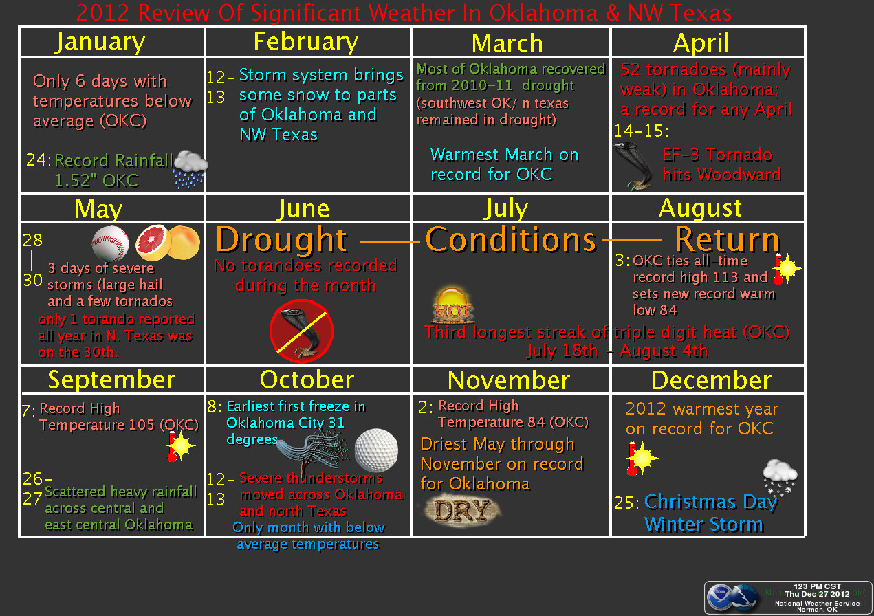
A graphical review of the significant weather events for the region in 2012 is available below.
 |
 |
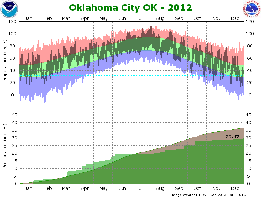
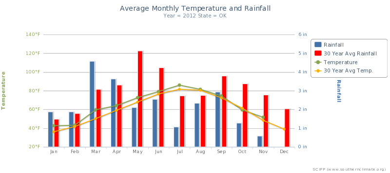
Annual summary for the state of Oklahoma from SCIPP.
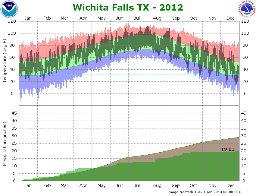
Annual summary for north-central Texas from SCIPP.
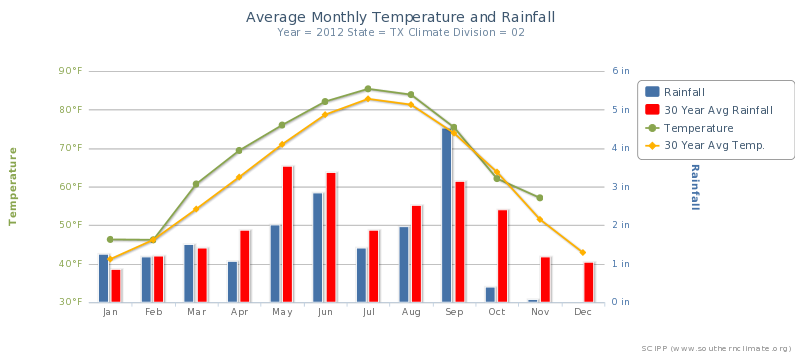
The start of 2012 was relatively quiet as compared to 2011. No major winter storms occurred and average temperatures were a bit warmer than normal. Wetter than average conditions were also present, which was beneficial given the lack of substantial rainfall events late in 2011. In fact, Oklahoma City set a new daily rainfall record of 1.52 inches on the January 24th, and Sheppard Air Force Base in Wichita Falls, TX, likewise set daily rainfall records on both the January 10th and 24th.
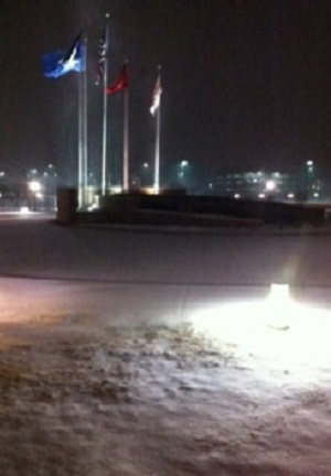
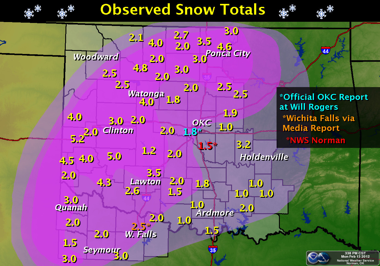
Despite better than average rains, much of Oklahoma and western north Texas struck off the year in extreme to exceptional drought. One marginal winter weather event occurred on February 12-13, 2012 when measurable snows blanketed much of Oklahoma and western north Texas. Both Oklahoma City and Wichita Falls measured around 2.0-2.5 inches of snow before the storm ended.
The month of February, on whole, was generally milder and drier than normal, but not significantly so. Several severe wind and hail events occurred in February. The most significant was on the February 22nd, when severe storms resulted in widespread wind damage across northern parts of Oklahoma City.
 |
 |
We generally tend to see severe weather start popping up in mid to late March, and this year was no exception. Several severe weather events occurred. The most significant of these took place on the 18th, when several supercell thunderstorms tracked across southwest Oklahoma and western north Texas. Several tornadoes were reported across Greer and Beckham counties in southwest Oklahoma, along with baseball sized hail. Fortunately, none of the tornadoes produced major damage, and all were rated EF-0. March was another wet month, with monthly rainfall at Oklahoma City and Wichita Falls, TX coming in at 5.03'' and 3.49'' respectively. These were one to two inches above average for the month, making for beneficial relief of the drought-stricken region. March 2012 also ranked as the warmest March on record for Oklahoma City, and the fourth warmest for Wichita Falls.

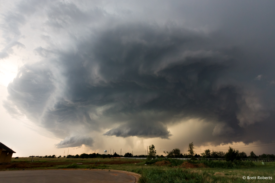
This is a panorama of a supercell in Southwest Oklahoma on the evening of March 18th. Photo courtesy Brett Roberts.
April 2012 was the busiest severe weather month, with several days of significant severe weather. Just two days into April, damaging winds and large hail fell across western Oklahoma and western north Texas, with multiple other severe events occuring during the month.
 |
 |
| Very large hailstone that fell in Woodward. Photo courtesy of Kim Garcia |
Hail damaged vehicle. Photo courtesy of Maria Everett |
A significant hailstorm, along with a few tornadoes, developed across portions of northwest Oklahoma on the 9th. Most of the tornadoes remained over rural areas, but hail as large as softballs pummeled Woodward, OK with two separate storms during the late afternoon and early evening.
 |
 |
A total of 52 tornadoes were reported across the state in 2012, and a new record was set for the total number of tornadoes occurring during the month of April.
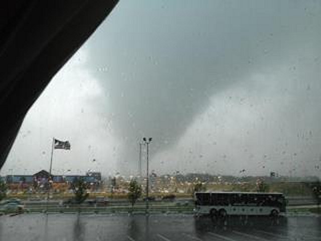
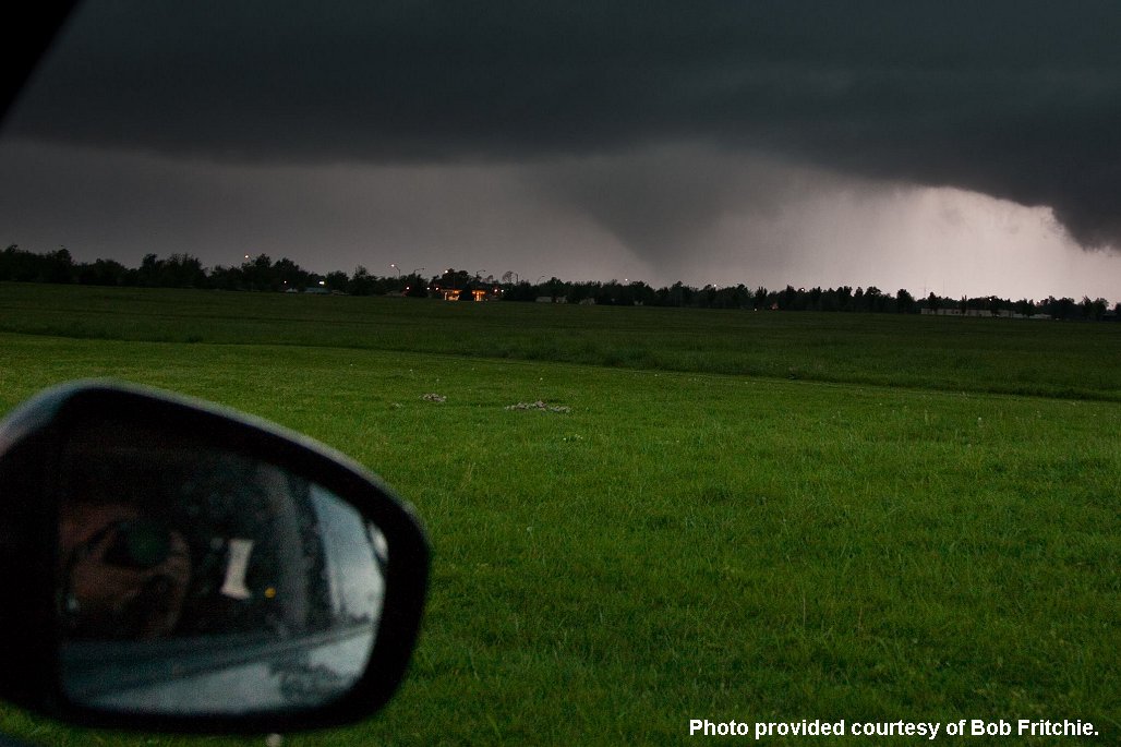
The most active days were April 13th and 14th. A total of 12 tornadoes touched down on the April 13th, including the strongest on that day, an EF-1 tornado that carved a path of damage across Norman, just south of the Oklahoma City metro area. Several other weak tornadoes were reported across mainly southwest Oklahoma in Jackson, Kiowa, and Caddo counties, and one other tornado touched down near Mustang on the southwest side of Oklahoma City during the evening hours of the April 13th.
 |
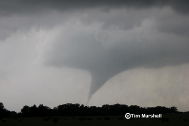 |
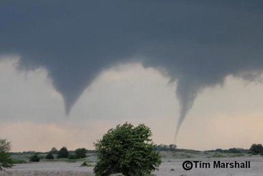
The more active, and deadliest day, was April 14th, when several tornadoes tore across portions of northwest and north central Oklahoma in an outbreak that stretched from Nebraska down to Oklahoma. Most of the tornadoes were brief and weak (EF-0 or EF-1). However, one tornado, which occurred during the late evening hours of April 14th and the early morning hours of the April 15th, was rated EF-3, and carved a path of destruction across Ellis and Woodward counties. This tornado began near Arnett and moved rapidly northeastward into Woodward around midnight. The tornado took six lives and caused major damage to parts of west Woodward. This tornado turned out to be the deadliest of the tornadoes that impacted OK, KS, NE, and IA during the April 14, 2012 tornado outbreak.
Another tornado event took place along a warm front in northwest and north central Oklahoma on the evening of April 30th. Eight tornadoes affected parts of Alfalfa, Grant, and Kay counties. The strongest of the tornadoes was near Medford, resulting in numerous toppled power poles and power lines, and damage to several barns and outbuildings. Most of these tornadoes were relatively weak (EF-0 to EF-1).
Above normal precipitation continued across most of Oklahoma with near normal monthly precipitation over western north Texas. The abundance of rainfall on April 8th led to flash flooding along Honey Creek at Turner Falls in south central Oklahoma. More substantial flash flooding took place on April 29th at Ponca City and Tonkawa in northern Oklahoma. Several inches of water closed streets and flooded homes in Ponca City.
After the action-packed month of April 2012 that featured the most tornadoes of any April in the state of Oklahoma since official records began in 1950, May was somewhat quiet in terms of severe weather. While May is statistically our most tornado-prone month, tornadoes were reported on only two days this year (May 29th and May 30th). Several other severe wind and hail events took place, mainly across the western half of Oklahoma.
 |
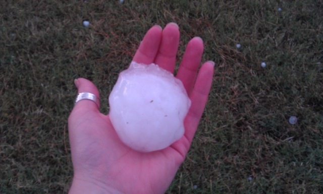 |
| Photo of the prolific hail-producing storm that moved into North Oklahoma City on the 29th. Photo courtesy Brett Roberts | This large hailstone was one of hundreds that fell near Kingfisher, OK on the evening of the 29th. |
The most significant severe weather event began during the afternoon hours of May 29th and lasted well into the night. Several long-lived supercells tracked from northwest and north-central Oklahoma down into the Oklahoma City metro area. Very large hail, measuring from 3.5 to 5 inches in diameter, was reported in northern parts of Oklahoma City and surrounding suburbs. High winds and large hail caused significant damage to homes and businesses, and resulted in hundreds of thousands without power. Two tornadoes were reported in Canadian County, but resulted in only minor damage. Total damages from the storms were estimated to be between $400 and $500 million.
A less costly severe storm event took place the next day, with hail and high winds reported in some of the same areas as the day before. Supercells also scoured parts of western north Texas, with a brief tornado near Truscott in rural Foard County, the only tornado reported in western north Texas for the year.
After a summer chalk full of record heat in 2011, this summer wasted little time in trying to match its predecessor. June featured four days with highs over 100 degrees at Oklahoma City, while July had 15 such days. The most extreme heat arrived in early August, when numerous records were shattered across the area. At Oklahoma City, the high temperature climbed to at least 112 degrees for three consecutive days on August 1-3, 2012, setting daily records in each case. The high of 113 degrees on August 3, 2012 tied the all-time hottest temperature ever recorded, last reached during the Dust Bowl era in August 1936. The stretch of 18 consecutive days with highs above 100 from July 16th to August 3rd also exceeded any such stretch recorded during the summer of 2011!
Concurrent with the extreme heat, drought conditions worsened across the southern Plains after the brief improvement seen during the spring months. At Oklahoma City, precipitation was below average for all three months; July featured only 0.36" of rainfall, less than 20% of normal. One unfortunate result of the scorching heat and parched landscape was an active wildfire season. The most significant fires were seen on August 3, 2012, when extreme temperatures combined with gusty winds ahead of a cold front to yield ideal fire weather conditions. Large wildfires in east Norman near Slaughterville, and near Luther, caused extensive damage and property loss, and both produced significant pyrocumulus clouds for several hours during the afternoon.
In terms of severe weather, meteorological summer proved very benign, even in the normally-active month of June. While a handful of days each month produced scattered reports of wind and hail across the region, no organized or significant severe weather events occurred.
The above video shows the time lapse of a pyrocumulus cloud generated by extreme heat from the Slaughterville, OK fire. This video was taken from the National Weather Center parking lot on the afternoon of August 3, 2012, facing East. The video comes from a blog post discussing the weather conditions that lead to the fires.
Summer heat continued unabated into the first week of meteorological autumn, with six days above 100 degrees at Oklahoma City in early September. Unlike 2011, however, the heat subsided quickly thereafter, with temperatures averaging near normal for the period after September 10. In fact, a record low of 50 degrees was recorded on September 9, 2012.
Despite below-average precipitation, a few days featured severe thunderstorms. On September 7th, a high-based storm produced strong winds across parts of the Oklahoma City metro area, including a gust to 76 mph at Tinker AFB. September 25th and 26th both saw widespread severe wind and hail reports across portions of Oklahoma and north Texas. On September 25th, tennis ball size hail occurred in Vernon, and Altus recorded a gust to 80 mph. On September 26th, an evening supercell on the west side of the metro area dropped hail larger than baseballs near Mustang.
A generally quiet month, October 2012 featured the first below-normal monthly mean temperature at Oklahoma City since November 2011. This was aided by an unseasonably-cold period at the beginning of the month during which Oklahoma City set a record cold high of 50 degrees on the October 6th, and a record low of 31 degrees on October 8th. The latter also set the record for the earliest autumn freeze ever observed in Oklahoma City. The remainder of the month was relatively uneventful, except for a severe weather event on October 13th. On that date, numerous hail and wind reports were received from central and southern Oklahoma into western north Texas, highlighted by gusts to 80 mph at Ringling and Lehigh. A weak tornado also occurred near Healdton with minor damage reported.
In sharp contrast to the rare tornado event experienced in November 2011, very little active weather was observed this time around. The only severe weather reports received in our warning area came on the evening of November 10th, when a supercell thunderstorm moved out of the Texas Panhandle and affected Roger Mills County with hail before weakening. Above-normal temperatures made a return, with Oklahoma City averaging three degrees above average for November 2012. The drought was also reinforced with below-average precipitation.
December began with record warmth and continued dryness. The week of December 1-4, 2012 saw record highs at both Oklahoma City and Wichita Falls, as temperatures soared into the upper 70s and low 80s. A strong strong cold front on the December 9th brought and abrupt end to the heat, with the coldest temperatures of the season thus far moving into Oklahoma and north Texas. Highs remained mainly in the 30s on December 10th, and lows on the morning of December 11th plunged into the single digits and teens for the first time since last winter. A damaging wind event occurred during the evening and overnight hours from the December 19-20, 2012. Minor wind damage and sporadic power outages occurred from the Oklahoma City metro to northwest Oklahoma. The storm system brought multiple facets of hazardous weather, including damaging winds, severe thunderstorms, a major dust storm that swept across the Texas Panhandle, and some light snow to portions of far northwest Oklahoma.
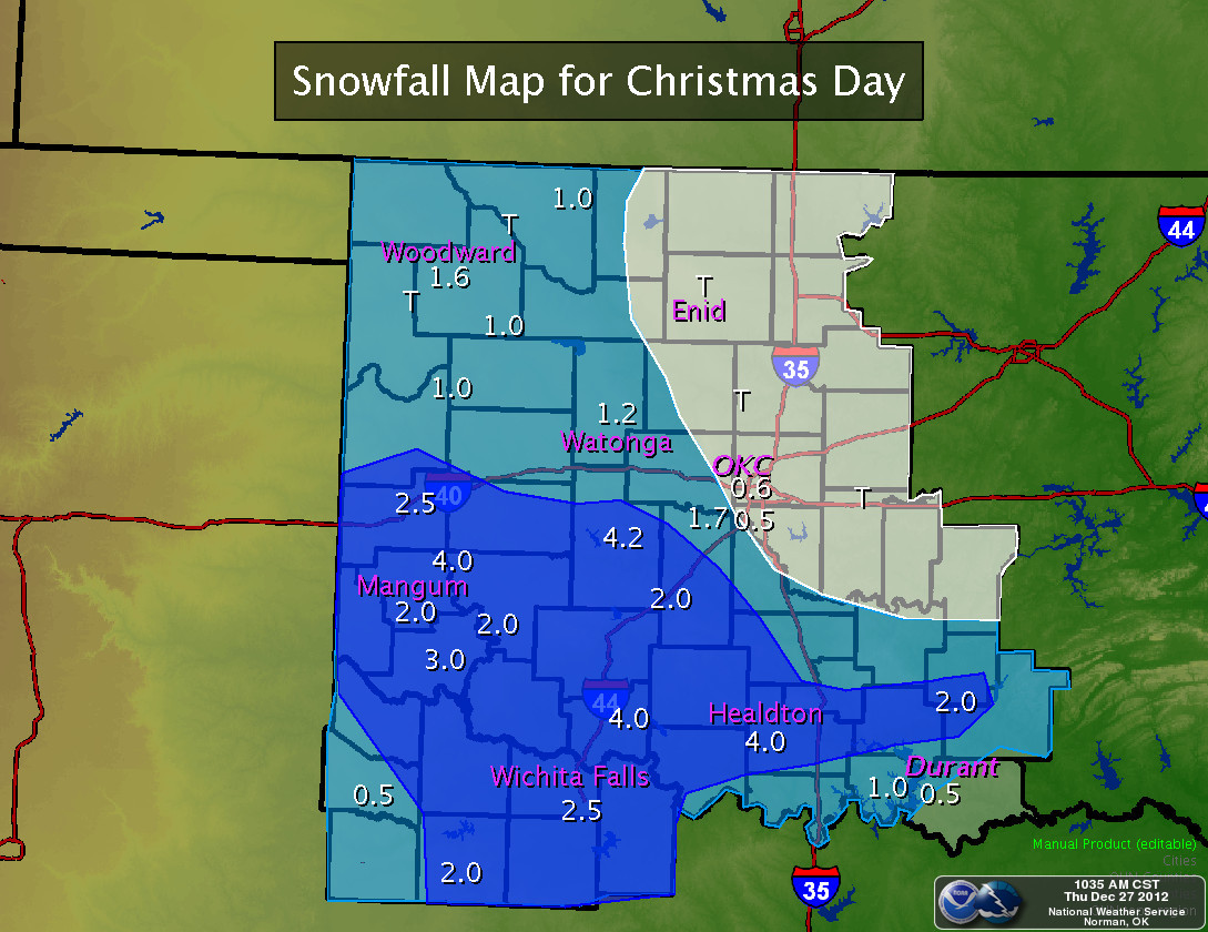
A strong winter storm system moved across the southern plains on Christmas Day, and brought a mixed bag of precipitation to Oklahoma and western north Texas. Rain, freezing rain and drizzle, sleet and snow were observed across the region. Southern Oklahoma and western north Texas received the most snow with amounts ranging from 2-7 inches. Northwestern Oklahoma and central Oklahoma received snowfall amounts of 2 inches or less while parts of north central Oklahoma received little if any snowfall.
The winter precipitation created traffic problems in many areas and gusty north winds of 35-55 mph helped generate near blizzard conditions and drifting snow in parts of south central and southwestern Oklahoma. The high winds combined with frigid temperatures also produced dangerous wind chills of -10 to 10 degrees F during the event.
The long term drought, arguably one of the most impactful aspects of our weather this year, continued across Oklahoma and western north Texas. January and February saw extreme to exceptional drought across much of the region. Welcome relief came to Oklahoma from March through mid-May with an unusually wet Spring season, but drought persisted over north Texas. From June through the remainder of 2012, rainfall events became scarce, and extreme to exceptional drought conditions spread rapidly eastward into much of Oklahoma and north Texas.
 |
 |
 |
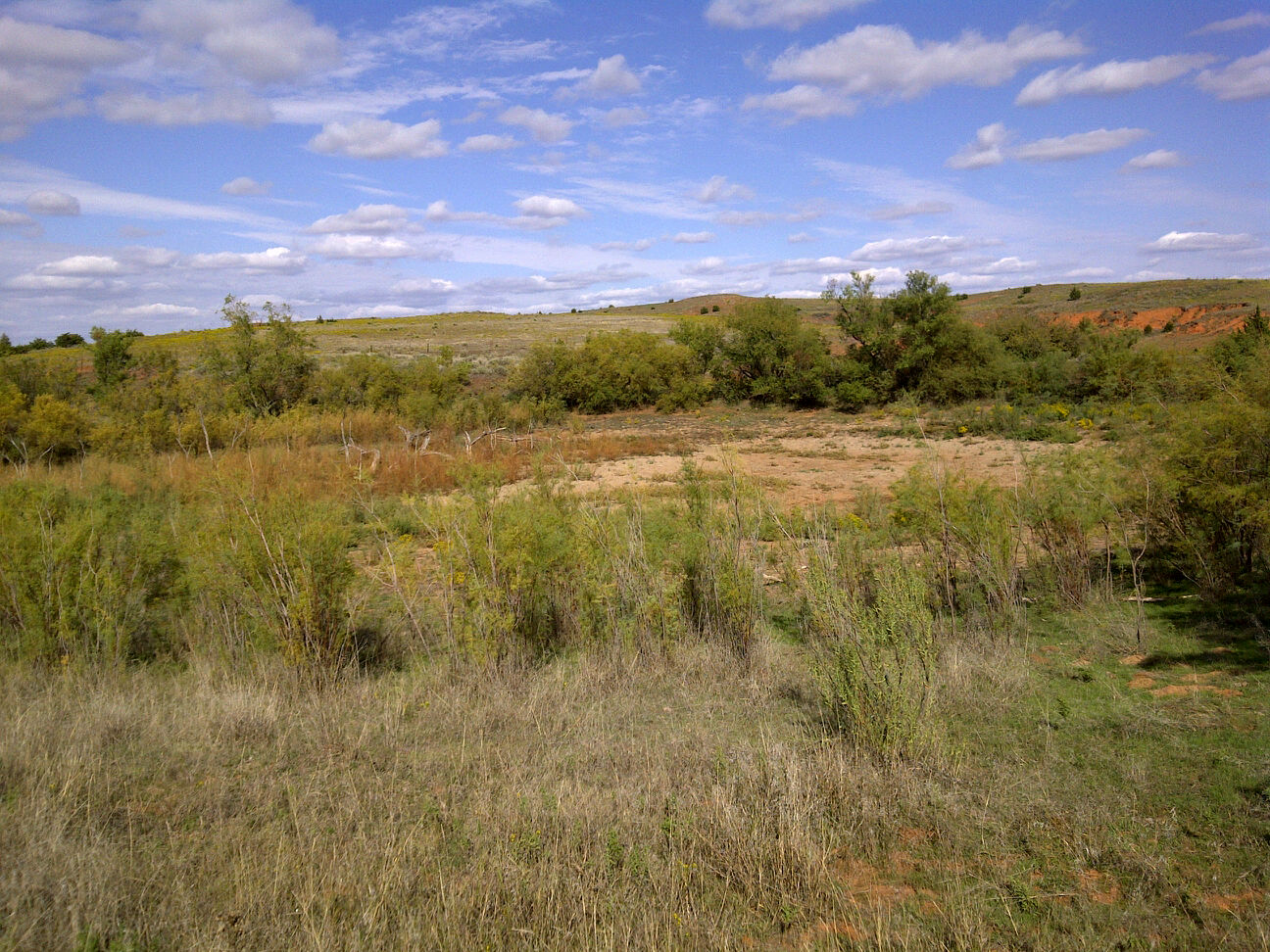 |
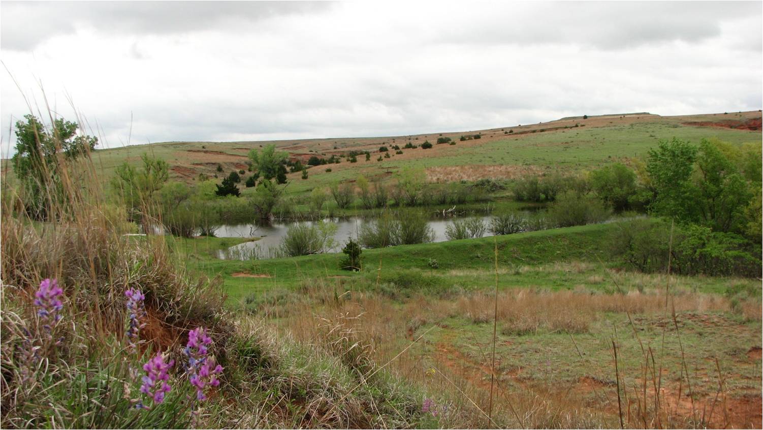
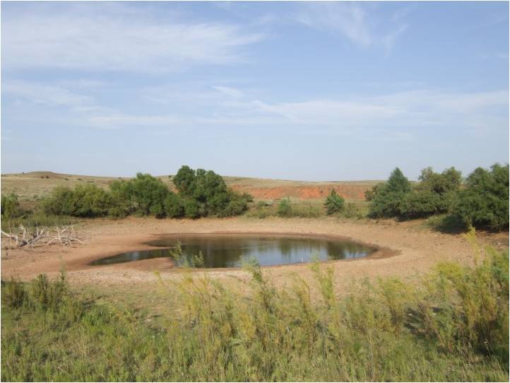
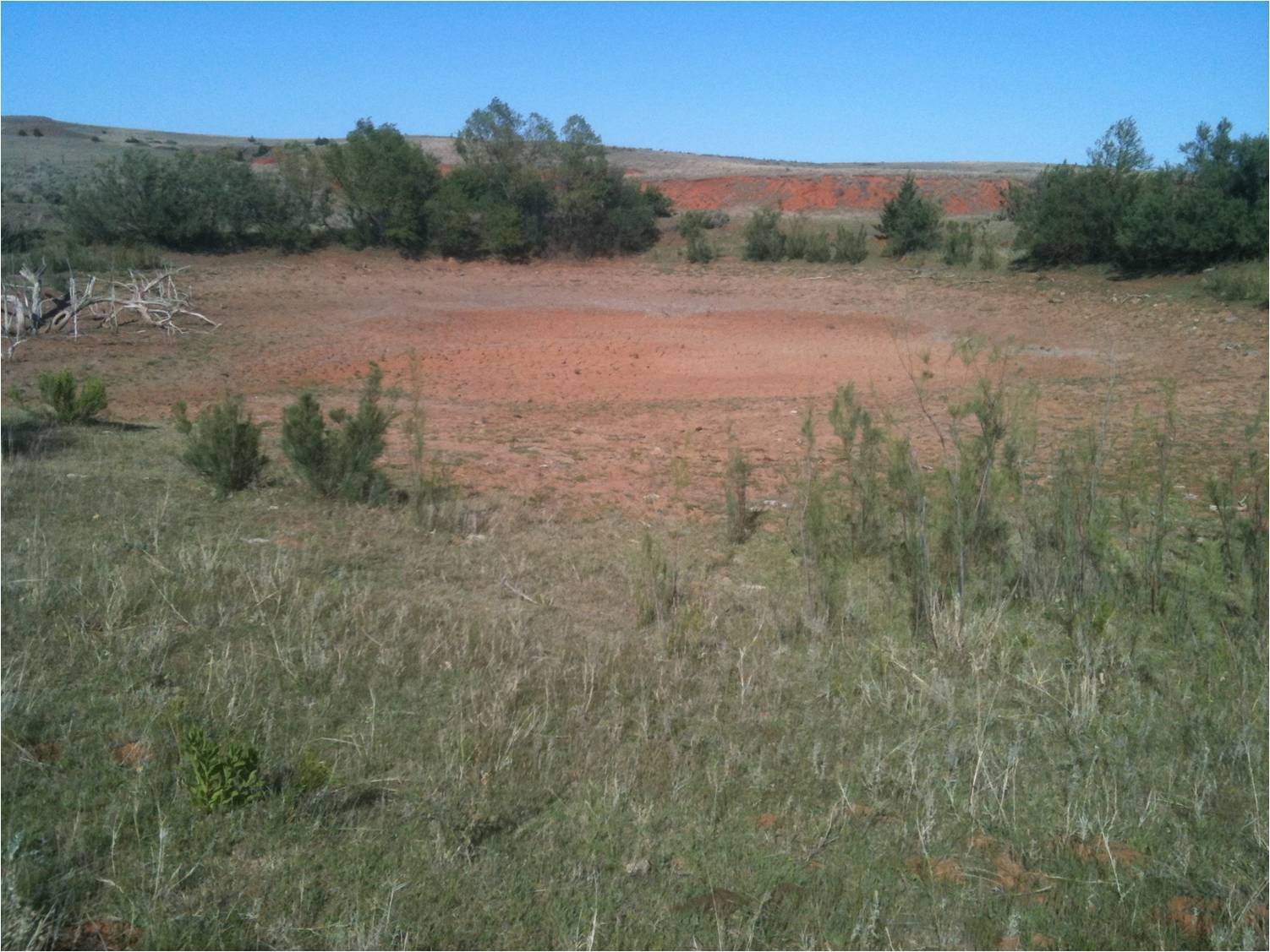
| The photos above are from the Oklahoma Mesonet ticker of October 9, 2012. They show what happens to a pond near Buffalo in northwest Oklahoma when long-term drought strikes. The upper left photo is from 2009, the upper right from summer 2010, and the bottom right is from October of this year. | |
The extended period of drought has caused many problems including crop losses and water shortages. It also increased the threat of wildfires with unusually dry plants and vegetation, and resulted in many areas experiencing record heat this year. As of late December 2012, there appears to be little relief on the way. December and January are typically a very dry time of year for the Southern Plains states, so the extended period of drought is likely to continue at least into early 2013.
The following image is an animated loop of the U.S. Drought Monitor Conditions for the NWS Norman Forecast Area from January through December 2012.
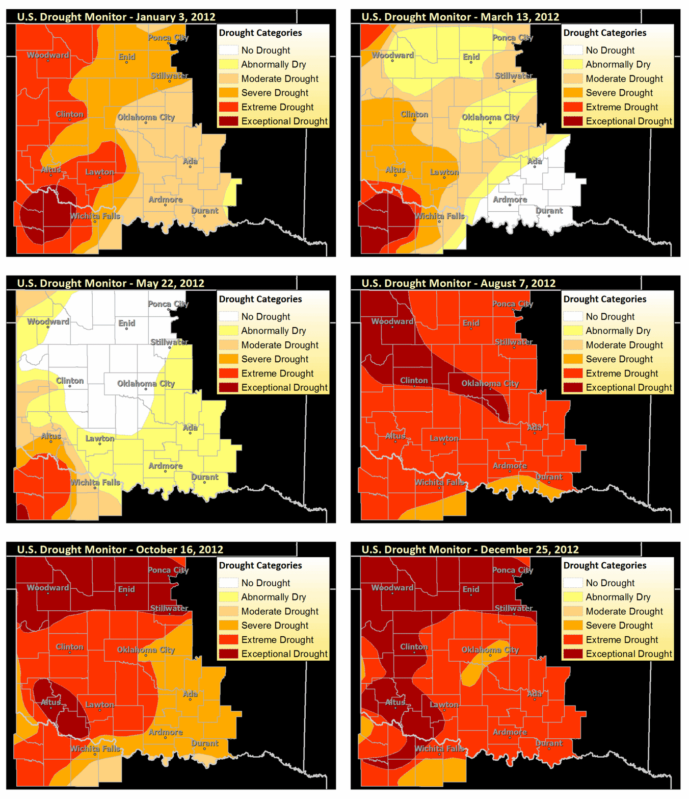
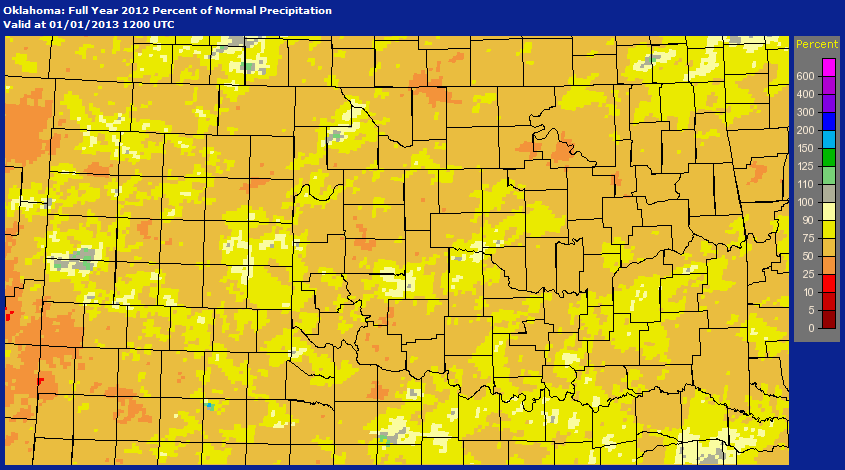
The following image depicts the percent of normal precipitation that had occurred across the NWS Norman forecast area for 2012.
