285
FXUS64 KEWX 211851
AFDEWX
Area Forecast Discussion
National Weather Service Austin/San Antonio TX
151 PM CDT Tue Jul 21 2026
...New SHORT TERM, LONG TERM...
.KEY MESSAGES...
Updated at 131 PM CDT Tue Jul 21 2026
- Major to Moderate flooding on the Nueces and Frio River basins
to continue. Elevated flows on area rivers continue to ease.
- Heat Advisory is in effect Wednesday for areas generally along
and east of the Interstate 35 corridor.
- Tropical Storm Bertha over the northeast Gulf will continue to
be monitored for for possible forecast impacts on south central
Texas.
&&
.SHORT TERM...
(Tonight through Wednesday night)
Issued at 131 PM CDT Tue Jul 21 2026
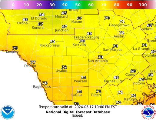
Dry weather along with a warming trend will continue across south
central Texas today and Wednesday. Highs today are still on track
to peak in the lower 90s to near 100 degrees. While a few spots in
the coastal plains may see peak heat index values near 106
degrees, we should remain below Heat Advisory levels today.
On Wednesday, a slight strengthening of the low-level thermal
ridge will occur along with a bump in low-level moisture. In
addition, we expect to see a decrease in afternoon wind speeds and
this will serve to reduce afternoon mixing of dew points. With
warmer temperatures and moisture levels remaining higher, a Heat
Advisory has been issued for areas generally along and east of
Interstate 35 for Wednesday afternoon. For ares within the Heat
Advisory, look for high temperatures of 100 to 104 along with heat
index values up to 112 degrees. Elsewhere, it will remain hot as
well with highs in the mid 90s to near 105 along the Rio Grande
south of Eagle Pass.
&&
.LONG TERM...
(Thursday through next Tuesday)
Issued at 131 PM CDT Tue Jul 21 2026
On Thursday, we expect to see a fairly deep east to northeast flow
through most of the atmosphere. While the low-level thermal ridge
axis should be nudged westward slightly, still suspect a good
portion of locations along and east of Interstate 35 will likely
be at or just above the heat index threshold of 108 degrees. If
this pans out, we would need another Heat Advisory for the above
mentioned areas on Thursday. While most of the region will remain
dry, we do have a very low chance for afternoon convection near
the coastal plains.
The forecast for the remainder of the week will likely depend on
the eventual track of current Tropical Storm Bertha in the
northeast Gulf. The medium range models continue to be reluctant
to show much in the way of precipitation chances across our
region. For the remainder of the forecast, we will continue the
current trend of near to slightly above normal temperatures along
with dry weather.
&&
.AVIATION...
(18Z TAFS)
Issued at 106 PM CDT Tue Jul 21 2026
VFR will prevail through the forecast period at all TAF sites with
generally light winds below 10 knots. MVFR ceilings are expected to
remain well south and east of the TAF sites tonight and into early
tomorrow morning, with low probabilities (20% or less) closer to
the immediate Texas coast. Some patchy fog cannot be ruled out as
winds become calm to variable below 3 knots tonight.
&&
.PRELIMINARY POINT TEMPS/POPS...
Austin Camp Mabry 81 103 83 100 / 0 0 0 0
Austin Bergstrom Intl Airport 80 102 83 99 / 0 0 0 0
New Braunfels Muni Airport 78 102 82 100 / 0 0 0 0
Burnet Muni Airport 79 102 81 99 / 0 0 10 0
Del Rio Intl Airport 75 99 78 100 / 0 0 0 0
Georgetown Muni Airport 81 102 82 99 / 0 0 10 0
Hondo Muni Airport 76 100 80 99 / 0 0 0 0
San Marcos Muni Airport 78 102 81 100 / 0 0 0 0
La Grange - Fayette Regional 79 104 82 100 / 0 0 10 0
San Antonio Intl Airport 79 101 83 99 / 0 0 0 0
Stinson Muni Airport 78 101 83 100 / 0 0 0 0
&&
.EWX WATCHES/WARNINGS/ADVISORIES...
Heat Advisory from noon to 8 PM CDT Wednesday for TXZ171>173-
191>194-204>209-219>225.
&&
$$
SHORT TERM...Platt
LONG TERM....Platt
AVIATION...99
No recent Short Term Forecast (NOW) has been issued for NWS Austin/San Antonio CWA (EWX).
Special Weather Statement Issued: 07/21/2026 05:14:00 PM UTC