
Tropical Depression Two is expected to gradually strengthen and could bring tropical storm conditions to the Florida Panhandle beginning late Monday. Areas of flash flooding will be possible through Thursday along the eastern and central Gulf Coast. Severe thunderstorms will develop and move along a cold front crossing the Upper Midwest Monday, and through the Ohio Valley/Mid-Atlantic on Tuesday. Read More >
| Severe Thunderstorm Warning | Tornado Warning |
|
Hail > 1.00” AND/OR Wind > 58 mph (50kts) AND/OR Significant Wind Damage, i.e., Trees down, large tree limbs down, structural damage to buildings. |
Tornado A violently rotating column of air in contact with the ground, indicated by either radar or report. |
| Winter Weather Advisory | Ice Storm Warning | Blizzard Warning |
|
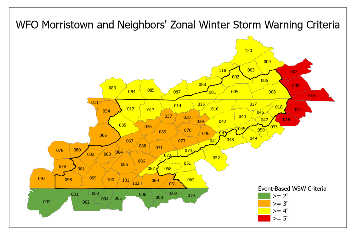
Snow 1" to 3” in 12 hours* OR Freezing Rain & Sleet
Ice accumulation < 0.25”
OR at the forecaster's discretion |
Ice accumulation > 0.25” in 12 hours |
Visibility < ¼ mile AND Sustained Winds or Frequent Gusts > 35mph for at least 3 hours which is accompanied by either snow or blowing snow |
| High Wind Warning | Wind Advisory | Dense Fog Advisory | Dense Smoke Advisory | Freeze Warning | Frost Advisory |
|
Sustained Winds > 40 mph for at least 1 hour AND/OR Wind Gusts > 58 mph for any duration |
Sustained Winds 26 to 39 mph for at least 1 hour AND/OR Wind Gusts between 40 and 57 mph for any duration |
Visibility < ¼ mile over a large area |
Visibility < ¼ mile over a large area |
Temperature < 32° for areas still in Freeze program |
Temperature 33° to 36° during defined growing season |
| Extreme Heat Warning | Heat Advisory |
Red Flag Warning for TN/NC |
Red Flag Warning for VA |
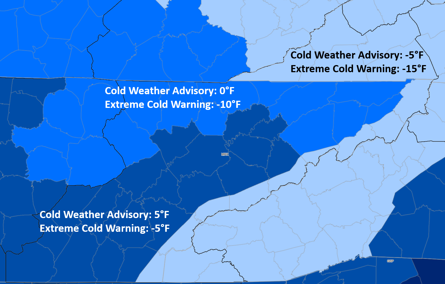
Cold Weather Products |
|
Daytime Heat Index > 110°F OR Temperature > 105°F |
Daytime Heat Index > 105°F OR Temperature > 103°F |
Sustained winds (2 minute average) > 18 mph AND relative humidities < 25% AND rainfall < 0.25" over the past 2 days |
Sustained winds (2 minute average) > 20 mph AND relative humidities < 30% AND 10-hour fuel moisture observed or expected < 7% |
See map and description of criteria below |


 Local Radar
 Huntsville Radar
 Regional Satellite
 Graphical Forecast
 Weather Map