
Heat expands across the Desert Southwest, Plains, Mississippi Valley and Midwest into Monday. Fire weather concerns continue for portions of the Intermountain West. Active monsoonal moisture fuels thunderstorms over the Southwest with possible flash flooding. Tropical cyclone Fausto in the Pacific, should weaken as it approaches Hawaii; Dangerous surf, swells and rip currents are expected. Read More >
 |
Local Satellite Imagery |
|
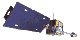
Satellite imagery is a critical ingredient in weather forecasting. The imagery provides a thorough look at large scale weather systems and their movement. In addition, small scale features such as thunderstorms, or areas of fog, can also be detected and monitored. Two satellites provide satellite coverage over the U.S.
The sensors located on the satellites provide a variety of imagery in various resolutions and scales. This lets forecasters use satellite data to its fullest.
Here are some of the latest visible images (daylight hours only):
Full disk visible image shows the entire globe.
Eastern CONUS visible image shows the eastern U.S.
Regional visible image shows Tennessee and surrounding states.
Here are some of the latest infrared (IR) images:
Full disk IR image shows the entire globe.
Eastern CONUS IR image shows the eastern U.S.
Fog product is used only at night (dark areas are either low clouds or fog).
Here are some of the latest water vapor images:
Northern Hemisphere image shows the large view of water vapor.
Eastern CONUS image shows water vapor over the eastern U.S.
For a more complete selection of all 3 types of satellite imagery plus other products, including time lapses, click here.
If you want a more comprehensive look at satellites, check out the Office of Satellite Operations at NOAA.
If you are interested in obtaining satellite images from past dates, check out the National Climatic Data Center's satellite archives.


 Local Radar
 Huntsville Radar
 Regional Satellite
 Graphical Forecast
 Weather Map