Marine Product Dissemination Information

The Marine Radiofax Charts for Station KVM-70 are now available via E-mail or FTP. Click here for more details on the charts available. For information on FTPMAIL click here.
|
Graphic Forecasts
for Hawaiian Islands and surrounding coastal waters Oceanic Graphic Forecasts
for Pacific from 120W to 160E south of the equator and from 140W to 160E north of the equator NW Hawaiian Islands Graphic Forecasts
for Pacific from 150W to 178E from 15N to 30N Oceanic Graphic Forecasts near American Samoa
for Pacific from 166.5W to 175.5W from 16.5S to 10S |
|||||||||||||||||||||||||
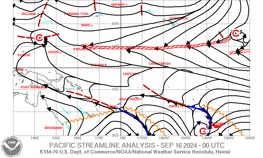
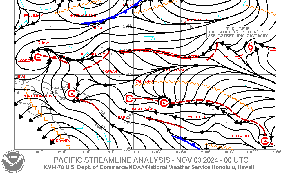
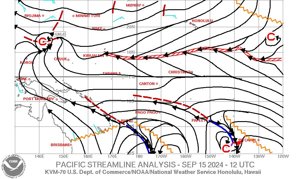
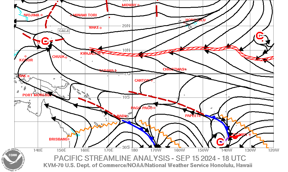
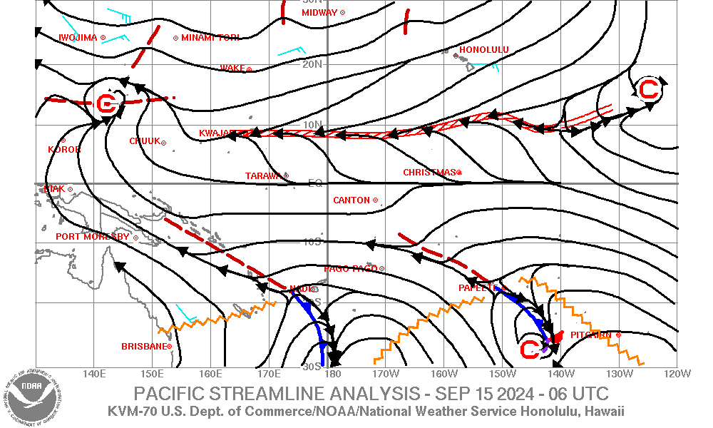
| Pacific Streamline Analysis (130E-120W, 30S-30N) |
|
||||||||||||||||||||||||
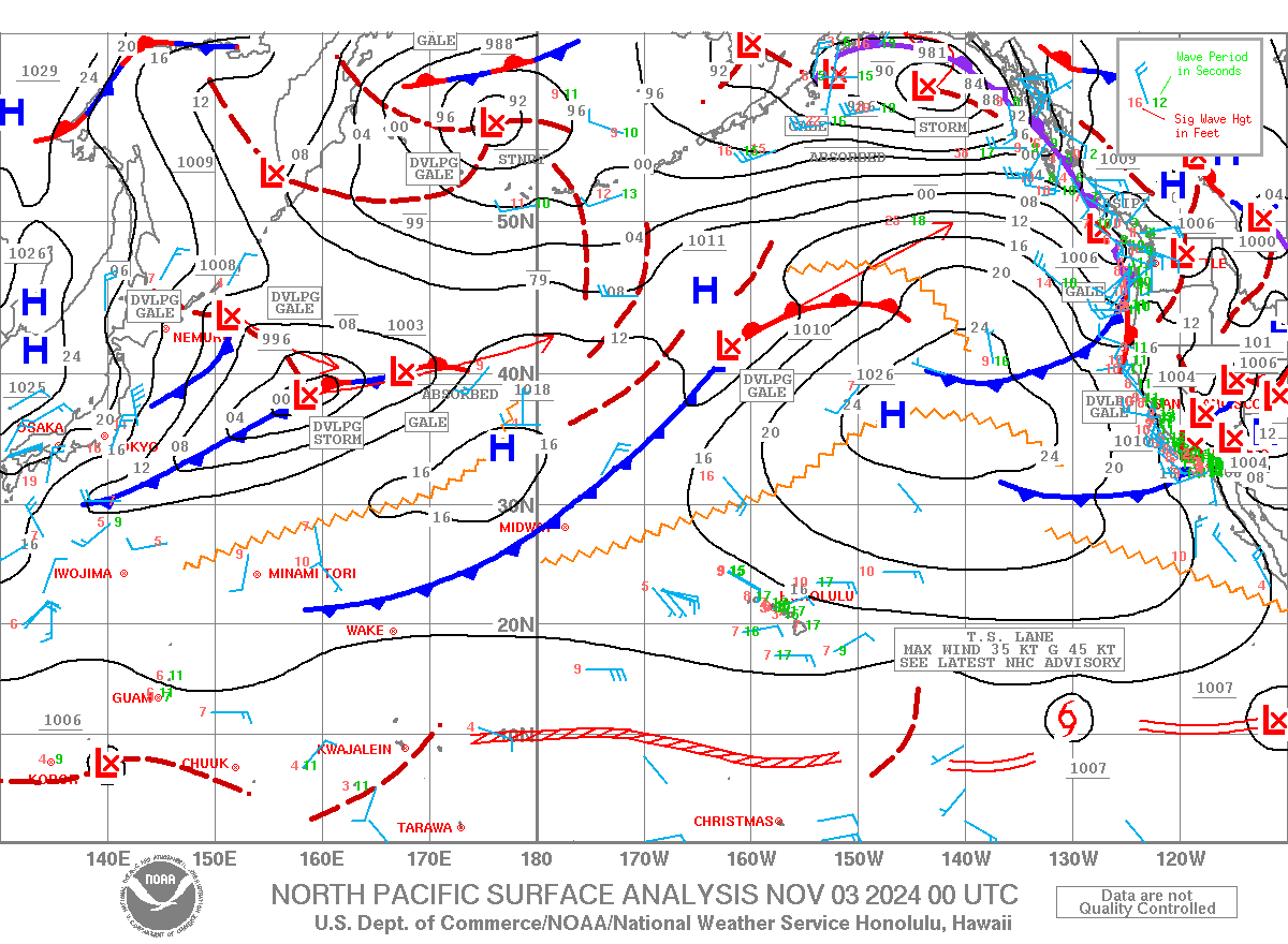
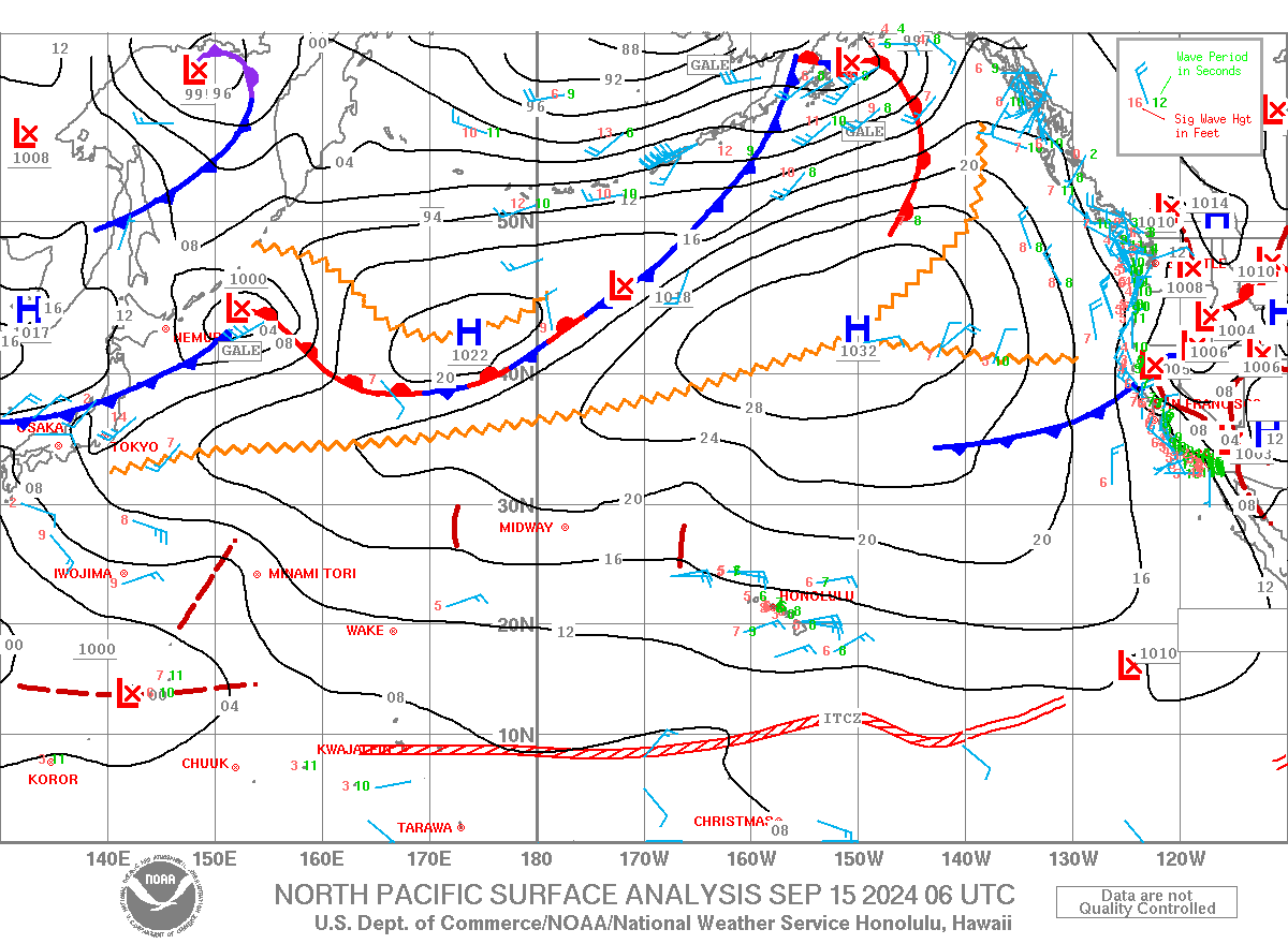
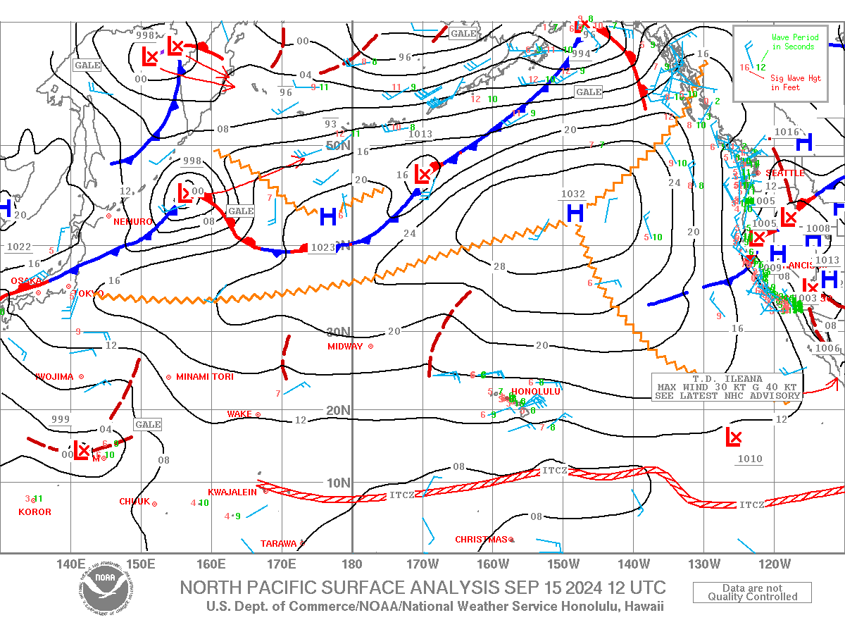
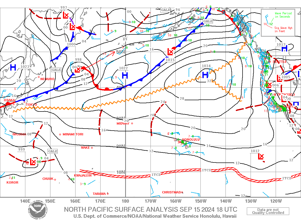
| North Pacific Surface Analysis (130E-110W,EQ-60N) From the Unified Surface Analysis |
|
||||||||||||||||||||||||
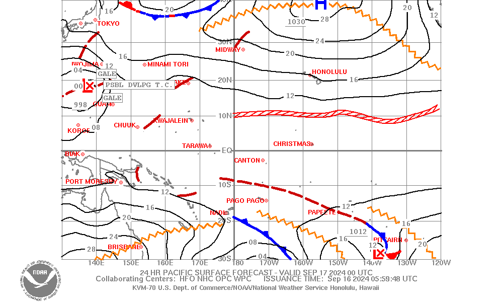
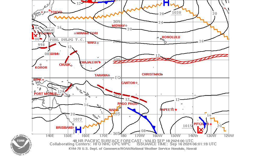
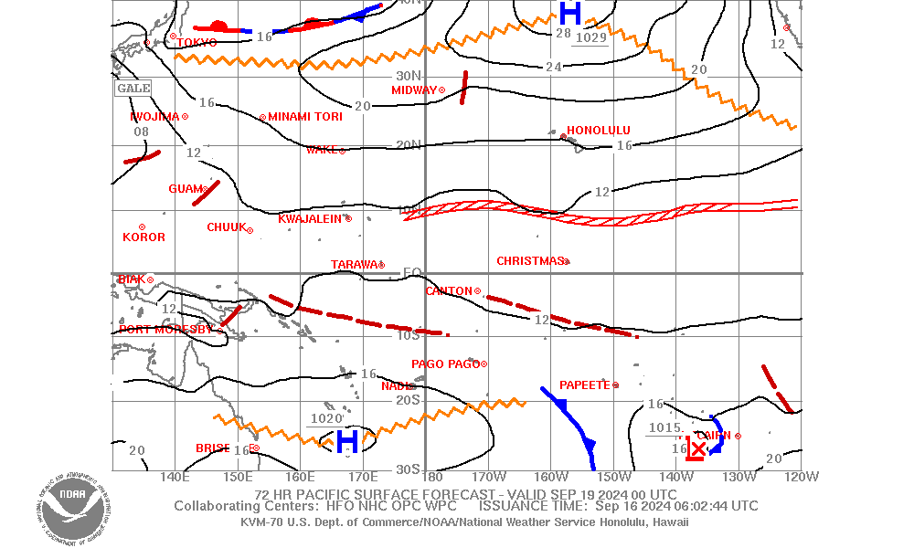
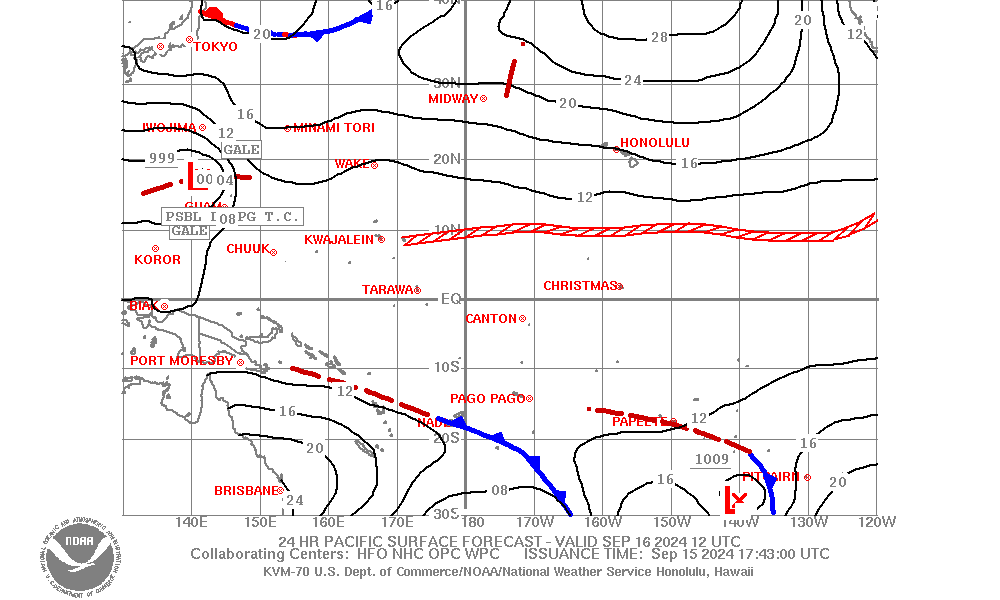
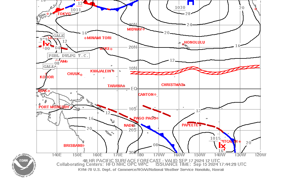
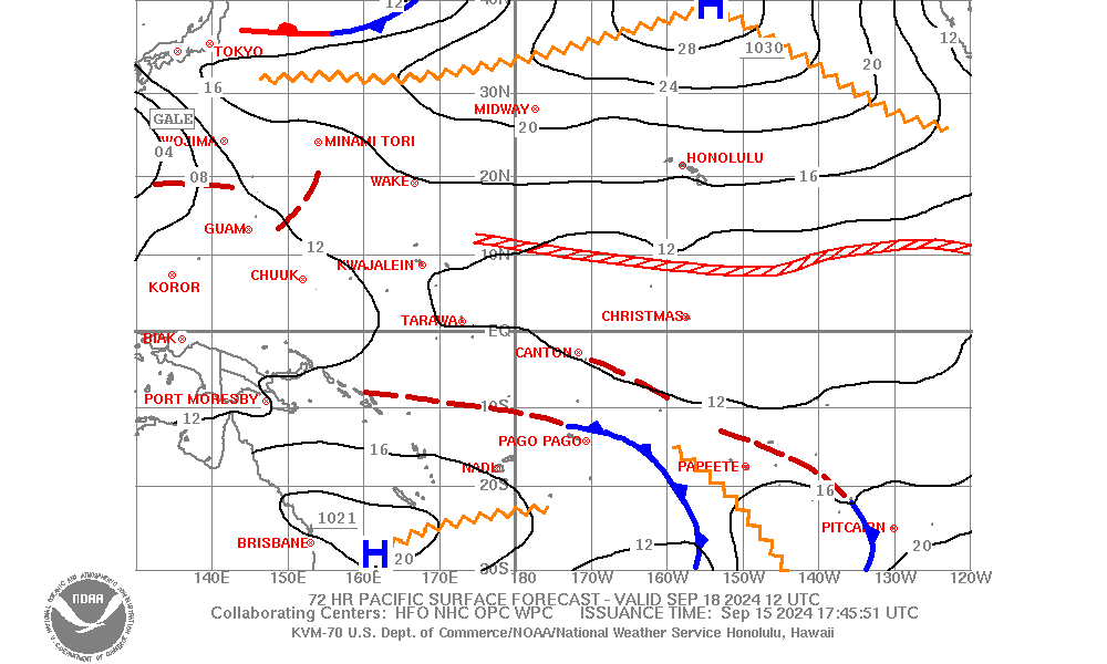
| Pacific Surface Forecast (130E-120W, 30S-40N) |
|
||||||||||||||||||||||||
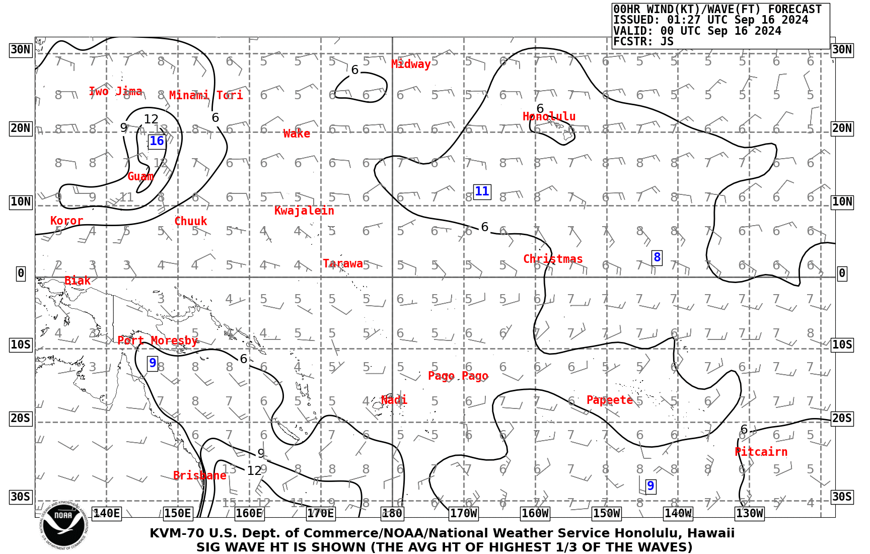
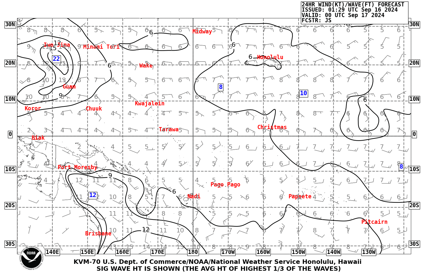
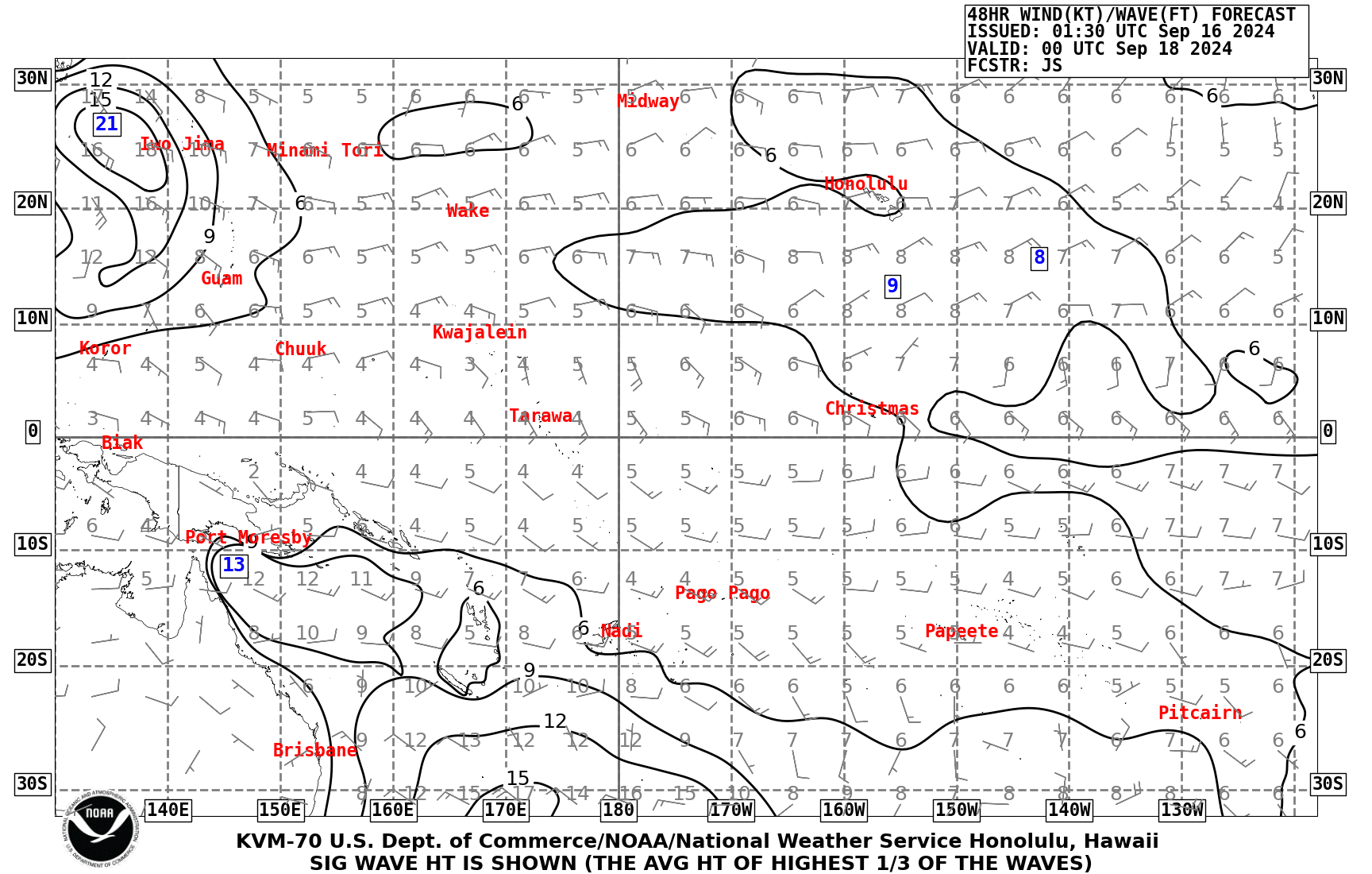
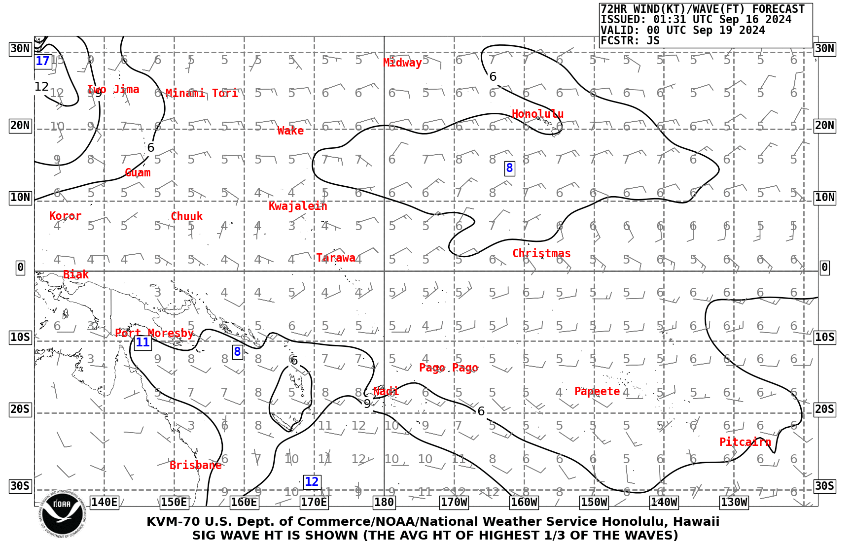
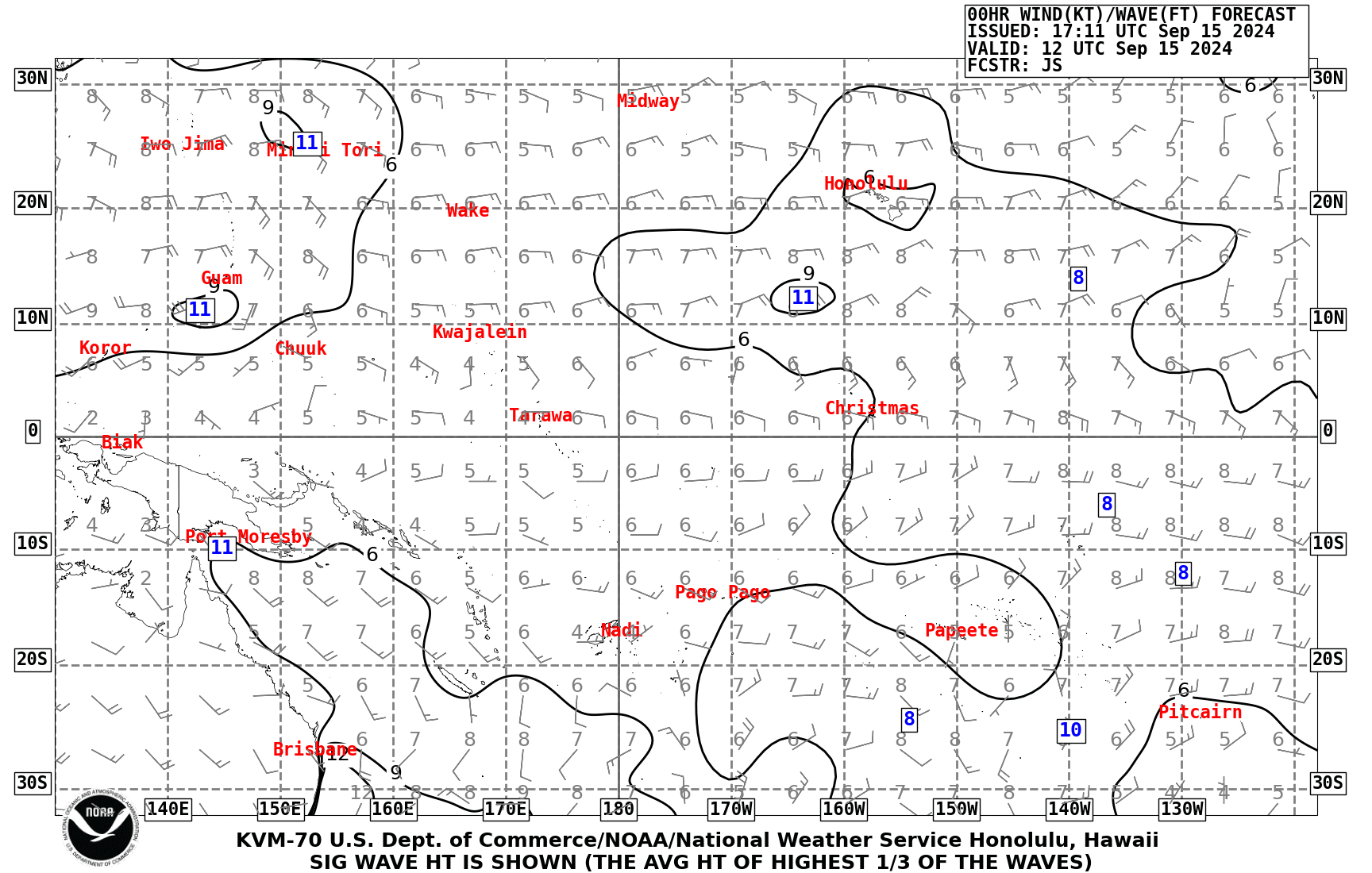
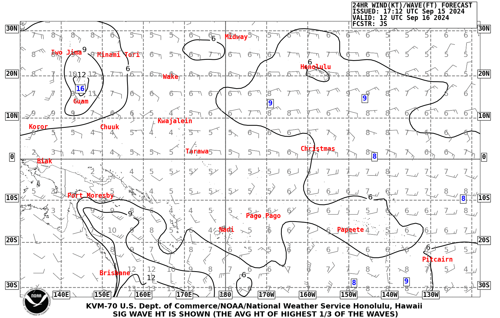
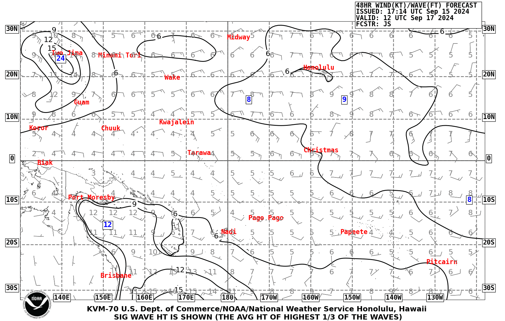
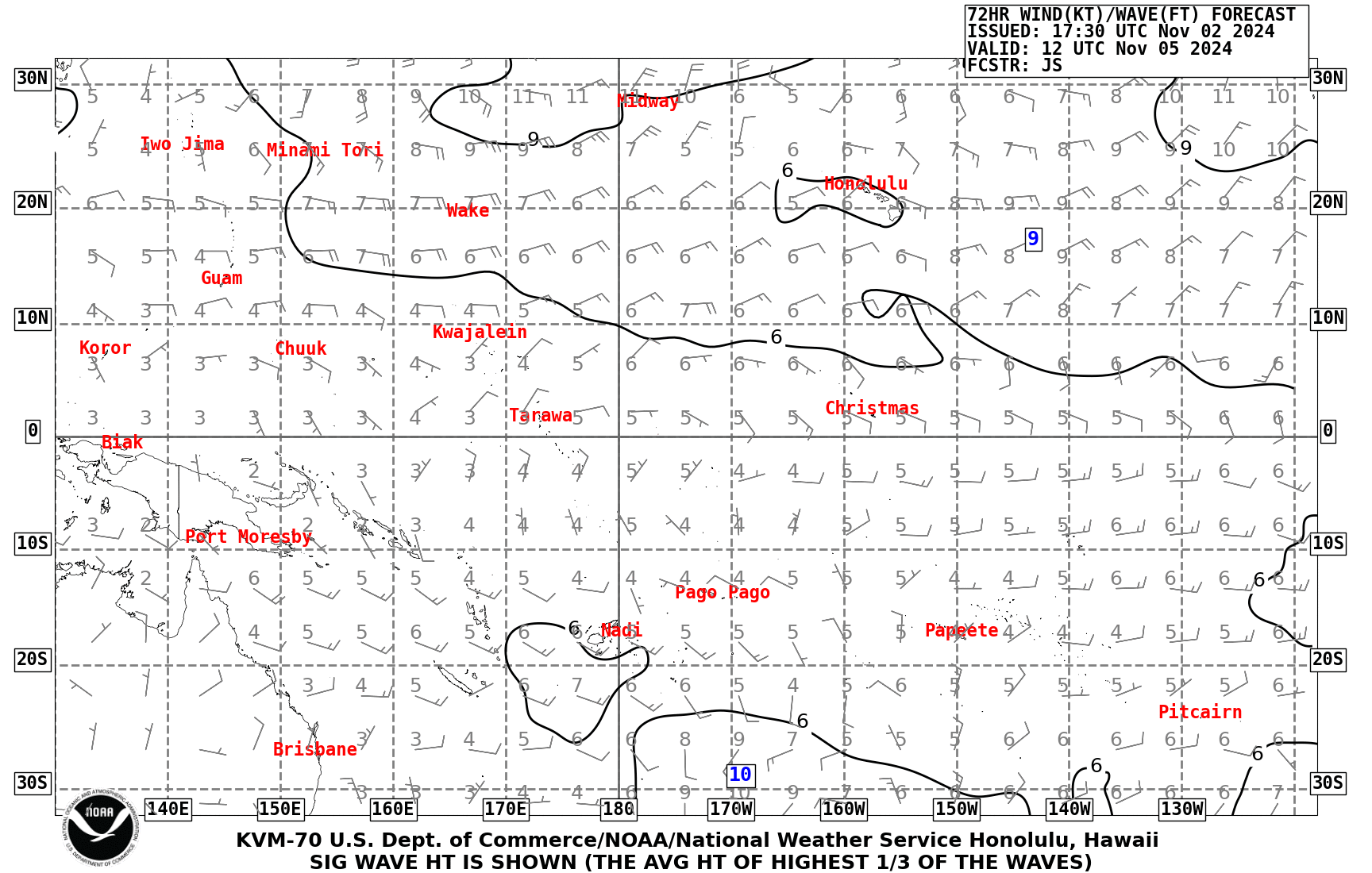
| Pacific Wind Wave Analysis and Forecasts |
|
||||||||||||||||||||||||
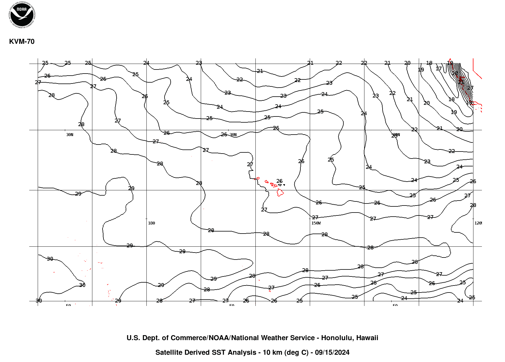
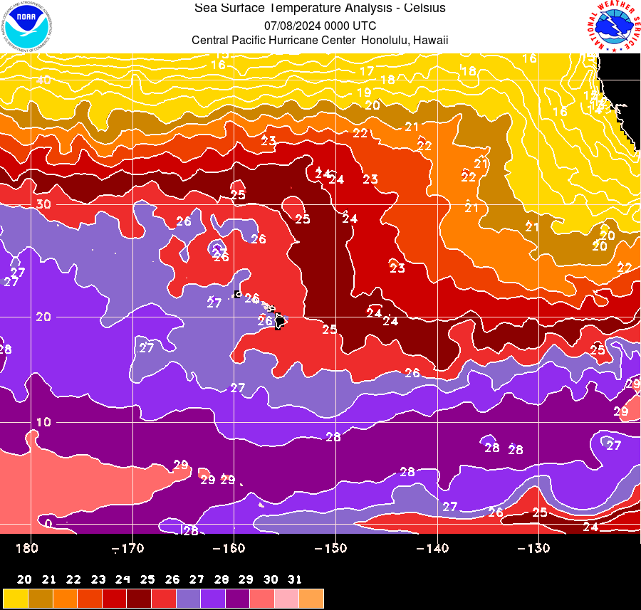
| Pacific Sea Surface Temperature Analysis satellite-derived (updated twice weekly) CPHC centric Sea Surface Temperature Analysis satellite-derived (updated daily) CPHC centric Sea Surface Temperature Analysis Loop satellite-derived (updated twice a week, with loop of Monday data) |
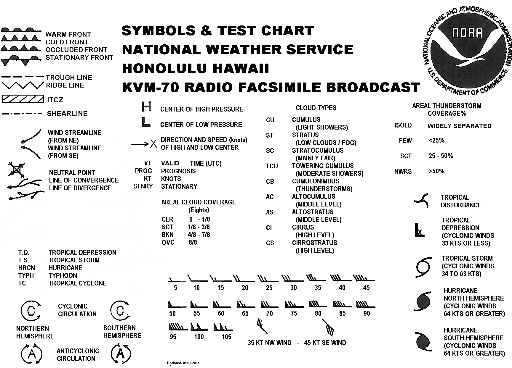
Symbols & Test Chart (gif)
|
||||||||||||||||||||||||
Routine forecast are issued for the Hawaiian Coastal Waters, the Offshore Waters, and High Seas.
The marine forecasts issued are based on marine observations and model data. Marine observations include buoy and ship reports. Ship reports are invaluable to the NWS, and are reported through the U.S. Voluntary Observing Ship Project. If you are a mariner, please consider joining the nearly 1,000 volunteer ships from around the world that observe the weather at their location.

