Honolulu, HI
Weather Forecast Office
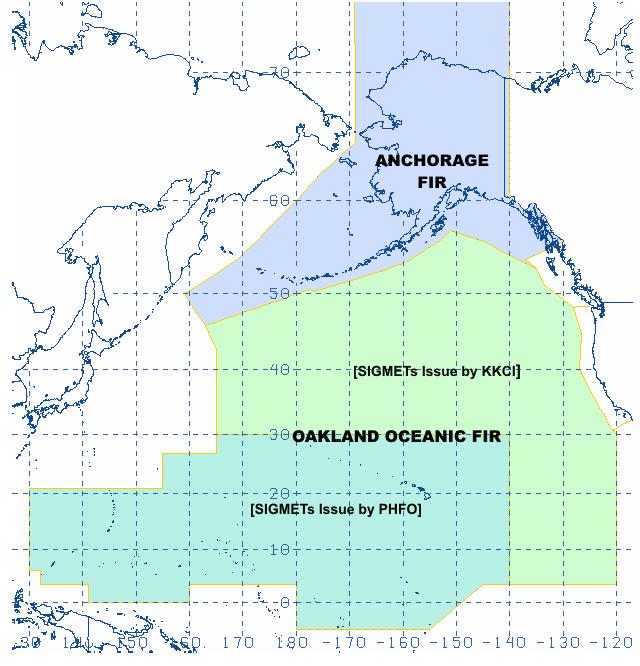
For the immediate Hawai`i area, products issued are Terminal Aerodrome Forecasts (TAFs), area forecasts, upper level wind and temperature forecasts, and AIRMETs (AIR pilots METeorological information) for low clouds, turbulence, and icing. In addition, the Honolulu forecast office is an aviation Meteorological Watch Office that covers approximately 8,650,800 square miles. See Aviation Area Map.
For questions, comments or suggestions concerning aviation issues, please contact W-HFO.aviation@noaa.gov.

Use the AWC Graphical Forecast for Aviation website for flight path information.
US Dept of Commerce
National Oceanic and Atmospheric Administration
National Weather Service
Honolulu, HI
2525 Correa Rd Suite 250
Honolulu, HI 96822
(808) 973-5286
Comments? Questions? Please Contact Us.

