Atlanta/Peachtree City, GA
Weather Forecast Office
July 23, 2000 |
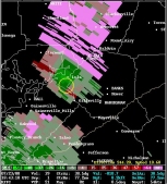
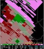
On Sunday, July 23, 2000 a severe thunderstorm moved across Dawson, Hall, and Banks counties. There was considerable wind damage across all three counties along with some large hail. There were also reports of tornadoes. A Storm Survey Team from the National Weather Service Forecast Office in Peachtree City visited the area and reviewed all available data the next day. The following are its findings:
Storm Summary...
Map of storm / damage path:
Damage Summary...
A Public Information Statement on this storm was released after the storm survey was completed.
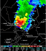 |
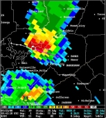 |
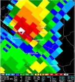 |
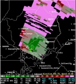 |
 |
 |
Current Hazards
Outlooks
Georgia Road Conditions
Nationwide
Local Storm Reports
Local
Submit Storm Report
Forecasts
Fire Weather
Forecast Discussion
Incident Support
Tropical Weather
Local
Computer Models
Graphical
Aviation Weather
Activity Planner
Recreational Forecast
Current Weather
Rivers/Lakes
Satellite Images
Observations
Maps
Radar Imagery
Regional Loop
Nationwide
Warner Robins
Peachtree City
US Dept of Commerce
National Oceanic and Atmospheric Administration
National Weather Service
Atlanta/Peachtree City, GA
4 Falcon Drive
Peachtree City, GA 30269
770.486.1133
Comments? Questions? Please Contact Us.


