A Review of the March 12 Supercell
Weather Images (click images to enlarge):
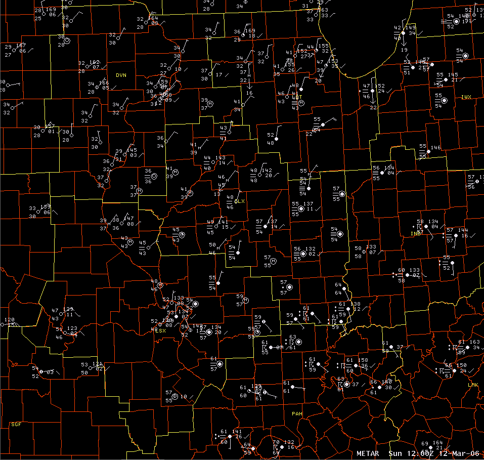 |
The image at left shows weather observations from Illinois and nearby areas at 6 am. A frontal boundary lay across the middle of the state, as indicated by the sharp temperature contrasts (37 at Galesburg and 64 at Robinson). Showers and thunderstorms were occurring across southeast Illinois. |
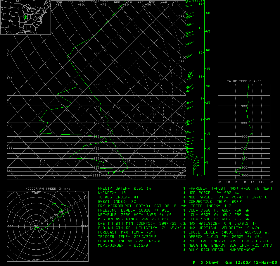 |
This is the upper air observation from Lincoln the morning of March 12. The front is still located south of Lincoln, indicated by northerly winds in the lowest levels of the atmosphere. |
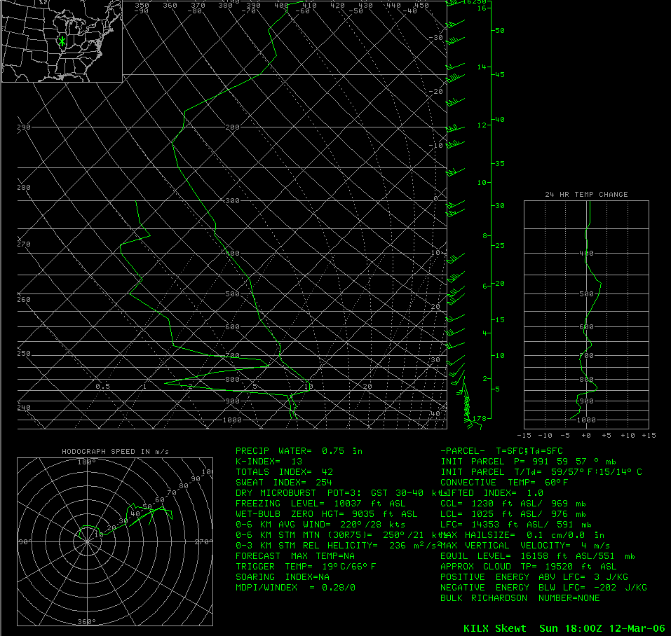 |
A special balloon launch was done at noon. The front had lifted north of Lincoln by then, and the low levels were showing significant wind shear. |
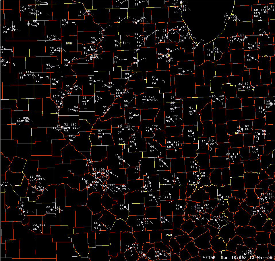 |
The noon surface map showed the warm front lifting northward, as temperatures in the 60s had reached as far north as Lincoln, with dewpoint values also significantly increasing. |
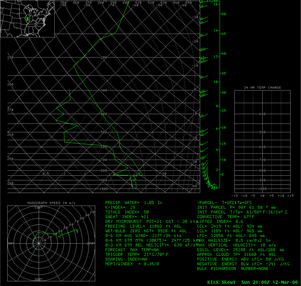 |
Another special balloon launch was done at 3 pm. Significant wind shear continued to be displayed at the lower levels. |
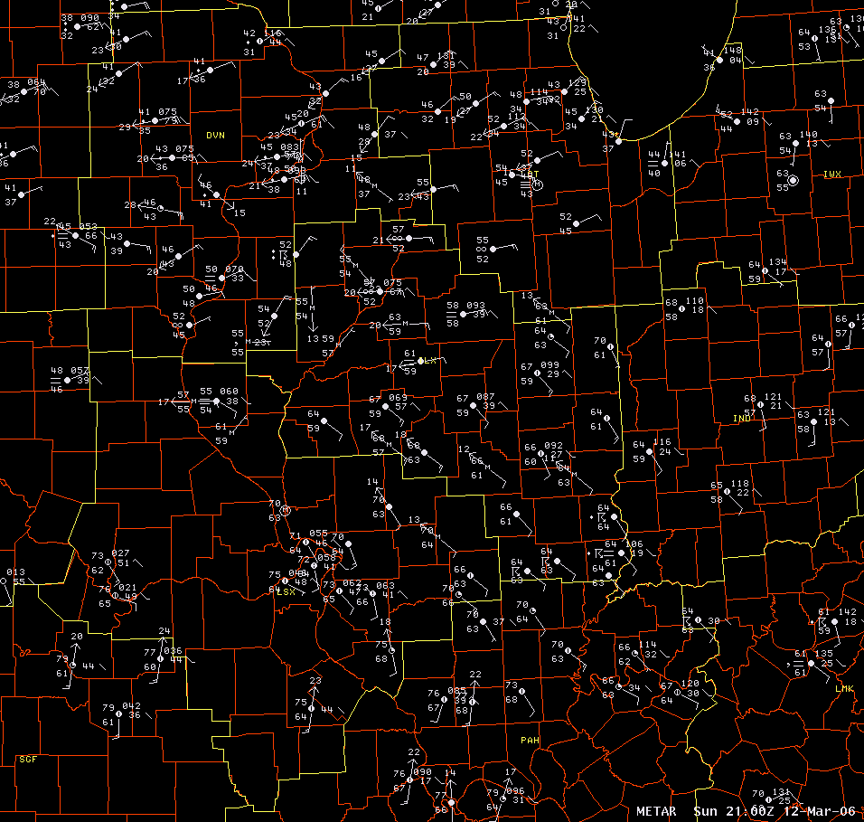 |
By 3 pm the surface map showed that the warm front had reached roughly a Quincy to Kankakee line, with central and southern Illinois in the mid to upper 60s. |
Radar Images (click images to enlarge):
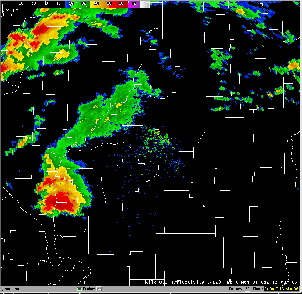 |
The two supercell storms merged into a single storm around sunset. This radar image from Lincoln at 7:08 pm showed a hook echo on the storm as it approached the Illinois River southeast of Pittsfield. |
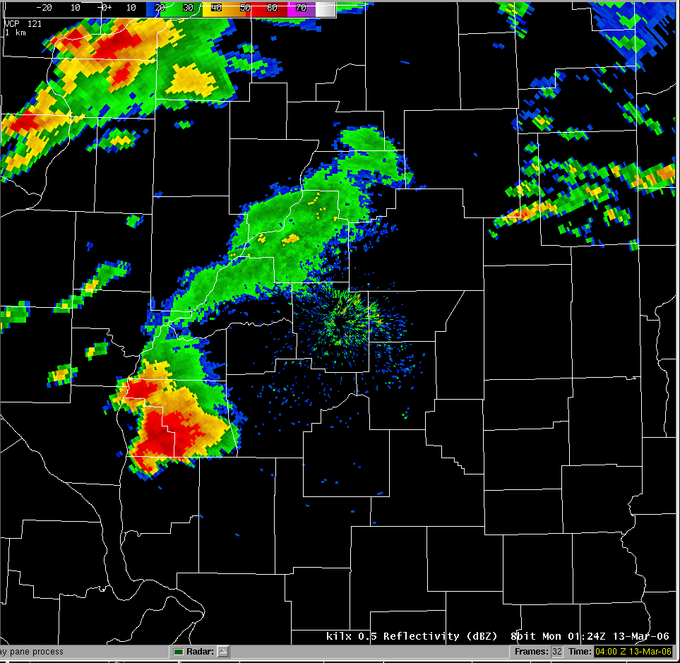 |
By 7:24 pm, the hook echo had become better defined. A tornado was moving across northern Greene County at this time. |
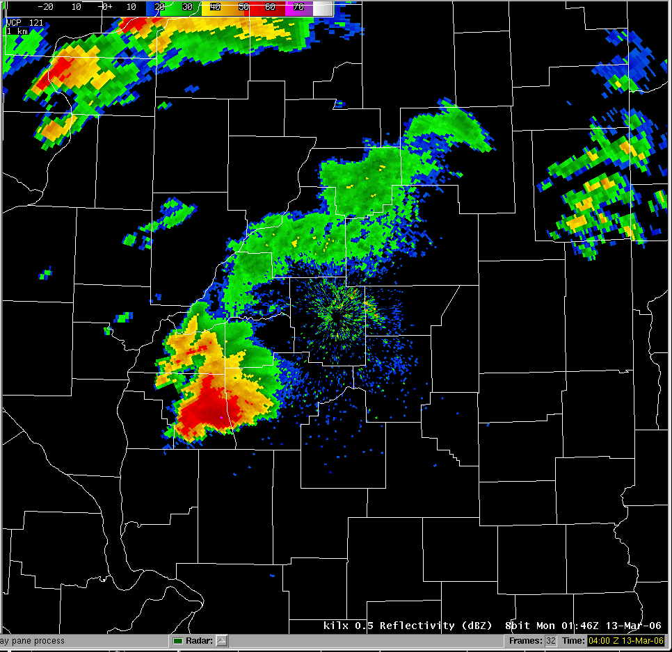 |
At 7:46 pm, the radar showed the hook echo in southern Morgan County. A tornado was in progress, having moved into southeast Scott County around 7:30 pm and then into southern Morgan County around 7:35 pm. |
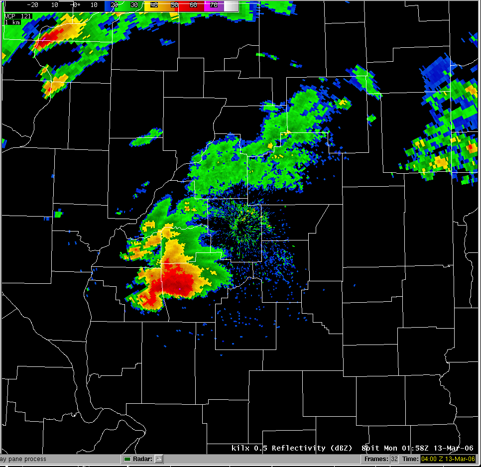 |
At 7:56 pm, the hook echo was approaching the Sangamon County line. The tornado would cross the county line a few minutes later. In addition, a second tornado developed just outside of Franklin (eastern Morgan County) at this time, and headed toward Loami, in Sangamon County. |
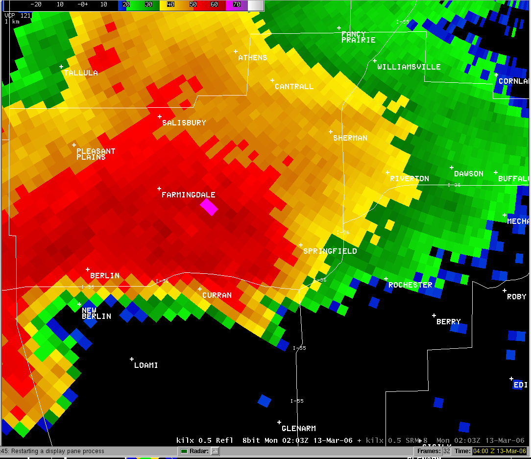 |
This zoomed-in radar image in Sangamon County at 8:03 pm shows the hook echo beginning to move into the county. |
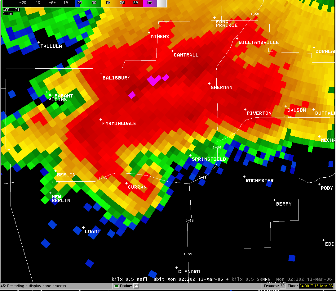 |
At 8:20 pm, the hook echo was moving across Curran. The tornado was between 1/2 and 3/4 mile wide. |
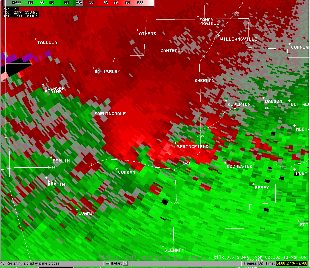 |
This storm relative motion image from 8:20 pm shows the intensity circulation along I-72 east of Curran. |
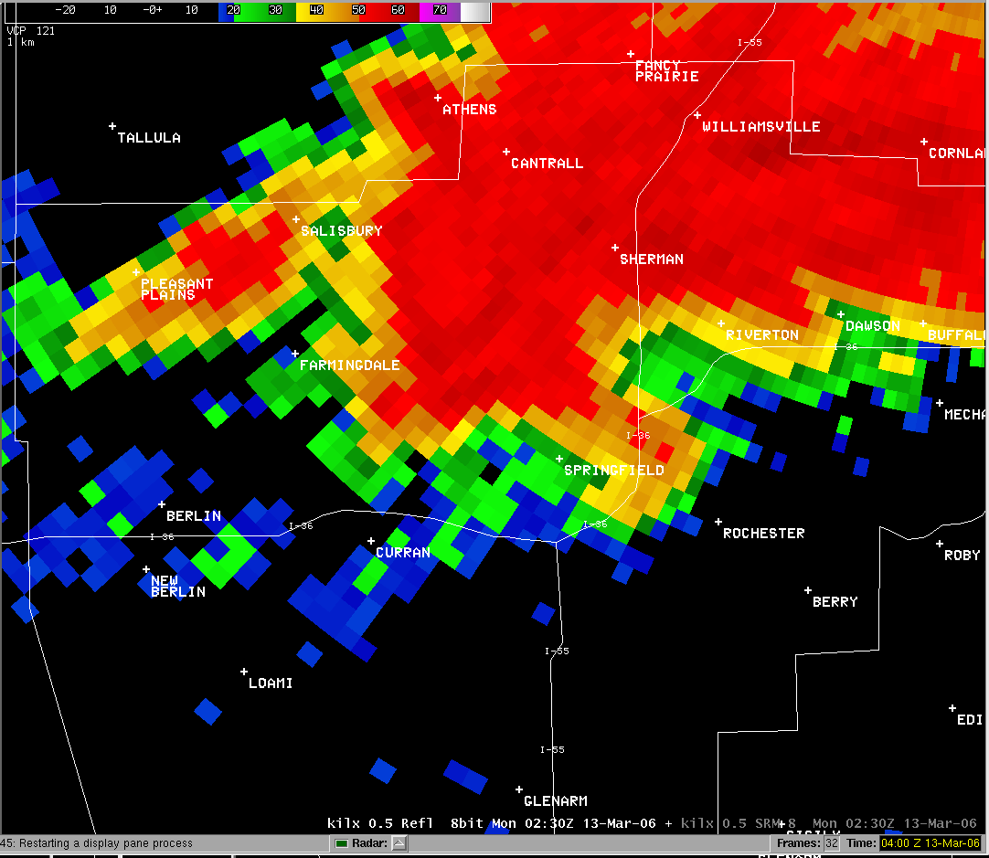 |
By 8:30 pm, the hook echo was moving to the I-55 corridor in Springfield. |
Event Links: Overview | Long-Track Tornado | Springfield | Franklin/Loami | Eastern Sangamon
Southern Logan | Greene/Scott #2 | Logan/Macon | Macon/De Witt | Radar&Satellite