Providing meteorological support to wildland fire management agencies for the protection of life and property.
Latest Fire Weather Products issued by our office:
Additional Forecast and Fire Weather Outlooks:
Today's National Fire Weather Outlook
Tomorrow's National Fire Weather Outlook
National Fire Weather Extended Outlook (3 to 8 days from now)
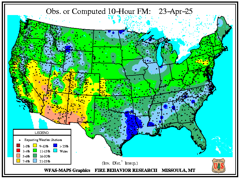
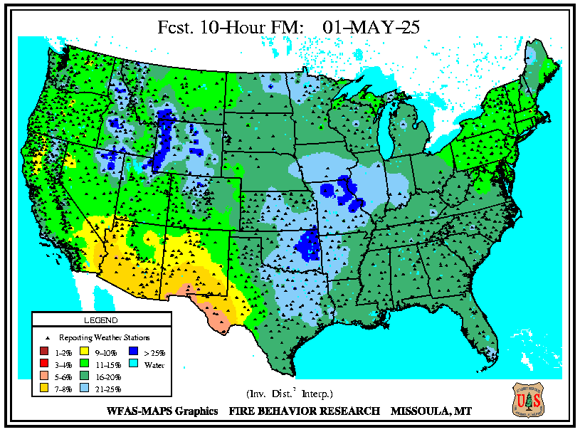
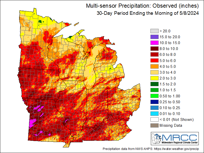
Weather is one of the most significant factors in determining the severity of wildland fires. Weather elements such as wind speed, temperature, and relative humidity directly impact the rate and intensity of a fire. Below are maps of fuels and drought indices that show the amount of moisture across the U.S.,along with maps of observed precipitation.
 10 hour dead fuel moisture |
 10 hour dead fuel moisture forecast |
| Regional RAWS Sites |
Energy Return Component, Burning Index, and Severe Fire Danger Index |
 U.S. Drought Monitor |
 Palmer Drought Index |
|
|
 Last 30 Days |
Wildland Fires and Other Links:
National Weather Service Fire Weather Page
National Fire Weather Outlooks - SPC
Incident Management Situation Report
WFAS - Wildland Fire Assessment System
National Interagency Fire Center
Eastern Area Coordination Center
Weekly Weather and Crop Bulletin
USDA Forest Service - Fire Management
US Fish & Wildlife Service - Illinois River National Wildlife & Fish Refuges
Illinois Department of Natural Resources
National Weather Service Central Illinois Annual Operating Plan
Spot Forecast Requests:
Spot Fire Weather Forecasts are non-routine specific point forecasts prepared for any legitimate Federal, State, County, or municipal government agency for a prescribed fire or wildland fire that has the potential of affecting life and property.
Request a Spot Forecast |
|
|