Record setting heat is expected over the next several days from the Intermountain West through the northern Plains. Furthermore, fire weather concerns increase with dry and breezy conditions. Meanwhile, heavy rainfall and severe thunderstorm threats for the Ohio/Tennessee Valleys, central Appalachians and Southeast today. The threat shifts to central Gulf Coast and across central Texas this week. Read More >
Central Illinois
Weather Forecast Office
Tornado #4:
Eastern Sangamon County
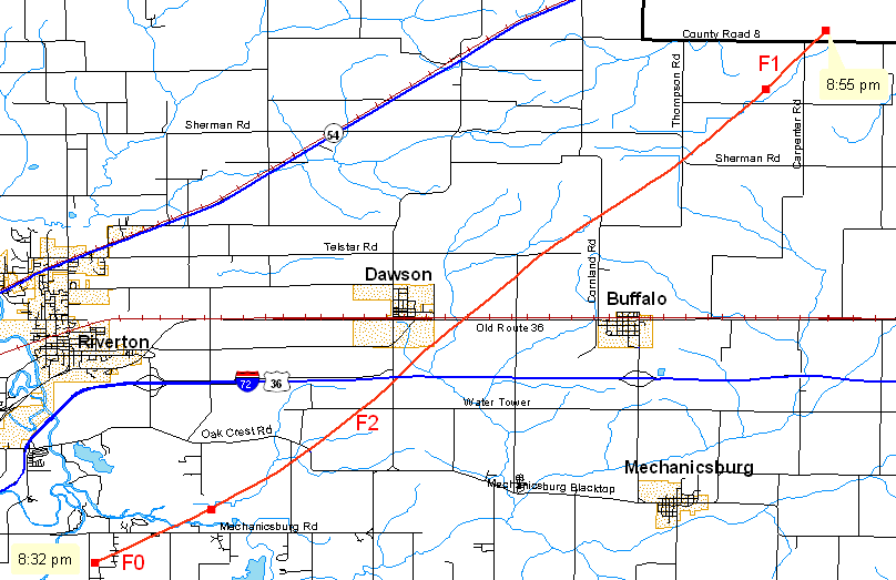
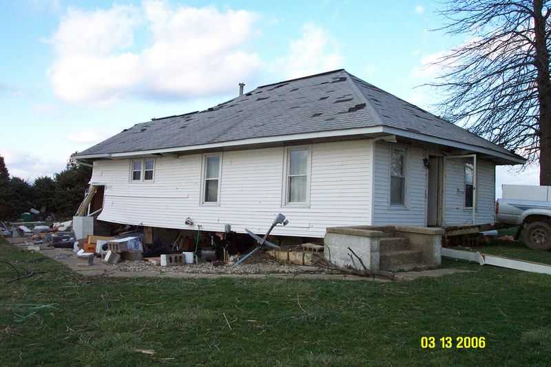
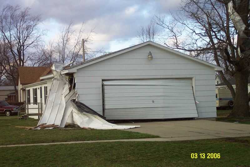
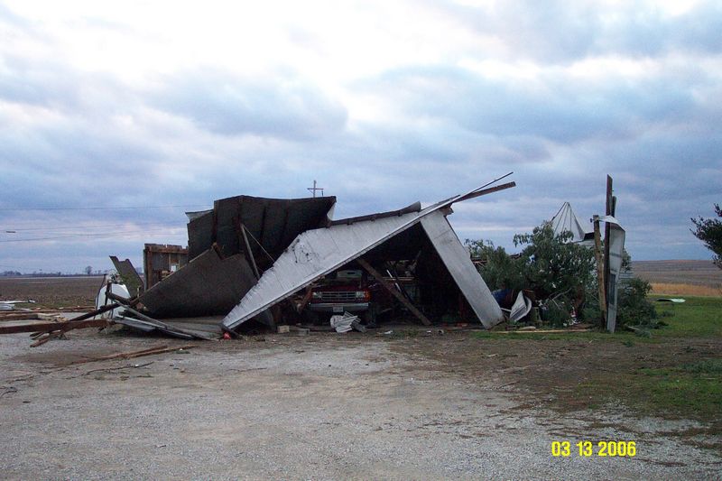
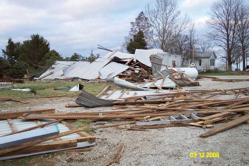
The 4th tornado of the outbreak was produced east of Springfield, touching down 3.75 miles south of Riverton at 8:32 PM. It moved northeast, between Dawson and Buffalo (passing 1.5 miles west of Buffalo), and lifted just south of the Logan County line, 5 miles northeast of Buffalo at 8:55 PM.
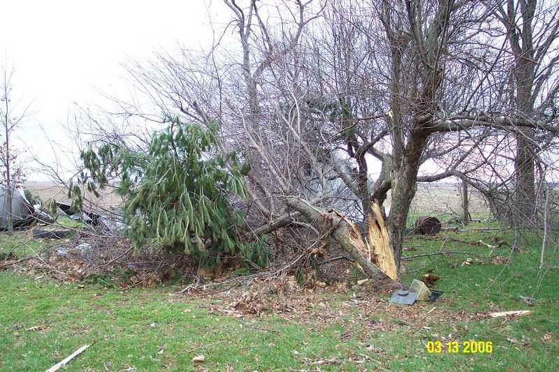
This tornado started at F0 strength, about 100 yards wide, and quickly strengthened to F2 intensity (120 mph) with a maximum width of 200 yards. It weakened to F1 intensity, and was about 100 yards wide when it ended. Total path was 12.5 miles in length. Damage from this storm consisted of damage to barn buildings and some significant house damage. Power poles were again snapped, with major tree damage.
Pictures (click images to enlarge):
|
|
|
|
|
|
|
|
Event Links: Overview | Long-Track Tornado | Springfield | Franklin/Loami | Eastern Sangamon
Southern Logan | Greene/Scott #2 | Logan/Macon | Macon/De Witt | Radar&Satellite
US Dept of Commerce
National Oceanic and Atmospheric Administration
National Weather Service
Central Illinois
1362 State Route 10
Lincoln, IL 62656
217-732-7321 (forecast recording) or 217-732-3089
Comments? Questions? Please Contact Us.