
Record setting heat is expected over the next several days from the Intermountain West through the northern Plains. Furthermore, fire weather concerns increase with dry and breezy conditions. Meanwhile, heavy rainfall and severe thunderstorm threats for the Ohio/Tennessee Valleys, central Appalachians and Southeast today. The threat shifts to central Gulf Coast and across central Texas this week. Read More >
Central Illinois
Weather Forecast Office
Tornado #8
Southeast Logan and Northwest Macon Counties
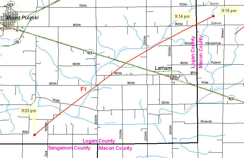
A tornado developed 6.5 miles southwest of Latham at 9:03 PM. This tornado moved across southeast Logan County, producing F1 damage, before it crossed the Logan/Macon County line at 9:14 pm, 3 miles north-northeast of Latham. The tornado continued to produce F1 damage for about a mile in northwest Macon County, before dissipating at 9:15 PM, 9 miles west-southwest of Maroa.
The tornado was on the ground for a total of 10 miles, and reached a maximum width of 400 yards.
Event Links: Overview | Long-Track Tornado | Springfield | Franklin/Loami | Eastern Sangamon
Southern Logan | Greene/Scott #2 | Logan/Macon | Macon/De Witt | Radar&Satellite
US Dept of Commerce
National Oceanic and Atmospheric Administration
National Weather Service
Central Illinois
1362 State Route 10
Lincoln, IL 62656
217-732-7321 (forecast recording) or 217-732-3089
Comments? Questions? Please Contact Us.

