Green Bay, WI
Weather Forecast Office
|
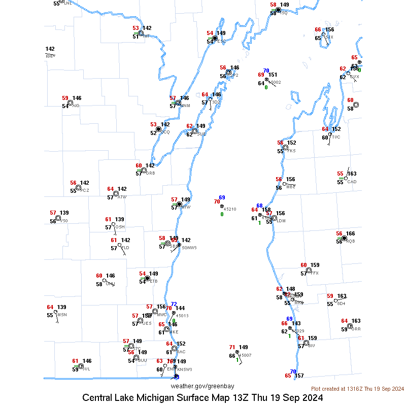
Surface Observations |
|
|
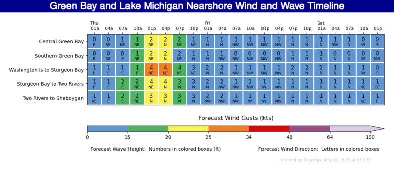
Lake Michigan Watches, Warnings, and Advisories |
Information for the Marine Community
About the Program
The National Weather Service in Green Bay issues forecasts and warnings for a part of northwest Lake Michigan, including the Bay of Green Bay.
The Nearshore Marine Forecast is for waters within 5 nautical miles from shore, and contains a forecast of wave heights, wind and weather out to 48 hours. The Nearshore Marine Forecast is issued year round for much of the lake.
A Special Marine Warning is issued when hazardous weather conditions of short duration, such as those associated with thunderstorms, are expected to produce winds of 34 knots or more.
Lakeshore and Coast Guard Observations are collected and broadcast hourly on the Green Bay and Sister Bay NOAA Weather Radio stations.
US Dept of Commerce
National Oceanic and Atmospheric Administration
National Weather Service
Green Bay, WI
2485 South Point Road
Green Bay, WI 54313-5522
920-494-2363
Comments? Questions? Please Contact Us.