Green Bay, WI
Weather Forecast Office
Aviation Weather
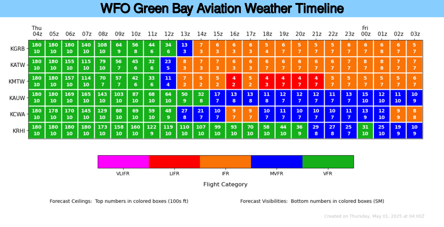
Aviation Weather Matrix
Pilot's Guide to Aviation Weather Services
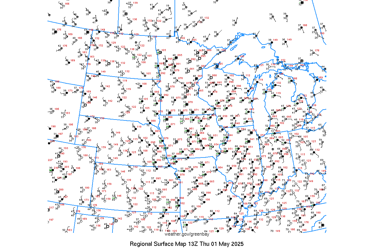
Real-time Aircraft Observations
| Terminal Aerodrome Forecasts & Obs KGRB Green Bay, WI KATW Appleton, WI KMTW Manitowoc, WI KAUW Wausau, WI KCWA Mosinee, WI KRHI Rhinelander, WI OSH Oshkosh, WI -- Issued only in late Jul-early Aug TAF Map |
Current and Previous 72 hours of KGRB Green Bay, WI |
About the Program
The NWS Office in Green Bay issues Terminal Aerodrome Forecasts (TAF) for four airports in northeast Wisconsin: Green Bay (KGRB), Appleton (KATW), Manitowoc (KMTW), Wausau (KAUW), Mosinee (KCWA), and Rhinelander (KRHI). A TAF is also issued for Oshkosh (KOSH) during the late July/early August period.
These site-specific forecasts detail weather changes out to 24 hours, and include forecasts of ceilings and cloud heights, wind speed and direction, weather and obstructions to visibility, and low-level wind shear. The forecasts are issued four times a day and are updated as needed.
US Dept of Commerce
National Oceanic and Atmospheric Administration
National Weather Service
Green Bay, WI
2485 South Point Road
Green Bay, WI 54313-5522
920-494-2363
Comments? Questions? Please Contact Us.

