
Severe thunderstorm and heavy rainfall threats will persist from the Midwest to Lower Great Lakes through Monday, shifting into the Ohio Valley and Central Appalachians Monday evening into Tuesday. Mid-summer heat will continue across much of the CONUS this week, with record highs possible well into the 100s across the south-central High Plains. Read More >
Last Map Update: Fri, Aug 14, 2026 at 2:36:26 am CDT
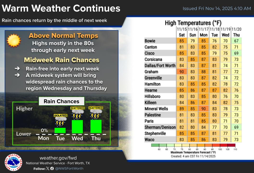

|
Text Product Selector (Selected product opens in current window)
|
|
|
Latest Text Products Issued (Experimental)
|
|
 |
 |
 |
 |
 |
 |


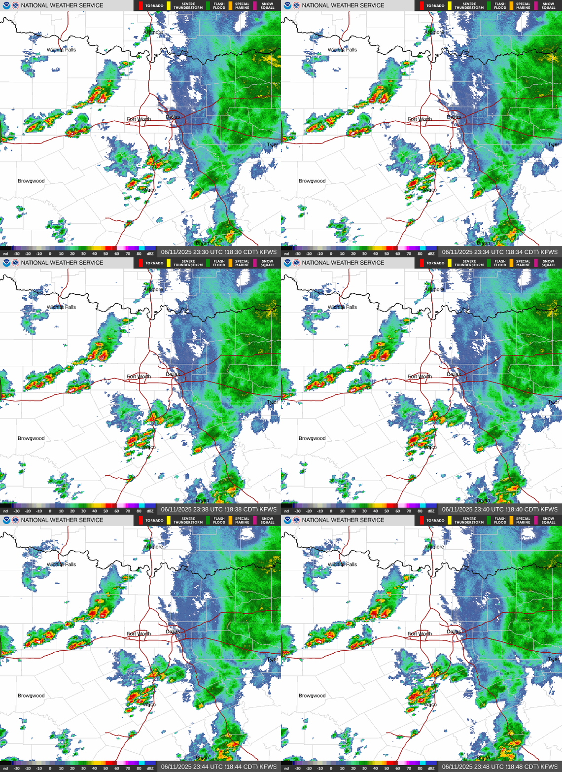 Local Radar
 Weather Map
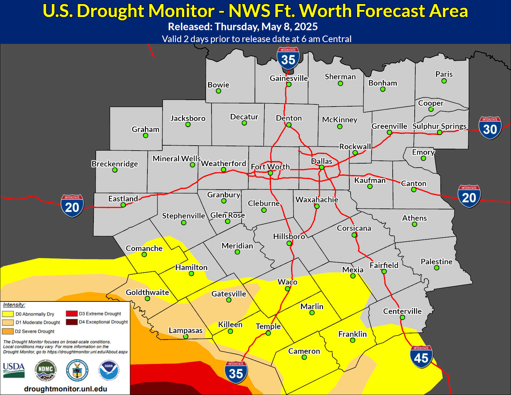 Drought Monitor
 Follow us on X
 Follow us on Facebook
 Follow us on YouTube
 FWD RSS Feed