
Tropical Depression Two is expected to gradually strengthen and could bring tropical storm conditions to the Florida Panhandle beginning late Monday. Areas of flash flooding will be possible through Thursday along the eastern and central Gulf Coast. Severe thunderstorms will develop and move along a cold front crossing the Upper Midwest Monday, and through the Ohio Valley/Mid-Atlantic on Tuesday. Read More >
Drought Information
6/30/26 Update
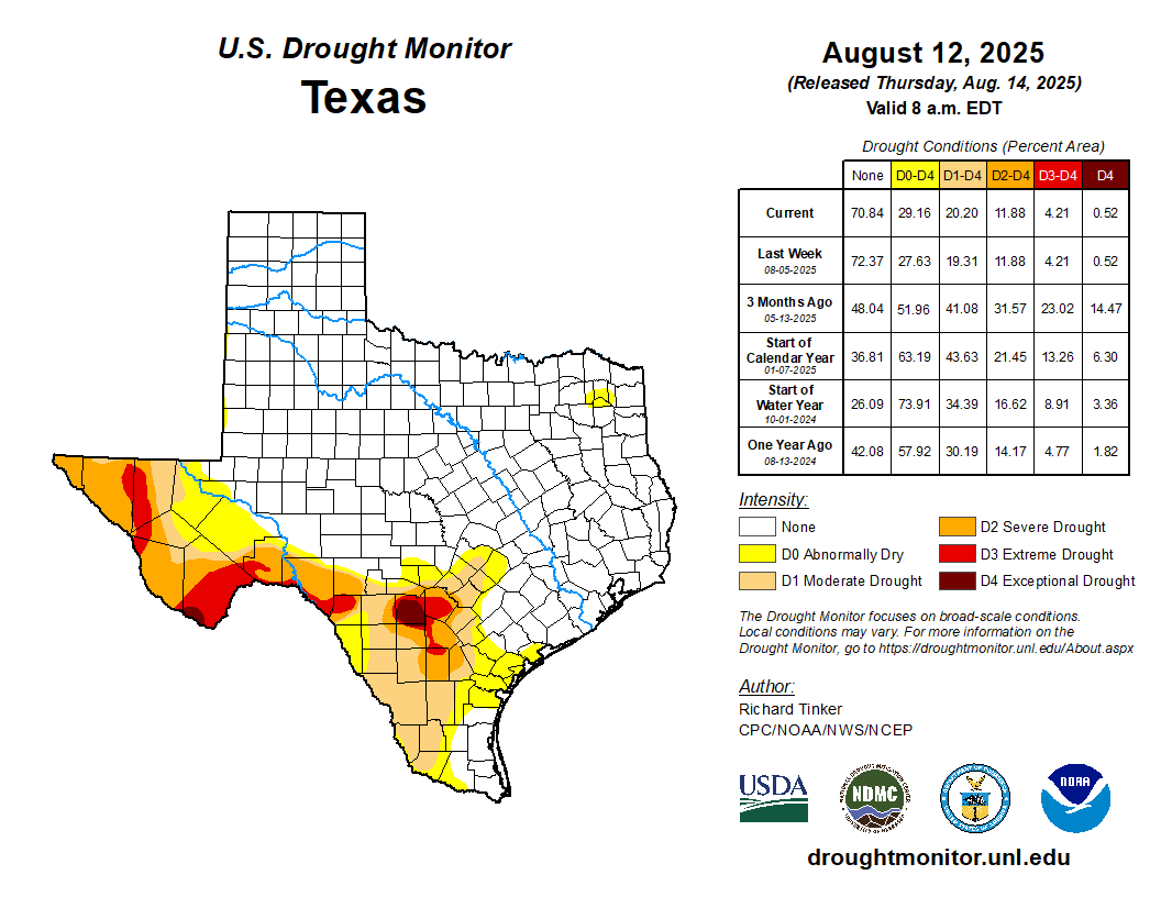
Drought conditions across North and Central Texas have improved markedly over the last 60 days, thanks largely to repeated rounds of above-normal rainfall in June following a somewhat mixed but still beneficial May.
Portions of Central Texas and East Texas picked up near to well above normal rainfall in May, and June brought even more substantial improvement with several locations across both North and Central Texas, including the DFW Metroplex and Waco, receiving roughly 150 to 300 percent of normal precipitation. At DFW, 8.07 inches of rain has fallen in the month of June, which places this month among the wettest Junes on record locally.
The result has been a sharp contraction in drought coverage across North and Central Texas, including the complete removal of Extreme Drought (D3), with the remaining drought now focused mainly across our eastern counties where longer-term deficits have been slower to recover. Looking ahead, the broader signal still favors drought persistence where it remains, especially across East Texas as we move into the climatologically hotter and drier part of the year. CPC’s Seasonal Outlook continues to favor above-normal temperatures with little indication of beneficial summer rainfall, which means any remaining drought across our eastern zones will likely be slow to fully erode until a wetter cool-season pattern arrives later in the year. More broadly, El Niño conditions are present and expected to strengthen through winter 2026-2027.
Click Here To View The Most Recent North and Central Texas Drought Information Statement
Current Drought Conditions

Fire Danger
With winter dormancy ongoing, any extended period without precipitation could reignite wildfire concerns. The days with the greatest potential for fire initiation and spread are those that are sunny and warm with low humidity and breezy winds. This potential will diminish with the onset of the spring growing season.
Even if a formal burn ban is not in effect for your area, it is still important to be vigilant about fire usage. Avoid open flames near dry vegetation, and assure all coals and embers are fully extinguished.

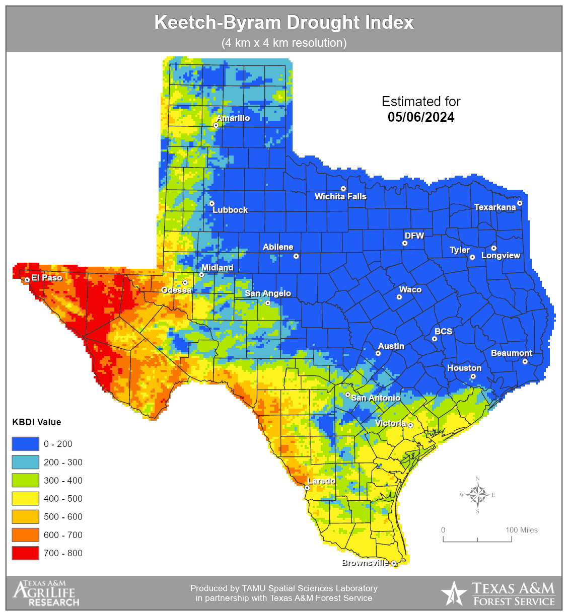
The Keetch-Byram Drought Index is a drought statistic specifically designed to assess fire danger.
Drought Links
![]() National Integrated Drought Information System
National Integrated Drought Information System
![]() National Drought Mitigation Center
National Drought Mitigation Center

