Atlanta Floods 10th Anniversary
Catastrophic flooding impacted the Atlanta metropolitan area September 15-22, 2009, as a result of multiple days of prolonged rainfall. A combination of ample moisture from both the Atlantic Ocean and the Gulf of America and topography enhancement produced heavy rains that fell faster than local watersheds could handle. At the height of the event, September 20-21, an estimated 10 to 20 inches of rain occurred in less than 24 hours. Historic flash flooding resulted, with flooded river basins remaining swollen for weeks. Numerous flood records were set, with some locations observing conditions exceeding the 0.2% chance of occurrence in a given year.
The maximum 24-hour rainfall total for September 20-21, 2009, was 21.03 inches, observed at the Douglas County Water and Sewer Authority. The chance of any location in the Atlanta area receiving this amount of rainfall in any given 24-hour period is less than 0.01% annually.
The epic flooding that occurred greatly impacted the community and economy. Initial property damage in Georgia was estimated at $250 million, but was eventually raised to $500 million. More than 20,000 homes, businesses and other buildings sustained major damage, including 16,981 residences. Unfortunately, 10 Georgia residents lost their lives during this event. Of those, 9 died during the overnight hours, and 8 died driving across flooded roads. Additionally, hundreds of people were rescued from their homes and vehicles. Portions of all major Atlanta-area interstates, including I-20, I-75 and I-85, were closed.
The impact of the heavy rainfall to area creek and river systems lasted for weeks. There were 79 river gages that rose above flood stage, with 35% of those cresting above major flood stage. More than one third of the gages rose to never-before-seen levels. During the height of the event, 20 river gages went underwater and stopped reporting. In these cases high water marks were surveyed to determine the peak stage height. At Sweetwater Creek near Austell, Georgia, the new established record was 20 feet above flood stage and nine feet above the previous record crest. In Douglas County, the Dog River overtopped the USGS stream gage by 12 feet. In total, 28 new record crests were set, one of which was originally established in 1919. These swollen river basins resulted in damage to 21 Category One dams.
Seventeen counties in Georgia received Federal Disaster Declarations, the majority of which were in the Atlanta Metropolitan area. The clean-up and rebuild process continued into 2010. As of September 2010, there were more than 16,000 requests and inquiries for federal aid.
Improvements in forecast tools and availability of real-time data – such as flood inundation mapping and increased river gage density – should aid hydrologists, meteorologists and decision makers when the next big flood strikes.
Epic Floods Of 2009
|
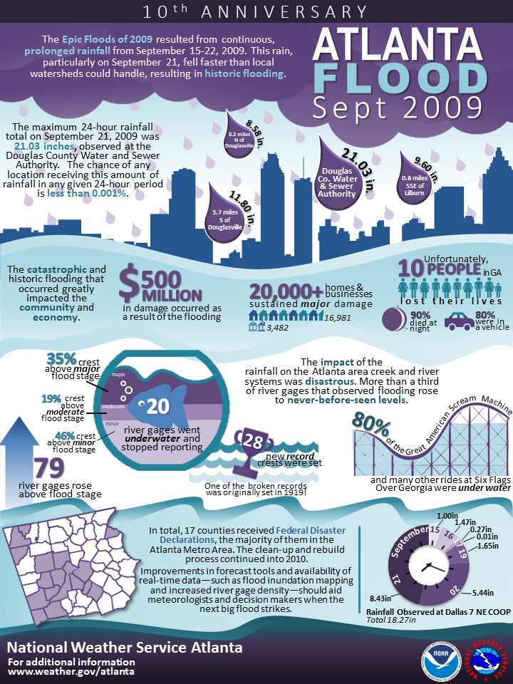
Douglas County Post Road 1 mile South of I20 (Courtesy AJC)
|
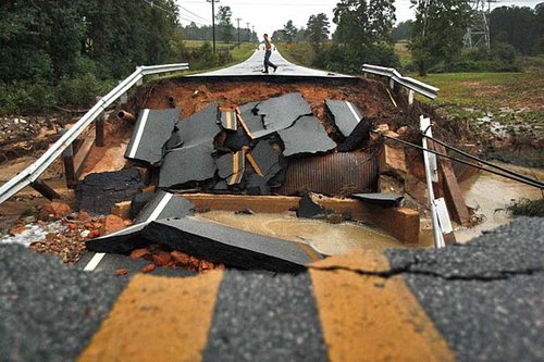
Flooded Subdivision Cobb County (Brant Sanderlin)
|
|

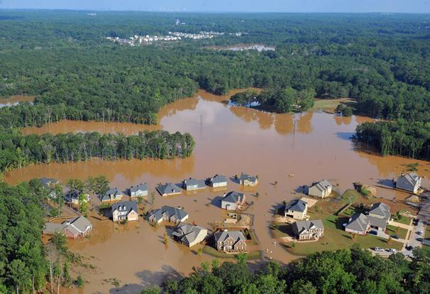
Chattahoochee River Covers Six Flags (Courtesy AJC)
|
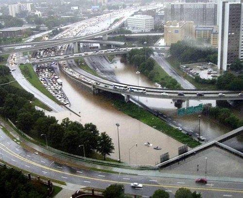
Downtown Connector Just North of International Blvd Ellis St Interchange (Courtesy AJC)
|
|
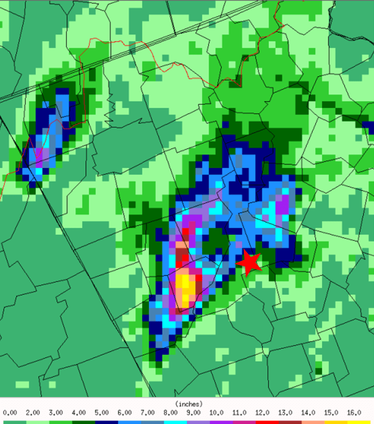
24 Hour Rainfall Totals Ending Sept 21st
|

