Below Normal to Near Normal Tropical Cyclone (TC) Activity anticipated for American Samoa in the 2025-26 TC Season Read More >
In 1963, the NWS and American Samoa Government (ASG) signed a land lease for a parcel on Tutuila Island with an existing weather service building constructed in the 1950s. The Weather Service continued their operations at that location with execution of a new twenty (20) year agreement through 2004.
Many severe weather events in American Samoa (AS) occurred from 1966-2002, which qualified for Federal Emergency Management Agency (FEMA) assistance. In the devastating aftermath of these storms, NWS upgraded the WSO Pago Pago with increased staffing and support facilities to better accommodate some of the upgraded forecast equipment.
While these upgrades were important, the need was clear for a new weather service office to replace the limited office space in the existing structure. This substantial undertaking used existing leased land about 200 feet away from the old facility and completed in 2002. In keeping on track with the NWS modernization program, installation of additional upgrades to the upper air facilities (UAFs) provided new technology to improve the quality and accuracy of data. With construction of the new WSO Pago Pago, a new land lease extending fifty (50) years was negotiated with the ASG (through 2/28/2051).
Read about our building dedication on November 3, 2003. (See pics here)
Because of the relative isolation of American Samoa, its complex geography, and absence of a weather radar, the forecasts and warnings issued from WSO Pago Pago are of great importance to the community and surrounding area. A reliable network to access the data stored at PRH is critical. After many years of paying premium internet rates to BlueSky Communications, NWS invested in equipment upgrades to be able to access satellite communications via a polar orbital tracking system. In June 2016, NWS signed a contract with SES Government Solutions for a complete managed service that uses a satellite constellation with the newest O3b Medium Earth Orbit (MEO) communications link with a high-bandwidth and low latency. This technology has the capability of providing fiber-like connectivity via satellite. This was the best and most cost effective solution meeting NWS requirements
The WSO Pago Pago is currently located next to the Pago Pago International Airport (formerly known as Tafuna Airfield) and the FAA control tower.
The WSO Pago Pago office issues short- and long-term local/regional weather outlooks (watches, warnings, and advisories) and forecasts and provides Impact-based Decision Support Services (IDSS). They provide broadcast messages and recordings and recorded phone messages for the public. Technicians also collect meteorological data about the upper atmosphere twice daily at set times with weather balloons or four times daily during severe weather.
The WSO Pago Pago works with the Central Pacific Hurricane Center in Honolulu, Joint Typhoon Warning Center in Honolulu, and the Meteorological Service Offices in Apia, along with the Region V Regional Service Meteorological Center (RSMC) Nadi to issue cyclone watches and warnings for American Samoa. The WSO Pago Pago office issues coastal (high surf) advisories and marine forecasts. Additionally, they work closely with the Pacific Tsunami Warning Center in monitoring nearby earthquakes that could trigger tsunami events impacting American Samoa. They also collect data for hydrology and precipitation reports, climate reports, as well as issue flash flood warnings and advisories.
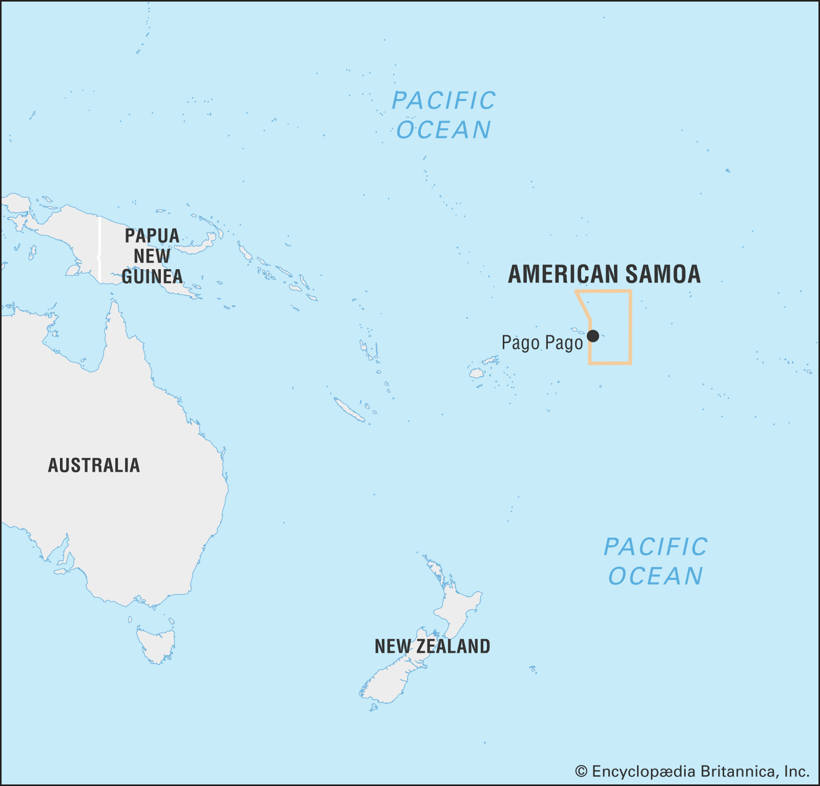
American Samoa is a Territory of the United States. It is the only U.S. possession located in the Southern Hemisphere and in the South Pacific. The country is comprised of five volcanic islands (Tutuila, Aunuu, Ofu, Olosega, and Tau) and two atolls (Rose Island and Swains Island). The island of Tutuila is the largest, most populated, and most urban. The Pago Pago Harbor is one of the deepest natural harbors in the South Pacific. The island of Tutuila is home to WSO Pago Pago.

The Samoan people are Polynesians who traveled from Southeast Asia and the dominant socio-cultural group in American Samoa. They are mostly bilingual, speaking Samoan and English. The local greeting is talofa, meaning “hello.” According to historians, habitation of the island was dated to around 600 BC. Traditional Samoan society is known as Faa—Samoa (the Samoan way), and describes acceptable behavior with authority figures, familial relationships, customs, and traditions.
The tropical weather in American Samoa is consistently warm, humid, and rainy, though there is a wetter summer season between October and May and a slightly cooler, drier season that runs June through September. Annual rainfall averages anywhere from 125 inches in the drier areas to as much as 300 inches in the high mountains. The National Park of American Samoa is the only one in the United States that is south of the equator. It covers 13,500 acres (both land and marine) across four volcanic islands and consists of lush tropical rainforests, unpopulated beaches, and coral reef systems, providing habitat to many endemic animal and plant species.