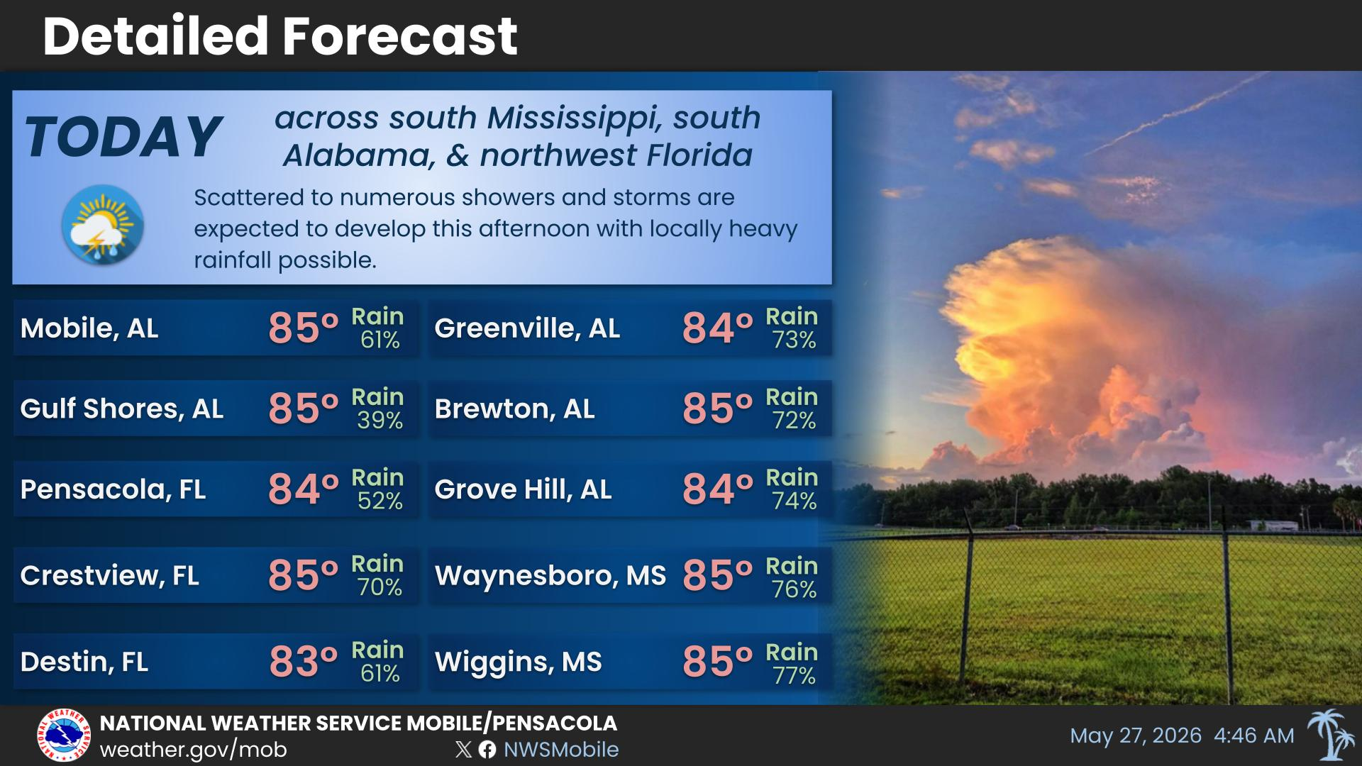
Today's high at Mobile was 92, and the high at Pensacola was 94.
For more information, visit our social media pages at Facebook and X pages or listen to a NOAA Weather Radio. Stay weather aware!
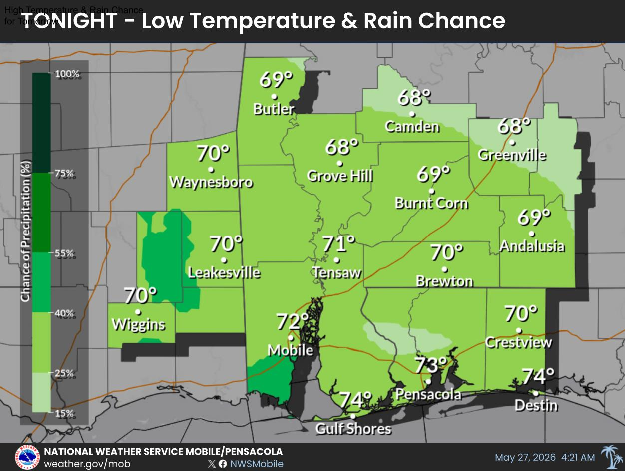
Low Temperature & Rain Chances for Tonight.
For more information, visit our social media pages at Facebook and X pages or listen to a NOAA Weather Radio. Stay weather aware!
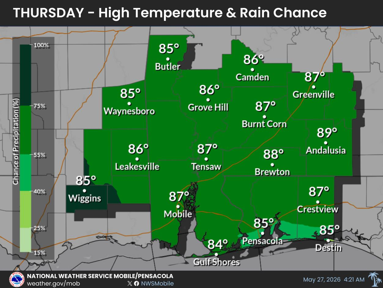
High Temperature & Rain Chances for Wednesday.
For more information, visit our social media pages at Facebook and X pages or listen to a NOAA Weather Radio. Stay weather aware!
Low Temperature & Rain Chances for Wednesday Night.
For more information, visit our social media pages at Facebook and X pages or listen to a NOAA Weather Radio. Stay weather aware!


 Local Radar
 Weather Map
 Satellite Imagery
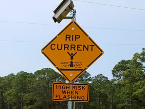 Beach and Surf
 Tropical Weather
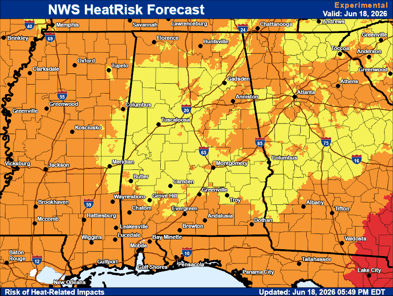 Heat Risk
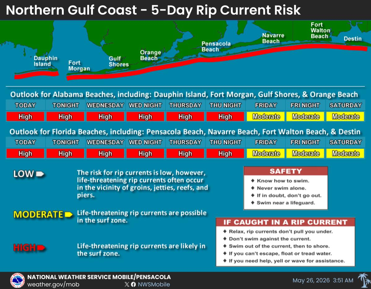
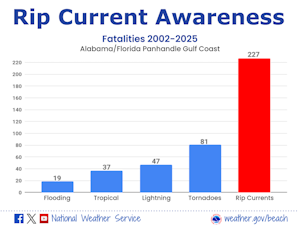 Rip Current Awareness
 Local Forecast Maps