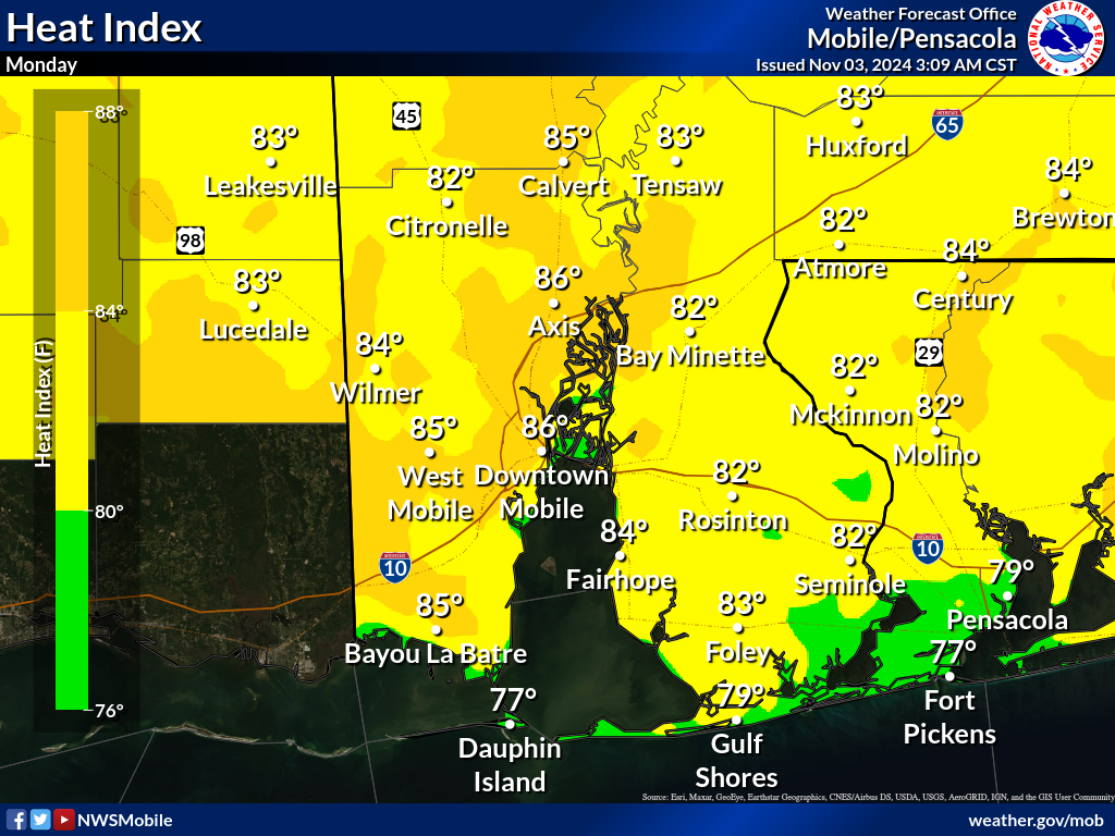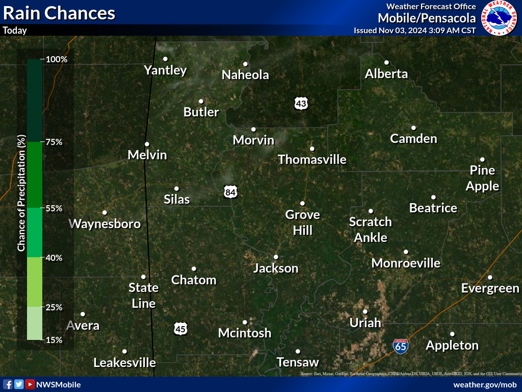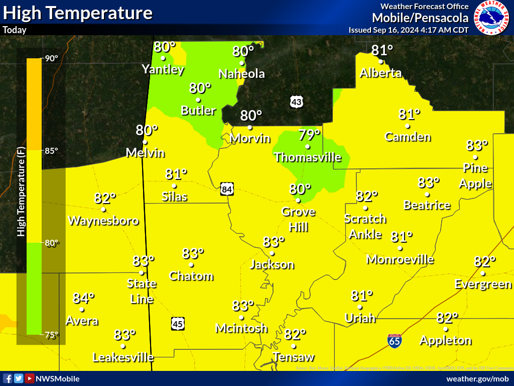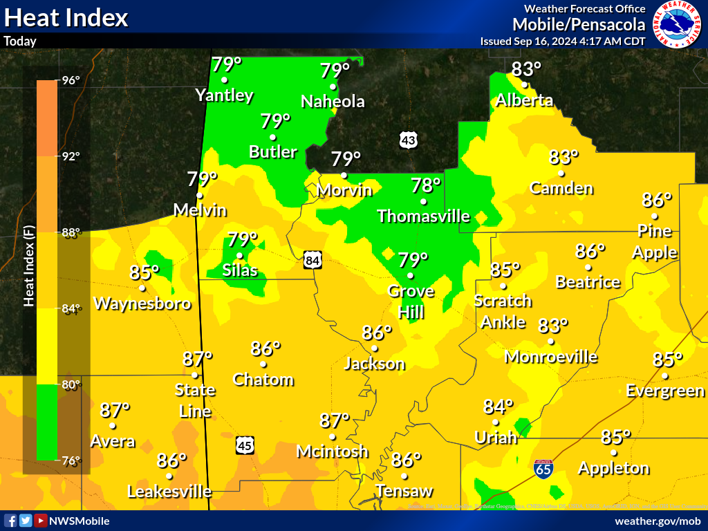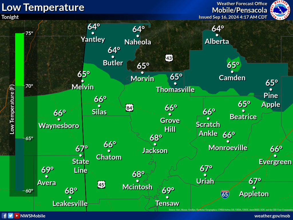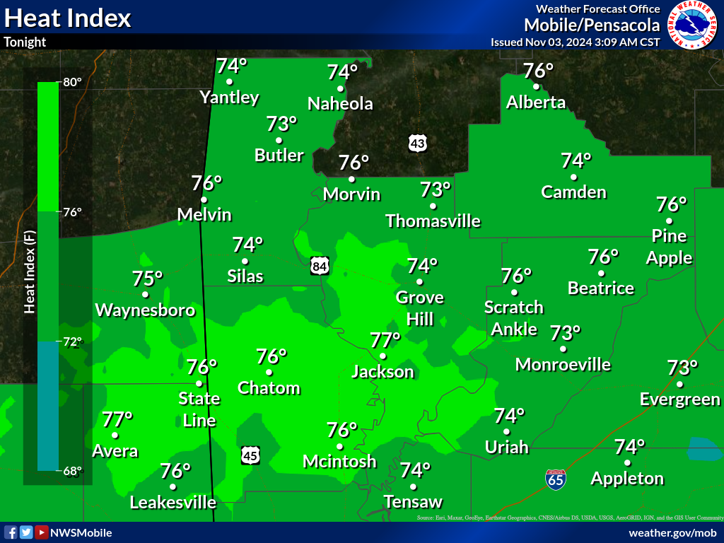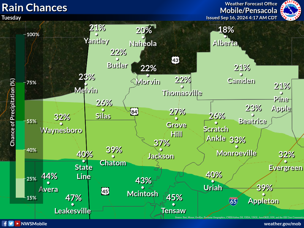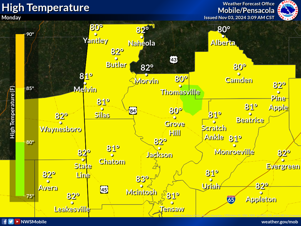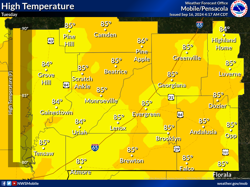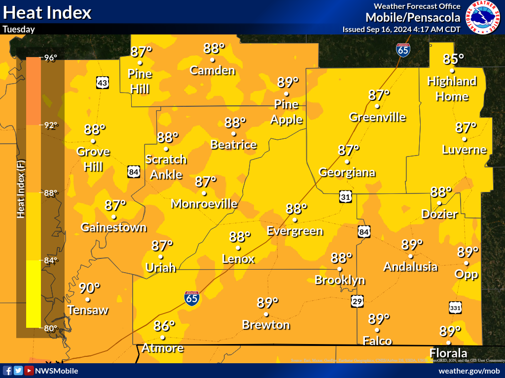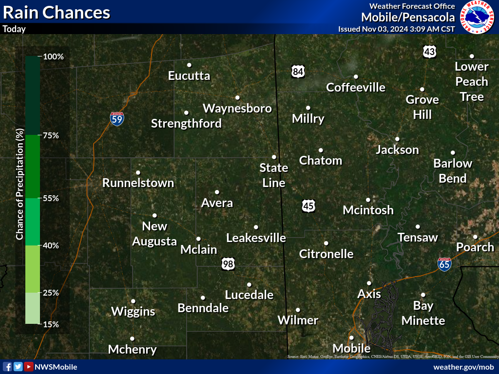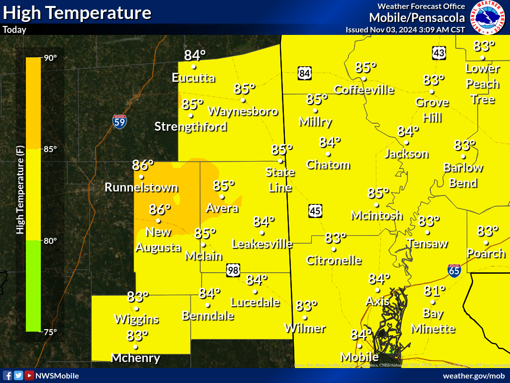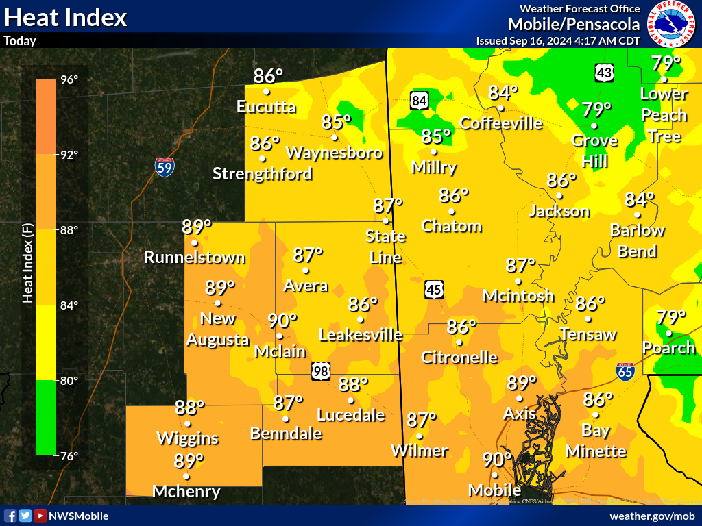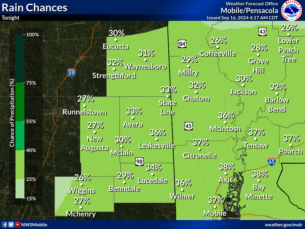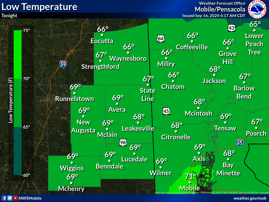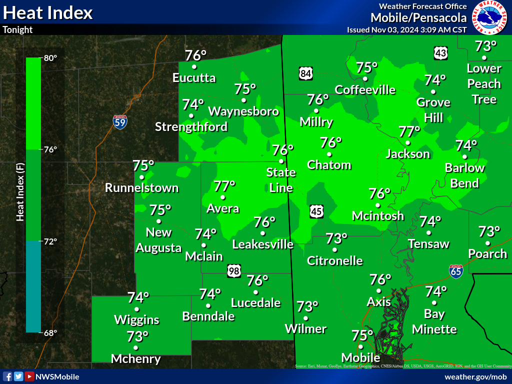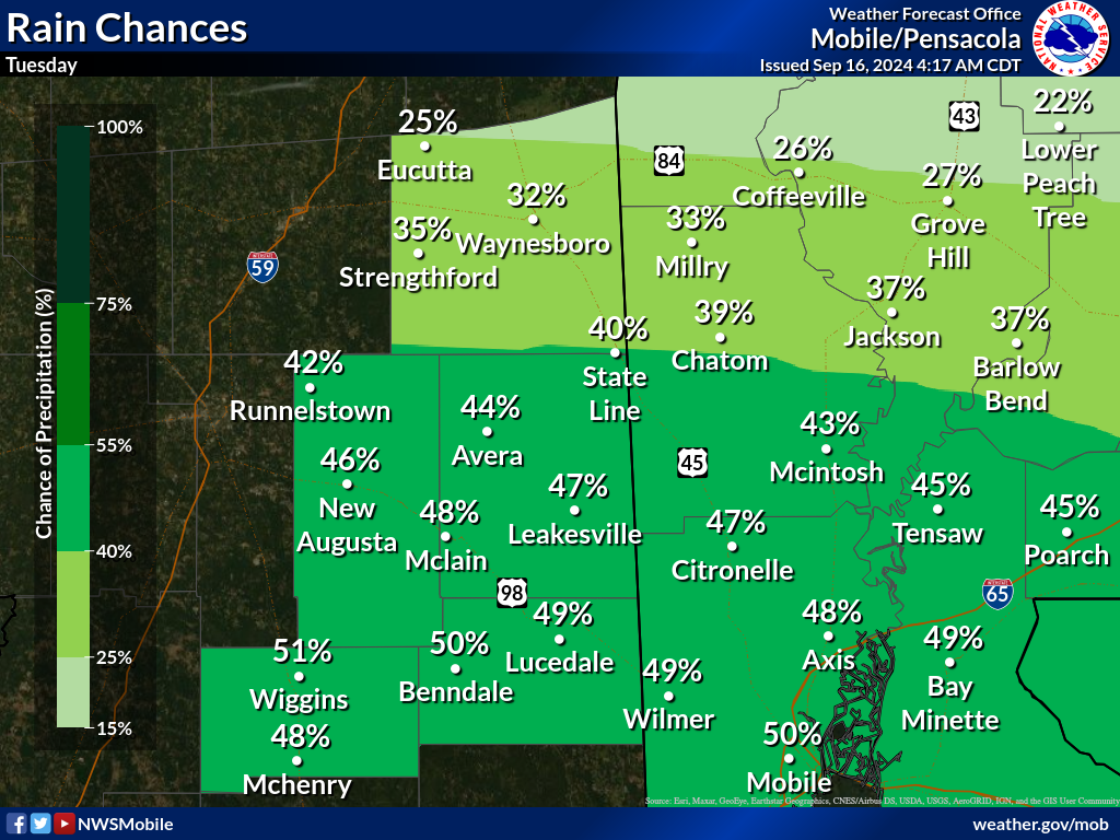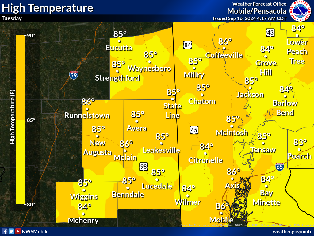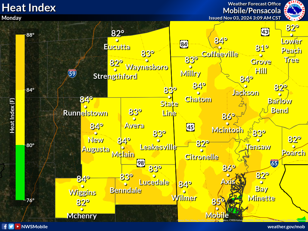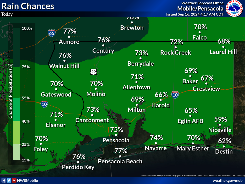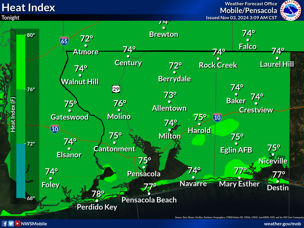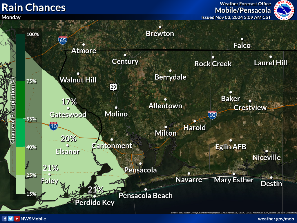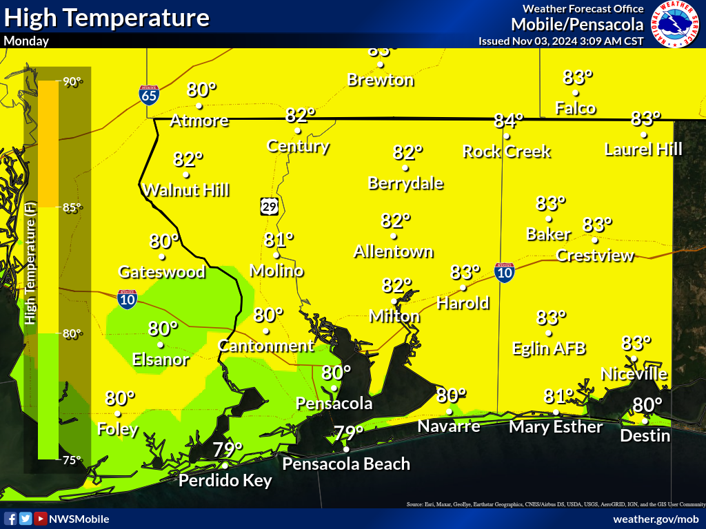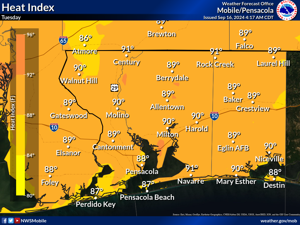
Maps provided on this webpage are zoomed in to the different parts of the local area to provide forecast information at a community level. Maps are automatically updated at least three times a day based on the latest forecast issued from the NWS Mobile/Pensacola Office. The chance for rain, high/low temperatures, and apparent temperatures (heat index/wind chill) are provided for the next three forecast periods, which typically coincides with the following timeframes: today, tonight, tomorrow OR tonight, tomorrow, tomorrow night (dependent on the time of day). Always check the timestamp in the upper right corner of the map to ensure the graphic is showing the latest information. Note: If you need more specific, hourly forecast information, please check out the hourly weather graph webpage.
Jump to - Coastal Alabama, Southwest Alabama, South-Central Alabama, Southeast Mississippi, or Northwest Florida maps.
|
|
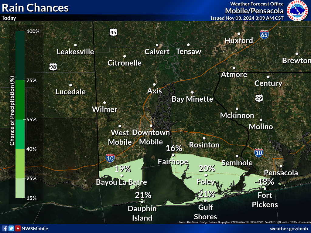
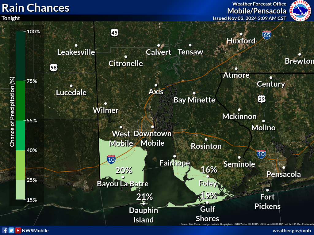
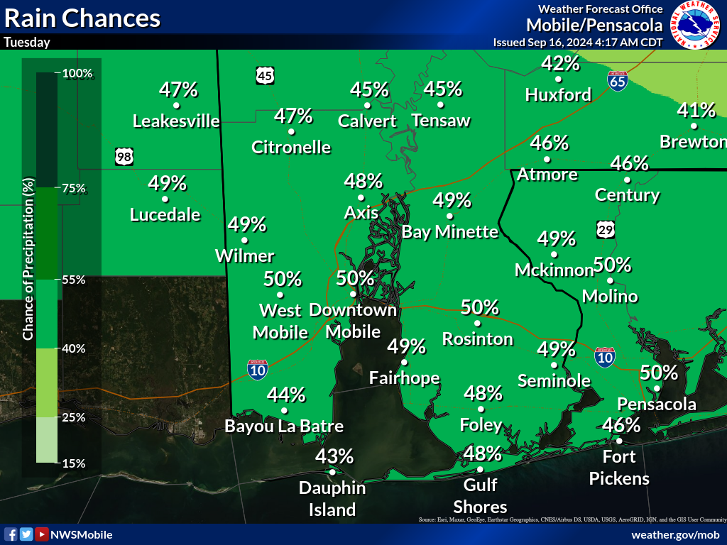
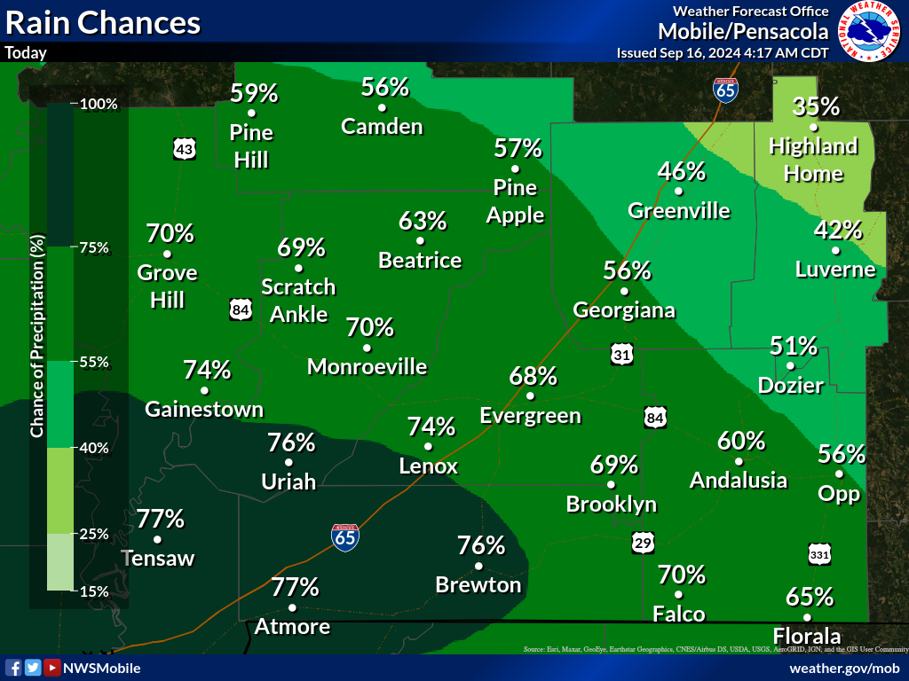
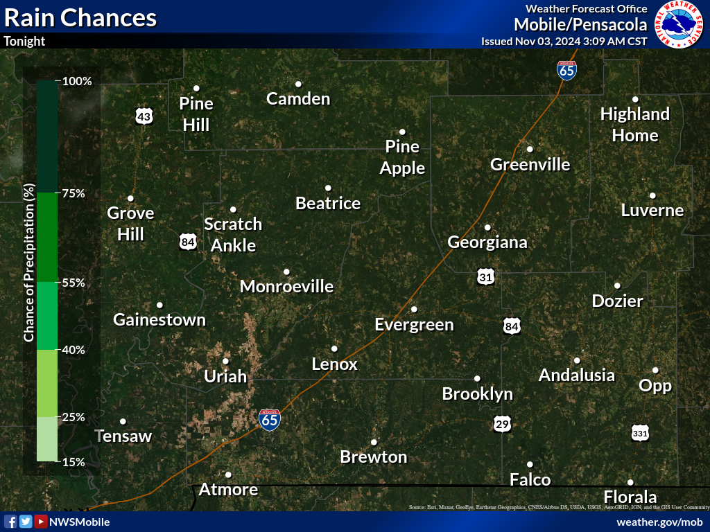
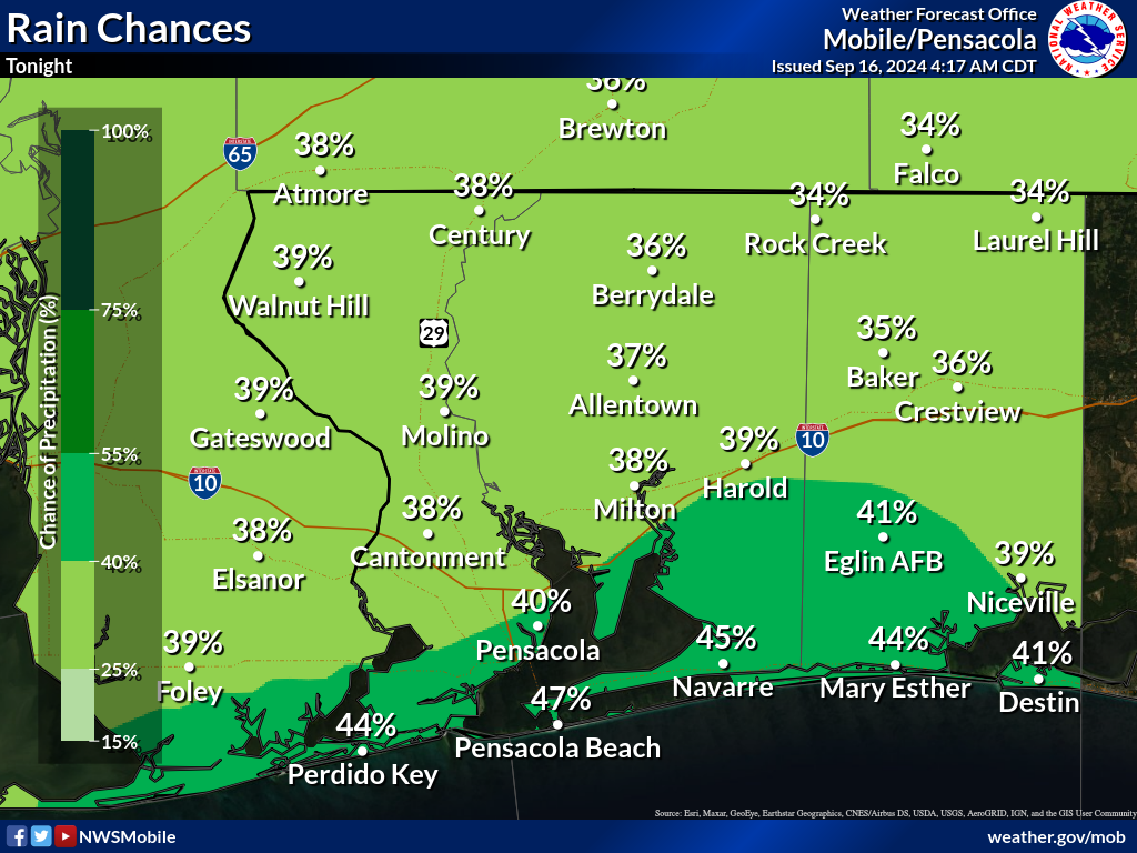
Rain Chances
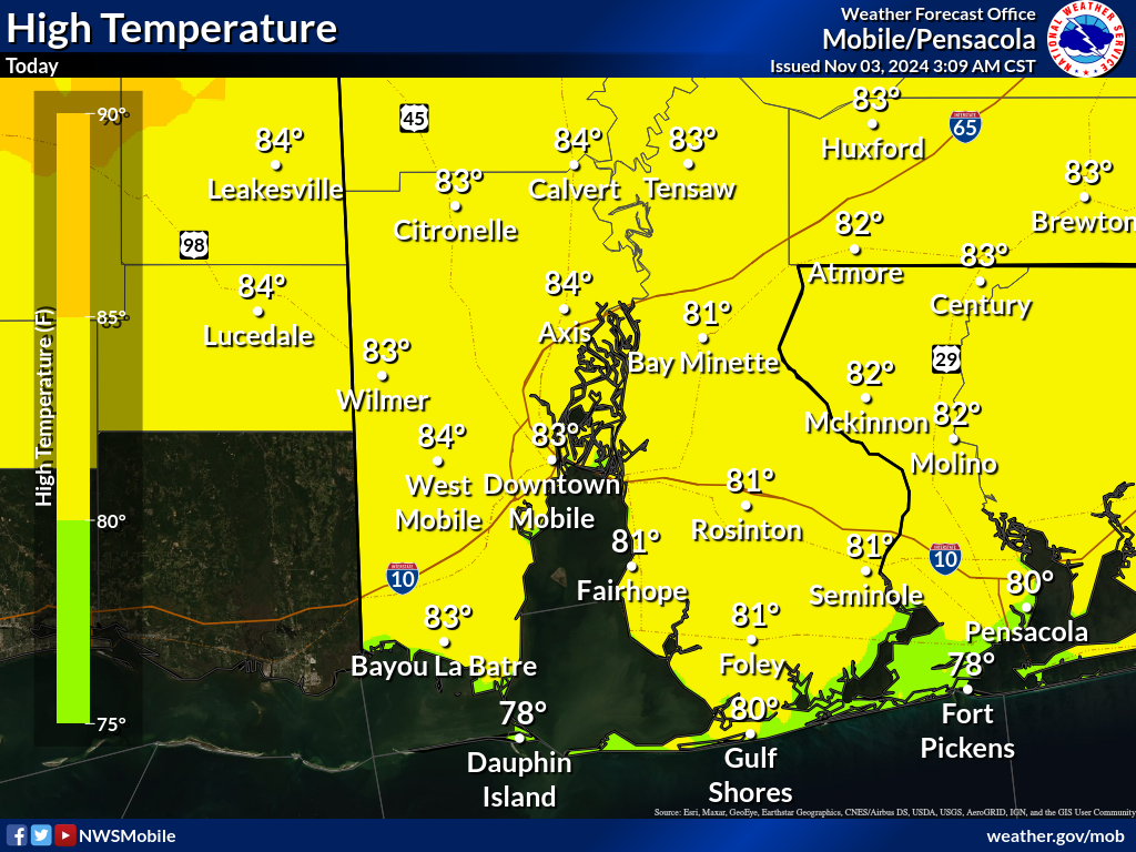
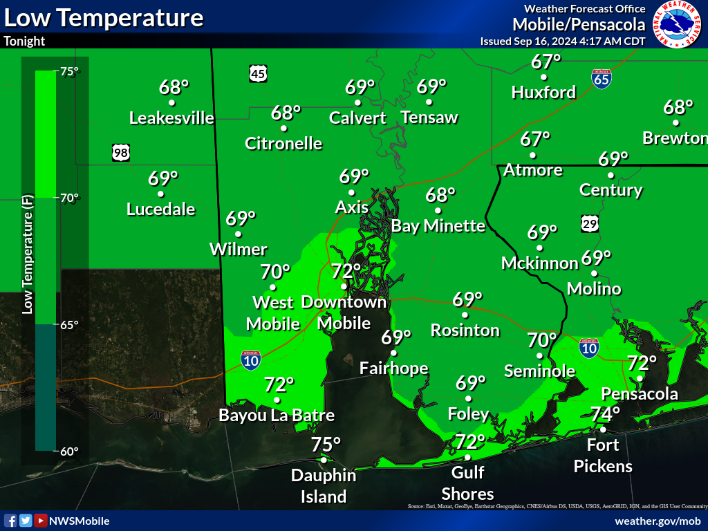
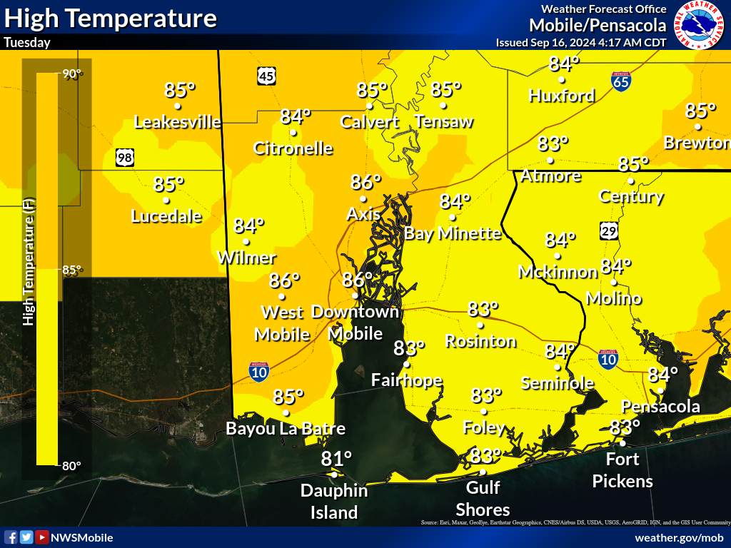
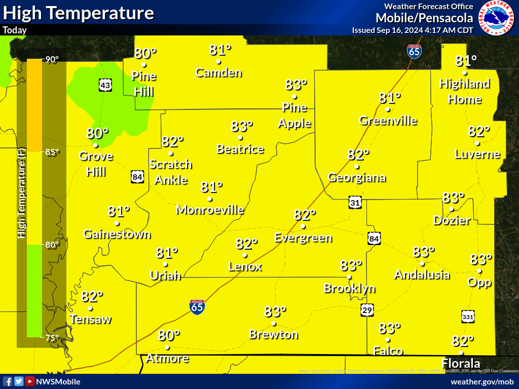
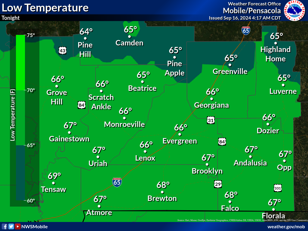
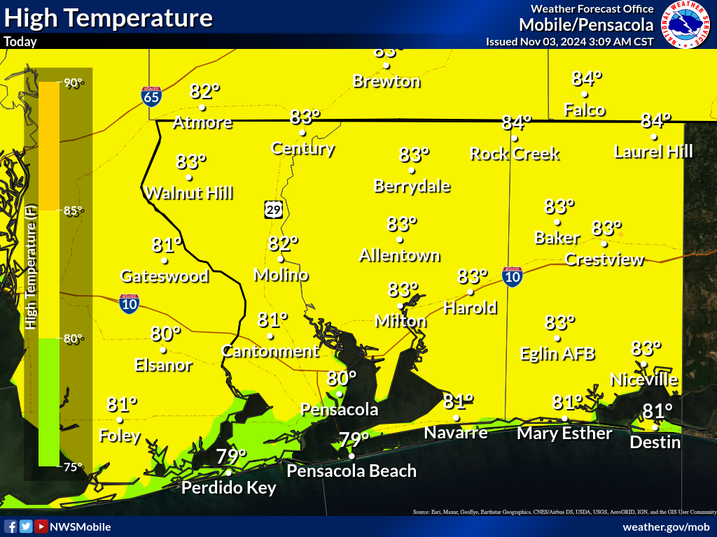
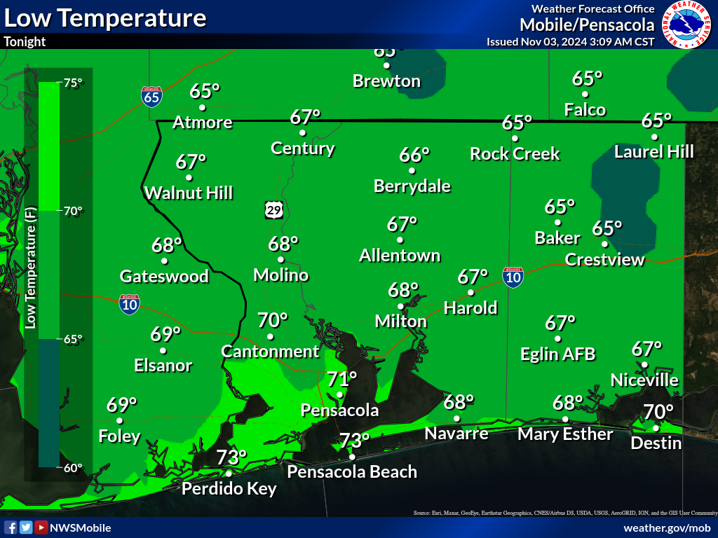
Temperatures
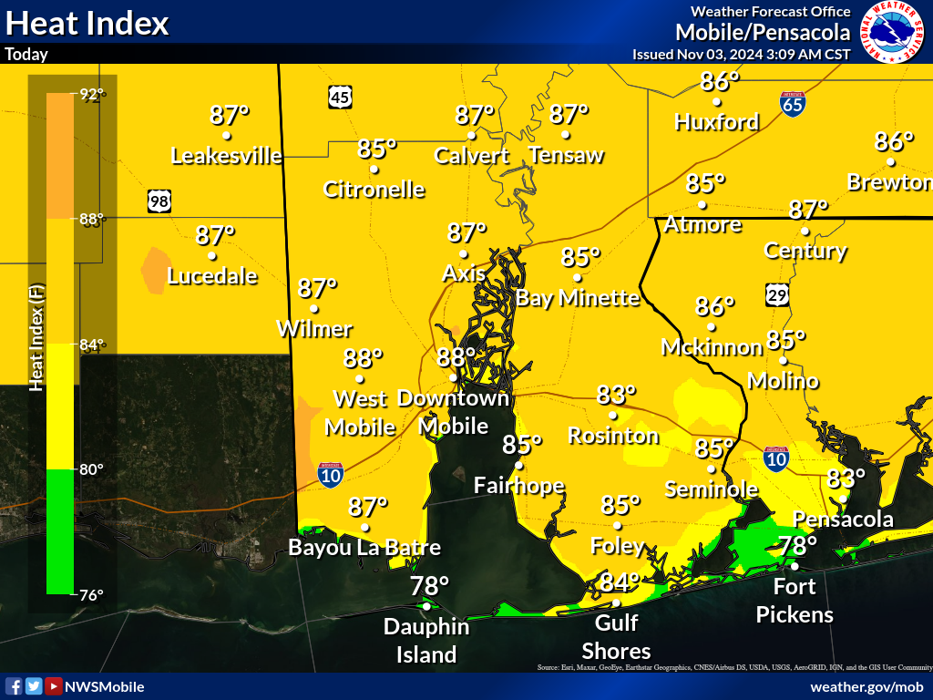
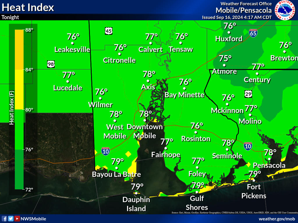
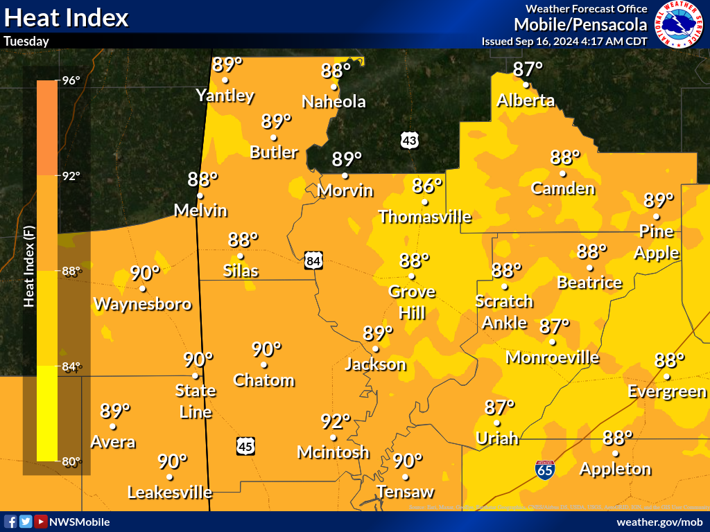
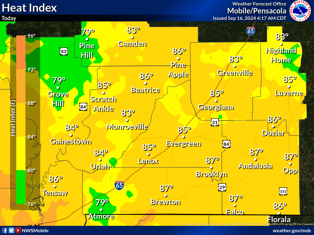
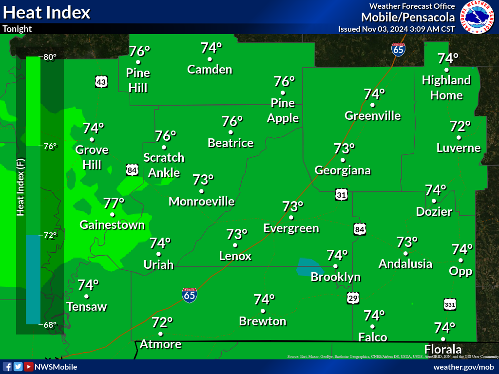
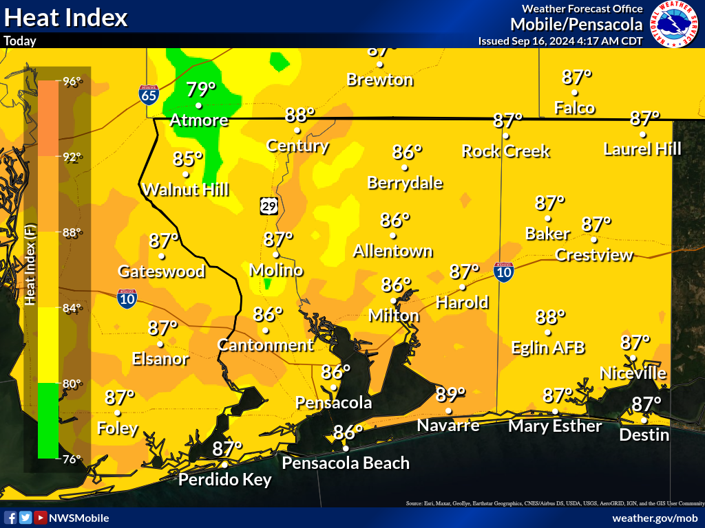
Apparent Temperatures |
|
|
|
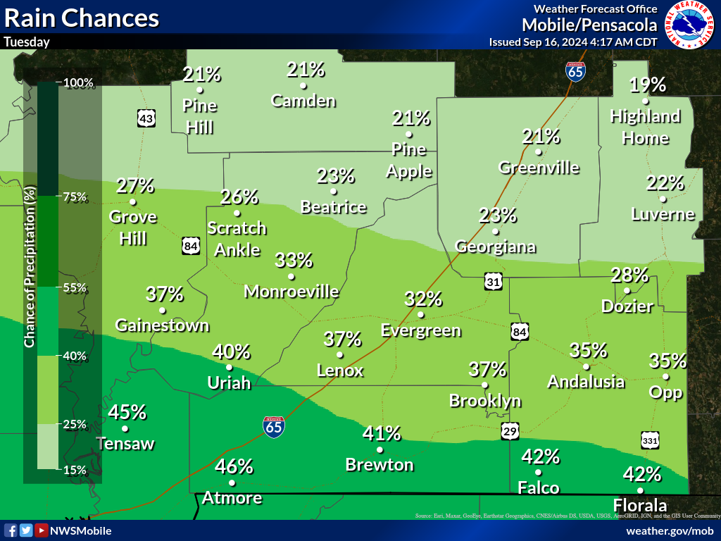
Rain Chances
Temperatures
Apparent Temperatures |
|
|
|
Rain Chances
Temperatures
Apparent Temperatures |
|
|
|
Rain Chances
Temperatures
Apparent Temperatures |
|
|
|
Rain Chances
Temperatures
Apparent Temperatures |
|