
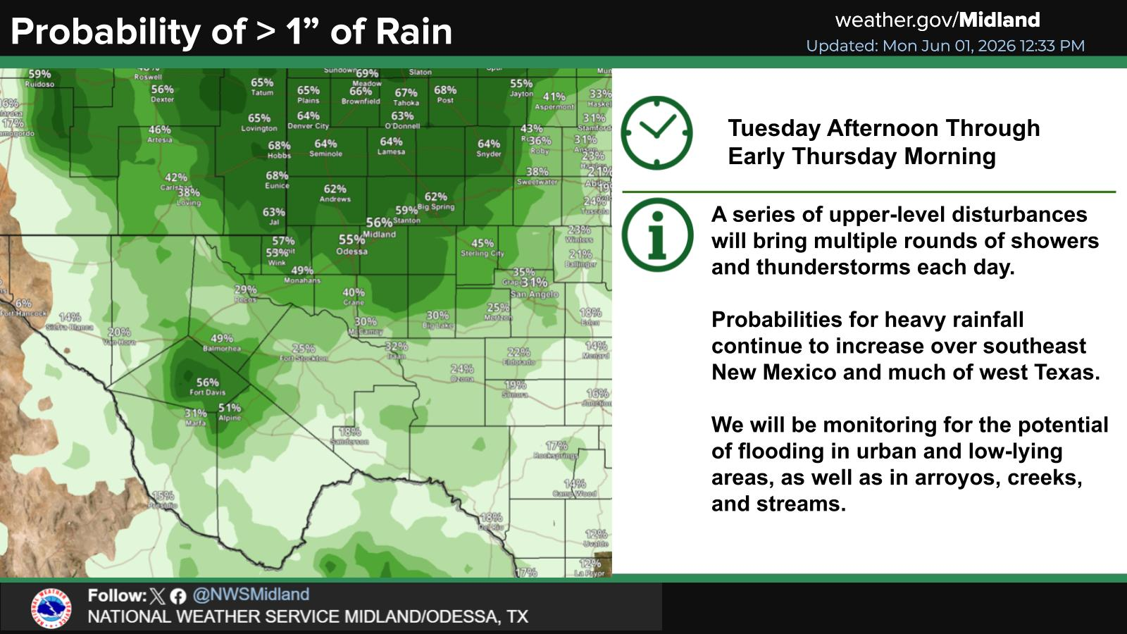
Tropical Depression Two is expected to gradually strengthen and could bring tropical storm conditions to the Florida Panhandle beginning late Monday. Areas of flash flooding will be possible through Thursday along the eastern and central Gulf Coast. Severe thunderstorms will develop and move along a cold front crossing the Upper Midwest Monday, and through the Ohio Valley/Mid-Atlantic on Tuesday. Read More >
Last Map Update: Tue, Jul 21, 2026 at 10:12:19 am CDT
|
Text Product Selector (Selected product opens in current window)
|
|
 |
 |
 |
 |
 |
 |
| Storm Reports | Spotter Briefing | Storm Spotters | Storm Data | Tornado Statistics | Social Media |
 |
 |
 |
 |
 |
 |
| Forecast Discussion | Hourly Forecast | Graphical Forecast | Fire Weather | Aviation | Hydrology |
 |
 |
 |
 |
 |
 |
| Observations | Air Quality | Satellite | Climate | Past Events | Weather Radio |


 Local Radar
 Weather Map
 Satellite