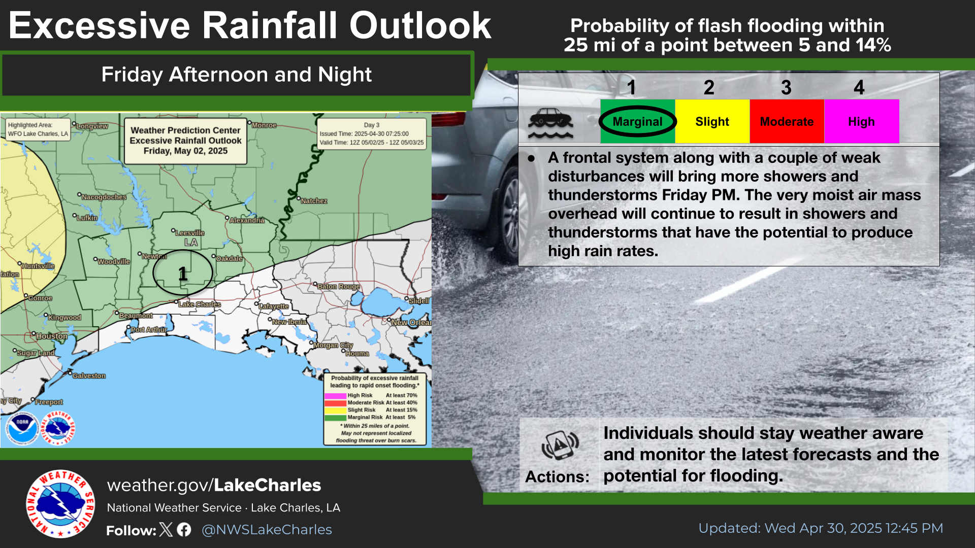
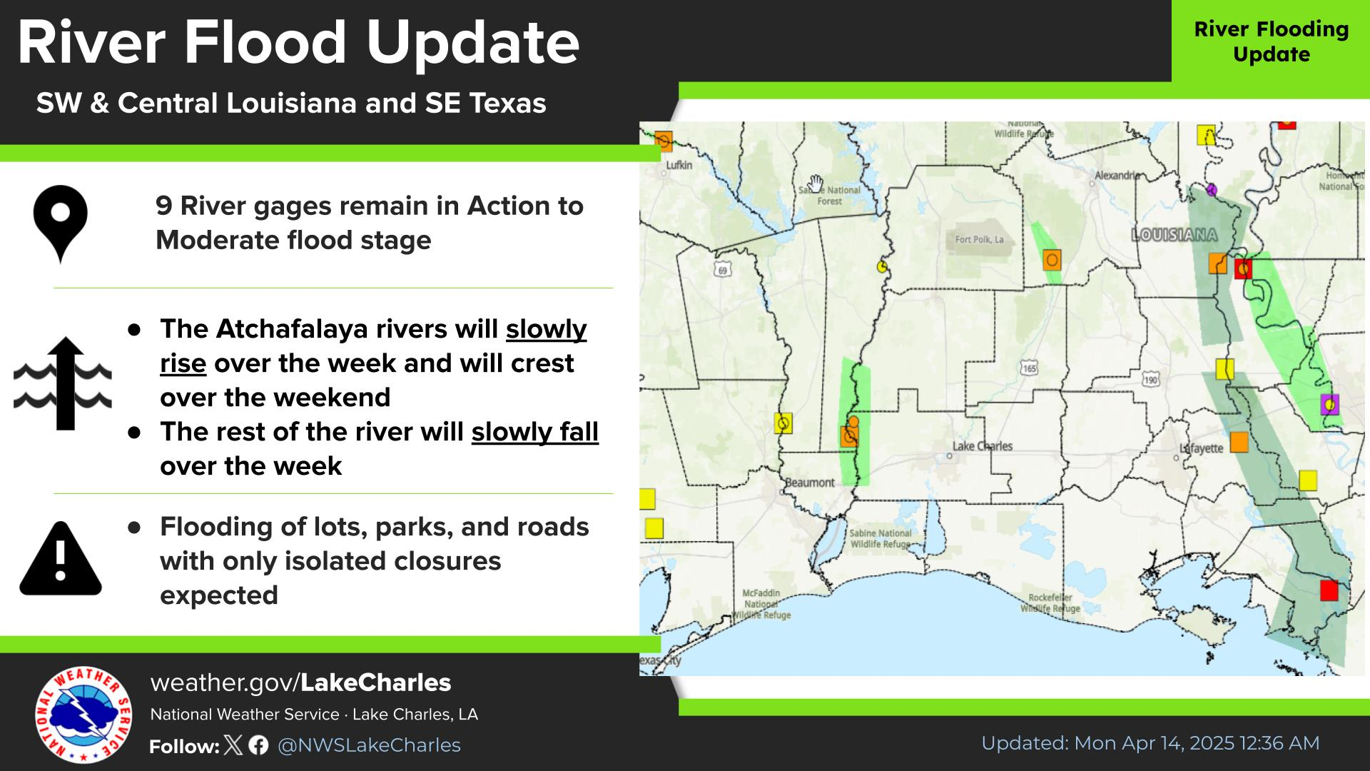
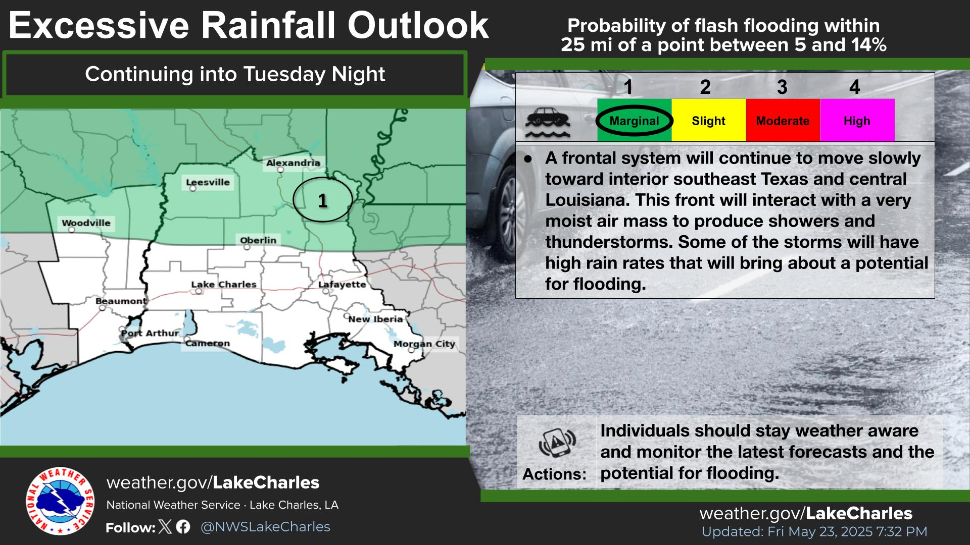
National Weather Service United States Department of Commerce

Critical Fire Weather and Severe Thunderstorm Threats This Week

Gusty winds and low relative humidity will contribute to critical fire weather Monday over parts of the central and southern High Plains. Scattered to widespread severe thunderstorms may bring damaging winds, large hail, and tornadoes Monday through Thursday over the lower Mississippi River Valley and southern Plains into the Midwest and Ohio Valley. Read More >

There is a risk of severe storms on Sunday evening/night with the potential for damaging wind gusts and large hail. Potential for Gale force winds over the coastal waters on Sunday night into Monday. Strong north winds and low relative humidity will bring the potential for fire danger on Monday. There is a potential for a light freeze and frost on Monday night into Tuesday morning.
A cold front will bring a risk of severe storms for interior southeast Texas and central Louisiana late Sunday afternoon into the evening hours.
Light and modest southerly winds to end the week before southerly winds increase ahead of a cold front on Sunday. Strong northerly winds are expected behind the front on Monday with the potential for a small craft advisory or gale warning.
Elevated Fire Danger expected Monday. The highest fire danger is expected for the area. Fires can spread rapidly in these conditions. Outside burning is discouraged except by experienced fire personnel.
Cold air advection and clearing skies behind the front will cool low temperatures well below normal for mid March

Latest Text Product Selector
 
 
Hourly Weather Roundup ( )
Location Sky/Weather Temp Dewpt RH Wind Baro Remarks
Lake Charles
N/A
N/A
N/A
N/A
N/A
N/A
N/A
Abbeville
N/A
N/A
N/A
N/A
N/A
N/A
N/A
Alexandria
N/A
N/A
N/A
N/A
N/A
N/A
N/A
Beaumont
N/A
N/A
N/A
N/A
N/A
N/A
N/A
De Quincy
N/A
N/A
N/A
N/A
N/A
N/A
N/A
De Ridder
N/A
N/A
N/A
N/A
N/A
N/A
N/A
Fort Polk
N/A
N/A
N/A
N/A
N/A
N/A
N/A
Jasper
N/A
N/A
N/A
N/A
N/A
N/A
N/A
Jennings
N/A
N/A
N/A
N/A
N/A
N/A
N/A
Lafayette
N/A
N/A
N/A
N/A
N/A
N/A
N/A
Nederland/Port Arthur
N/A
N/A
N/A
N/A
N/A
N/A
N/A
New Iberia
N/A
N/A
N/A
N/A
N/A
N/A
N/A
Oakdale
N/A
N/A
N/A
N/A
N/A
N/A
N/A
Opelousas
N/A
N/A
N/A
N/A
N/A
N/A
N/A
Orange
N/A
N/A
N/A
N/A
N/A
N/A
N/A
Patterson
N/A
N/A
N/A
N/A
N/A
N/A
N/A
Pineville
N/A
N/A
N/A
N/A
N/A
N/A
N/A
Sulphur/Carlyss
N/A
N/A
N/A
N/A
N/A
N/A
N/A
"N/A" or "MISG" will be displayed if values are not available. In the LOCATION column, click on links for a list of recent observations at sites of interest. In the WIND column, VRB is "variable" and G is "gust". Wind speeds are in MPH. In the BARO (pressure) column, values are in inches. In the REMARKS column, HX is "heat index", WCI is "wind chill index", and VSB is "visibility" (if shown).
 

Current Weather
 
Rivers & Lakes
 
Forecast Maps
 
Hour By Hour Forecast
 
Tropical Weather
 
Marine Forecast
 
Text Bulletins
 
Forecast Discussion
 
NOAA Weather Radio
 
Submit Storm Report