Jackson, Mississippi
Weather Forecast Office
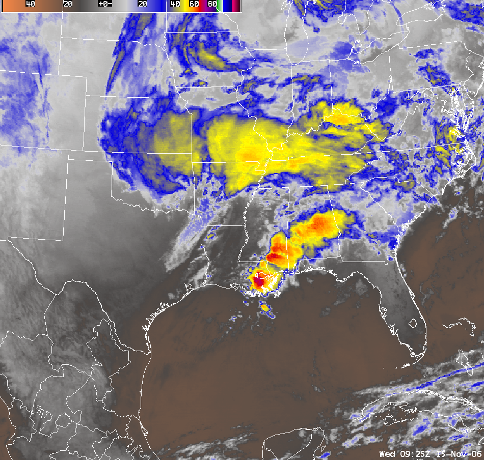
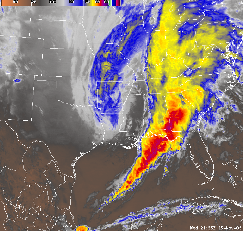
An intense fall cyclone developed over the region and produced an episode of severe weather which included tornadoes. This strong weather system developed as a very strong "jet stream", with winds between 160-200 mph, slammed into Oregon and Washington State. All that energy moved over the Rocky Mountains and caused a strong area of surface low pressure to develop. This low intensified as it moved east across the Red River Valley and then lifted across Arkansas and into Tennessee as it deepened to 990 mb! The strength of this deepening low caused warm and unstable air to lift northward across Louisiana and into central Mississippi. It was this northward moving warm front that became the focus of an area where tornadic supercell thunderstorms could thrive in an unstable and highly sheared environment.
This large and powerful storm system produced numerous tornadoes across the south and south eastern United States where many were of the strong (F2 or F3) variety. Within the Jackson, MS forecast area, there were a total of 5 tornadoes to impact the counties serviced. Two F3s, one in Lamar County and the other in Jones County. The Jones County tornado actually contained a satellite tornado, F1, which briefly rotated around the parent tornado. Next was an F1 tornado in southern Marion County which was actually the end of a strong tornado that moved out of Walthall County. Lastly, a brief F1 tornado occurred in central Lamar County. Tornadoes were not the only type of severe weather, scattered wind damage also occurred across northeast Louisiana and portions of central Mississippi between midnight and 10 am Wednesday.
The following pictures are satellite images of the developing cyclone. The image on the left represents the development stage and the time when the tornadic storms were occurring. The image on the right represents a mature cyclone.
 |
 |
Severe Intense Cyclone for Lamar County
Severe Intense Cyclone for Jones County
US Dept of Commerce
National Oceanic and Atmospheric Administration
National Weather Service
Jackson, Mississippi
234 Weather Service Dr.
Flowood, MS 39232
601-936-2189
Comments? Questions? Please Contact Us.

