Jackson, Mississippi
Weather Forecast Office
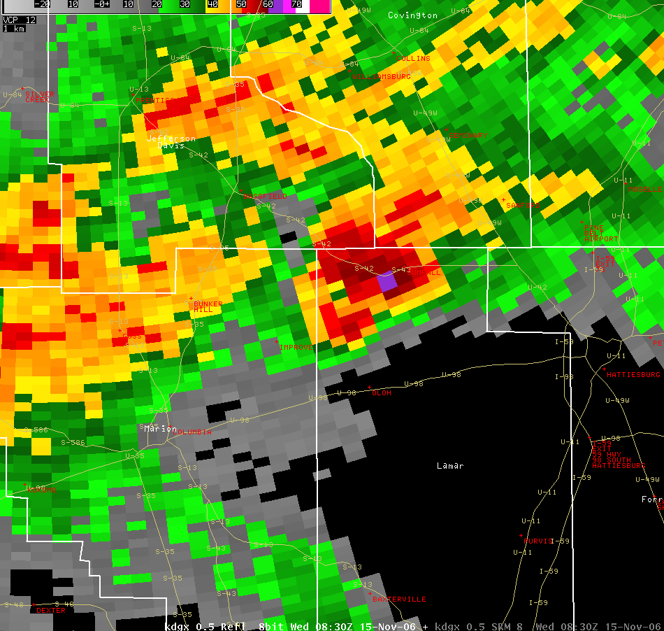
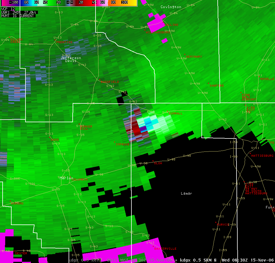
The following pictures are of the radar during the Sumrall tornado, in Lamar County. The tornado has been rated F3. The velocity image indicates gate-to-gate velocity of 140kts! This circulation is one of the strongest observed in the JAN forecast area.
Beginning Point: 7 SW Sumrall at 0230
Ending Point: 6.5 E Sumrall at 0251
Path Length: 13 miles
Maximum Width: 500 yd Maximum
F-scale Damage: F3
Casualties: 0 fatalities, 6 injuries
Summary of Damage: Approximately 25 homes were damaged, 16 of those suffering major damage or total destruction. The worst damage was along Old Salt Road, where a wood frame home on a concrete block foundation was totally destroyed, with the foundation cleared and the remnants of the home displaced dozens of yards away. A minivan was picked up and thrown/rolled a distance of approximately 150 yards, landing on top of a tractor and totally destroyed. Some large trees at this location were snapped at the base, denuded, and partially debarked. Heavy damage of F2 intensity was also observed along Foster Road, JD Hatten Road, and Rocky Branch road. Large swaths of trees were snapped and uprooted, and a few frame homes totally lost their roofs. Other damage along the path was weaker and generally of F1 intensity.
US Dept of Commerce
National Oceanic and Atmospheric Administration
National Weather Service
Jackson, Mississippi
234 Weather Service Dr.
Flowood, MS 39232
601-936-2189
Comments? Questions? Please Contact Us.


