Overview
|
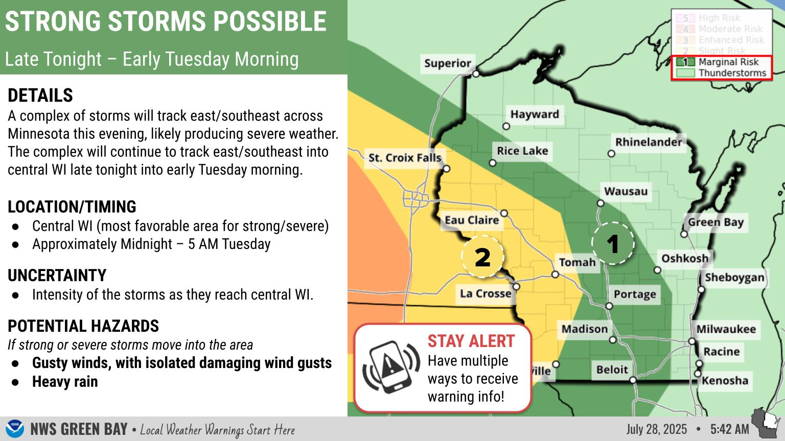
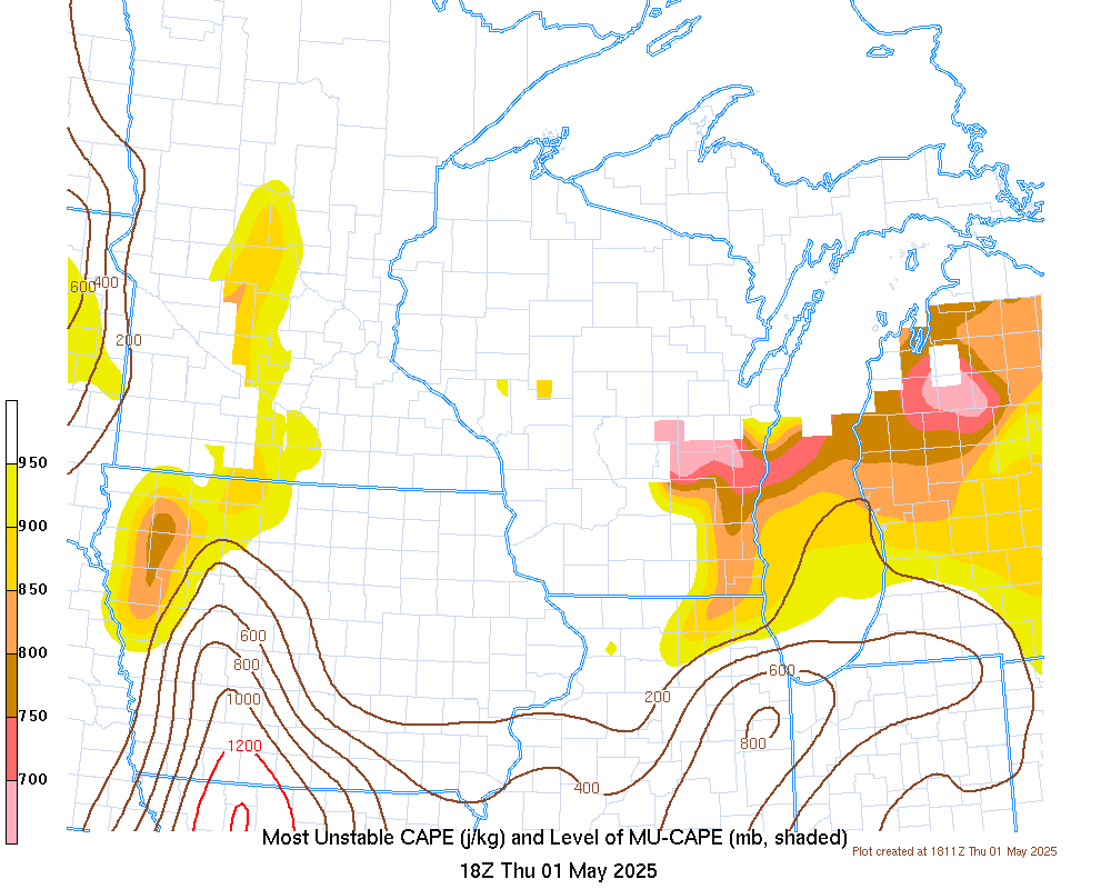
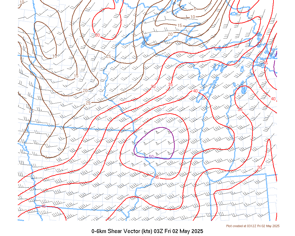
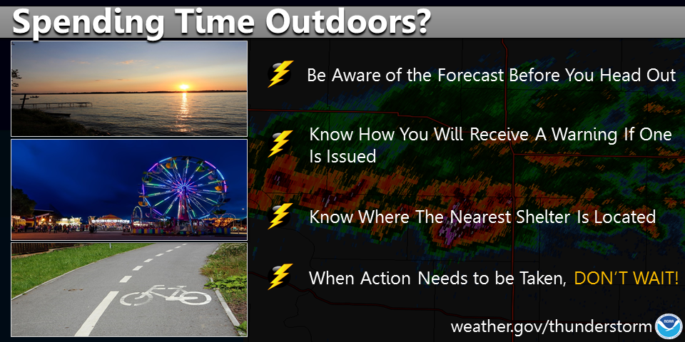
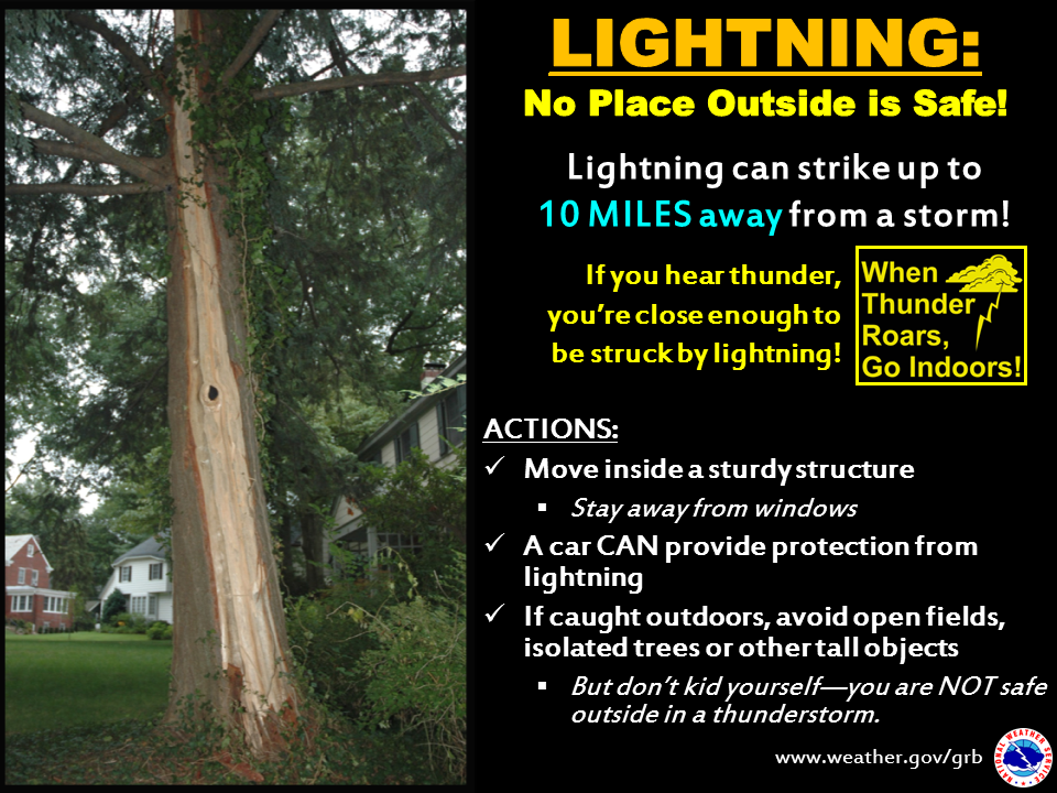
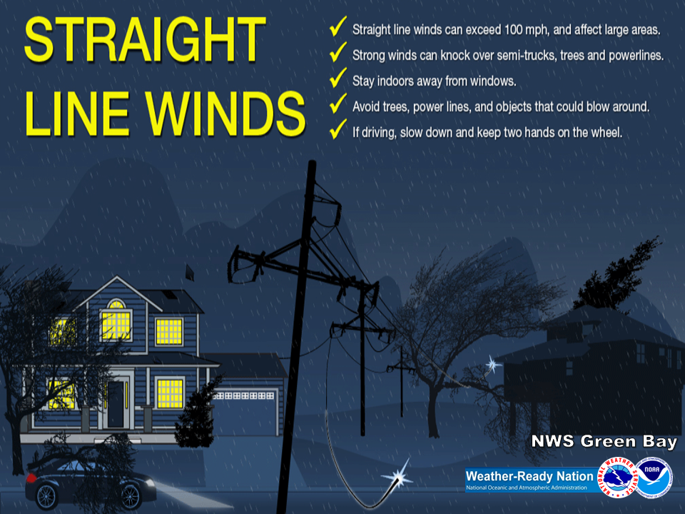
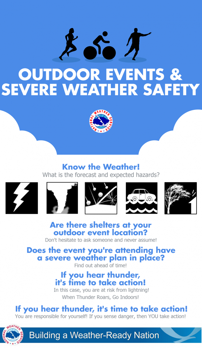
Thunderstorms/Flooding: THIS EVENING: A widespread line or complex of storms is expected to race across the area, mainly thru midnight. Tornadoes, damaging straight lined wind, large hail and very heavy rainfall will be possible Flooding will be possible, especially in urban areas as intense rainfall rates are expected in the heavies storms. Ponding of water on roads/highways is also expected. Make sure you follow the forecast and have a way to get the latest weather information, including any watches or warnings. If you are planning outdoor activities on land or water, have alternate plans in place, including knowing where the nearest sturdy shelter is, in the event severe weather threatens your area.
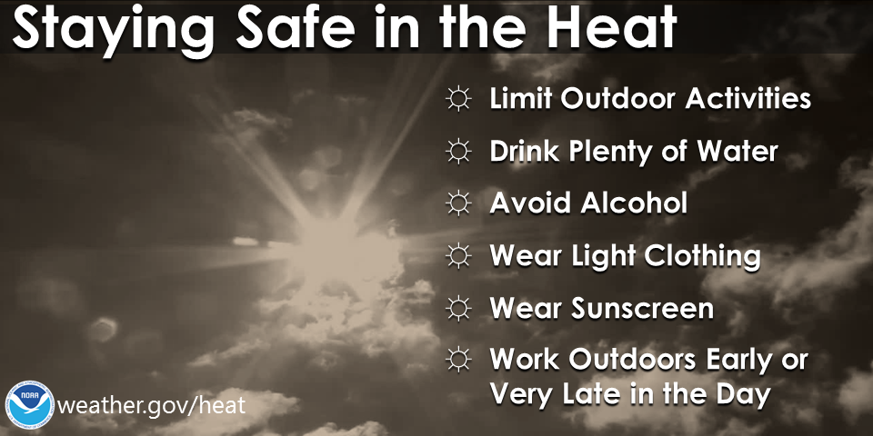
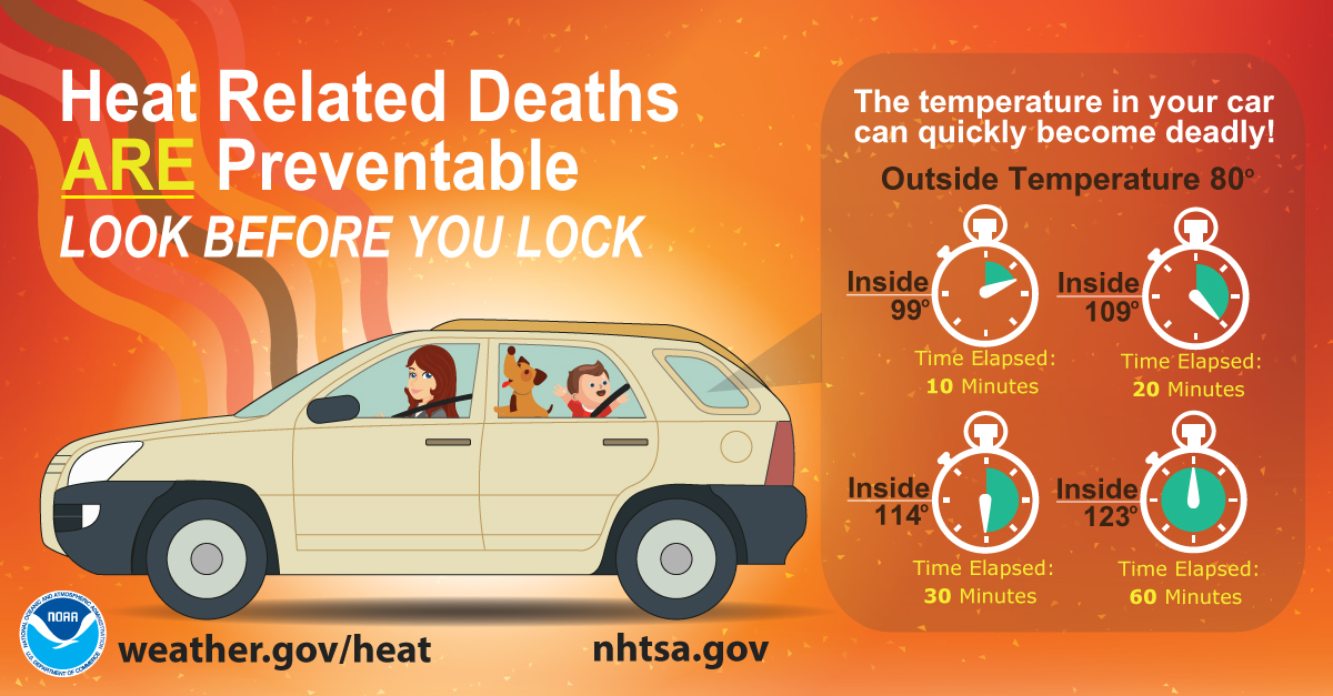
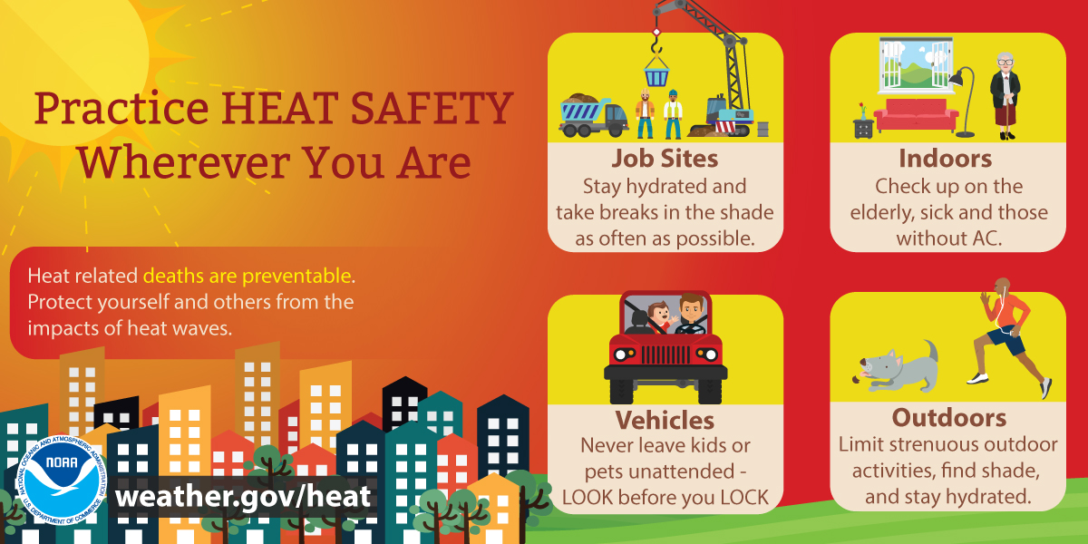
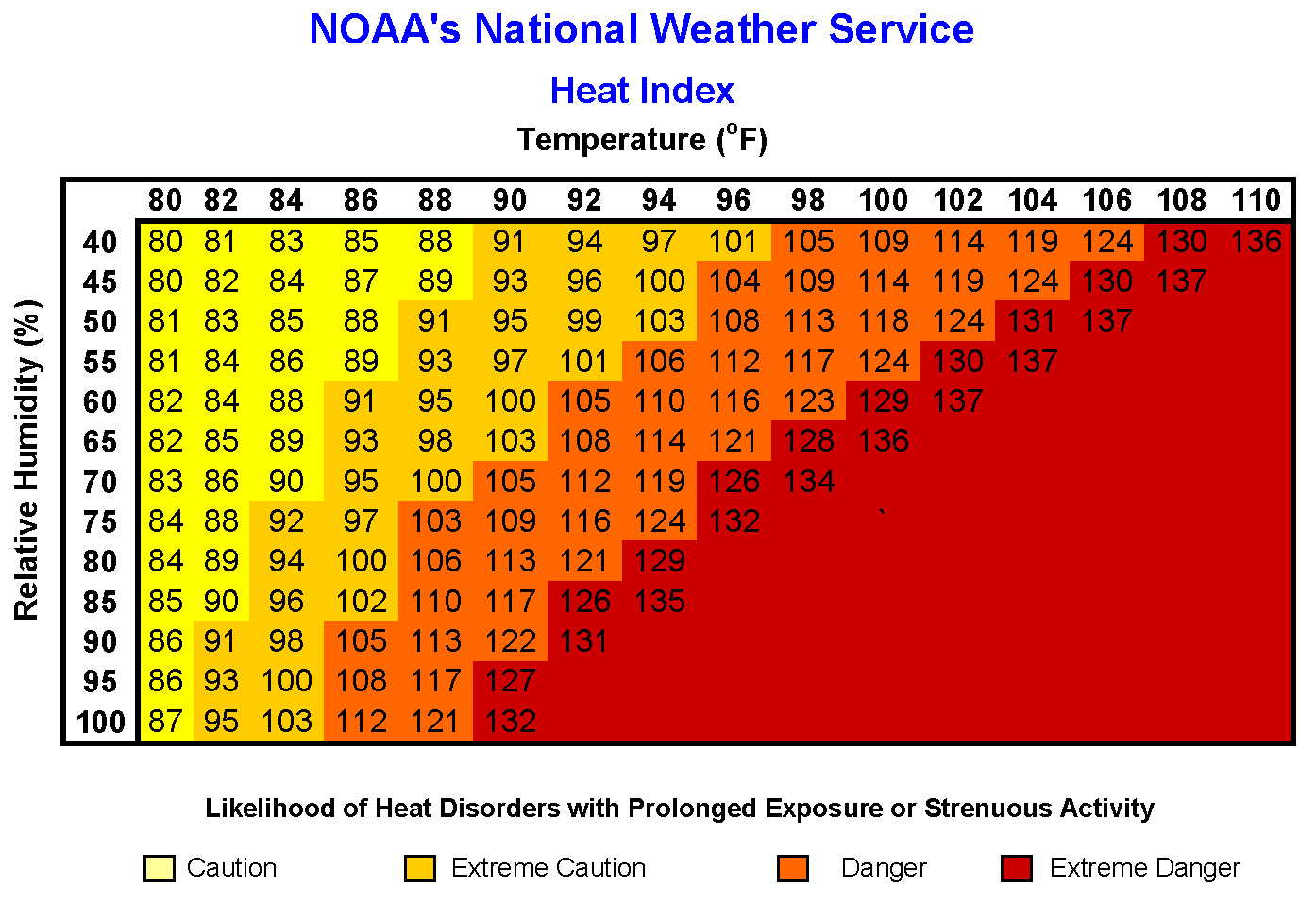
Heat/Humidity: Heat index readings in the 80s to lower/middle 90s are today, mainly in the afternoon and early evening. If headed outside, be sure to drink plenty of water, limit time outdoors, weather light/loose clothing and take breaks in the shade or in a place with air conditioning.
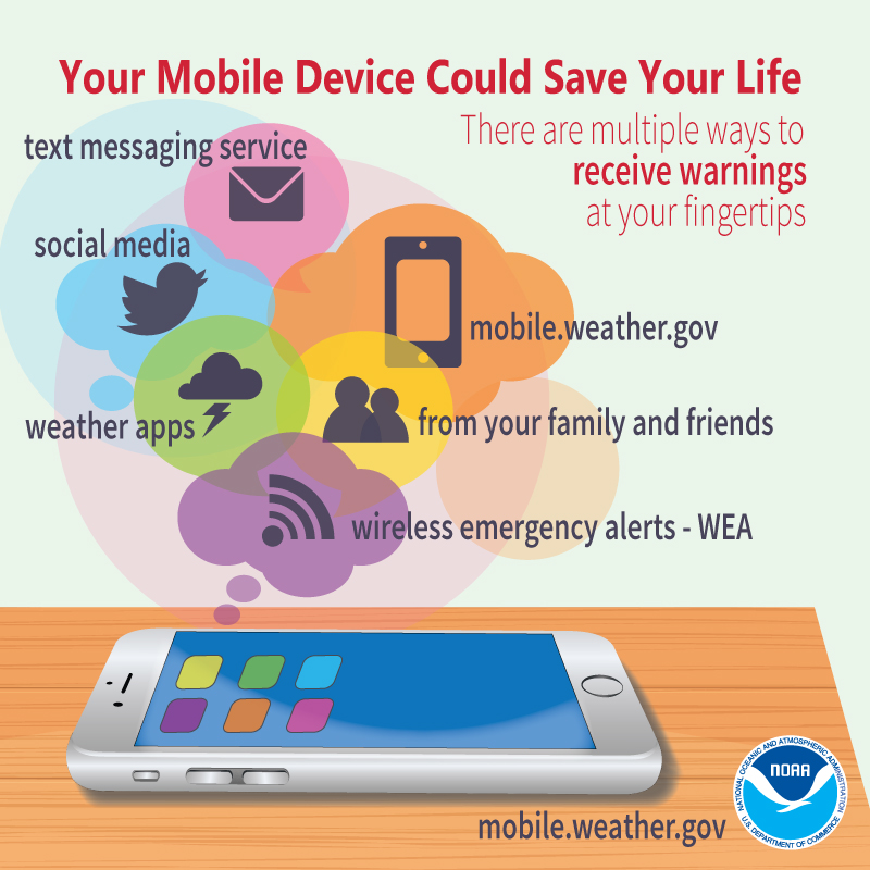
Please click on the tabs below for more information. Click on any image for a larger view. |
|
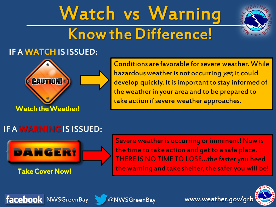
Latest Watches & Warnings
|
|
 Current Watches, Warnings, & Advisories Current Watches, Warnings, & Advisories |
|
 National Hazards Map National Hazards Map |
 Current Convective Watches Current Convective Watches |
Temps & Heat Index
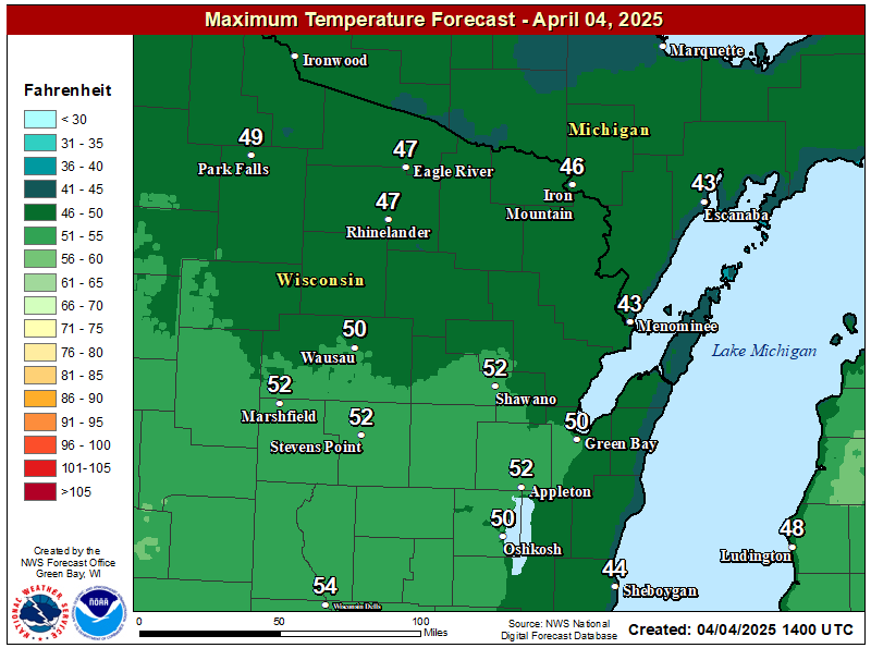 Day 1 High Temps Day 1 High Temps |
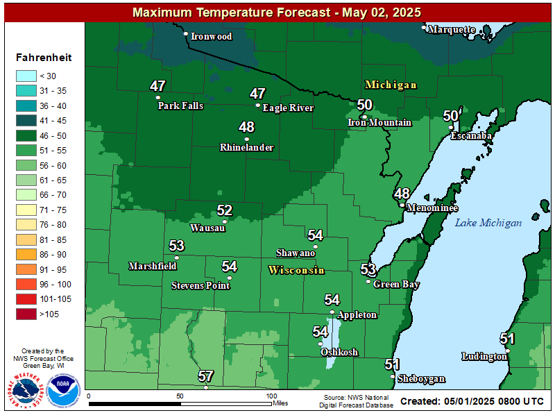 Day 2 High Temps Day 2 High Temps |
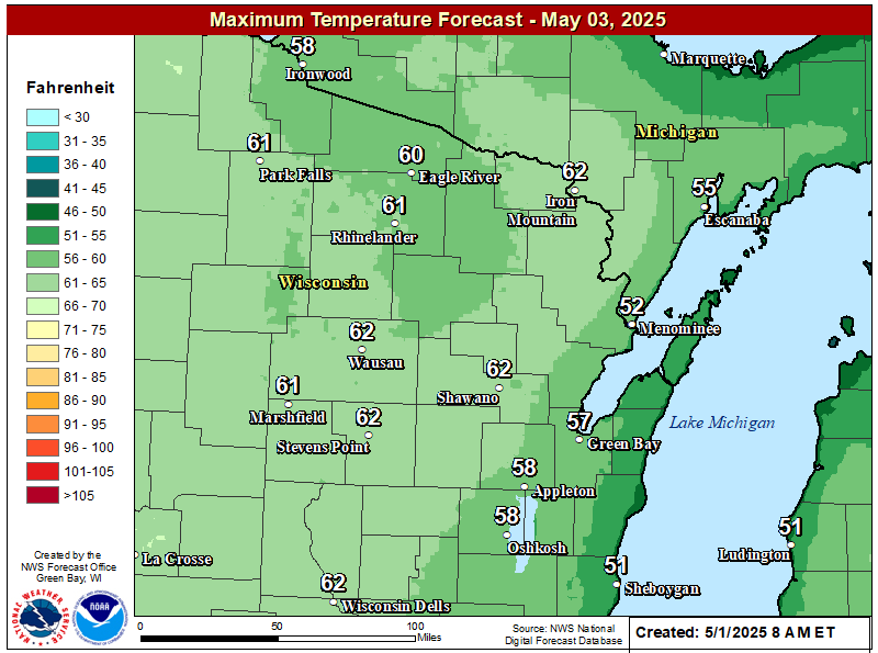 Day 3 High Temps Day 3 High Temps |
|
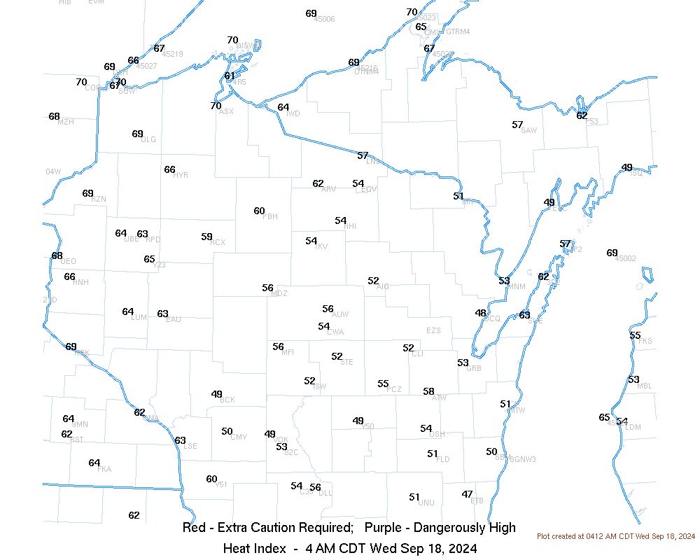 Current Heat Index Readings Current Heat Index Readings |
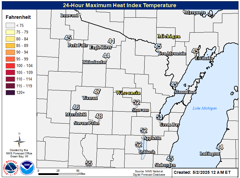 Day 1 Max Heat Index Day 1 Max Heat Index |
SPC / WPC Outlooks
 SPC Day 1 (discussion) SPC Day 1 (discussion) |
 SPC Day 1 Tornado Probabilities SPC Day 1 Tornado Probabilities |
 SPC Day 1 Hail Probabilities SPC Day 1 Hail Probabilities |
 SPC Day 1 Wind Probabilities SPC Day 1 Wind Probabilities |
 SPC Day 2 (discussion) SPC Day 2 (discussion) |
 SPC Day 2 Probabilities SPC Day 2 Probabilities |
 SPC Day 3 (discussion) SPC Day 3 (discussion) |
 SPC Day 3 Probabilities SPC Day 3 Probabilities |
 WPC Excessive Rain Day 1 (discussion) WPC Excessive Rain Day 1 (discussion) |
 WPC Excessive Rain Day 2 (discussion) WPC Excessive Rain Day 2 (discussion) |
|
|
 Mesoscale Discussions (more info) Mesoscale Discussions (more info) |
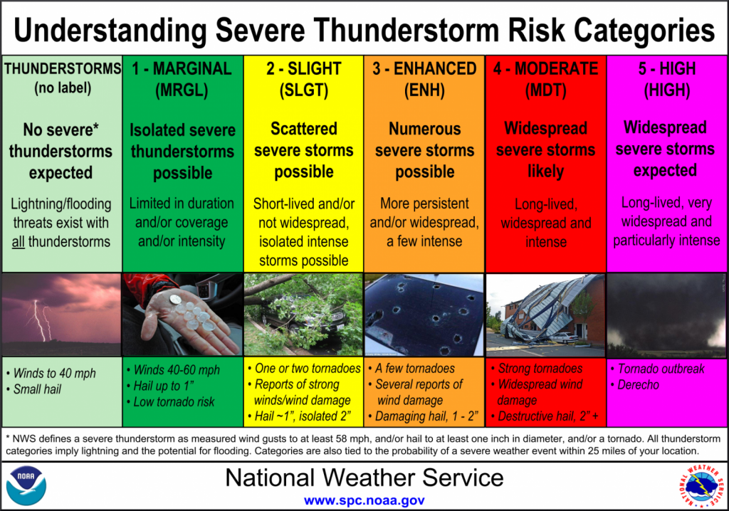 Severe Storm Risk Categories Severe Storm Risk Categories |
|
Radar & Satellite
Click on image for more radar options. Be sure to "Reload/Refresh" to ensure you are looking at the most recent image.
|
Green Bay, WI |
La Crosse, WI Milwaukee, WI |
|
|
Duluth, MN |
Marquette, MI |
Minneapolis, MN |
Regional Radar Mosaics
 |
 |
Satellite Imagery
 |
|
| Visible/IR Loop |
|
|
|
  Geo Color Geo Color |
|
Severe Weather / Rainfall Reports
|
Today's Storm Reports |
Yesterday's Storm Reports |
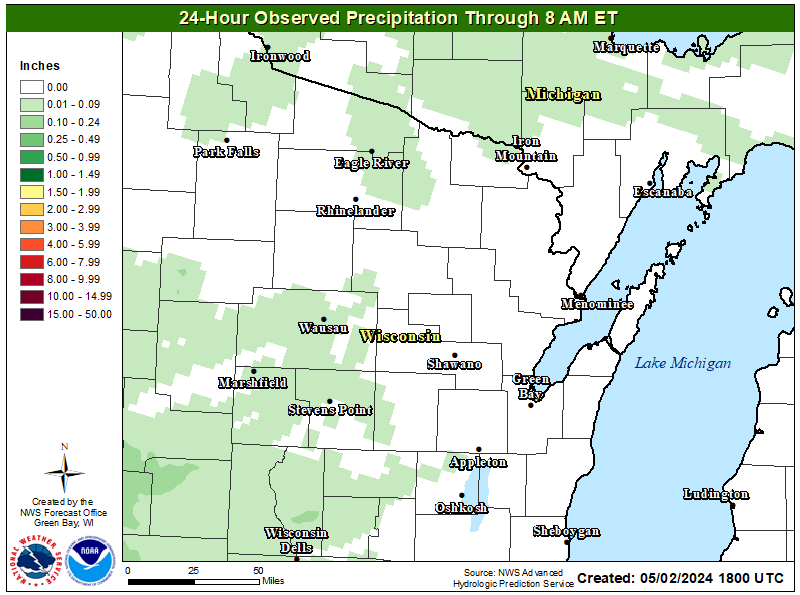 Previous 24-Hour Rainfall Totals Previous 24-Hour Rainfall Totals |
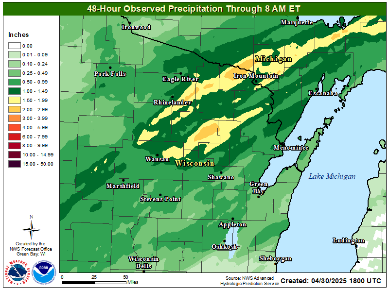 Previous 48-Hour Rainfall Totals Previous 48-Hour Rainfall Totals |
Nowcast Tools
|
|
|
|
|
|
|
Other Forecast Tools:
|
Heat Safety Information
|
|
|
 |
|
|
For more info on heat safety, please visit: https://www.weather.gov/safety/heat |
|||
 |
Media use of NWS Web News Stories is encouraged! Please acknowledge the NWS as the source of any news information accessed from this site. |
|


 "
"
.png)