Green Bay, WI
Weather Forecast Office
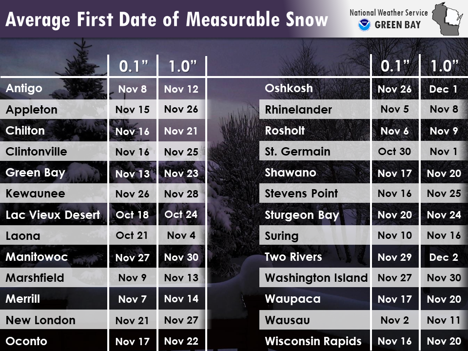
Here is a look at the average date of the first measurable (0.1") and 1" inch snowfalls of the season.
*Please note: the average first date may be affected by the amount of time that passed before the observer measured the snow. Compacting and melting of the snow is typical early in the season when the air and ground temperatures are usually above freezing.
US Dept of Commerce
National Oceanic and Atmospheric Administration
National Weather Service
Green Bay, WI
2485 South Point Road
Green Bay, WI 54313-5522
920-494-2363
Comments? Questions? Please Contact Us.

