Green Bay, WI
Weather Forecast Office
Changes are coming to NWS hydrology products. They were implemented at NWS Green Bay on Nov 15.
Why?
The NWS wants to simplify the communication of information and improve the understanding and utility of forecasts and warnings.
This is part of a larger hazard simplification project and there will be changes to other weather products over the next few years.
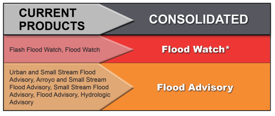
Flash Flood Watch and Flood Watch will be consolidated to Flood Watch*.
* Flash Flood Watches will still be issued due to possibility of flash flooding due to possible dam failure
Urban and Small Stream Flood Advisory, Small Stream Flood Advisory, Flood Advisory, Hydrologic Advisory will be consolidated to Flood Advisory
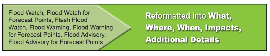
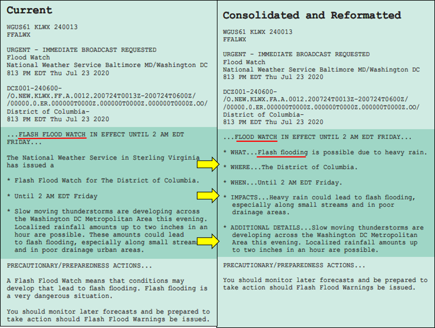
The wording within the Flood Watch/Warning, River Flood Watch/Warning, and Flood Advisory will be reformatted with What, Where, When, Impacts, Additional Details. This has already been done for Flash Flood Warnings.
US Dept of Commerce
National Oceanic and Atmospheric Administration
National Weather Service
Green Bay, WI
2485 South Point Road
Green Bay, WI 54313-5522
920-494-2363
Comments? Questions? Please Contact Us.

