Green Bay, WI
Weather Forecast Office
Wausaukee Tornado on August 19, 2011
Last updated 8/22/11
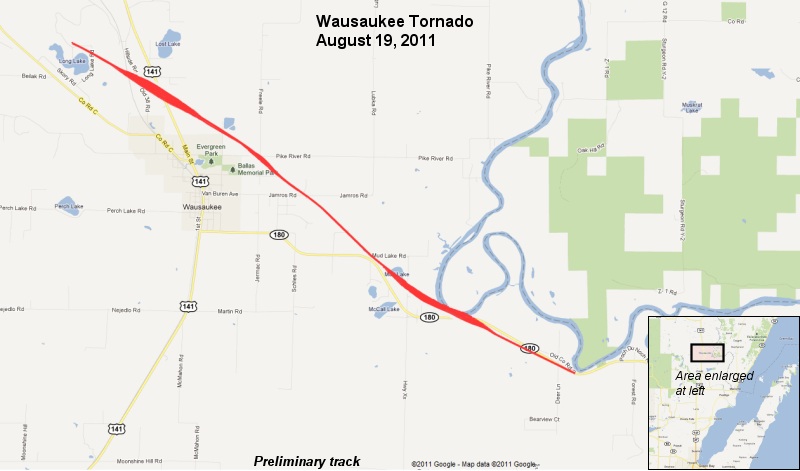
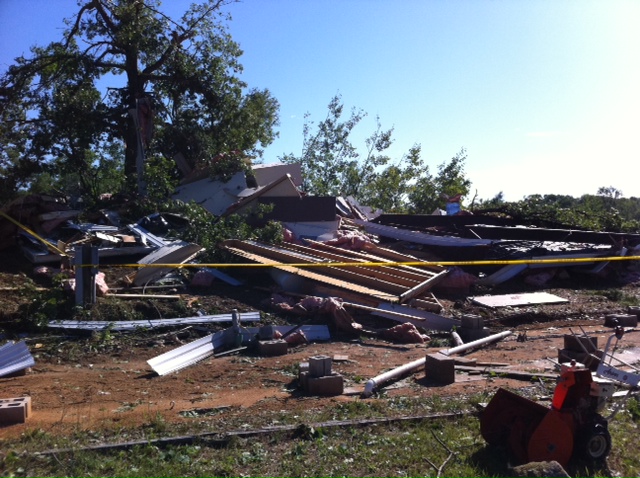
A severe thunderstorm produced a tornado over Marinette County near Wausaukee late in the afternoon on August 19, 2011. The twister flattened a mobile home, killing the occupant; another mobile home was heavily damaged. At least four other buildings sustained minor damage. Hundreds of trees were snapped or uprooted along the nearly eight mile long path of the storm. The tornado was rated EF1 on the Enhanced Fujita Scale, with maximum winds estimated at 100 to 105 mph.
Preliminary data:
| Time of tornado: | 4:45 pm - 5:00 pm |
| Strength: | EF1 |
| Path length: | 7.8 miles |
| Maximum width: | 250 yards |
| Injuries / Fatalities | 0 / 1 (male) |
Track map (Preliminary):
Visible satellite animation (Courtesy UW-CIMSS):

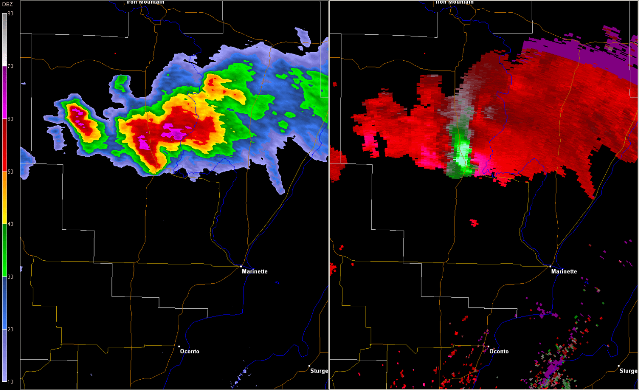
Radar 4:51 PM (Reflectivity on the left and velocity on the right):
US Dept of Commerce
National Oceanic and Atmospheric Administration
National Weather Service
Green Bay, WI
2485 South Point Road
Green Bay, WI 54313-5522
920-494-2363
Comments? Questions? Please Contact Us.

