Winter 2018-2019 Outlook
Updated October 18, 2018 - Jeff Boyne
NOAA's Climate Prediction Center (CPC) forecast for the upcoming winter months of December-February:
A weak El Niño is favored to develop during the remainder of the Northern Hemisphere autumn (70-75%) and then continue into the winter of 2018-19. Due to this, the CPC winter temperature outlooks are consistent with typical El Niño impacts.
The last El Niño winter was 2015-16, which was one of the strongest El Niños ever recorded. By comparison, this year's El Niño is starting later and thus is expected to remain on the weak side.
Besides El Niño, this winter will also be affected by:
|
National Outlook: For the upcoming 2018-2019 winter, NOAA's Climate Prediction Center (CPC) temperature forecasts for the most part reflect typical weak El Niño temperature anomalies in the United States. This includes:
Local Outlook: Locally, the odds are tilted slightly to warmer-than-normal for northeast Iowa, southeast Minnesota, and western Wisconsin.
While temperature impacts associated with El Niño are favored, El Niño is not the only player this winter, so the temperatures could be highly variable throughout the winter. This is often the case with weak El Niños. Since the winter of 1949-50, there have been 12 weak El Niño winters. In those winters:
|
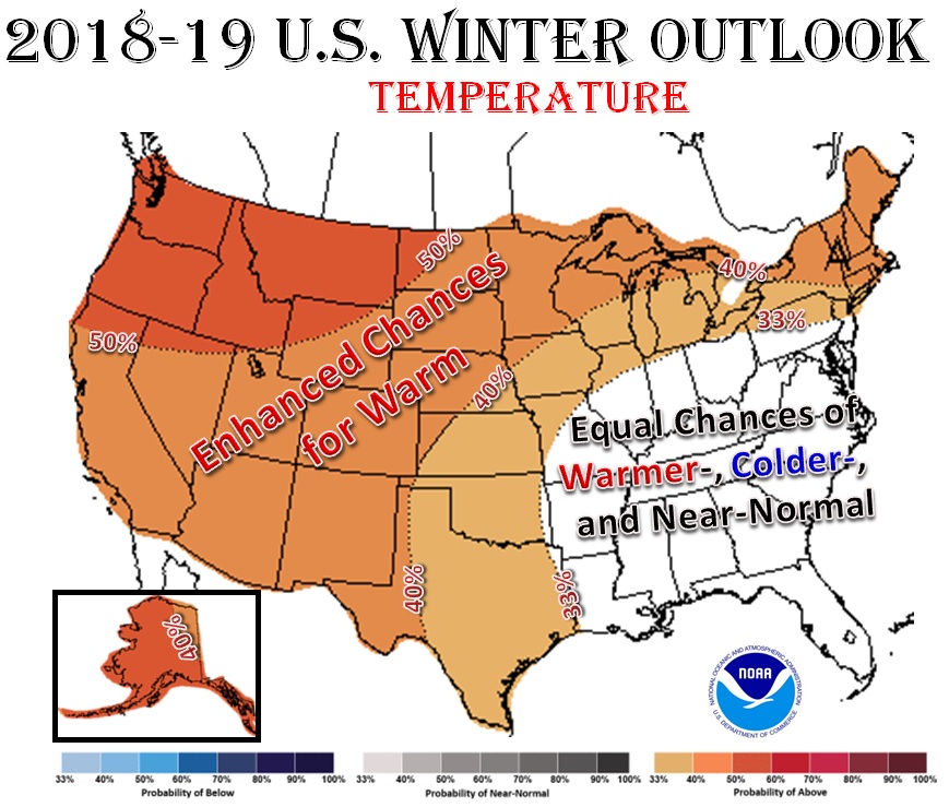 |
| CPC's Winter 2018-19 U.S. Temperature Outlook |
|
For the upcoming 2018-2019 winter, NOAA's Climate Prediction Center (CPC) precipitation forecasts for the most part reflect typical El Niño precipitation anomalies in the United States. This includes:
Local Outlook: Locally the forecast for southeast Minnesota, northeast Iowa, and western Wisconsin is for equal chances of wetter-, near, and drier-than-normal. This forecast was based upon the following:
During the 12 weak El Niño winters since 1949-50...
|
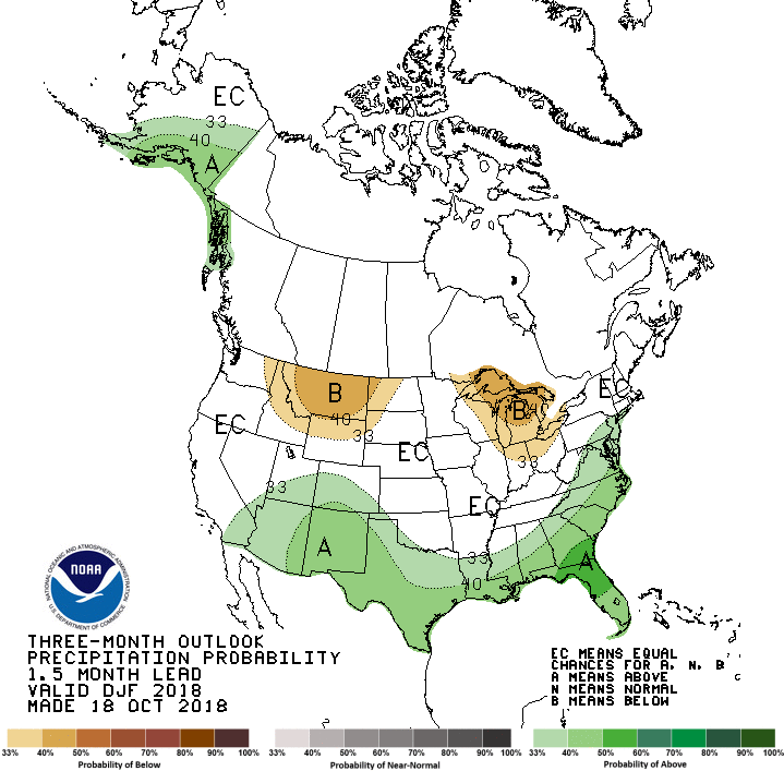 CPC's Winter 2018-19 U.S. Precipitation Outlook |
|
|
|
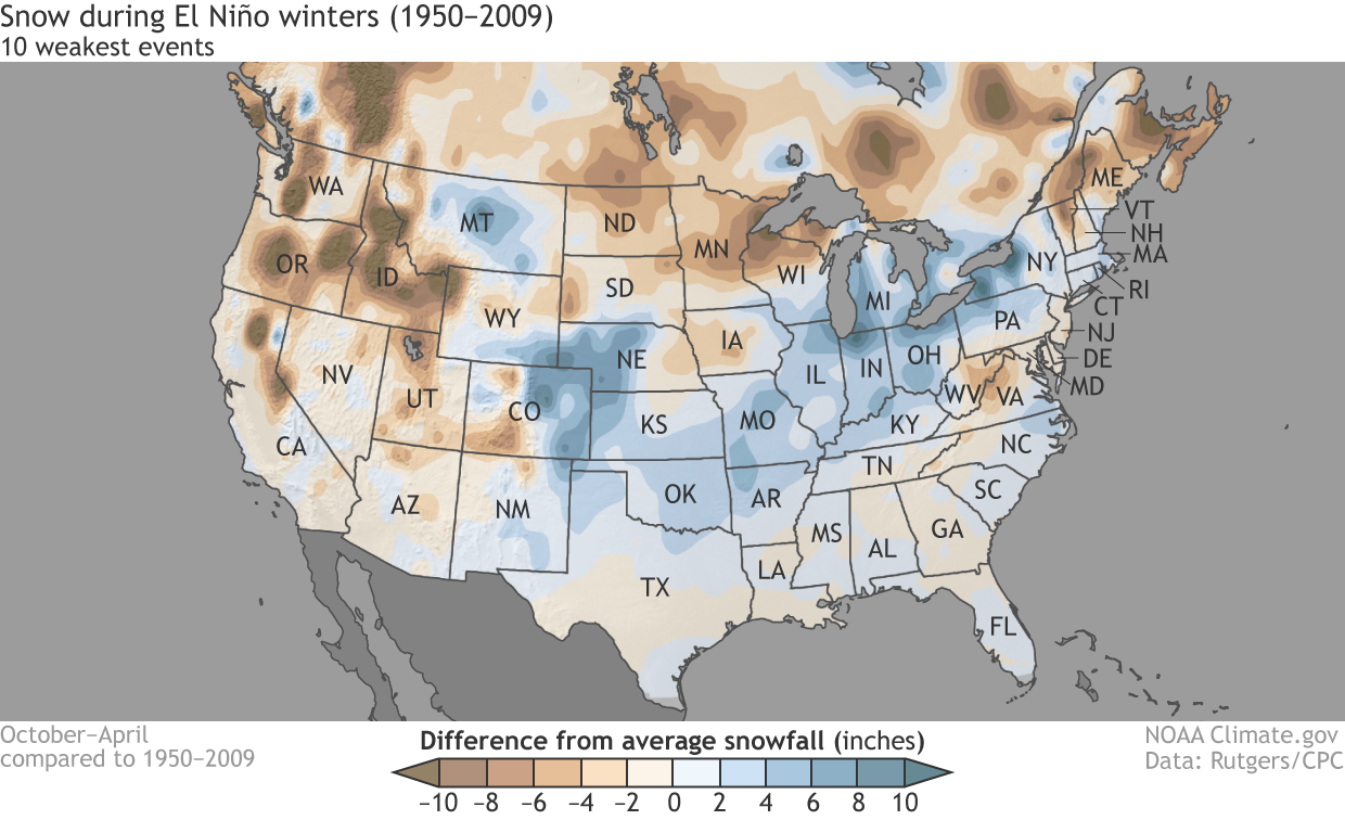
Snow storms will likely occur at times this winter. However, the frequency, number, and intensity of these events cannot be predicted on a seasonal timescale. Locally, there has been a tendency for below-normal winter (December through February) snowfall during weak El Niños. However, the seasonal snowfall totals are a totally different story. During these 12 weak El Niños, there have been 6 snow seasons with below-normal snowfall and 6 snow seasons with above-normal snowfall. During the 12 weak El Niño winters since 1949-50...
|
 |


 Weather Story
 Weather Map
 Local Radar