| Click anywhere on the map for the forecast for that location. Turn "on and off" the various weather parameters using the display options. Hover over a highlighted area to see the hazard. | Map Display Options | ||
|
|
|
| Fire Weather Planning Forecast | Discussions/Outlooks |
|
|
CURRENT CONDITIONS
 More Details |
 |
 |
 |
RADAR
| Local, Regional, & National Radar | ||||||||
La Crosse |
Regional Radar |
National Radar |
||||||
| Neighboring NWS Radars | ||||||||||
Duluth |
Twin Cities |
Des Moines |
Quad Cities |
Milwaukee |
Green Bay |
|||||
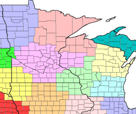
| Iowa | Minnesota | Wisconsin | ||
|
|
|
||||||||||||||||||||||||||||||
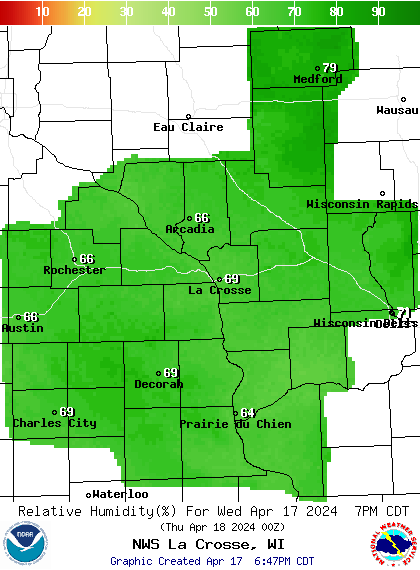
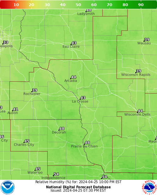
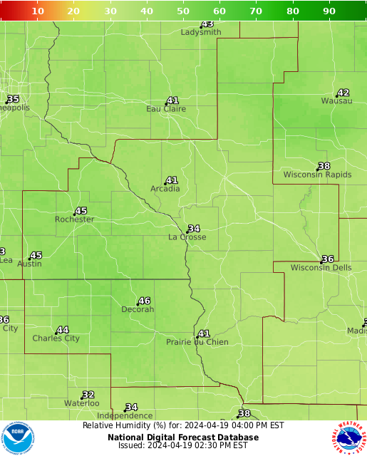
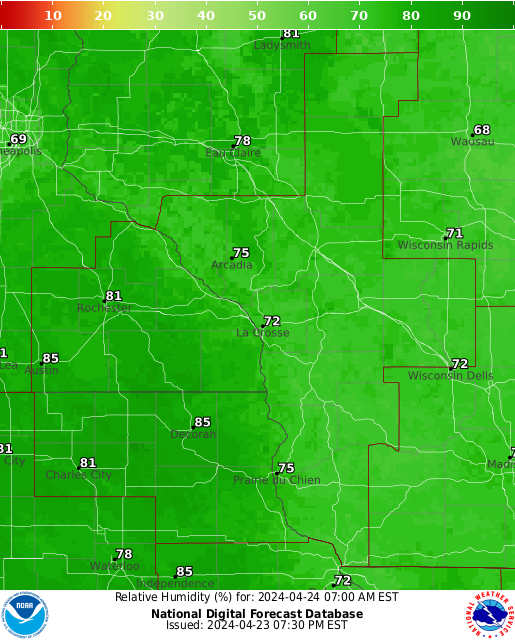
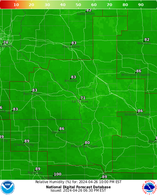
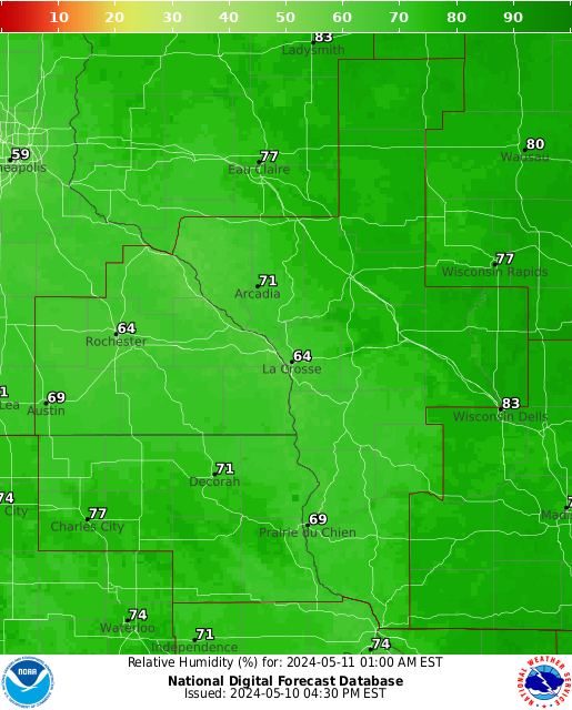
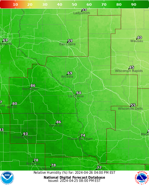
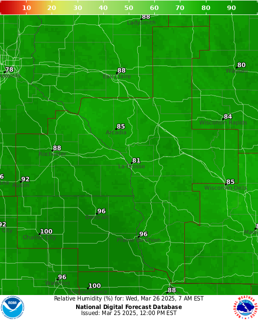
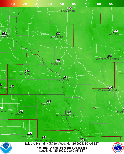
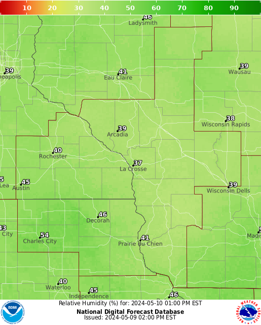
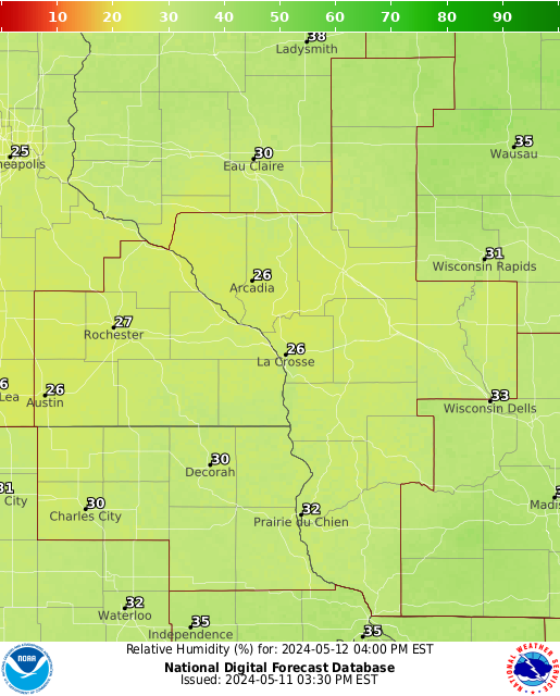
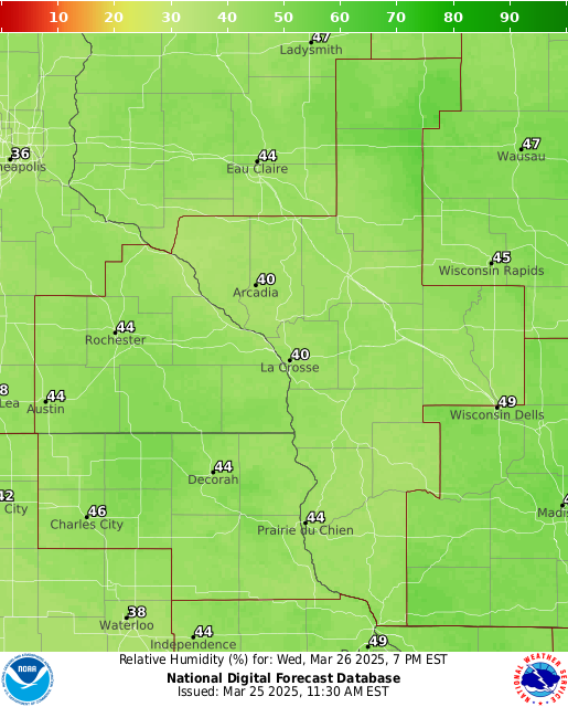
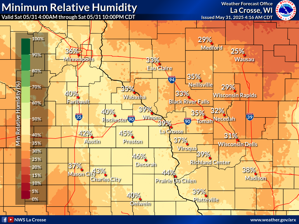
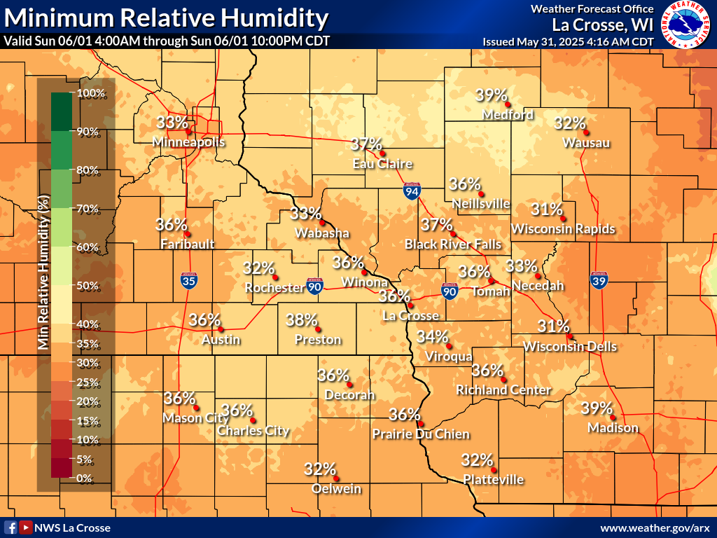
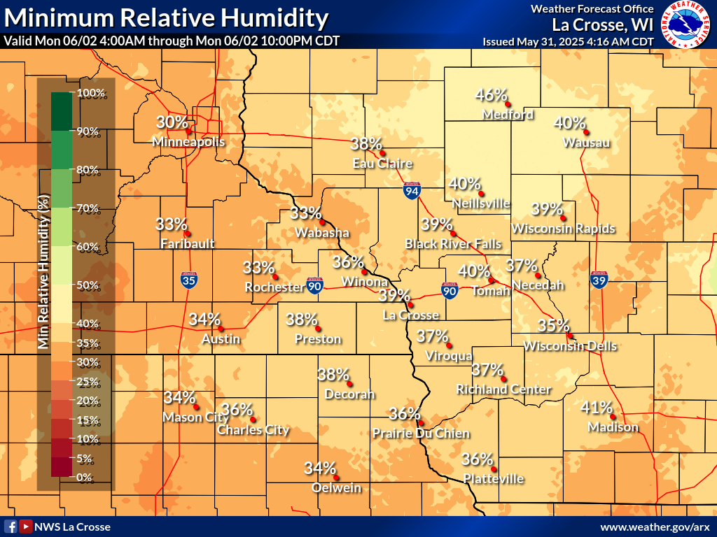
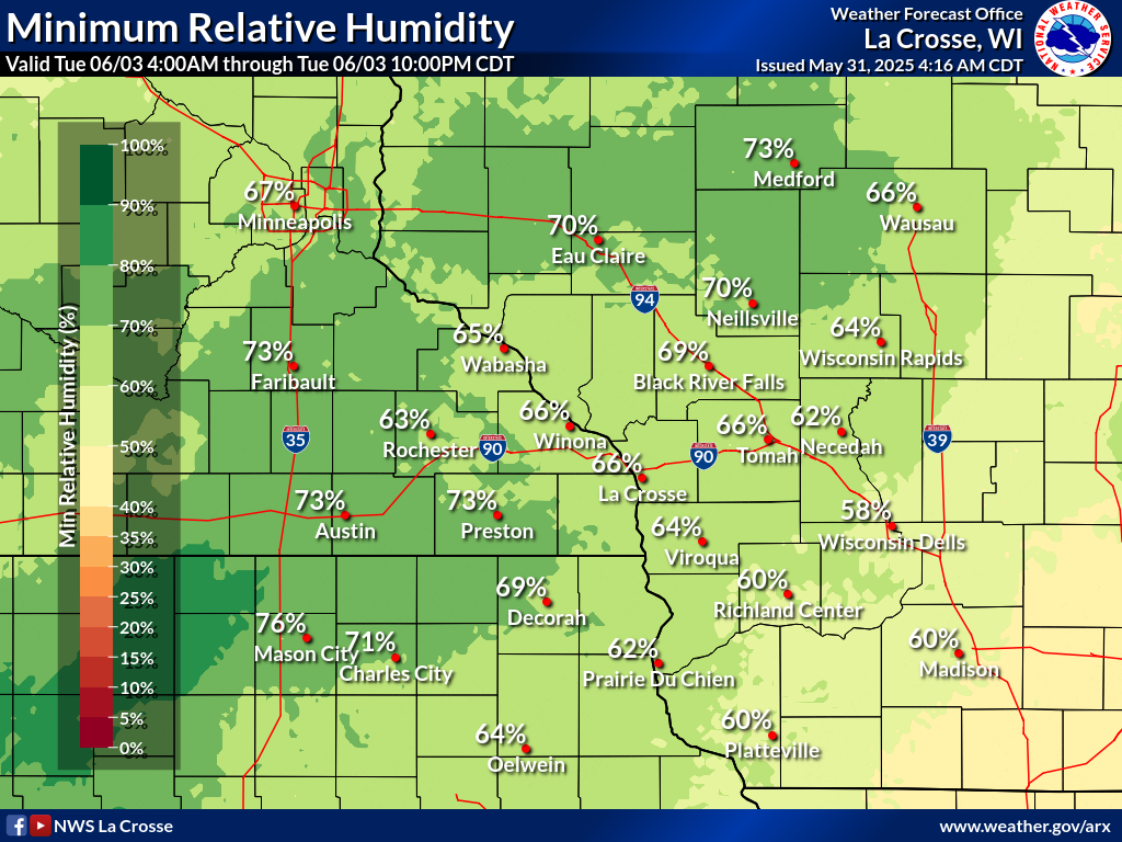
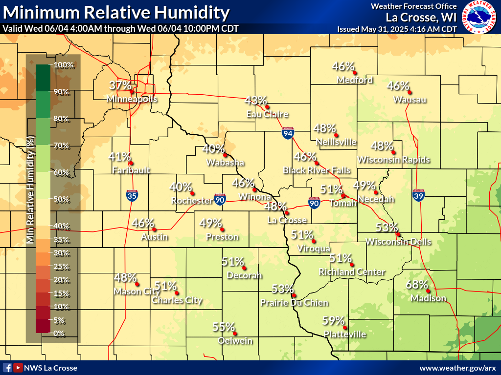
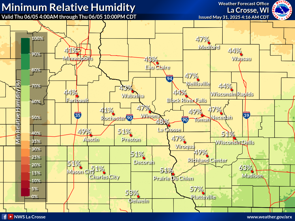
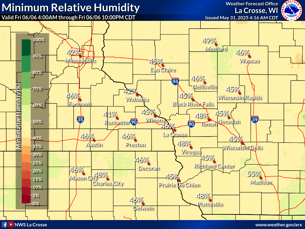
| Humidity 3 Hour Forecasts | ||||||||||||
| NOW | 6hr | 12hr | 18hr | 24hr | 30hr | 36hr | ||||||
 |
 |
 |
 |
 |
 |
 |
 |
 |
 |
 |
 |
 |
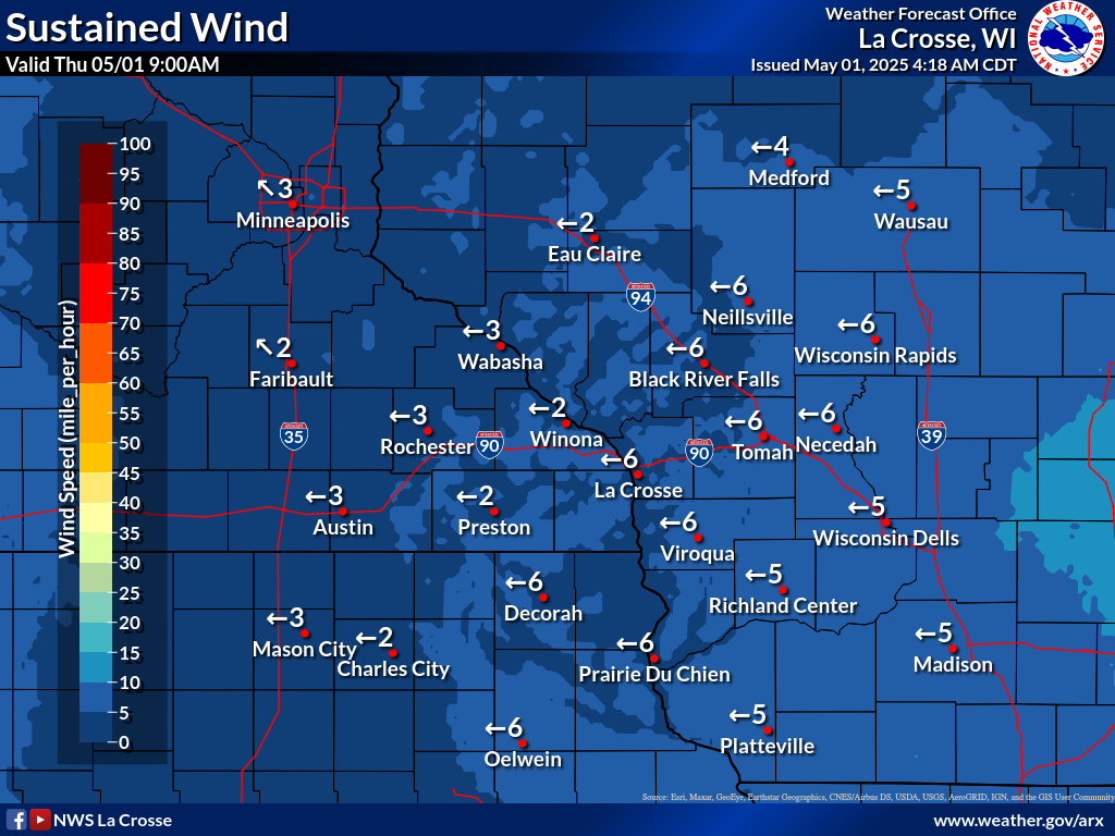
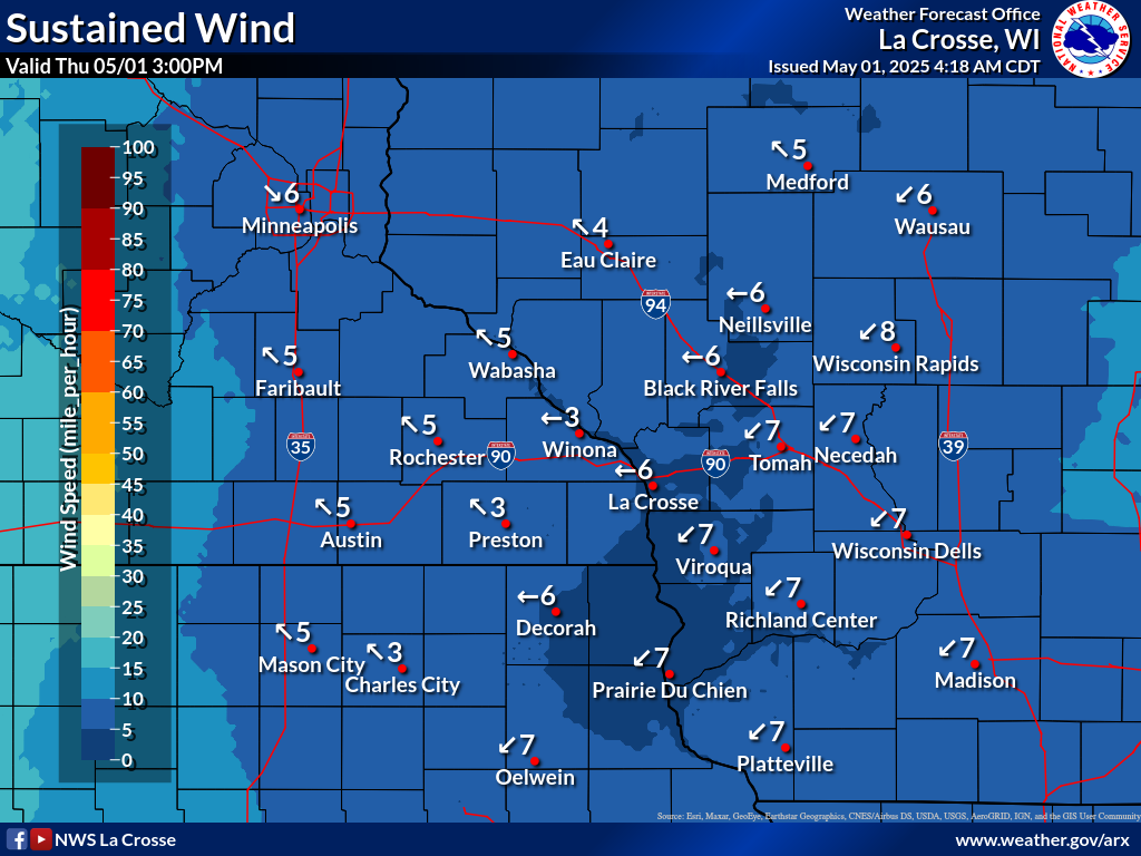
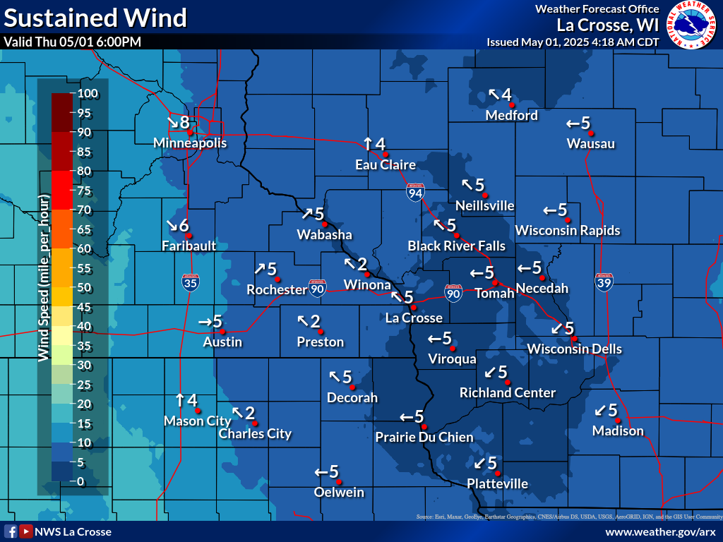
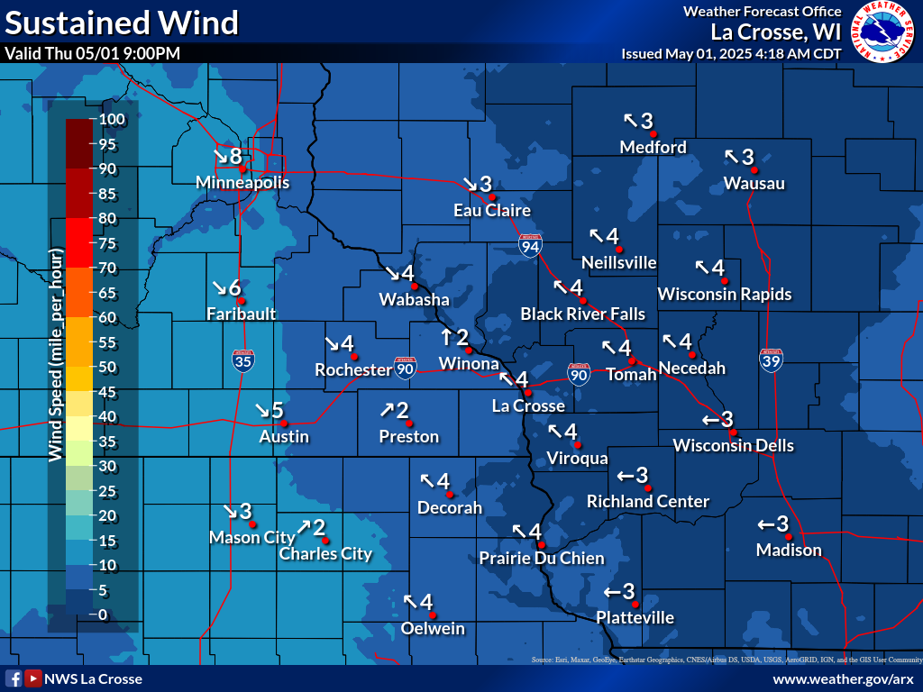
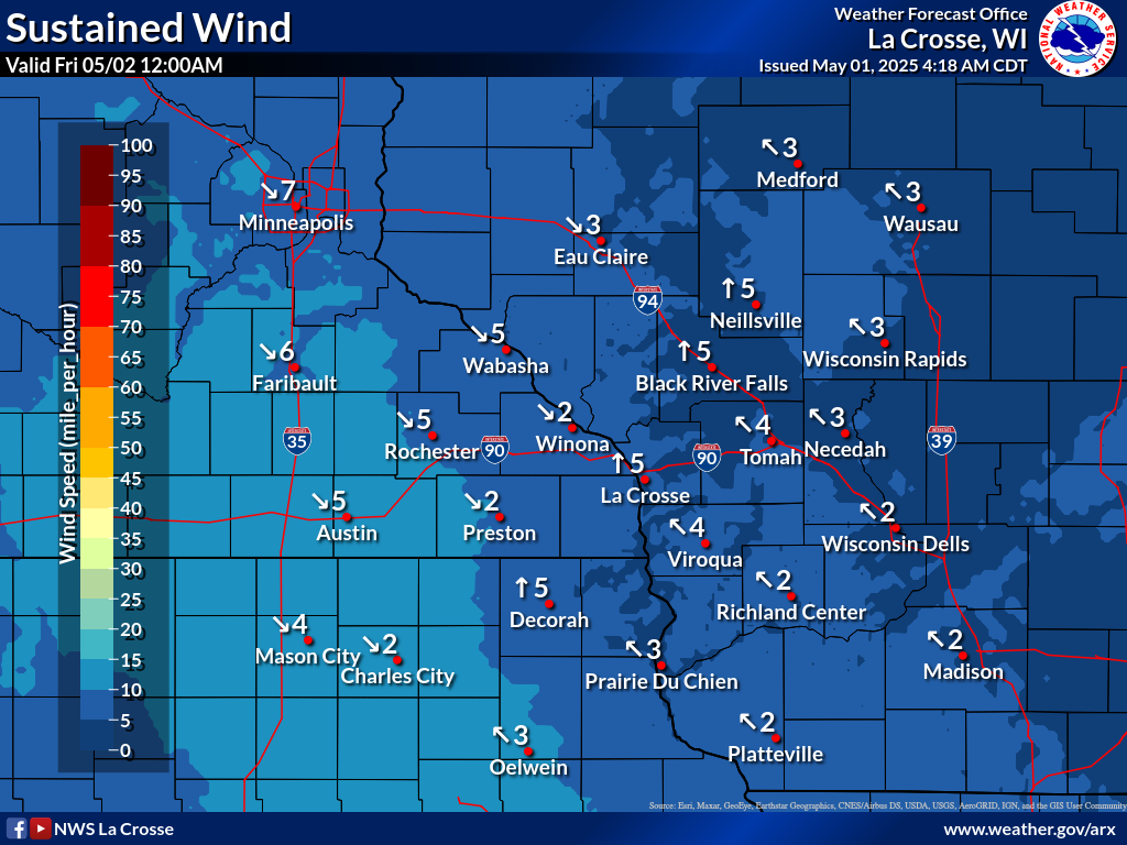
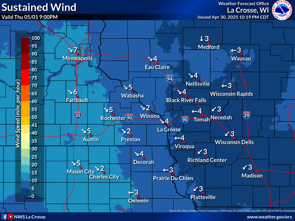
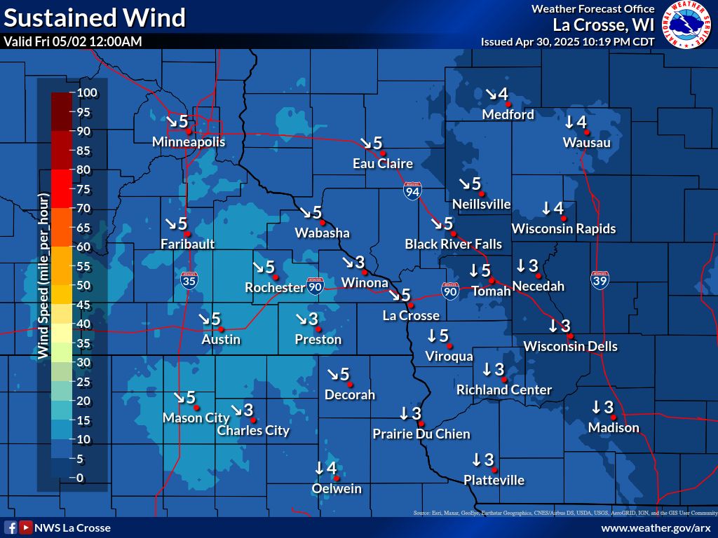
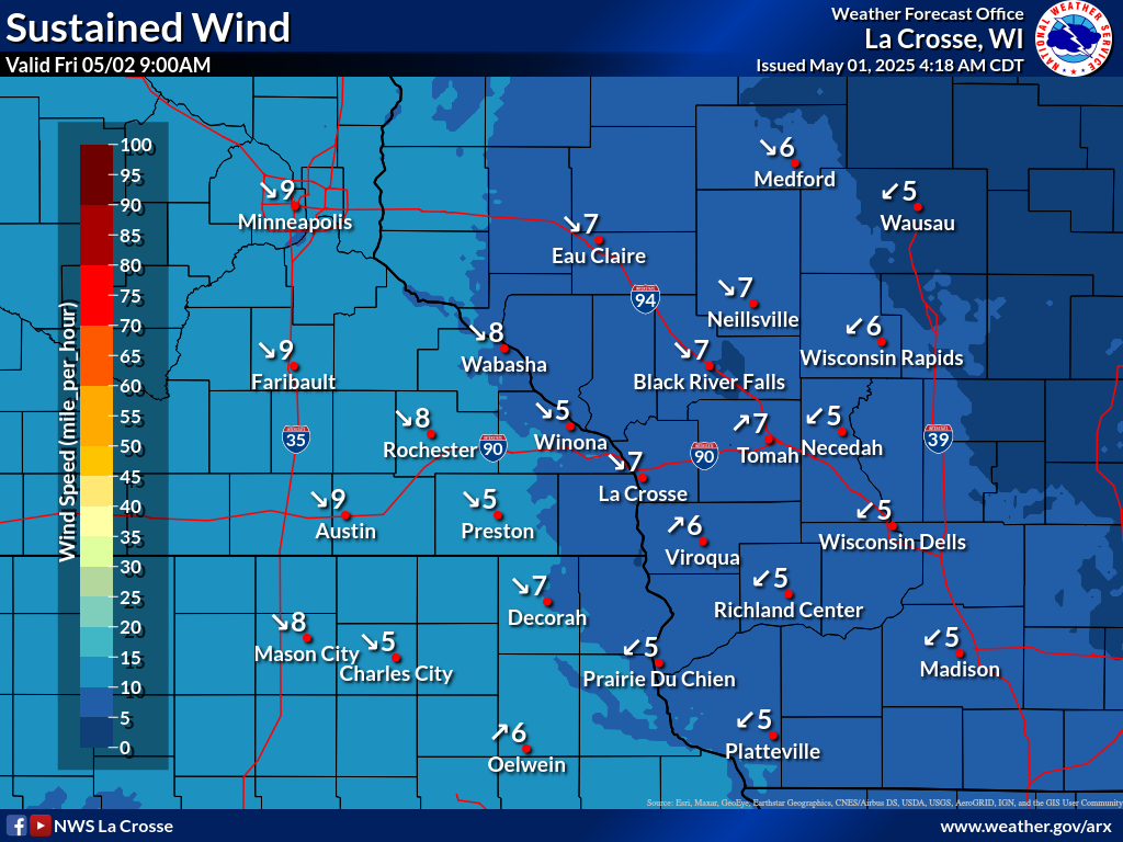
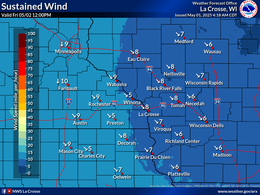
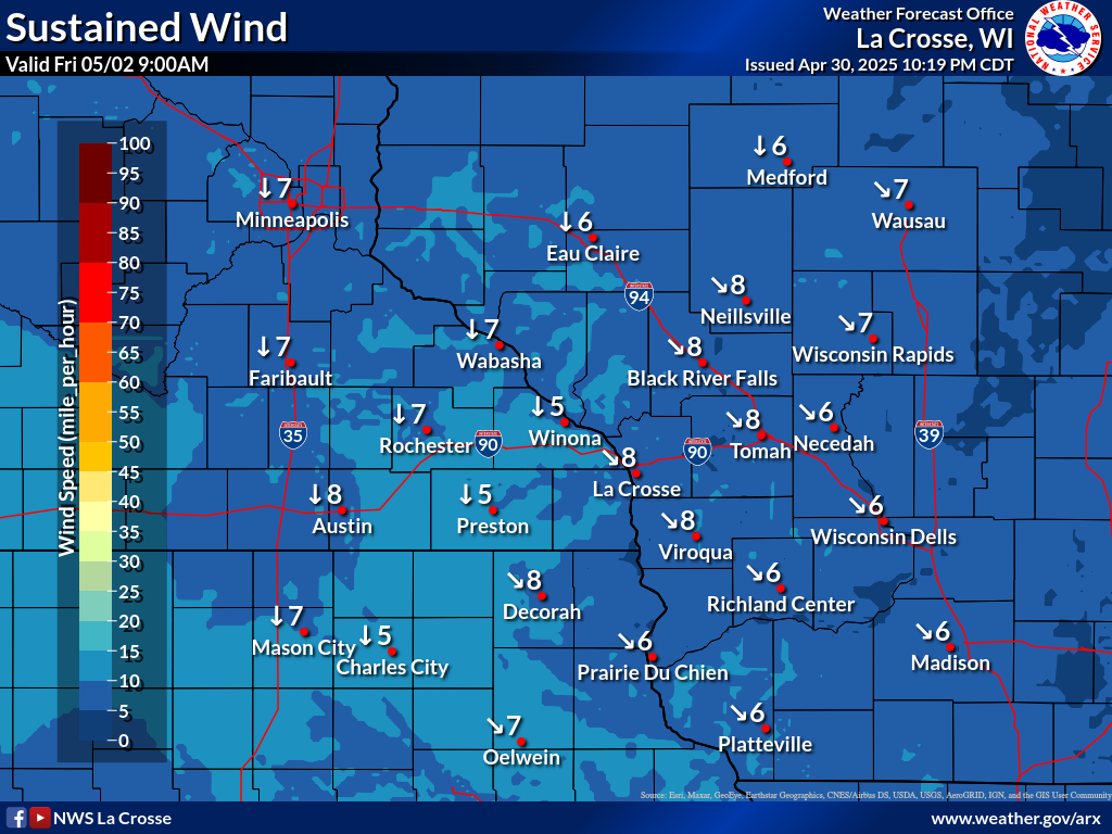
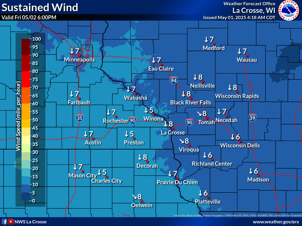
| Forecast Wind Speeds / Direction / Gusts | |||||||||||||
| NOW | 6hr | 12hr | 18hr | 24hr | 30hr | 36hr | |||||||
| WIND | 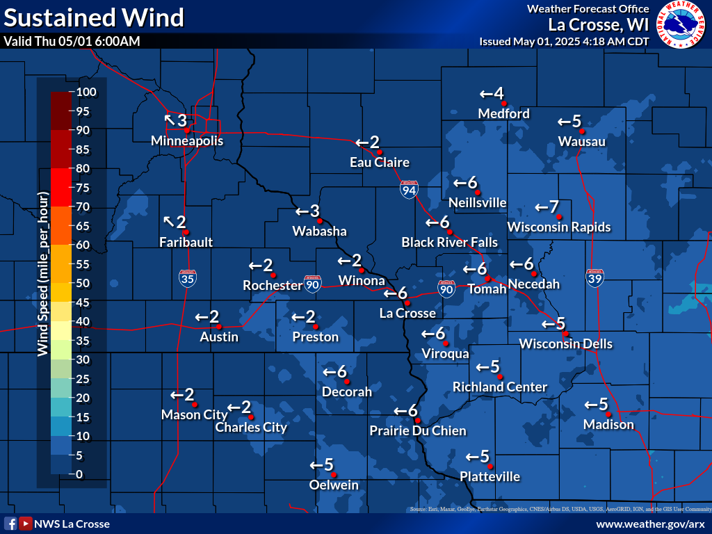 |
 |
 |
 |
 |
 |
 |
 |
 |
 |
 |
 |
 |
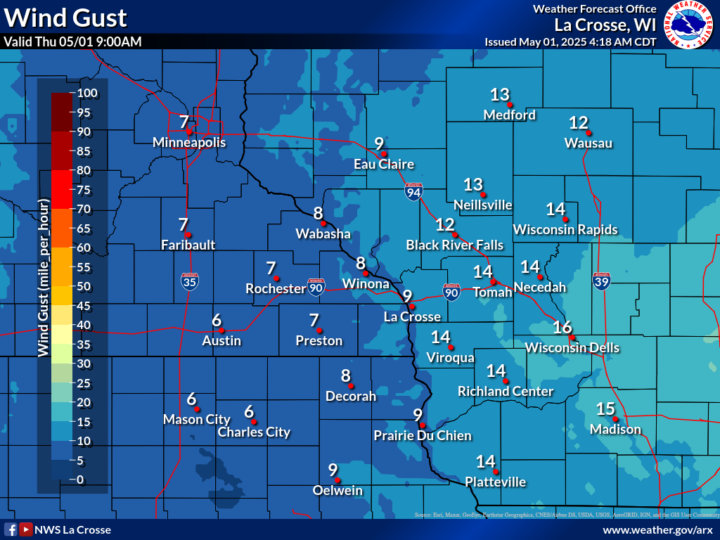
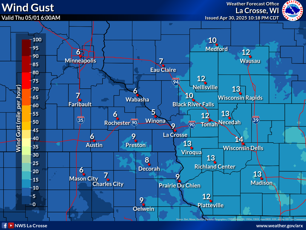
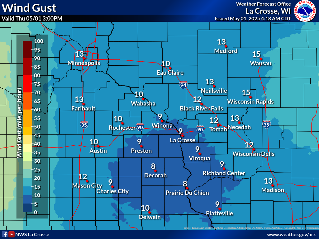
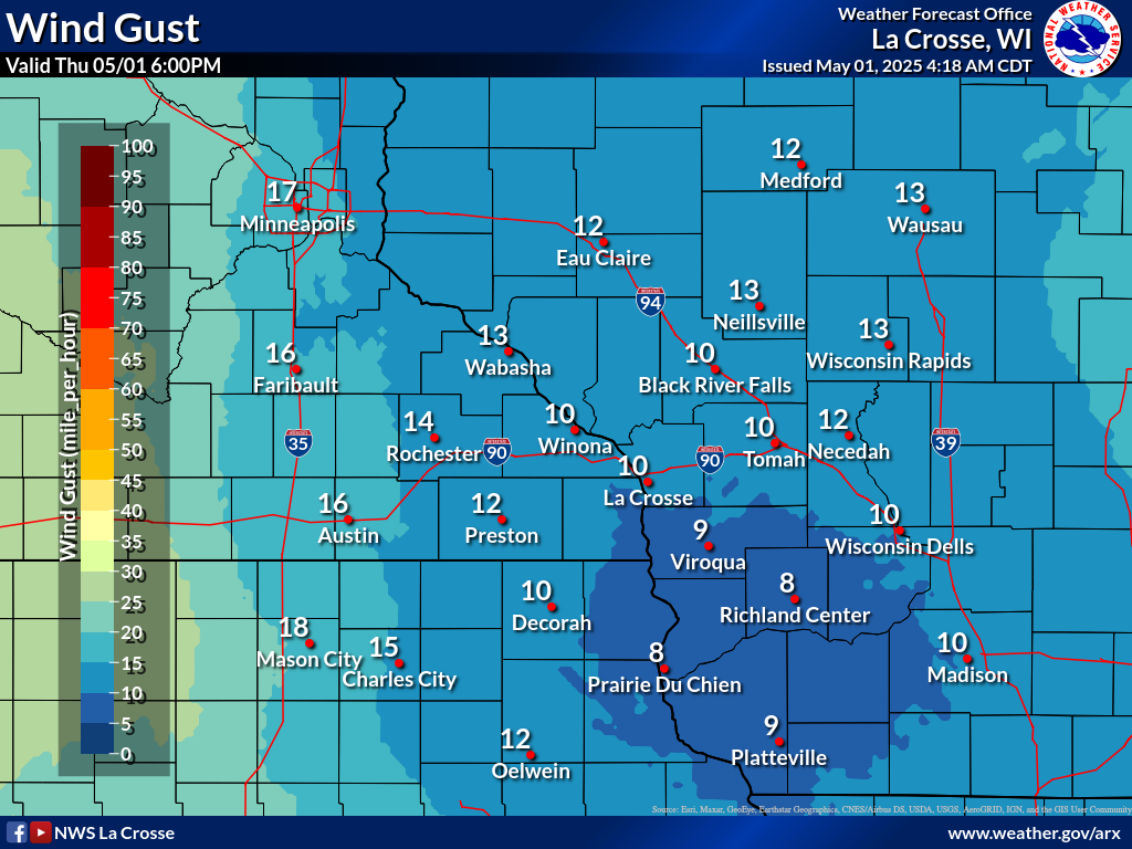
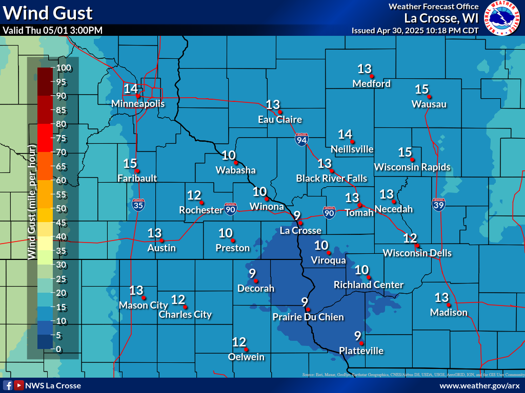
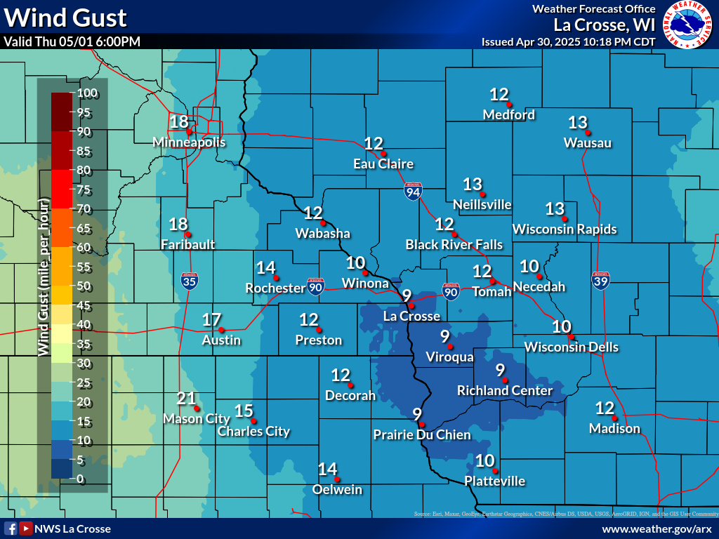
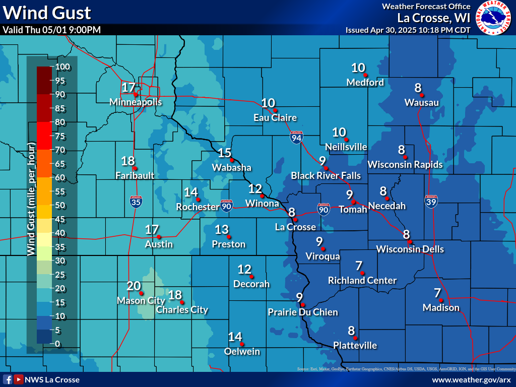
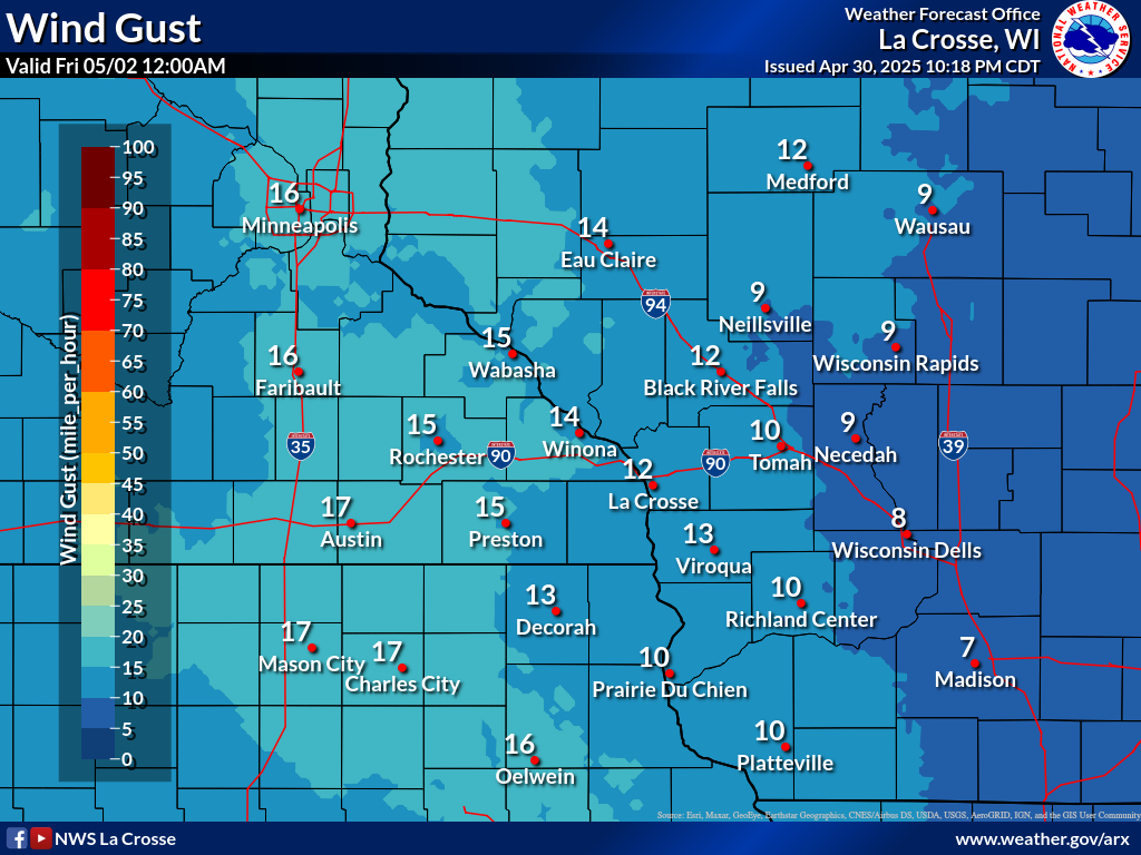
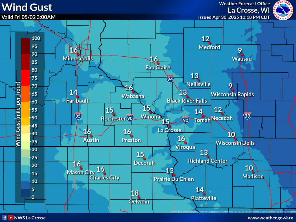
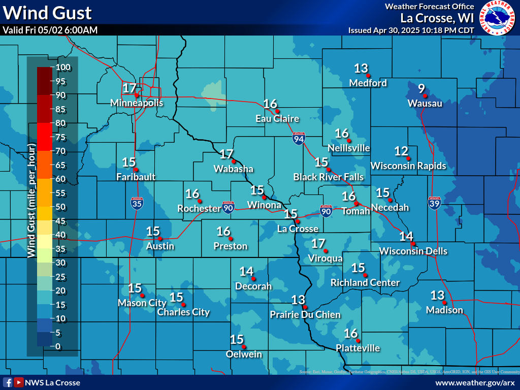
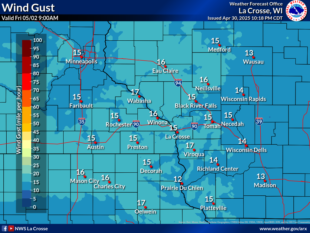
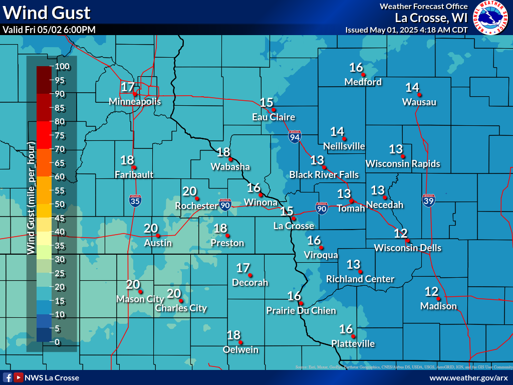
| GUSTS |  |
 |
 |
 |
 |
 |
 |
 |
 |
 |
 |
 |
 |
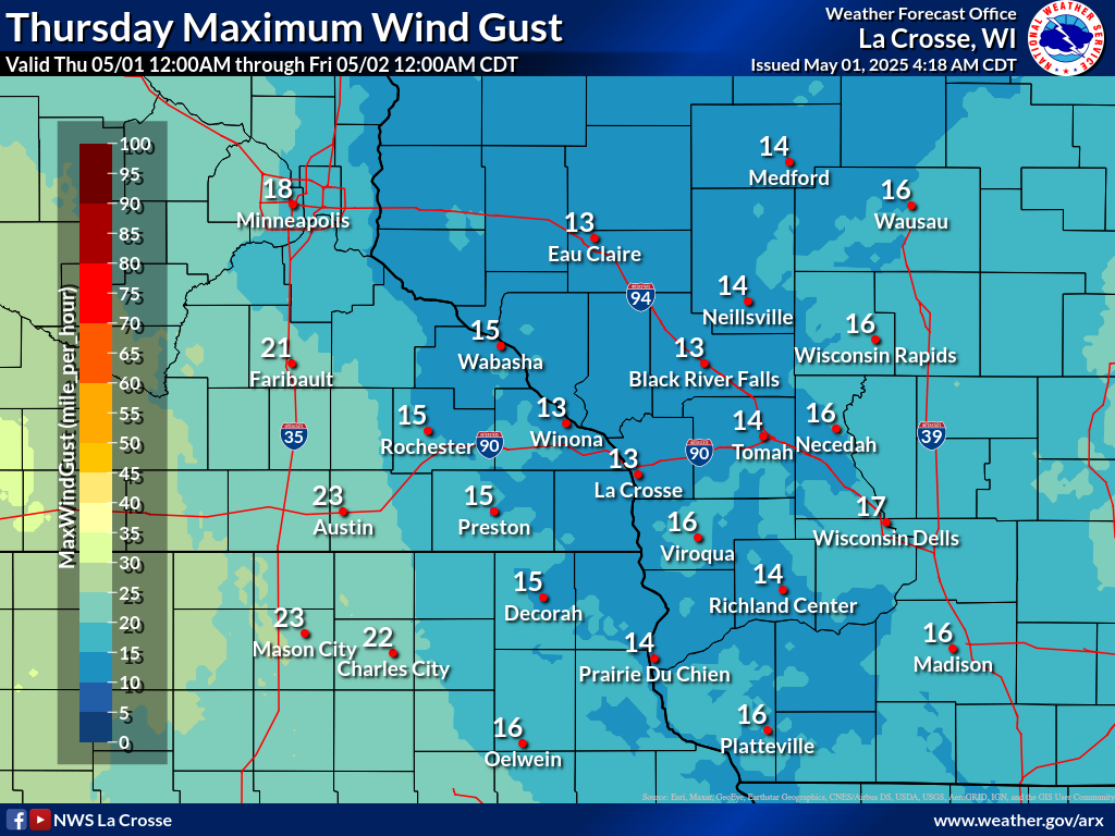
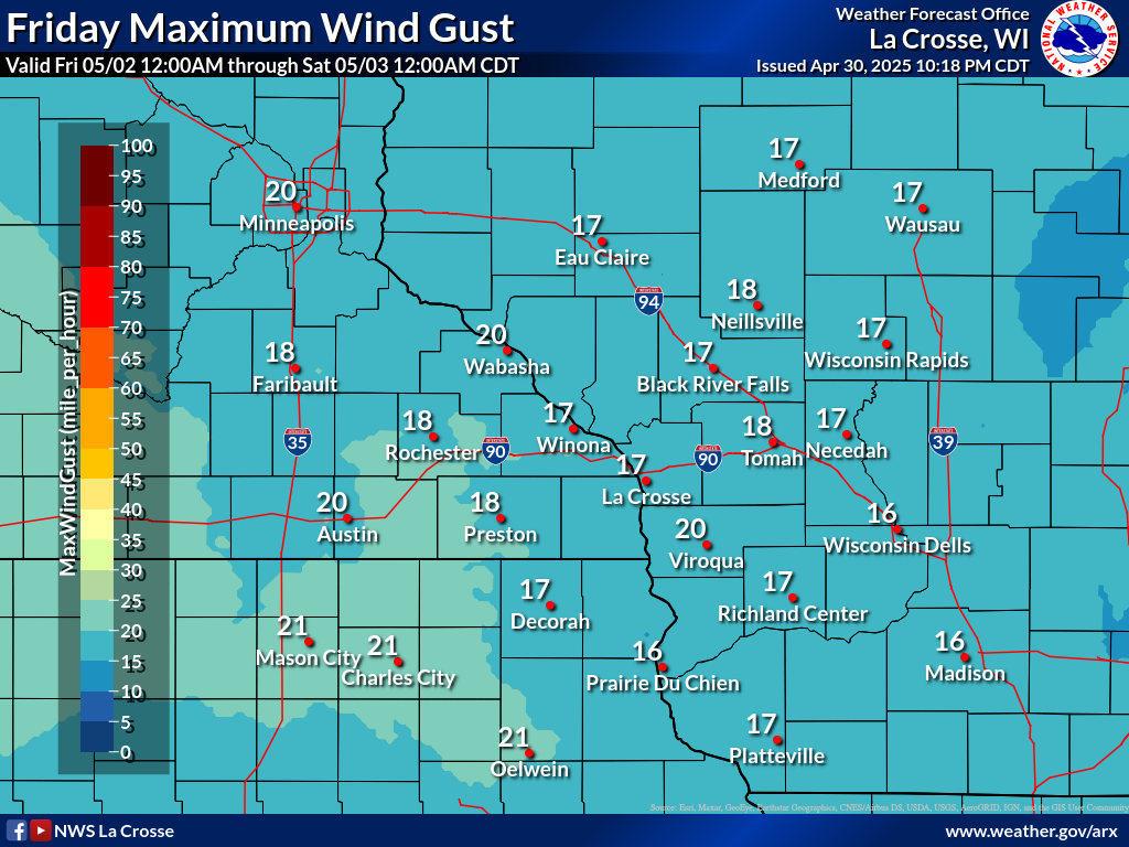
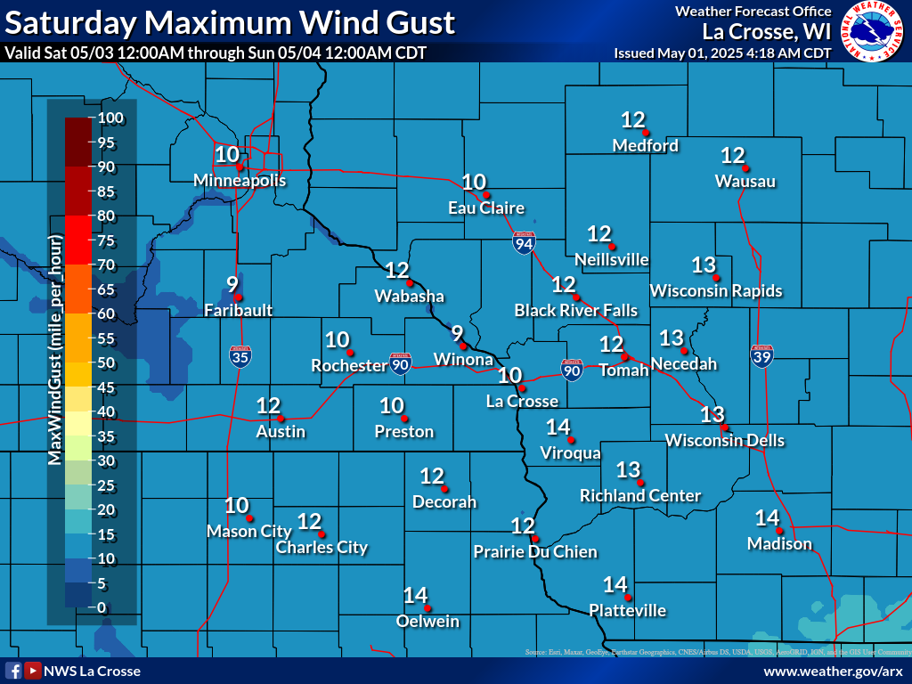
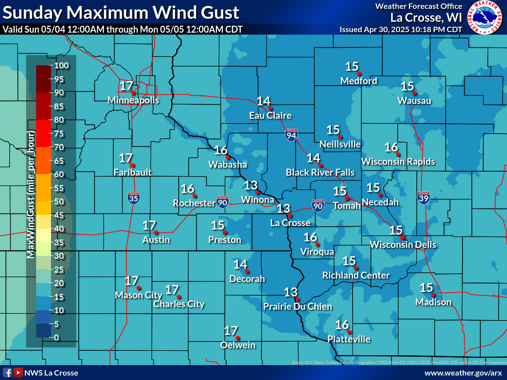
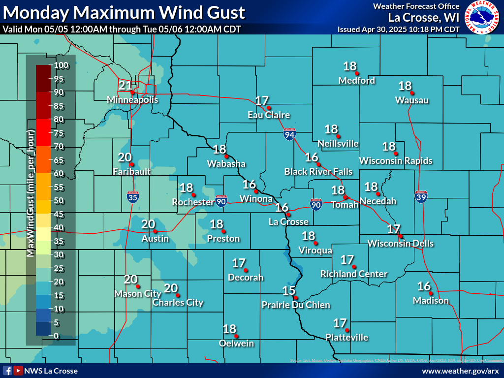
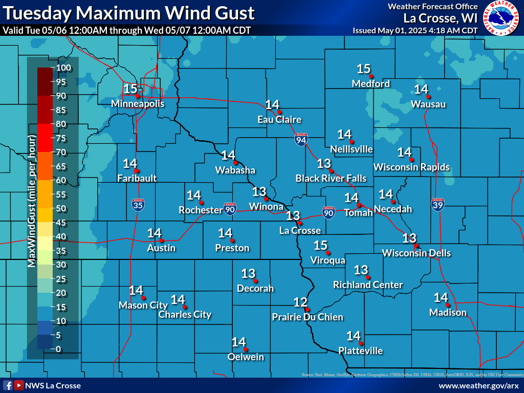
| Forecast Daily MAXIMUM Wind Gusts | ||||||
 |
 |
 |
 |
 |
 |
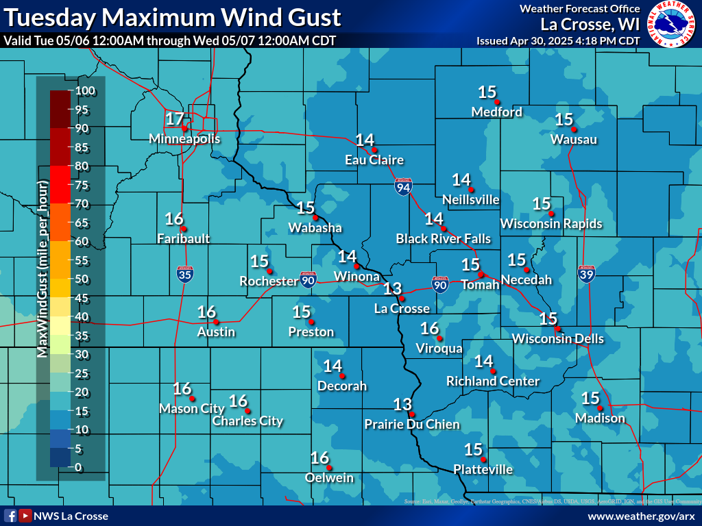 |
| Day 1 | Day 2 | Day 3 | Day 4 | Day 5 | Day 6 | Day 7 |
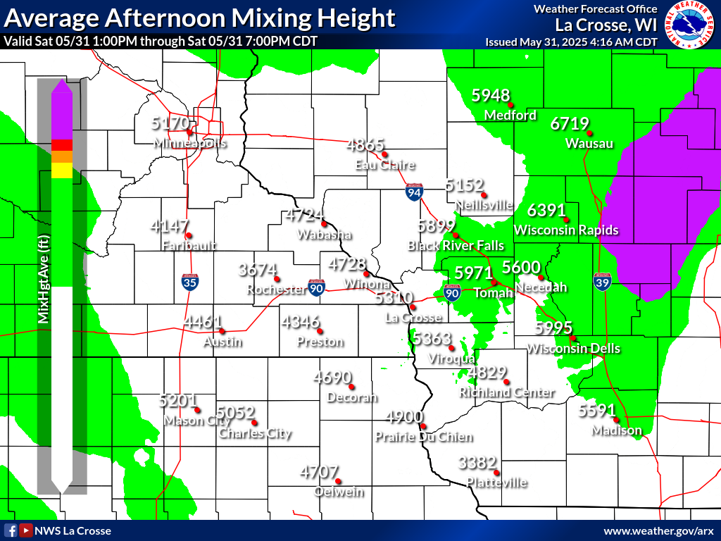
| 4 Day Average Mixing Heights | |||
 |
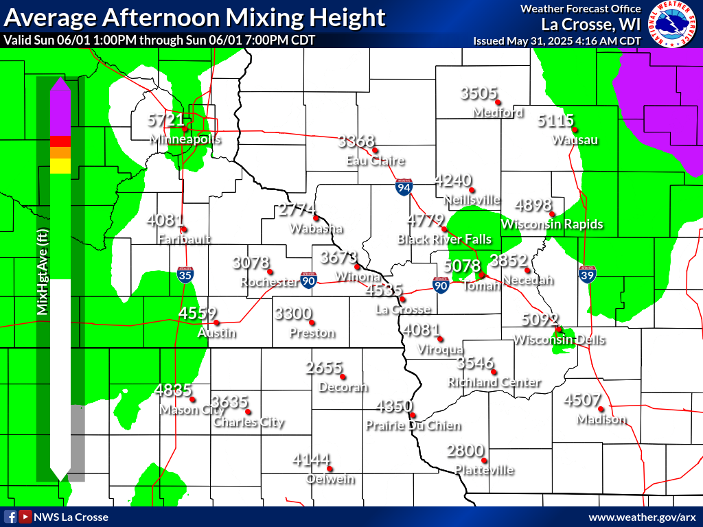 |
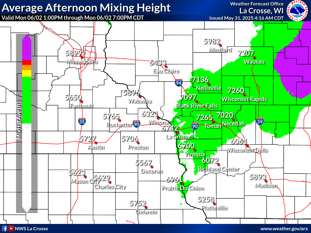 |
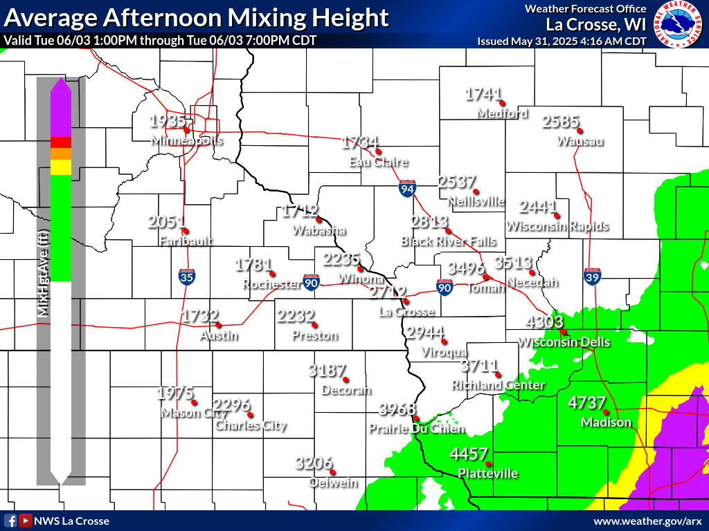 |
| Today | Day 4 | ||
| 4 Day Average Transport Winds | |||
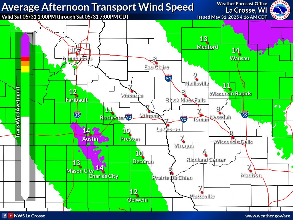 |
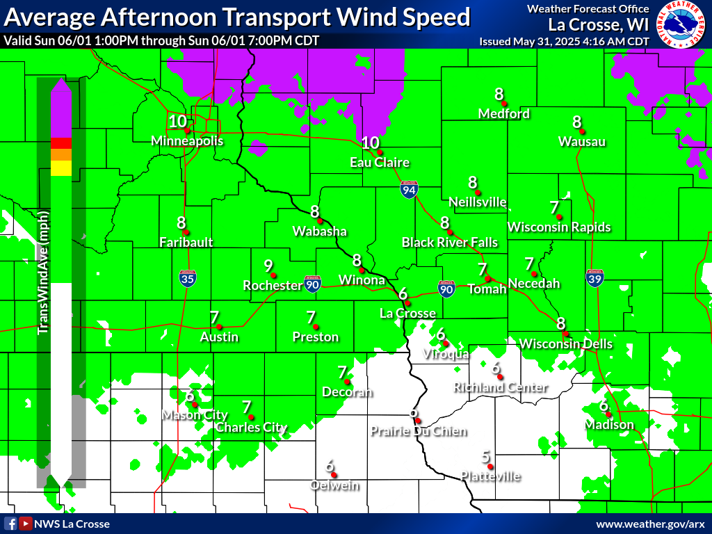 |
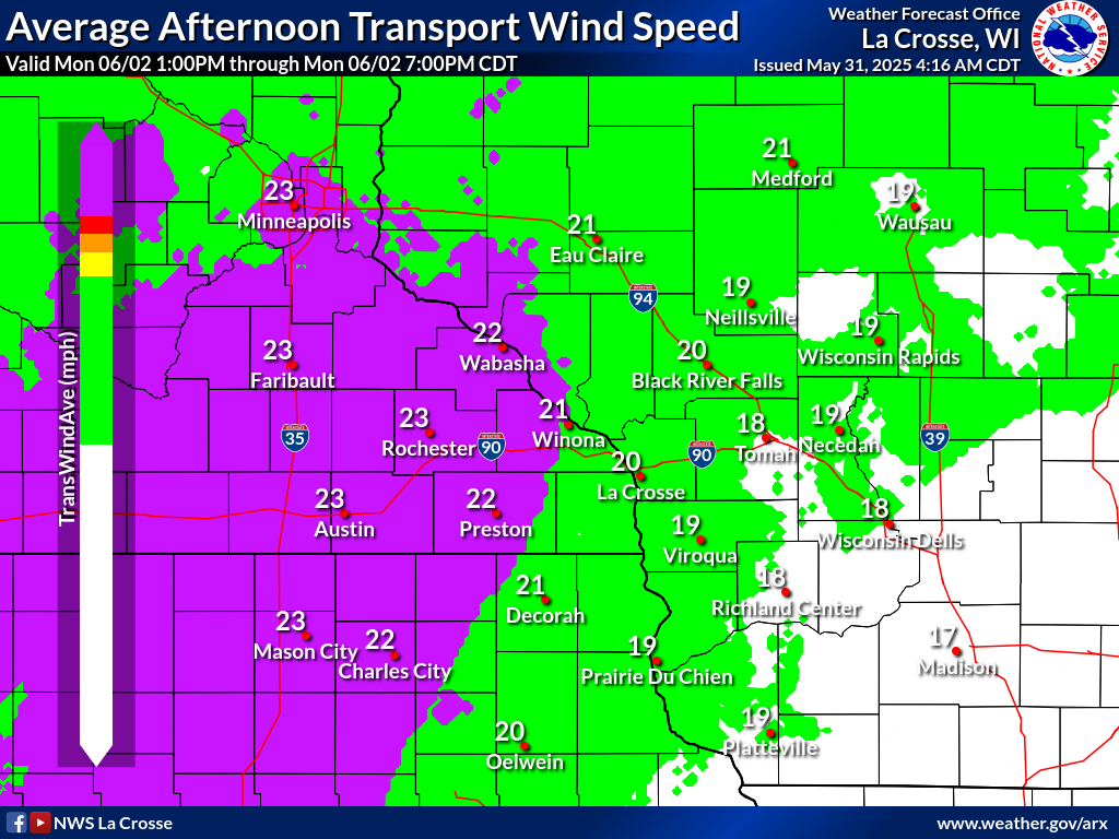 |
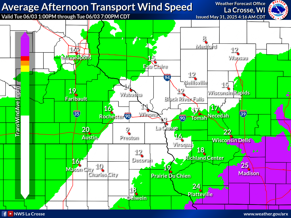 |
| Today | Day 4 | ||
| 4 Day Average Ventilation Rates | |||
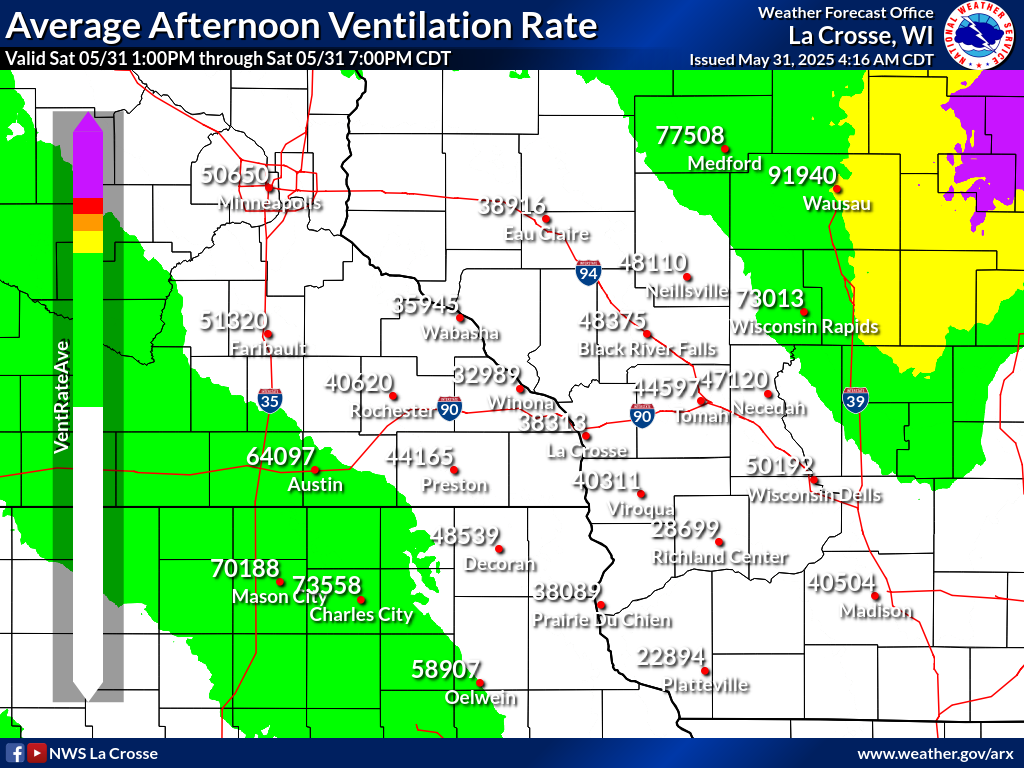 |
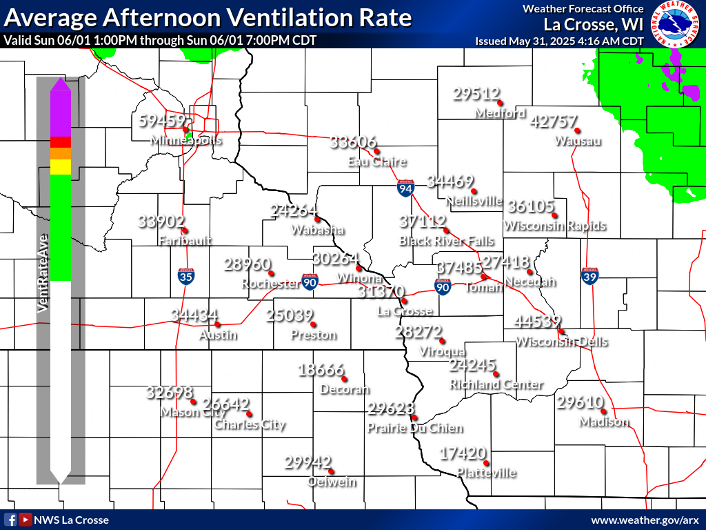 |
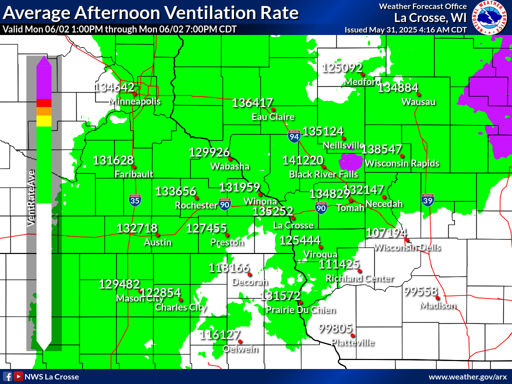 |
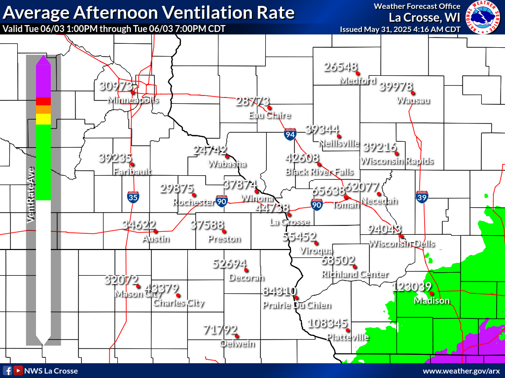 |
| Today | Day 4 | ||


 Weather Story
 Weather Map