| Click anywhere on the map for the forecast for that location. Turn "on and off" the various weather parameters using the display options. Hover over a highlighted area to see the hazard. | Map Display Options | ||
|
National Water Prediction Service Hazardous Weather Outlook Forecast Discussion Local Hydro Outlook
|
Any questions or comments regarding the information located here, or about the NWS La Crosse's hydrological service area? Please contact the NWS La Crosse Hydrology Team.
|
| La Crosse | Other Local Radars | ||||
STANDARD / ENHANCED |
Minneapolis |
Duluth |
Green Bay |
||
Des Moines |
Davenport |
Milwaukee |
|||
National  |
|||||
|
||||||||||||||||||||
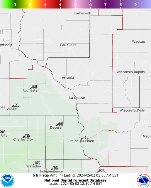
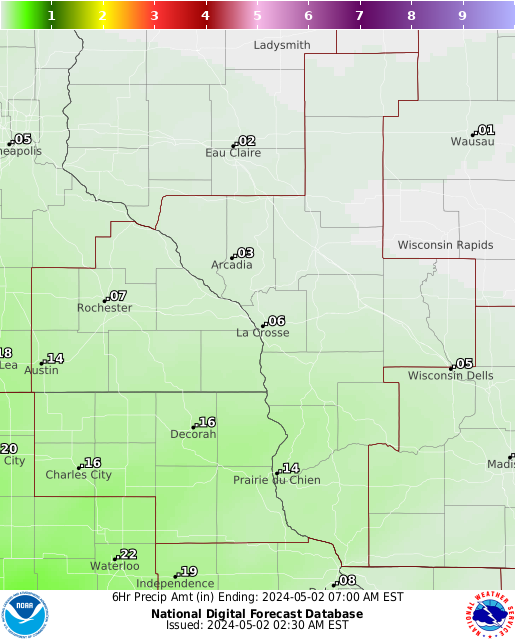
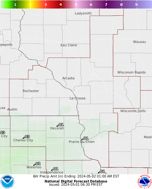
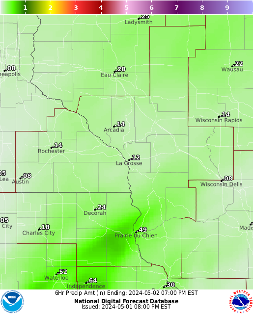
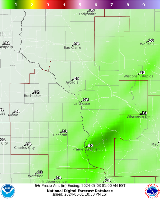
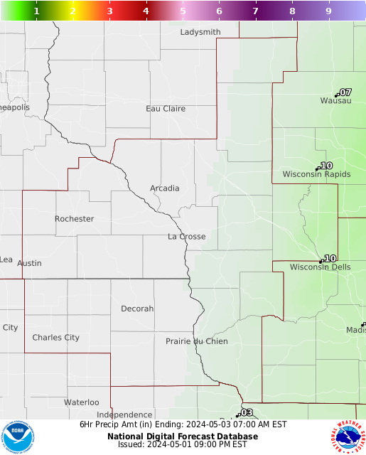
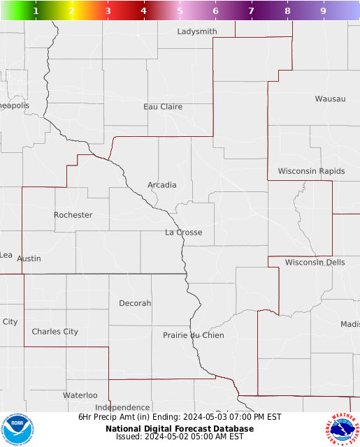
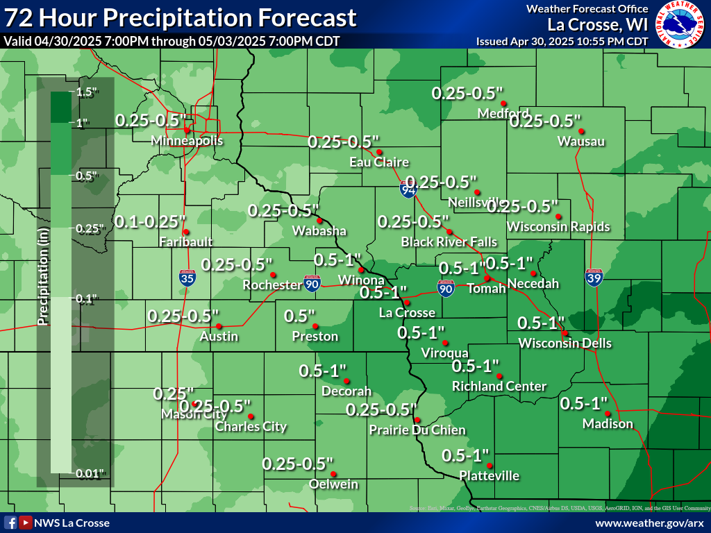
| Forecast Rainfall Amounts | |||||||
| The graphics below are for 6 hour rainfall amounts, from the most current time to 48 hours. | |||||||
 |
 |
 |
 |
 |
 |
 |
 |
| Most Current | 48 hours | ||||||
CURRENT CONDITIONS
 More Details |
 |
 |
 |


 Weather Story
 Weather Map