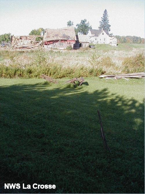
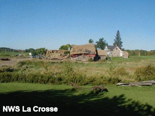
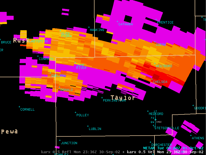
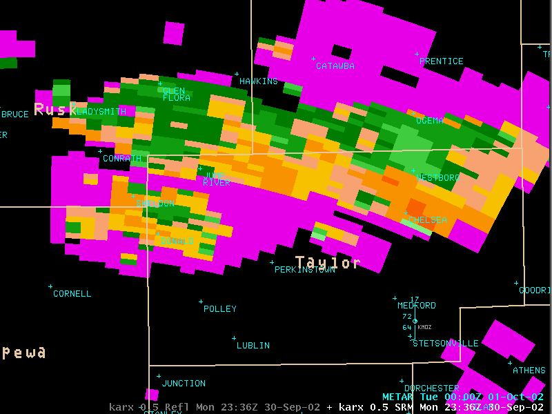
SEVERE THUNDERSTORMS MOVED THROUGH TAYLOR COUNTY IN NORTH-CENTRAL WISCONSIN MONDAY EVENING FROM 515 PM THROUGH 715 PM. AT 645 PM A TORNADO TOUCHED DOWN 2 MILES SOUTHWEST OF THE TOWN OF CHELSEA IN EASTERN TAYLOR COUNTY. THIS WAS CONFIRMED BY A NATIONAL WEATHER SERVICE LA CROSSE STORM SURVEY team early Tuesday morning. The tornado caused damage to a residence near the intersection of Fox Ave and Settlement Road. A barn and numerous trees were also downed. There were no injuries or deaths from this tornado.
THE TORNADO WAS RATED AN F0 ON THE FUJITA SCALE WHICH PLACES WIND ESTIMATES IN THE 40 TO 72 MPH RANGE. THE TORNADO WAS ON THE GROUND FOR ABOUT ONE-HALF MILE AND WAS APPROXIMATELY 100 YARDS WIDE AS IT MOVED NORTHEAST. THE PARENT THUNDERSTORM CONTINUED NORTHEAST AFTER THE TORNADO LIFTED...CAUSING NUMEROUS FUNNELS AND SPORADIC TREE DAMAGE FROM ABOUT 1.5 MILES SOUTHWEST OF CHELSEA THROUGH 3 MILES EAST OF WESTBORO. THESE DOWNBURST WINDS WERE ESTIMATED AT 60 TO 70 MPH. HOWEVER...NO FURTHER TORNADOES WERE CONFIRMED ALONG THIS PATH.
THE NATIONAL WEATHER SERVICE IN LA CROSSE ISSUED A TORNADO WARNING FOR TAYLOR COUNTY AT 645 PM. A SEVERE THUNDERSTORM WARNING HAD BEEN IN EFFECT FOR TAYLOR COUNTY FROM 522 PM UNTIL THE UPGRADE TO A TORNADO WARNING. A TORNADO WATCH WAS ISSUED BY THE STORM PREDICTION CENTER AT 305 PM...EFFECTIVE THROUGH 8 PM...FOR TAYLOR COUNTY.
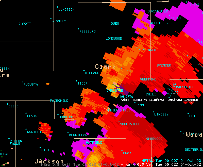
ANOTHER STORM MOVED THROUGH CLARK COUNTY AROUND 7 PM AND PRODUCED LARGE HAIL FROM CHRISTE THROUGH SPENCER IN WESTERN MARATHON COUNTY. THIS STORM WAS ROTATING STRONGLY AND PRODUCED ONLY A BRIEF F0 TORNADO IN A FIELD.
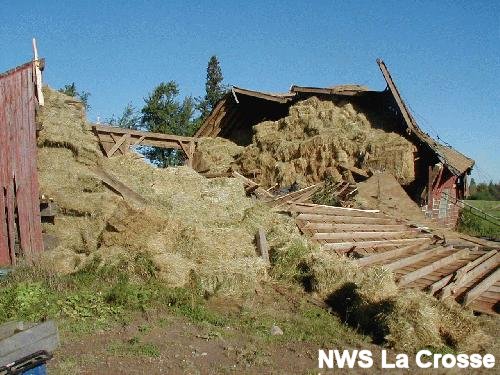 Barn damage 2 miles southwest of Chelsea. |
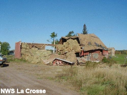 Barn damage 2 miles southwest of Chelsea. |
 Barn damage 2 miles southwest of Chelsea. |
 Barn damage 2 miles southwest of Chelsea. |
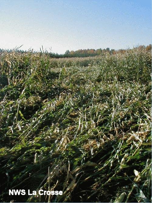 Corn damage path from F0 tornado 2 miles southwest of Chelsea. Path was 100 yards into field. |
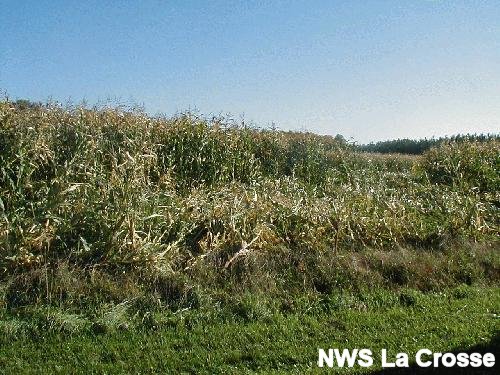 Corn damage from F0 tornado 2 miles southwest of Chelsea. Close-up. A rotation pattern was seen in the corn damage. |
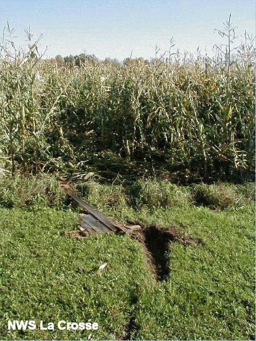 Corn and debris from tornado 2 miles southwest of Chelsea. |
||
|
|
||
Base Reflectivity |
||
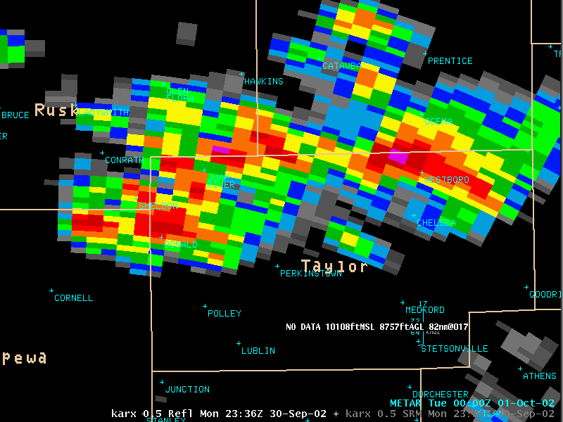 0.5 degree Base Reflectivity at 636 pm with the storm near Chelsea in Taylor county. |
||
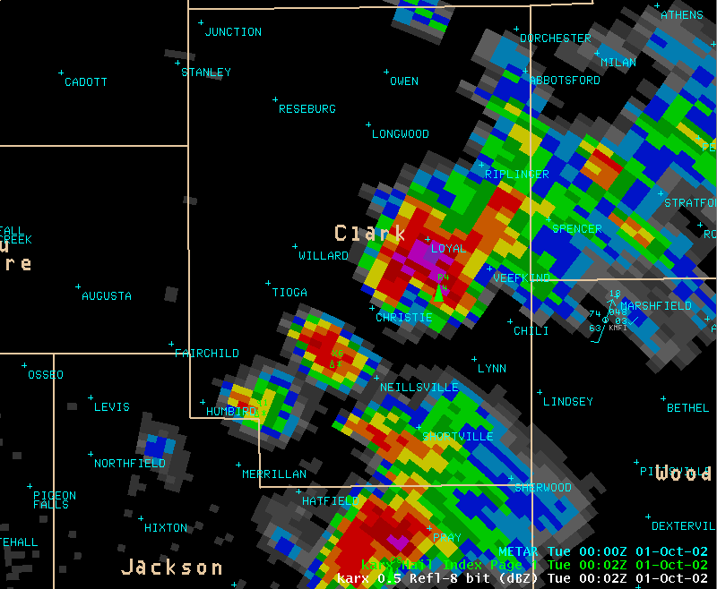 0.5 degree Base Reflectivity at 702 pm for a hail producing storm in Clark county near Loyal. |
||
|
|
||
High Resolution Base Velocity |
||
 0.5 degree high resolution Base Velocity at 636 pm with the storm near Chelsea in Taylor county. |
||
 0.5 degree high resolution Base Velocity at 702 pm for a hail producing storm in Clark county near Loyal. |
||
|
|
||
Storm Relative Motion |
||
 0.5 degree Storm Relative Velocity at 636 pm with the storm near Chelsea in Taylor county. |
||
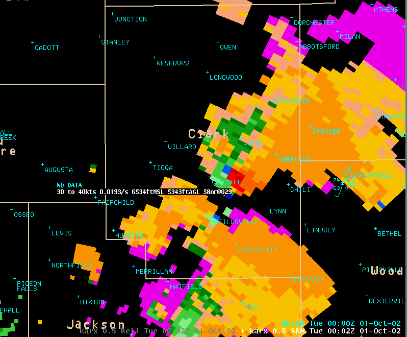 0.5 degree Base Reflectivity at 702 pm for a hail producing storm in Clark county near Loyal. |
||
|
|
||


 Weather Story
 Weather Map
 Local Radar