Overview
|
A swath of heavy snow fell near the Minnesota-Iowa state line into western Wisconsin starting during the evening of January 24th and continuing through the day on January 25th. Snowfall was generally 5 to 12 inches near the Minnesota-Iowa stateline. North of Interstate 90 snowfall totals were lower, as well as areas closer to Highway 20 in northeast Iowa and far southern Wisconsin. The main impact was snow covered roads for the morning commute on Wednesday, January 25th, but in some areas the weight of the heavy, wet snow actually broke branches off trees and caused some sporadic power outages. Many schools were closed on January 25th. |
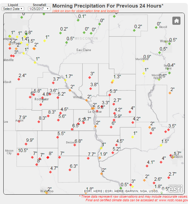
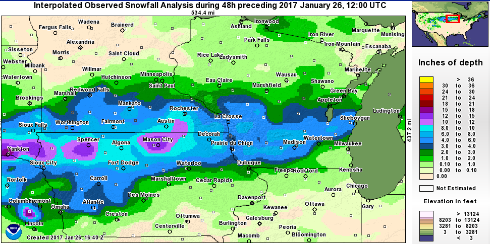 2-Day Snowfall ending 7AM January 26, 2017 |
Snowfall Totals - January 24-25
Location                     Amount

...IOWA...

...Allamakee County...
Lansing 2S                   8.9 in
Waukon                       8.8 in
Dorchester 1E                7.0 in

...Chickasaw County...
Alta Vista                   8.5 in
Nashua 2SW                   8.0 in
New Hampton                  8.0 in
Ionia 2W                     8.0 in
Lourdes 6SSE                 7.8 in

...Clayton County...
Monona                       9.8 in
Pikes Peak State Park        7.5 in
Edgewood                     4.5 in
Strawberry Point             4.0 in
Guttenberg Dam 10            3.0 in
Volga                        3.0 in
Elkader 6SSW                 2.7 in
St Olaf 1SE                  2.3 in

...Fayette County...
Fayette                      8.5 in
West Union                   8.0 in
Waucoma 1SE                  7.0 in
Fayette 2NNW                 5.8 in
Oelwein 1WNW                 3.0 in
Oelwein                      3.0 in
Oelwein 2E                   2.3 in
Wadena                       2.2 in

...Floyd County...
Charles City                14.0 in
Nora Springs 3SSE           10.5 in

...Howard County...
Elma                         8.0 in
Cresco 1NE                   7.0 in
Cresco                       6.0 in

...Mitchell County...
St Ansgar                   11.2 in
St Ansgar 8NW               11.2 in
Osage 1SE                   10.9 in
Riceville                    9.0 in

...Winneshiek County...
Calmar                       8.0 in
Decorah 7ENE                 7.5 in
Nordness 5ENE                6.8 in
Decorah                      5.0 in

...MINNESOTA...

...Dodge County...
Mantorville 2SE              8.8 in
Mantorville                  7.0 in
Dodge Center                 6.0 in

...Fillmore County...
Wykoff 3NW                   8.3 in
Spring Valley                8.0 in
Mabel                        7.5 in
Lanesboro                    7.1 in
Preston                      5.8 in
Pilot Mound 1SSE             5.5 in
Lanesboro 3S                 5.0 in
Peterson 1S                  4.9 in
Rushford                     4.0 in

...Houston County...
Caledonia                    8.8 in
Eitzen 4NW                   7.4 in
Spring Grove                 7.0 in
Hokah 4WNW                   6.0 in
Hokah 2S                     5.5 in
Spring Grove 4N              5.2 in
La Crescent                  4.3 in
Hokah                        3.5 in
La Crescent 1N               3.5 in

...Mower County...
Grand Meadow                12.0 in
Racine                      10.0 in
Lansing 2NE                  9.0 in
Lyle                         9.0 in
Austin                       9.0 in
Austin 1SW                   9.0 in
Ostrander 5WNW               8.3 in
Austin 1S                    8.1 in

...Olmsted County...
Stewartville                11.0 in
Predmore 2SSW                9.5 in
Rochester Intl Airport       9.3 in
Byron 4N                     8.8 in
Eyota 8SW                    8.8 in
Rochester 2NW                8.2 in
Rochester Downtown           8.0 in
Marion 2S                    8.0 in
Rochester Airport 5N         7.8 in
Rochester 1SW                7.3 in
Chester                      7.0 in
Rochester 2SW                6.9 in
Oronoco                      6.5 in
Elgin 2SSW                   5.6 in

...Wabasha County...
Millville                    7.0 in
Mazeppa 1N                   5.0 in
Plainview                    5.0 in
Theilman 1SSW                4.5 in
Wabasha 2NW                  4.0 in
Wabasha                      2.2 in

...Winona County...
Winona 4SW                   9.0 in
Pickwick 2NW                 6.5 in
Winona 3SSE                  6.5 in
Nodine 1WSW                  6.0 in
St Charles 3N                5.8 in
Dresbach Dam 7               4.9 in
Altura 5W                    4.5 in
Minnesota City Dam 5         3.0 in
Goodview                     2.5 in

...WISCONSIN...

...Adams County...
Friendship                   2.2 in

...Buffalo County...
Buffalo 4E                   3.0 in
Mondovi                      2.2 in
Alma Dam 4                   1.7 in

...Clark County...
Colby                        1.2 in
Neillsville                  0.8 in

...Crawford County...
Steuben 4SE                  8.2 in
Eastman                      6.3 in
Mt Zion 1NW                  4.5 in
Prairie du Chien             3.0 in
Lynxville Dam 9              2.0 in

...Grant County...
Mt Hope                    10-12 in
Lancaster 4WSW               6.1 in
Cuba City                    3.0 in
Sinsinawa                    2.8 in

...Jackson County...
Northfield 8NNE              3.0 in
Black River Falls            2.0 in
Hatfield                     2.0 in

...Juneau County...
Mauston WRJC Radio           3.9 in
Union Center                 3.0 in

...La Crosse County...
NWS La Crosse                9.6 in
St Joseph                    7.0 in
West Salem                   4.0 in
La Crosse Mun Airport        3.8 in
Holmen 2S                    3.7 in
French Island 1N             2.2 in

...Monroe County...
Four Corners                 7.6 in
Warrens 4WSW                 6.8 in
Cashton 3NNW                 6.2 in
Tomah 2S                     6.1 in
Tomah 5NNW                   5.5 in
Tomah                        4.5 in
Sparta                       3.2 in
Cataract                     3.0 in
Kendall                      2.5 in

...Richland County...
Richland Center 4N           3.0 in
Ithaca 2S                    2.8 in

...Taylor County...
Medford                      0.2 in

...Trempealeau County...
Ettrick 4WNW                 4.8 in
Elk Creek 3SSE               4.0 in
Arcadia                      3.5 in
Galesville 2N                3.0 in
Whitehall                    3.0 in
Trempealeau Dam 6            2.0 in
Osseo                        1.7 in

...Vernon County...
Westby 3ENE                  9.8 in
Coon Valley                  8.0 in
Viroqua                      8.0 in
Hillsboro 2SW                6.5 in
Genoa Dam 8                  4.0 in
La Farge                     4.0 in
Ontario                      3.6 in
Stoddard 2NE                 2.7 in

Observations are collected from a variety of sources with varying
equipment and exposures. Not all data listed are considered official.
Photos:
 |
 |
 |
 |
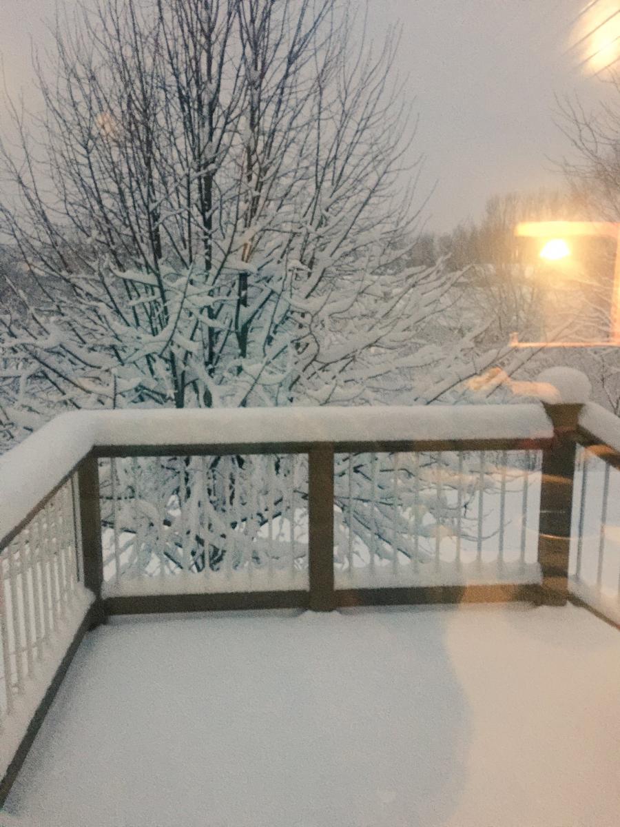
| Snow in Rochester, MN (Photo courtesy of William Mason) |
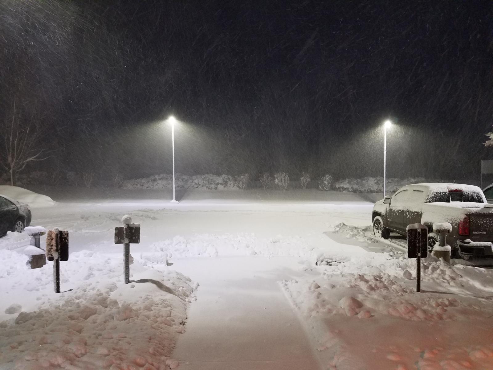
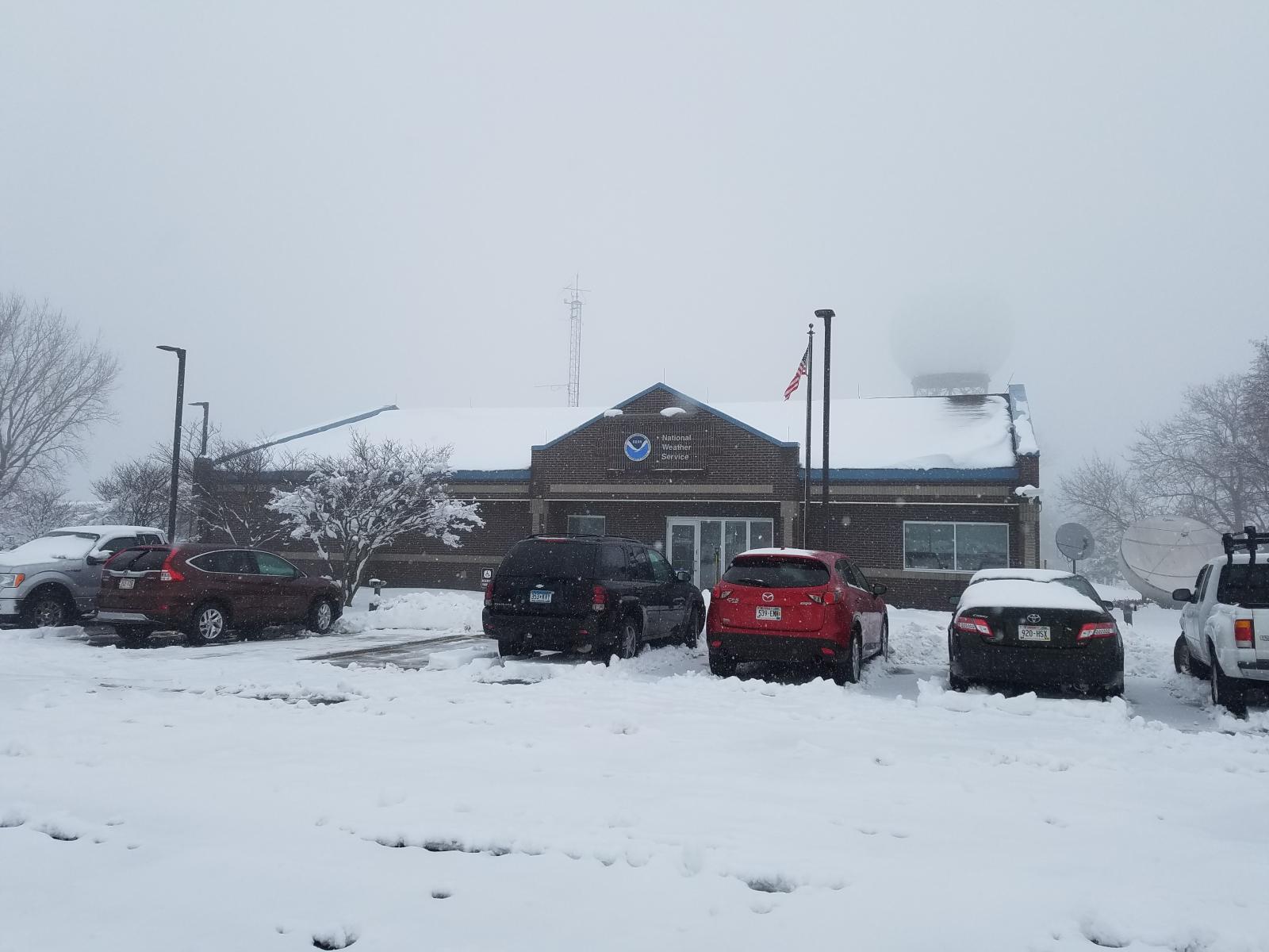
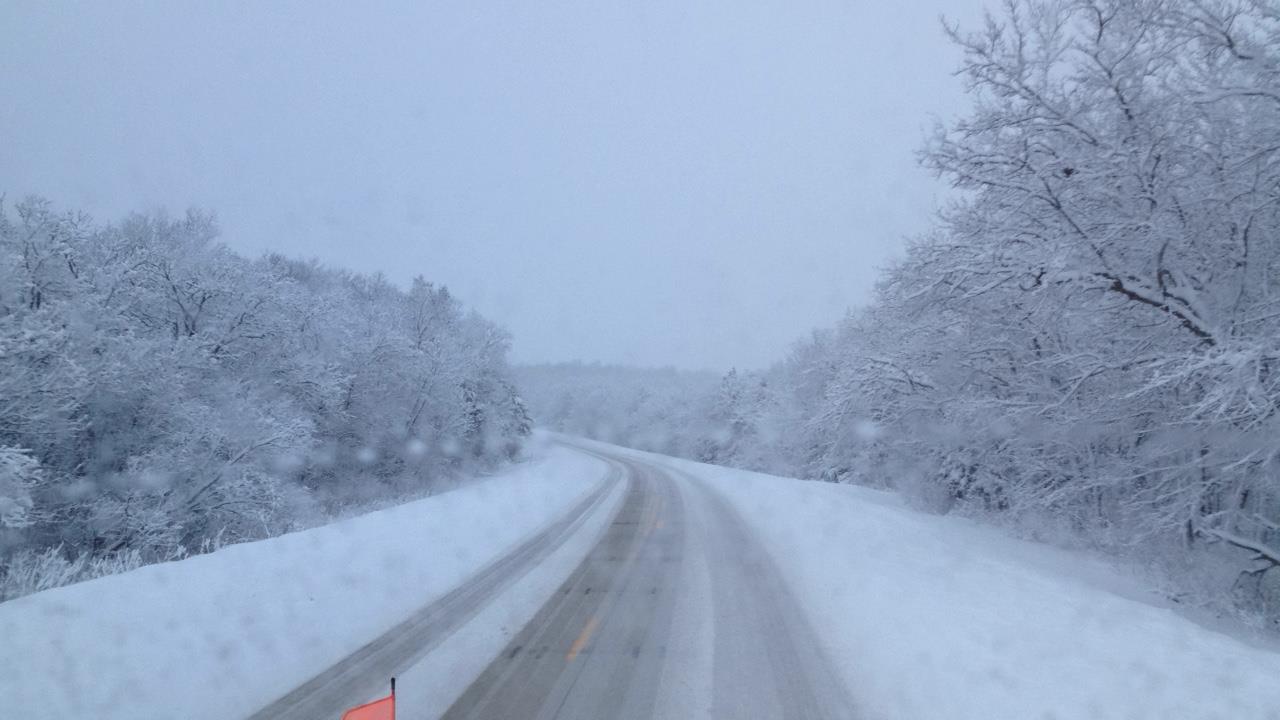
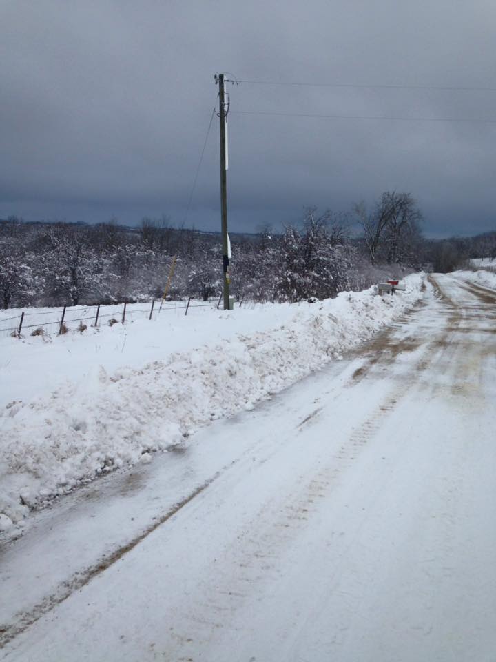
Snow falling during the morning of January 25th at NWS La Crosse. | Snow falling Midday at NWS La Crosse. | Roads north of Decorah, IA around 8AM January 25th (Photo courtesy of Iowa DOT Snowplow cams) |
 |
 |
 |
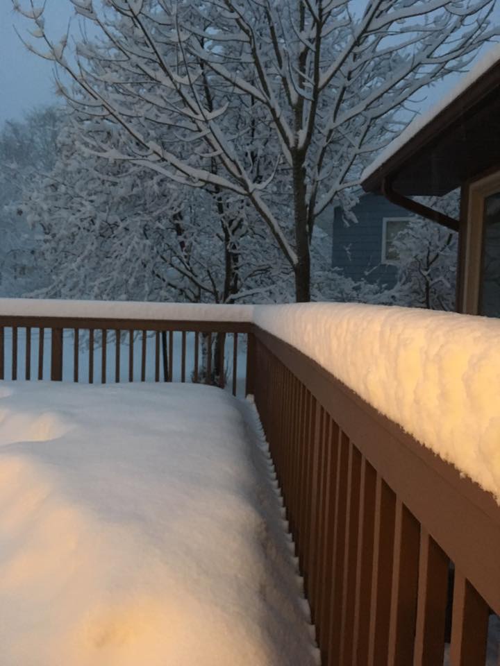 |
| Snow in Rochester, MN (Photo courtesy of Mark Peterson) |
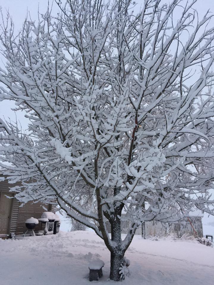
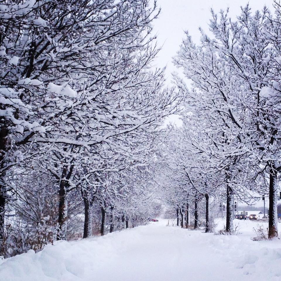
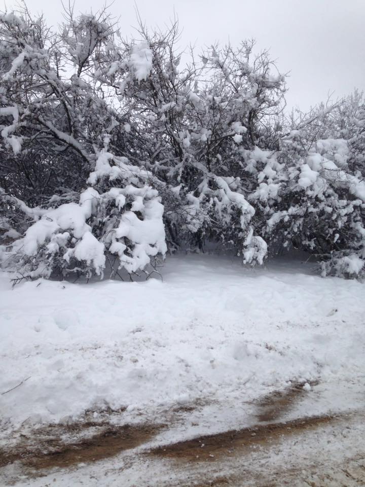
Snow near Lansing, IA (Photo courtesy of Jared Steven) |
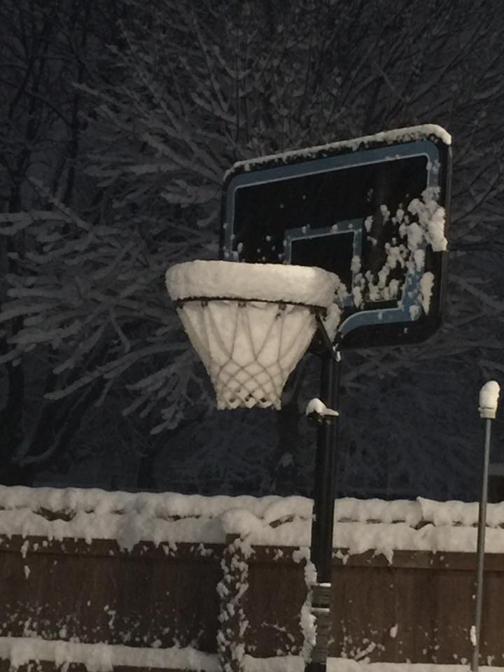
Snow in Spring Valley, MN (Photo courtesy of Randee Wesely) |
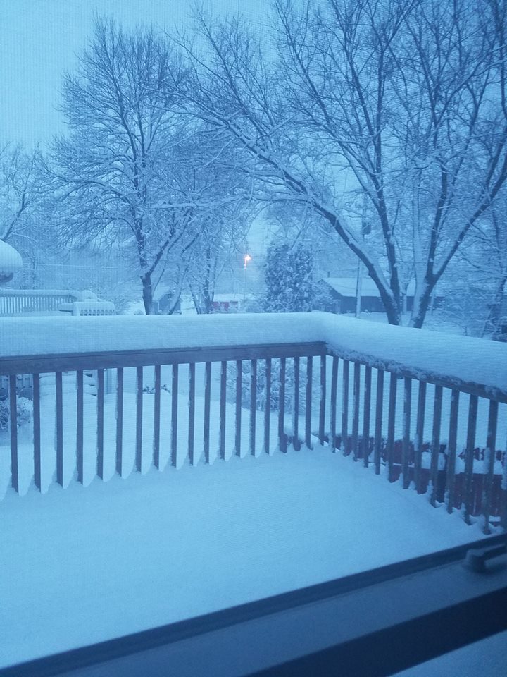
Snowfall in Winona, MN (Photo courtesy of Keith Nelson) |
 |
 |
 |
 |
| Snow in Rochester, MN (Photo courtesy of Sue Burke Haydon) |
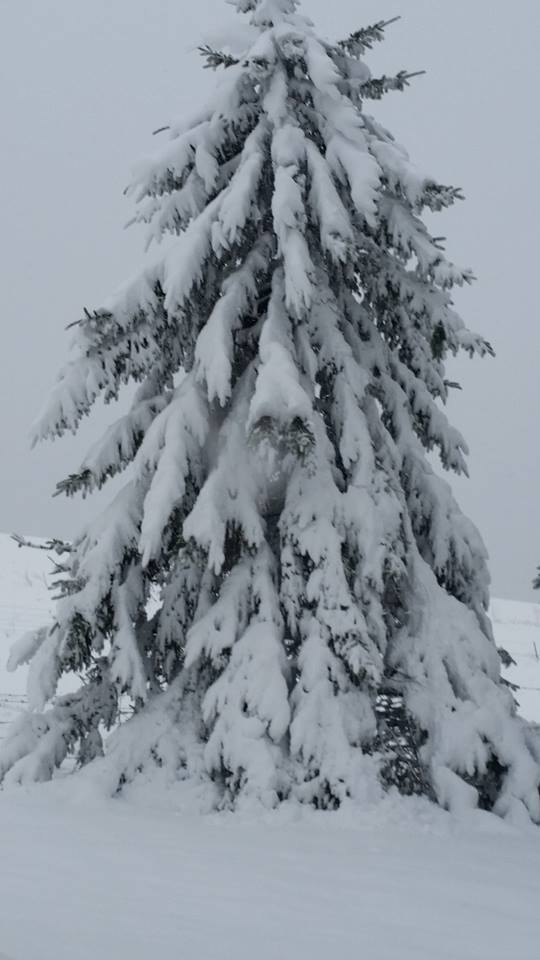
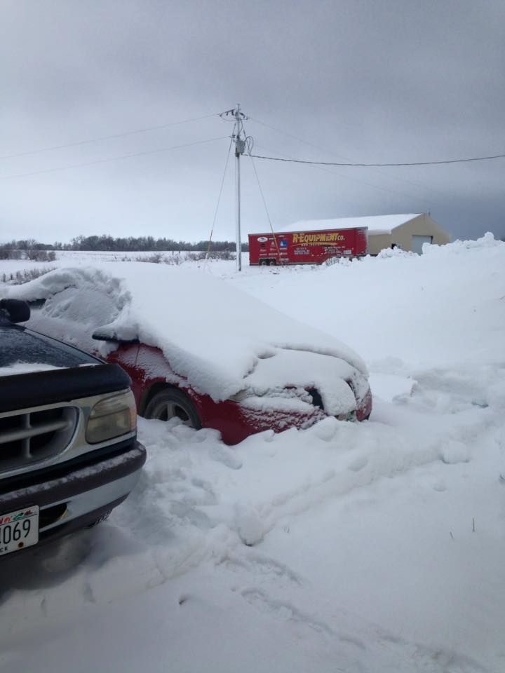
Snow in Harpers Ferry, IA (Photo courtesy of Judy Jones) |
Snow in Mount Hope, WI (Photo courtesy of James Mulrooney) |
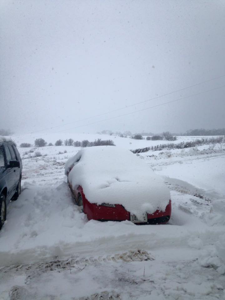
Snow in Mount Hope, WI (Photo courtesy of James Mulrooney) |
 |
 |
||
| Snow in Mount Hope, WI (Photo courtesy of James Mulrooney) |
Snow in Mount Hope, WI (Photo courtesy of James Mulrooney) |
Radar / Snowfall Maps:
 |
 |
 |
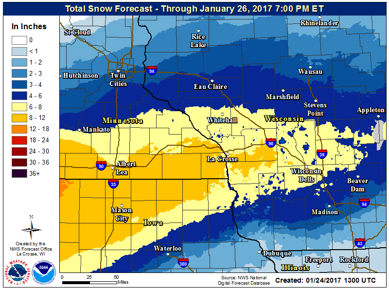 |
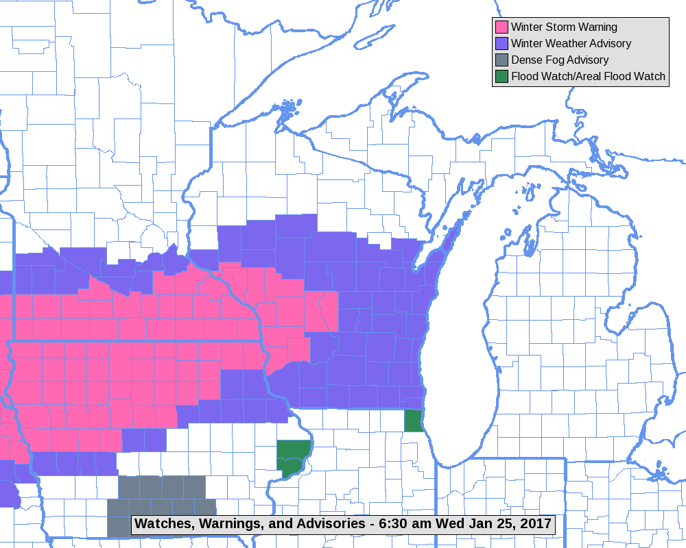
| Radar loop from 1pm January 24th through 2pm January 25th | Snowfall totals ending 7AM January 25th | Map showing where Winter Storm Warnings and advisories were in place for the storm. (Image courtesy of NWS Green Bay) | Snow forecast by NWS La Crosse |
 |
Media use of NWS Web News Stories is encouraged! Please acknowledge the NWS as the source of any news information accessed from this site. |
|


 Weather Story
 Weather Map
 Local Radar