La Crosse, WI
Weather Forecast Office
A winter storm impacted the region on Tuesday Dec.9th, and Wednesday Dec.10th bringing a fresh coating of snow and much colder temperatures into the region. Parts of southeast Minnesota and central Wisconsin picked up 6-9 inches of snow over a two day period. Areas along the Mississippi River and into northeast Iowa received less snow.
Here is a summary of La Crosse NWS actions:
With the fresh snow cover, bitter cold temperatures followed with early morning low temperatures on Friday, December 12th below zero in many areas. Bryon, MN dropped to -18, Theilman, MN had -16, and Blair, WI had -10. Rochester, MN had -7 and La Crosse, WI had -2. :
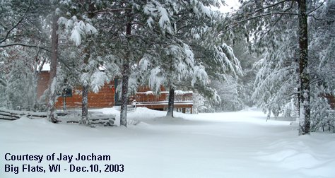
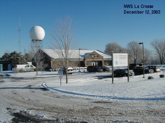
Jay Jocham, from Big Flats, Wisconsin (Adams Co.) sent in this image (left) after 8.5 inches of snow fell. NWS La Crosse (right) at -3 degrees and 3 inches of snow.
 |
 |
Our Office
Community Involvement
Station / Location Info
Follow Us On Social Media
Student Opportunities
Additional Information
Storm Summaries
Cooperative Observers
Educational Resources
Science / Research
Weather Phenomenon
Mayfly Tracking
Latest
Temp/Pcpn Summary
Precipitation Reports
Forecast Discussion
Hazardous Weather Outlook
Hourly Weather
Public Information Statement
Local Storm Report
Lightning Plot Archive
River Stages
Water Temp
Observations
Precipitation Plotter
Soil Temps
US Dept of Commerce
National Oceanic and Atmospheric Administration
National Weather Service
La Crosse, WI
711 County Road FA
La Crosse, WI 54601
608-784-7294
Comments? Questions? Please Contact Us.


 Weather Story
 Weather Map
 Local Radar
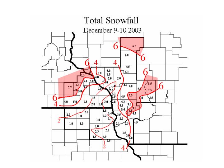