Overview
|
Warm and humid conditions, for early April, led to the eruption of numerous thunderstorms Sunday afternoon and evening, April 9th. Some of those storms became severe, producing large hail from north central Iowa, across southeast Minnesota, into north central Wisconsin. Hail ranged from the size of pennies all the way up to tennis balls, with the largest hail report occurring just north of the town of Stacyville, Iowa in Mitchell County. There were lots of reports of hail, without much rain or gusty wind. |
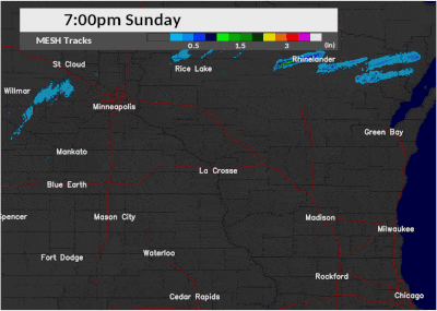
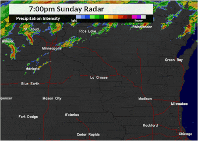 Radar loop of thunderstorms that worked through the region late Sunday afternoon and evening, April 9th. Note the dark red and purple colors are regions where large hail fell. |
Photos:
 |
 |
 |
 |
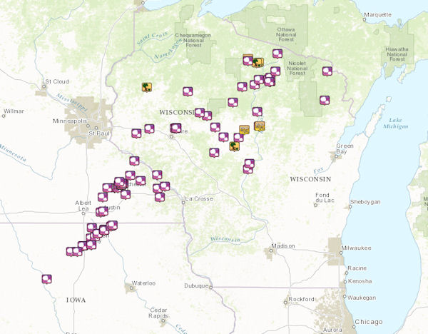
| Map of "hail tracks" from the NWS La Crosse radar. Green colors show the largest hail. | A look at all storm reports received by the National Weather Service. Interactive list available |
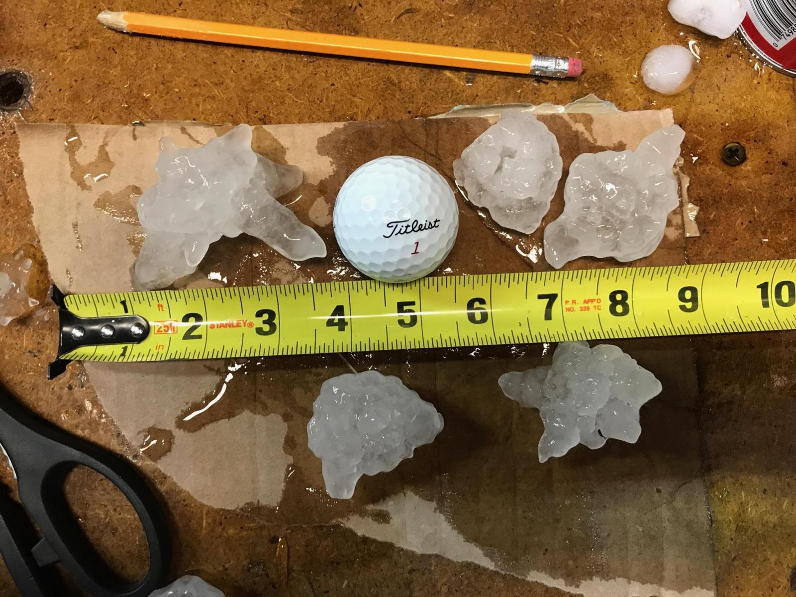
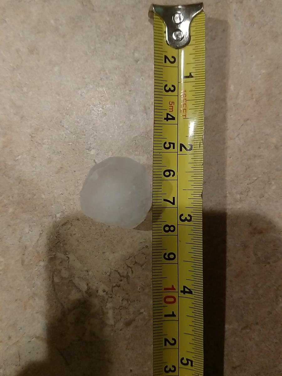
Hail slightly larger than quarter size from Stacyville, IA. (Photo used with permission by Brad Gerk) |
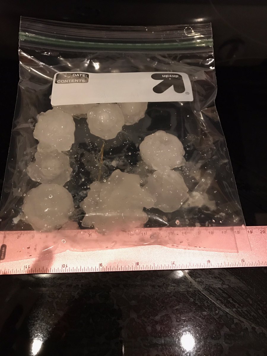
Large hail from northwest Rochester, MN. (Photo used with permission by Taylor Bauman) |
 |
 |
 |
 |
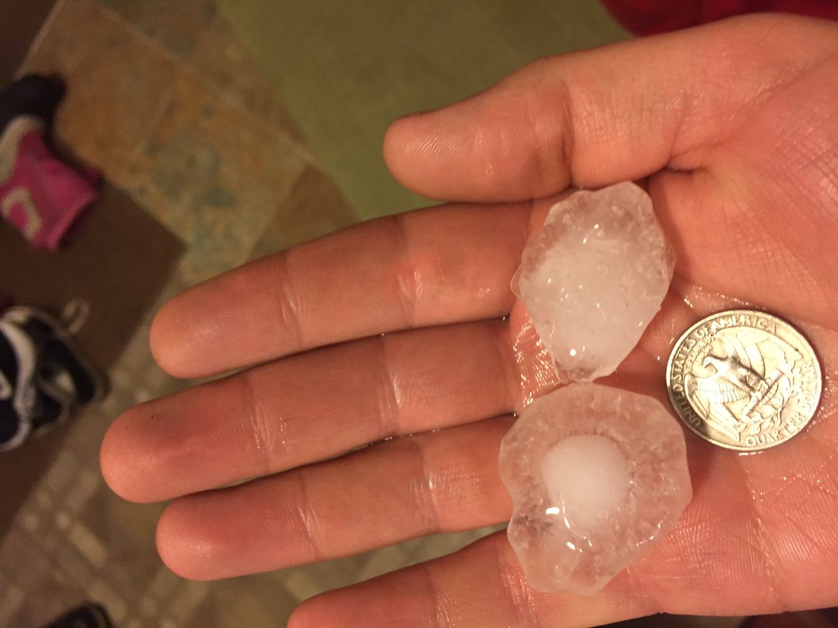
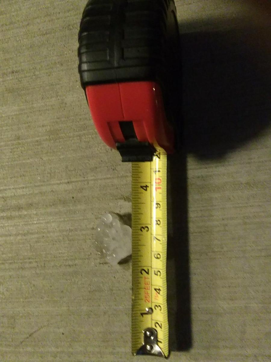
| 2" hail from Dodge Center, MN (Photo used with permission by Brandon Vermilyea) |
Hail from northwest Kasson, MN. (Photo used with permission by Roger Berge) |
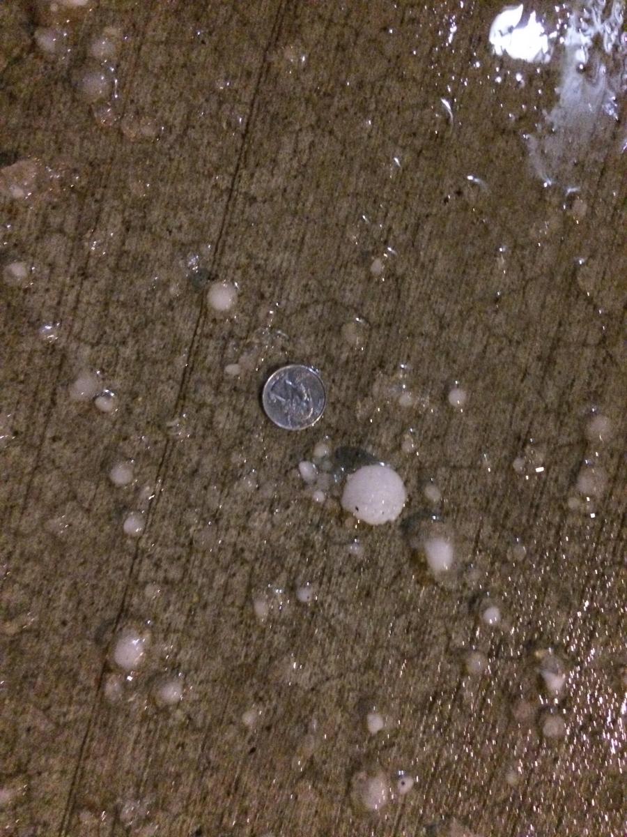
Hail around 1" in diameter in northwest Rochester, MN. (Photo used with permission by John Somheil) |
Large hail that fell in Austin, MN (8:15-8:17pm) (Photo by Amy Lammey, Mower Co. Emerg.Mgmt) |
 |
 |
 |
|
| Northwest Rochester, MN (Photo used with permission by Brian Morgan) |
Hail photo from Rochester, MN (Photo used with permission by Andrew Pederson) |
Large than 1" hail from Rochester, MN (Photo used with permission by @kevarh) |
Storm Reports
Below is a listing of all storm reports received. Note that an interactive graphical version of this list is also available.
PRELIMINARY LOCAL STORM REPORT...SUMMARY
NATIONAL WEATHER SERVICE LA CROSSE WI
1143 AM CDT MON APR 10 2017
..TIME... ...EVENT... ...CITY LOCATION... ...LAT.LON...
..DATE... ....MAG.... ..COUNTY LOCATION..ST.. ...SOURCE....
..REMARKS..
0329 PM HAIL 3 NNW LUBLIN 45.12N 90.75W
04/09/2017 U0.50 INCH TAYLOR WI TRAINED SPOTTER
TRAINED SPOTTER REPORTED HAIL SIZE OF PEA TO
LESS THAN A DIME FOUR MILES NORTH OF LUBLIN.
0811 PM HAIL 2 SW AUSTIN 43.66N 93.00W
04/09/2017 E0.75 INCH MOWER MN TRAINED SPOTTER
TRAINED SPOTTER REPORTED DIME SIZE HAIL NEAR
AUSTIN.
0812 PM HAIL 2 E AUSTIN 43.67N 92.94W
04/09/2017 M1.00 INCH MOWER MN BROADCAST MEDIA
BROADCAST MEDIA REPORTED NICKEL TO QUARTER
SIZE HAIL IN AUSTIN.
0840 PM HAIL 2 E KASSON 44.03N 92.70W
04/09/2017 M1.00 INCH DODGE MN PUBLIC
PUBLIC MEASURED QUARTER SIZE HAIL NEAR THE
CITY OF KASSON.
0849 PM HAIL 1 E BYRON 44.03N 92.63W
04/09/2017 E1.25 INCH OLMSTED MN PUBLIC
PUBLIC VIA SOCIAL MEDIA ESTIMATED HALF
DOLLAR SIZE HAIL NEAR THE CITY OF BYRON.
0900 PM HAIL 3 ESE DOUGLAS 44.09N 92.51W
04/09/2017 E0.75 INCH OLMSTED MN BROADCAST MEDIA
BROADCAST MEDIA REPORTED PENNY SIZE HAIL ON
THE NORTHWEST SIDE OF ROCHESTER.
0900 PM HAIL 3 SSE DOUGLAS 44.07N 92.56W
04/09/2017 E1.00 INCH OLMSTED MN PUBLIC
PUBLIC VIA SOCIAL MEDIA ESTIMATED QUARTER
SIZE HAIL ON THE NORTHWEST SIDE OF
ROCHESTER.
0900 PM HAIL 5 N STEWARTVILLE 43.93N 92.47W
04/09/2017 M1.00 INCH OLMSTED MN CO-OP OBSERVER
COOPERATIVE OBSERVER REPORTED QUARTER SIZE
HAIL TWO MILES NORTHEAST OF ROCHESTER
INTERNATIONAL AIRPORT.
0917 PM HAIL HAMMOND 44.22N 92.37W
04/09/2017 E1.00 INCH WABASHA MN PUBLIC
PUBLIC VIA SOCIAL MEDIA REPORTED QUARTER
SIZE HAIL IN THE TOWN OF HAMMOND.
0938 PM HAIL 2 SSE PLAINVIEW 44.14N 92.15W
04/09/2017 E1.00 INCH WABASHA MN FIRE DEPT/RESCUE
FIRE DEPARTMENT RESCUE REPORTED QUARTER SIZE
NEAR THE TOWN OF PLAINVIEW.
0946 PM HAIL LAKE CITY 44.44N 92.28W
04/09/2017 E0.50 INCH WABASHA MN PUBLIC
PUBLIC VIA SOCIAL MEDIA REPORTED HALF OF AN
INCH TO PENNY SIZE HAIL IN THE CITY OF LAKE
CITY.
0948 PM HAIL 1 N SAINT ANSGAR 43.39N 92.92W
04/09/2017 E1.00 INCH MITCHELL IA TRAINED SPOTTER
0950 PM HAIL SAINT ANSGAR 43.38N 92.92W
04/09/2017 M1.25 INCH MITCHELL IA PUBLIC
PUBLIC MEASURED QUARTER TO HALF DOLLAR SIZE
HAIL IN THE CITY OF ST. ANSGAR.
0950 PM HAIL SAINT ANSGAR 43.38N 92.92W
04/09/2017 E1.00 INCH MITCHELL IA PUBLIC
PUBLIC VIA SOCIAL MEDIA REPORTED QUARTER
SIZE HAIL IN ST. ANSGAR.
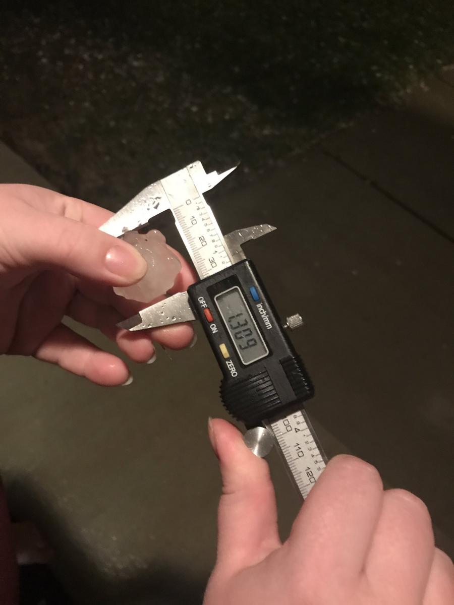
0958 PM HAIL STACYVILLE 43.44N 92.78W
04/09/2017 M1.25 INCH MITCHELL IA PUBLIC
TWITTER PHOTO REPORT.
1000 PM HAIL 2 NE STACYVILLE 43.46N 92.75W
04/09/2017 E2.50 INCH MITCHELL IA BROADCAST MEDIA
TIME ESTIMATED FROM RADAR. BIGGEST HAIL
REPORTED BETWEEN STACYVILLE, IA AND ADAMS,
MN.
1009 PM HAIL 2 S GENOA 44.08N 92.61W
04/09/2017 E1.00 INCH OLMSTED MN AMATEUR RADIO
AMATEUR RADIO REPORTED QUARTER SIZE HAIL TWO
MILES EAST OF OXBOW PARK.
1015 PM HAIL 2 SE DOUGLAS 44.09N 92.54W
04/09/2017 E1.50 INCH OLMSTED MN AMATEUR RADIO
AMATEUR RADIO OPERATOR REPORTED PING PONG
BALL SIZE HAIL ON THE NORTHWEST SIDE OF
ROCHESTER.
1015 PM HAIL 2 E COCHRANE 44.23N 91.80W
04/09/2017 M1.75 INCH BUFFALO WI LAW ENFORCEMENT
TIME ESTIMATED FROM RADAR.
1017 PM HAIL 2 SSE DOUGLAS 44.08N 92.57W
04/09/2017 M1.25 INCH OLMSTED MN PUBLIC
PUBLIC VIA SOCIAL MEDIA MEASURED NEAR HALF
DOLLAR SIZE HAIL ON THE NORTHWEST SIDE OF
ROCHESTER.
1019 PM HAIL COCHRANE 44.23N 91.84W
04/09/2017 E1.75 INCH BUFFALO WI LAW ENFORCEMENT
TIME ESTIMATED FROM RADAR, REPORT RELAYED
THROUGH COUNTY DISPATCH.
1019 PM HAIL 1 SE DOUGLAS 44.10N 92.56W
04/09/2017 E1.00 INCH OLMSTED MN PUBLIC
PUBLIC VIA SOCIAL MEDIA REPORTED QUARTER
SIZE HAIL ON THE NORTHWEST SIDE OF
ROCHESTER.
1019 PM HAIL 2 SSE DOUGLAS 44.08N 92.56W
04/09/2017 M1.25 INCH OLMSTED MN BROADCAST MEDIA
BROADCAST MEDIA VIA SOCIAL MEDIA MEASURED
NEAR HALF DOLLAR SIZE HAIL ON THE NORTHWEST
SIDE OF ROCHESTER.
1020 PM HAIL 1 ENE GENOA 44.12N 92.60W
04/09/2017 E0.50 INCH OLMSTED MN TRAINED SPOTTER
1030 PM HAIL 5 W HAYFIELD 43.89N 92.95W
04/09/2017 M1.00 INCH DODGE MN PUBLIC
FACEBOOK PHOTO REPORT.
1042 PM HAIL 5 W GILMAN 45.16N 90.90W
04/09/2017 E0.88 INCH TAYLOR WI PUBLIC
PUBLIC REPORTED NICKEL SIZE HAIL FIVE MILES
WEST OF GILMAN.
1050 PM HAIL DODGE CENTER 44.03N 92.85W
04/09/2017 M2.00 INCH DODGE MN PUBLIC
TWITTER PHOTO REPORT.
1050 PM HAIL PRESTON 43.68N 92.08W
04/09/2017 E0.88 INCH FILLMORE MN LAW ENFORCEMENT
TIME ESTIMATED FROM RADAR.
1052 PM HAIL INDEPENDENCE 44.36N 91.42W
04/09/2017 E1.00 INCH TREMPEALEAU WI PUBLIC
REPORT RELAYED THROUGH COUNTY DISPATCH.
1117 PM HAIL 1 W STOCKTON 44.02N 91.79W
04/09/2017 E0.88 INCH WINONA MN PUBLIC
1125 PM HAIL 5 N RUSHFORD 43.89N 91.75W
04/09/2017 E1.00 INCH WINONA MN FIRE DEPT/RESCUE
1130 PM HAIL 1 E WINONA 44.05N 91.64W
04/09/2017 M0.88 INCH WINONA MN PUBLIC
1134 PM HAIL RIB LAKE 45.32N 90.20W
04/09/2017 M1.00 INCH TAYLOR WI PUBLIC
PUBLIC VIA BROADCAST AND SOCIAL MEDIA
REPORTED QUARTER SIZE HAIL IN THE CITY OF
RIB LAKE.
1153 PM HAIL TAYLOR 44.32N 91.12W
04/09/2017 E0.50 INCH JACKSON WI PUBLIC
REPORT RELAYED THROUGH COUNTY EMERGENCY
MANAGER. HAIL RANGED FROM PEA TO QUARTER
SIZE. ALSO ESTIMATED WIND GUSTS TO 50 MPH.
TIME ESTIMATED FROM RADAR.
1210 AM HAIL GREENWOOD 44.77N 90.60W
04/10/2017 E0.25 INCH CLARK WI PUBLIC
TIME ESTIMATED FROM RADAR.
1215 AM HAIL OWEN 44.95N 90.57W
04/10/2017 E0.75 INCH CLARK WI PUBLIC
RELAYED VIA LAW ENFORCEMENT.
1220 AM HAIL 2 SSE RIPLINGER 44.80N 90.39W
04/10/2017 E0.75 INCH CLARK WI TRAINED SPOTTER
TIME BASED ON RADAR.
1222 AM HAIL NEILLSVILLE 44.56N 90.59W
04/10/2017 E0.88 INCH CLARK WI LAW ENFORCEMENT
0600 AM HAIL 1 SSE BLACK RIVER FALLS 44.28N 90.84W
04/10/2017 E1.00 INCH JACKSON WI PUBLIC
REPORT RELAYED THROUGH COUNTY EMERGENCY
MANAGER. NICKEL TO QUARTER SIZE HAIL.
0621 AM HAIL 5 SSE MERRILLAN 44.39N 90.82W
04/10/2017 E0.25 INCH JACKSON WI LAW ENFORCEMENT
 |
Media use of NWS Web News Stories is encouraged! Please acknowledge the NWS as the source of any news information accessed from this site. |
|


 Weather Story
 Weather Map
 Local Radar