National Weather Service United States Department of Commerce

Storm Impacting the Northwest U.S.; Fire Weather Conditions in Southern California; Severe Weather in the South

A Pacific storm is bringing areas of low elevation rain, moderate to heavy mountain snow, and high winds to the Northwest. Strong Santa Ana winds and very dry conditions are producing elevated to critical fire weather conditions in southern California. Isolated strong to severe thunderstorms are possible through early Wednesday morning across parts of northeast Texas into western Tennessee. Read More >

Banner

Southeast Newton to Meehan EF-1 Tornado

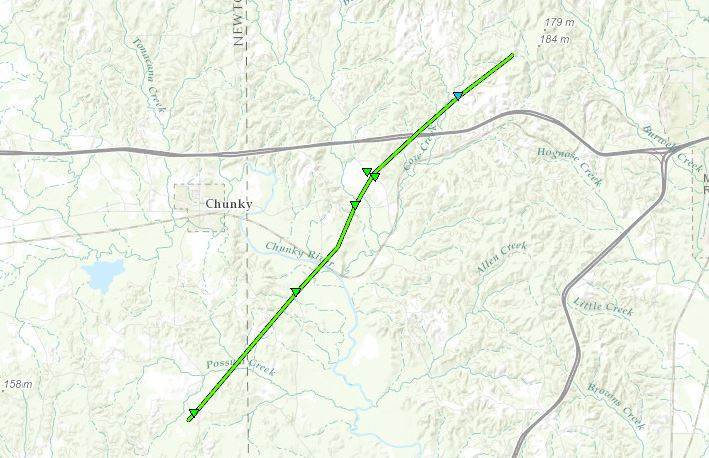
Click on map above to see entire damage point notation and damage pictures at select points.


Event Summary
The tornado began in southeast Newton County along Griffis Fountain Road, where numerous trees were snapped. It continued northeastward into western Lauderdale County, snapping trees as it crossed Point Wanita Lake Road, the Chunky River, and US Highway 80. It then caused roof damage to a house and damaged an outbuilding as it crossed Suqualena Meehan Road. Additional trees were snapped and uprooted as the tornado crossed I-20, then a few trees were snapped along Suqualena Graham Road shortly before the tornado lifted.

Rating:
(Click for EF Scale)
EF-1
Estimated Maximum Wind: 110 mph
Fatalities/Injuries: none
Damage Path Length: 9.9 miles
Maximum Path Width: 100 yards
Approximate Start Point/Time:

4 S Chunky
3:24 pm

Approximate End Point/Time:

3 WSW Nellieburg
3:36 pm