Jackson, Mississippi
Weather Forecast Office

Columbia EF-3 Tornado
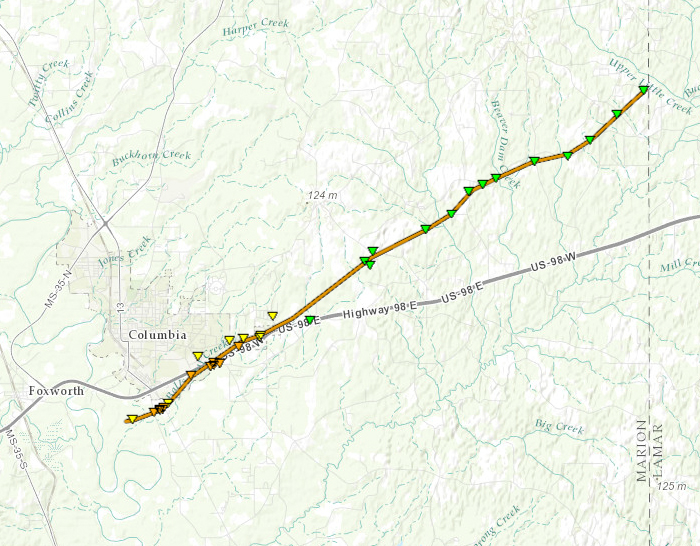
Click on map above to see entire damage point notation and damage pictures at select points.
|
Event Summary |
|
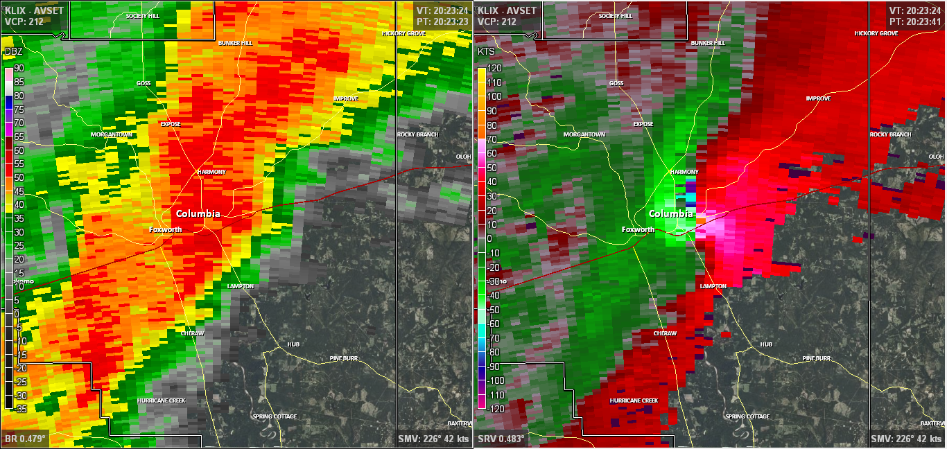
Radar Imagery
These images from the Slidell Doppler radar show the storm at 2:23 pm as it moved along the bypass on the southeast side of Columbia. The image on the left shows 0.5° base reflectivity data, and the image on the right shows 0.5° storm relative velocity data. Click on the thumbnail below for a higher resolution image.
US Dept of Commerce
National Oceanic and Atmospheric Administration
National Weather Service
Jackson, Mississippi
234 Weather Service Dr.
Flowood, MS 39232
601-936-2189
Comments? Questions? Please Contact Us.

