National Weather Service United States Department of Commerce

Banner
Banner image courtesy Mark Anderton

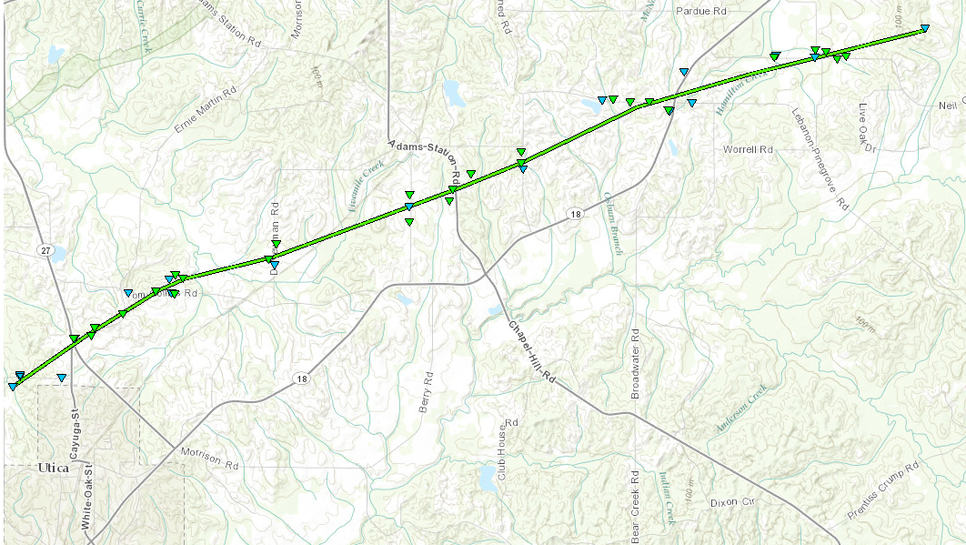
Southwest Hinds County EF-1 Tornado

Click on map above to see entire damage point notation and damage pictures at select points.

Event Summary
This tornado touched down along Thornton Road and moved north of Utica across MS Highway 27 and Ernie Martin Road. The heaviest damage occurred along Tom Collins Road, where there was considerable tree damage with several hardwood trees snapped. A metal pole was blown through the side of a house and a small shed was also blown over in this area. Another home suffered roof damage. The tornado continued east northeastward across D Newman Road, Berry road, Adams Station Road, and Peach Orchard Road, snapping and uprooting several trees and causing roof, siding, and skirting damage to some manufactured homes. It crossed MS Highway 18 near Learned Road, and then lifted after crossing Neil Collins Road and Seaton Road.

Rating:
(Click for EF Scale)
EF-1
Estimated Maximum Wind: 105 mph
Fatalities/Injuries: none
Damage Path Length: 10.9 miles
Maximum Path Width: 300 yards
Approximate Start Point/Time:

2 NW Utica
5:48 pm

Approximate End Point/Time:

4 NNW Dry Grove
6:05 pm