Jackson, Mississippi
Weather Forecast Office

Ashley County Tornado
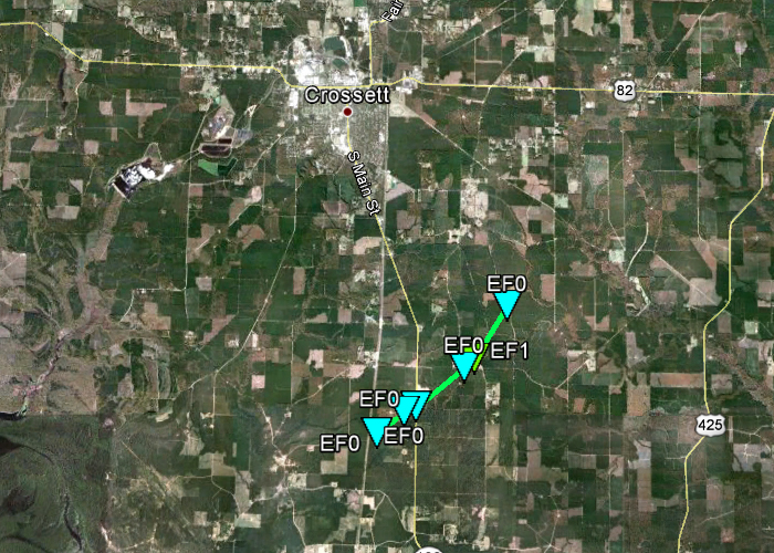
Click on map above to see entire damage point notation and damage pictures at select points.
|
Event Summary The tornado started along County Road 229 about six miles south of Crossett. It moved east-northeast to northeast, crossing Highway 133 near the intersection with County Road 5. Several large trees were downed across Highway 133 at this point. The tornado continued northeast, and reached its maximum intensity near the intersection of County Road 5E and County Road 4. Here a number of hardwood and softwood trees were snapped and uprooted. The tornado turned more north-northeast and appeared to dissipate as it was crossing Arkansas Trace Road about four miles southeast of Crossett. |
|
US Dept of Commerce
National Oceanic and Atmospheric Administration
National Weather Service
Jackson, Mississippi
234 Weather Service Dr.
Flowood, MS 39232
601-936-2189
Comments? Questions? Please Contact Us.


