Jackson, Mississippi
Weather Forecast Office
December 9-10, 2012 Tornadoes
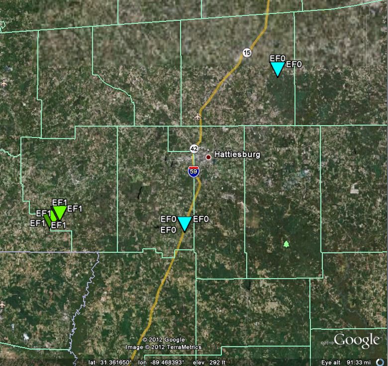
Tornado Track Map
The map below shows the locations of surveyed tornado tracks as determined by the National Weather Service Office in Jackson. The graphic is followed by a separate table detailing each surveyed tornado track. Maps for individual tornadoes can be found on those subsequent pages
Survey Information
| Location | Start/ End Time |
Event Type/ Max Winds |
Fatalities/ Injuries |
Path Length | Path Width |
| Lamar County 3 SSE Purvis |
Sun 12/9 4:15 pm |
EF-0 Tornado 85 mph |
none | 0.1 mi | 50 yds |
| Jones County 8 SE Laurel |
Sun 12/9 5:20 pm |
EF-0 Tornado 85 mph |
none | 0.1 mi | 50 yds |
| Marion County 6 SW Columbia to 5 SW Columbia |
Mon 12/10 8:19 am - 8:25 am |
EF-1 Tornado 100 mph |
none |
3 mi(in Marion County) |
100 yds |
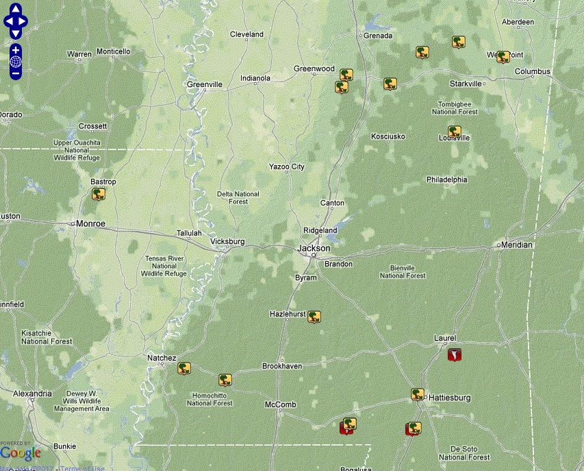
Local Storm Reports
Click on the map below for additional details.

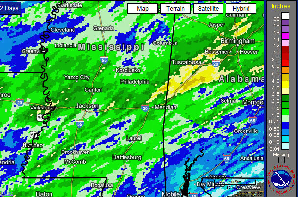
Rainfall Totals
The map below displays two-day rainfall amounts from 5:00 am December 9th to 5:00 a.m. December 11. Rainfall totals of 1 1/2 to 2 inches were common across the area. Isolated locations received 3 to 4 inches
.
US Dept of Commerce
National Oceanic and Atmospheric Administration
National Weather Service
Jackson, Mississippi
234 Weather Service Dr.
Flowood, MS 39232
601-936-2189
Comments? Questions? Please Contact Us.

