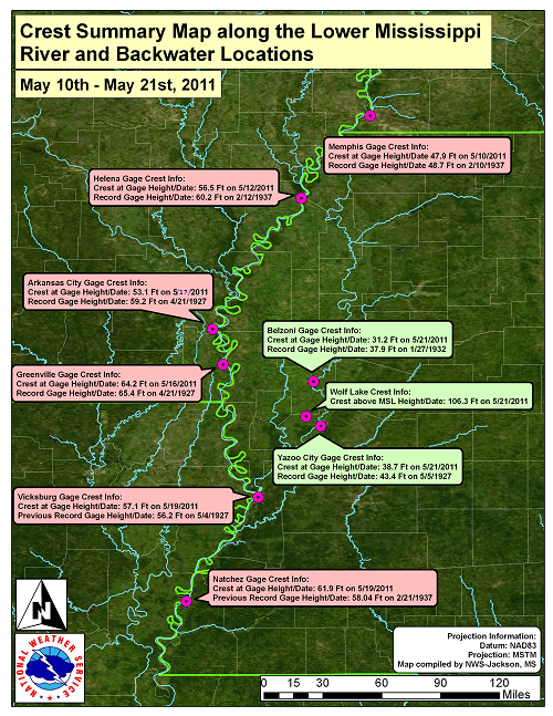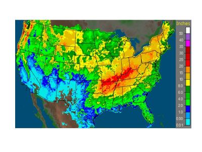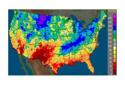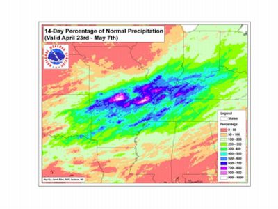
Excessive rainfall occurred from April 23 to May 7, 2011 across northern Arkansas, southern Missouri, and portions of the Ohio River Valley. Fourteen day rainfall totaled more than 800% of normal across parts of the Ohio, White and mid-Mississippi River valleys, with rain amounts up to 20 inches at some locations. This deluge resulted in record flooding on the lower Mississippi River. Arkansas City and Greenville reached flood stage on April 28, 2011 and the lower Mississippi River remained in flood at some point through late June with Natchez remaining in flood until June 22. Along with significant impacts along the main stem of the Mississippi River, substantial back water flooding occurred along the Yazoo River. The river crested at record levels at Vicksburg and Natchez and was pushed near record levels at Arkansas City and Greenville. Back water flooding along the Yazoo River reached near record levels at Belzoni and Yazoo City. River levels crested in mid May, with most points not falling below flood stage until the first and second weeks of June.
More than 350 residences were destroyed and another 1440 suffered some type of damage. Six businesses were destroyed and 34 were damaged. Approximately 2000 residences were evacuated, including 1500 in Warren County. Numerous roads along the river and in the Delta region were closed, including portions of US Highways 49 and 61. The Big Black River was closed to boat traffic near its confluence with the Mississippi River due to the proximity of the river surface to high tension power lines. One fatality was reported in Vicksburg when a person attempted to wade through flood waters and drowned.
 |
| Gage Location |
Flood Stage (ft) |
2011 Crest Stage (ft) |
Crest Date | Record Stage (ft) and Date |
| Arkansas City | 37 | 53.1 | May 16 |
59.2 - Apr 21 1927 |
| Greenvile | 48 | 64.2 | May 17 |
65.4 - Apr 21 1927 |
| Vicksburg | 43 | 57.1 New Record |
May 19 |
Previous Record |
| Natchez | 48 | 61.9 New Record |
May 19 |
Previous Record |
 |
 |
60-Day Rain Accumulation 60-Day Percentage of Normal Rain
Ending June 1, 2011;Ending June 1, 2011
 |
Percentage of Normal Rainfall
Apr 23-May7, 2011