Jackson, Mississippi
Weather Forecast Office

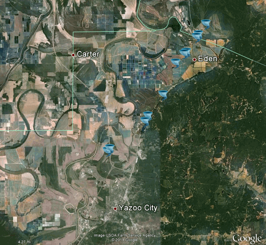
Yazoo/Holmes Counties Tornado

|
Event Summary This tornado caused a path of extensive downed trees along a path from U.S. Highway 49W north of Yazoo City, northeast along the west side of U.S. Highway 49E, to just northwest of the Eden Community. It caused roof damage to a home on Money Sunk Road, and also damaged the front porch of another home. The tornado then crossed Highway 49E at the Holmes County line, still snapping and uprooting numerous trees. The tornado then apparently dissipated over the Hillside National Wildlife Refuge. |
|
US Dept of Commerce
National Oceanic and Atmospheric Administration
National Weather Service
Jackson, Mississippi
234 Weather Service Dr.
Flowood, MS 39232
601-936-2189
Comments? Questions? Please Contact Us.

