Jackson, Mississippi
Weather Forecast Office

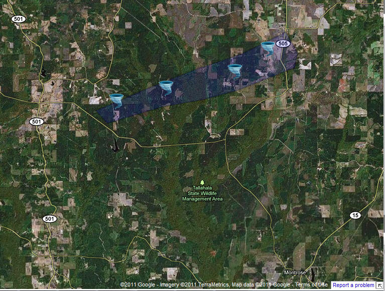
Smith/Scott/Newton Counties Tornado
|
Event Summary This tornado touched down along Sun Road just south of the Scott/Smith county line, where it downed some limbs and snapped a tree. The tornado then tracked into extreme southeastern Scott County, where it uprooted and snapped numerous trees across Cox Camp Road. This was the most intense damage. The tornado continued into southwestern Newton County, downing some trees along Logan and Gordy Roads, before dissipating as it reached State Highway 505. |
|
 |
 |
-->
US Dept of Commerce
National Oceanic and Atmospheric Administration
National Weather Service
Jackson, Mississippi
234 Weather Service Dr.
Flowood, MS 39232
601-936-2189
Comments? Questions? Please Contact Us.

