Jackson, Mississippi
Weather Forecast Office
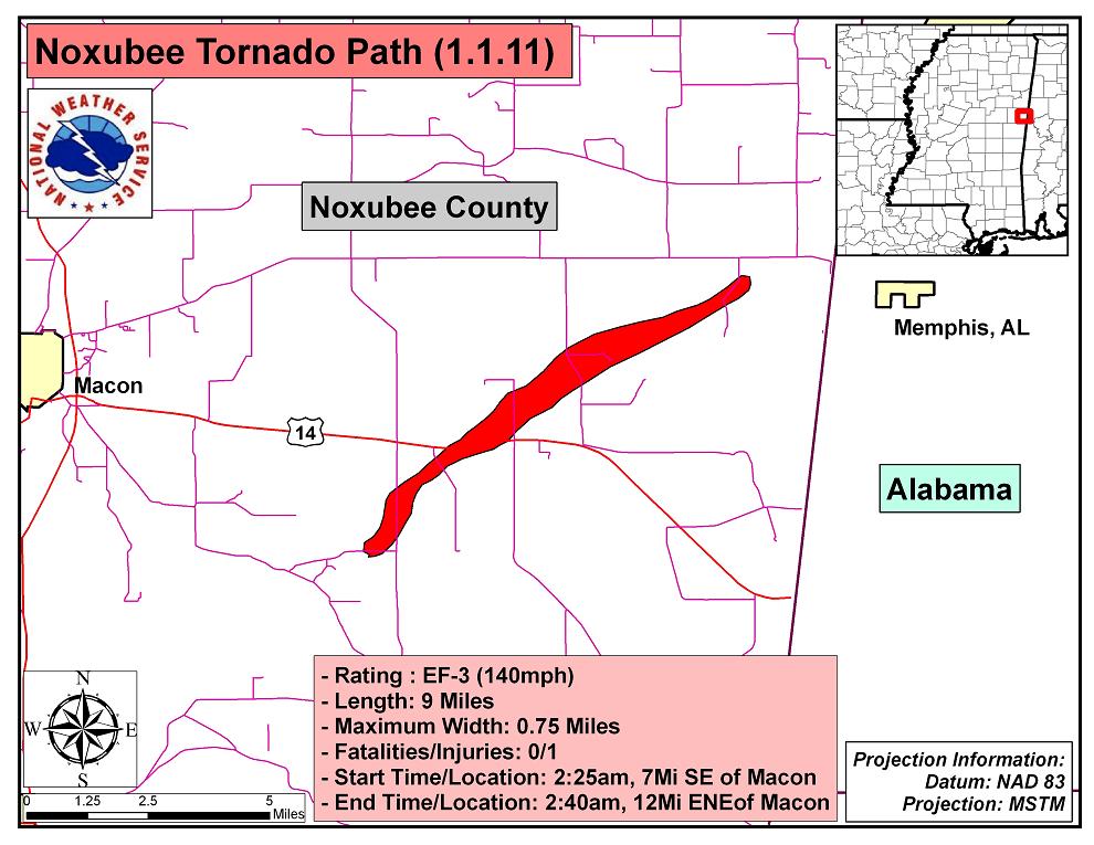
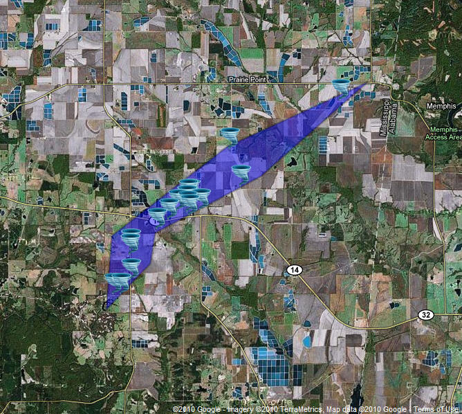
New Year's Day 2011 Noxubee County Tornado
Click on Map Below for More Details

|
Event Summary Initial damage was numerous snapped hard and softwood trees along E. Spann Road. The tornado moved northeast and caused significant damage to a dairy farm on Paulette Road. Numerous buildings were destroyed including a barn, a milk house, a silo, and a mobile home. The tornado also uprooted large trees and snapped several power poles. A horse trailer tumbled for approximately 100 yards. Debris was scattered approximately one mile to the northeast. The tornado continued on and destroyed a metal farm building and an office off of Stan Tabor Road and also pushed an 18 wheeler approximately 25 yards. The 2nd story of a home was destroyed along with a metal building just off of Hwy 14. Numerous trees were snapped at this location with one tree being completely debarked. The tornado continued on and destroyed some metal buildings at a pig farm and also overturned a pivot. A barn was destroyed along with roof damage to a home along Stoke Williams Road. The tornado ended near Koehn Road where a few trees were snapped. The tornado was rated EF-3 based on the damage to the dairy farm and the metal building off of Stan Tabor Road. The remainder of the damage was generally EF-1 in nature. |
|
US Dept of Commerce
National Oceanic and Atmospheric Administration
National Weather Service
Jackson, Mississippi
234 Weather Service Dr.
Flowood, MS 39232
601-936-2189
Comments? Questions? Please Contact Us.


