New Year's Eve 2010 Hinds-Rankin Counties Tornado
Click on Map Below for More Details

|
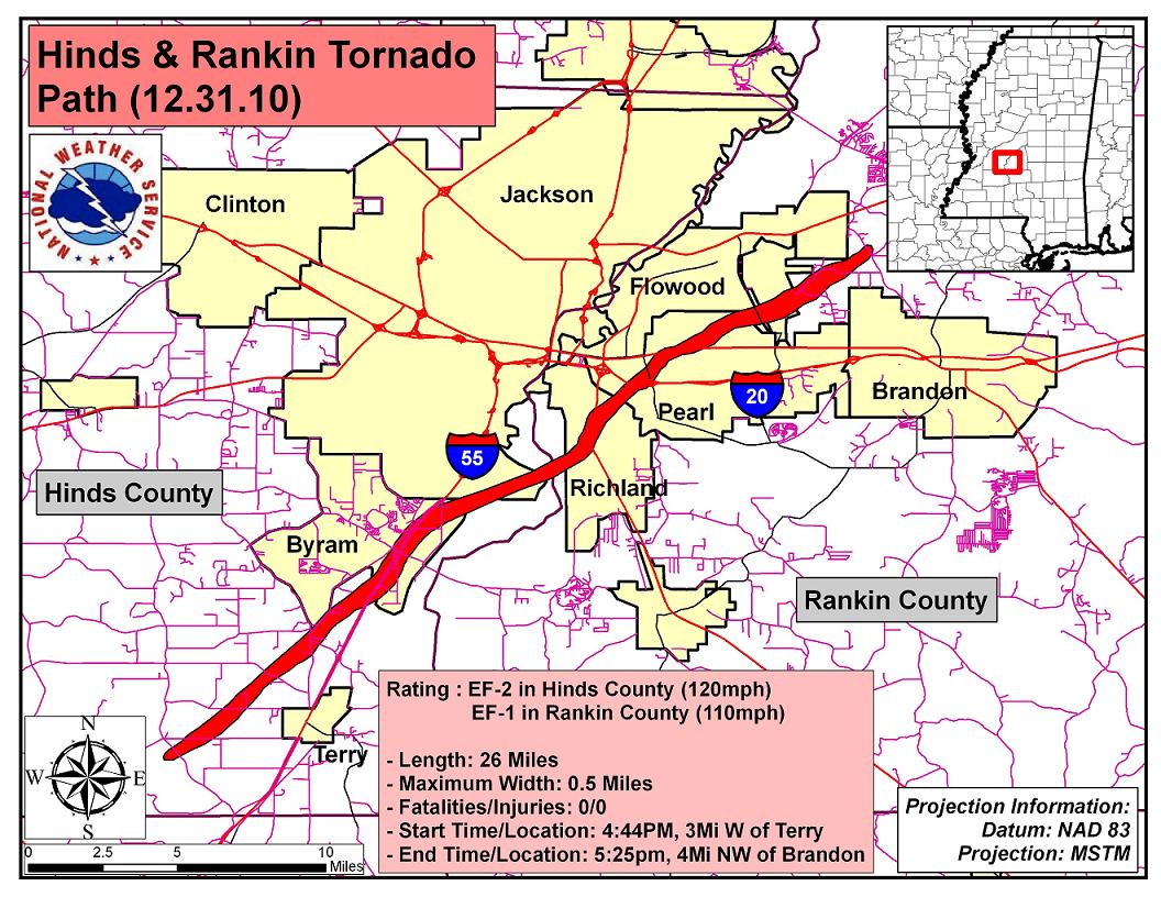
Event Summary The tornado first touched down in Midway Estates just to the west of Midway Road. Initially the tornado knocked down a few trees and caused minor shingle damage to roofs. The tornado tracked northeast crossing Tank Road, Green Gable Road and Lebanon-Pinegrove Road. The damage was predominantly downed trees and minor structural damage. The tornado then moved nearly parallel to Interstate 55 and passed through Byram. Numerous structures were damaged, numerous billboards were blown out, a tanker truck was overturned, numerous power poles were snapped and numerous trees were snapped and uprooted. The tornado was the most intense at this point with winds estimated to be around 120 mph. In addition, the maximum path width of 1/2 mile occurred in Byram. The tornado then crossed the Pearl River into Richland. The tornado was much weaker at this point with mainly tree damage occurring. As the tornado moved into Pearl it strengthened again. Roof damage occurred to a movie theater and a Kroger. The roof was completely torn off a car wash. In the Pearl neighborhoods, numerous trees were knocked down and several fell on houses. Several of the houses were total losses. The tornado then crossed Airport Road and onto the Jackson-Evers International Airport grounds, passing just south of the airport terminal. A roof was heavily damaged to a warehouse and numerous trees were knocked down. The tornado then tracked along Cooper Road, mainly downing trees. The tornado then lifted as it moved across Luckney Road, just a few miles south of Lakeland Drive. The highest estimated winds in Rankin County were 110 mph which occurred in Pearl. |
|